
The alien buttes of Mars
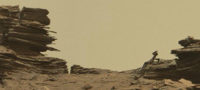
The image above is cropped from a panorama created by reader Phil Veerkamp from images taken by Curiosity’s mast camera on August 25, 2016 of the terrain that partly surrounds the rover since it passed the Balanced Rock and traveled beyond Murray Buttes
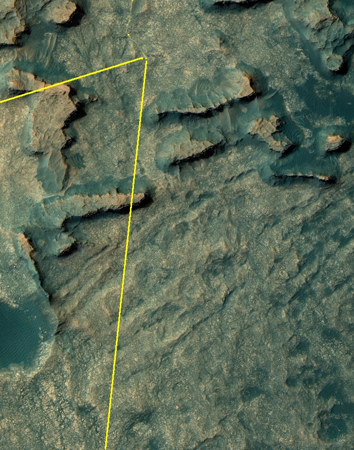
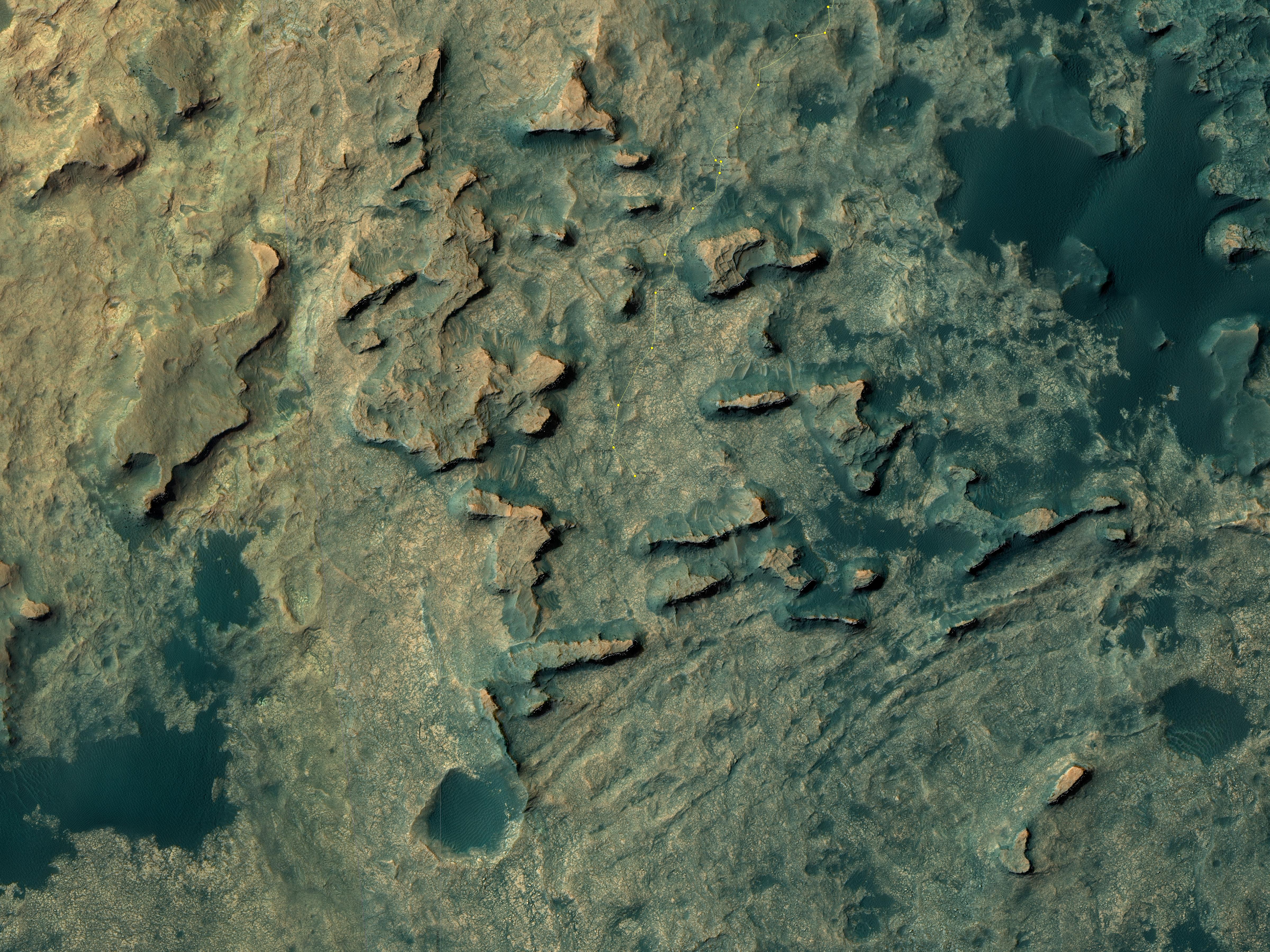
The full image is too large to post here. However, if you click on the first link above you can either download it and peruse it at your leisure, or view it with your browser. You will definitely want to do so, as it is high resolution and shows a lot of strange and alien geology, including multiple slabs seemingly hanging in space because of the low gravity. (Hint: Be sure to pan all the way to the right!) On the image’s left Mount Sharp can be seen raising in the background. Below the fold I have annotated the most recent Mars Reconnaissance Orbiter image of Curiosity’s location to indicate what I think is the area included in this panorama. This MRO image also shows that once Curiosity gets through the narrow gap to the south, the path heading south up the mountain’s slopes will, for awhile at least, be relatively open with few large obstacles. The view will also change, as the rover will be out of the region of buttes.

On Christmas Eve 1968 three Americans became the first humans to visit another world. What they did to celebrate was unexpected and profound, and will be remembered throughout all human history. Genesis: the Story of Apollo 8, Robert Zimmerman's classic history of humanity's first journey to another world, tells that story, and it is now available as both an ebook and an audiobook, both with a foreword by Valerie Anders and a new introduction by Robert Zimmerman.
The print edition can be purchased at Amazon or from any other book seller. If you want an autographed copy the price is $60 for the hardback and $45 for the paperback, plus $8 shipping for each. Go here for purchasing details. The ebook is available everywhere for $5.99 (before discount) at amazon, or direct from my ebook publisher, ebookit. If you buy it from ebookit you don't support the big tech companies and the author gets a bigger cut much sooner.
The audiobook is also available at all these vendors, and is also free with a 30-day trial membership to Audible.
"Not simply about one mission, [Genesis] is also the history of America's quest for the moon... Zimmerman has done a masterful job of tying disparate events together into a solid account of one of America's greatest human triumphs."--San Antonio Express-News
The image above is cropped from a panorama created by reader Phil Veerkamp from images taken by Curiosity’s mast camera on August 25, 2016 of the terrain that partly surrounds the rover since it passed the Balanced Rock and traveled beyond Murray Buttes
The full image is too large to post here. However, if you click on the first link above you can either download it and peruse it at your leisure, or view it with your browser. You will definitely want to do so, as it is high resolution and shows a lot of strange and alien geology, including multiple slabs seemingly hanging in space because of the low gravity. (Hint: Be sure to pan all the way to the right!) On the image’s left Mount Sharp can be seen raising in the background. Below the fold I have annotated the most recent Mars Reconnaissance Orbiter image of Curiosity’s location to indicate what I think is the area included in this panorama. This MRO image also shows that once Curiosity gets through the narrow gap to the south, the path heading south up the mountain’s slopes will, for awhile at least, be relatively open with few large obstacles. The view will also change, as the rover will be out of the region of buttes.
On Christmas Eve 1968 three Americans became the first humans to visit another world. What they did to celebrate was unexpected and profound, and will be remembered throughout all human history. Genesis: the Story of Apollo 8, Robert Zimmerman's classic history of humanity's first journey to another world, tells that story, and it is now available as both an ebook and an audiobook, both with a foreword by Valerie Anders and a new introduction by Robert Zimmerman.
The print edition can be purchased at Amazon or from any other book seller. If you want an autographed copy the price is $60 for the hardback and $45 for the paperback, plus $8 shipping for each. Go here for purchasing details. The ebook is available everywhere for $5.99 (before discount) at amazon, or direct from my ebook publisher, ebookit. If you buy it from ebookit you don't support the big tech companies and the author gets a bigger cut much sooner.
The audiobook is also available at all these vendors, and is also free with a 30-day trial membership to Audible.
"Not simply about one mission, [Genesis] is also the history of America's quest for the moon... Zimmerman has done a masterful job of tying disparate events together into a solid account of one of America's greatest human triumphs."--San Antonio Express-News
Wow! Hollywood couldn’t make this landscape up in the 1950s. It looks like a world smashed to pieces by a sledgehammer. And the protrusion at the far right looks unpossible. And there’s another one further away, about 1/6 of the image width from the right.
OT: Is there any hacker here who can help me find that crooked email deletion software? I’ve searched for bitchleech but the google doesn’t turn up with anything helpful. :~p
In refference to the rather extensive and relatively thin outcroppings of strata in the image, I would expect a much more extensive debris field under them. This, however, does not appear to be the case. This is strictly an obsevation from an uneducated viewer of the dynamics of Martian geophysics. I would assume that this is due to the extremely slow nature of erosion on the Martian surface. As there is no liquid water erosion, the primary mechanism would have to be wind and any resulting atmospheric born substrate (not accounting for fracturing of rock due to extreme thermal conditions). The outcroppings, even with the low gravitational force, I would assume must be rather ridged and the interdispersed layers significantly softer to account for the degree of overhang.
Just sayin.
Just a
Your tax dollars *really* at work. Very nice stuff and thanks for posting it. Interesting fractures middle right. Really interesting to see wind eroded structures in a low-g environment. I’d pay money to see that . . . oh, wait.
The outcropping on the left shows extensive layering of rocks. I am struck by the almost uniform thickness of these slabs.
Now, we need real paleontologist or at least geologist on site to look for fossils in these stratified deposits by splitting the layers step by step . This cannot be done by a robot.
On the sphinx enclosure in Egypt you can see wind erosion on different hardness levels of limestone. The erosion here reminds me of that. Hard layer then a soft layer, built up over time and then it finally gets exposed to wind weathering and they get defined.