
A typical Martian rock on Mount Sharp
Click for full 360 degree panorama.
Click for full image.
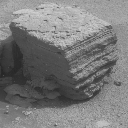
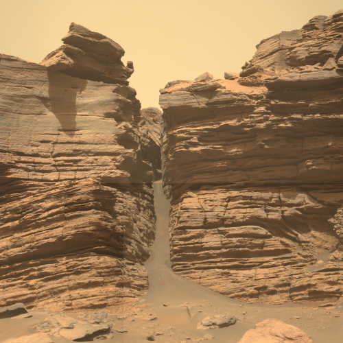
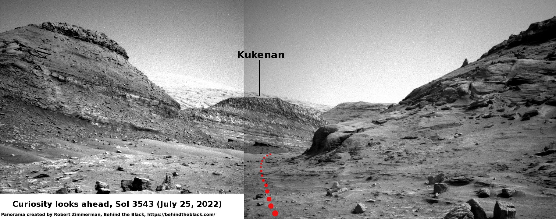
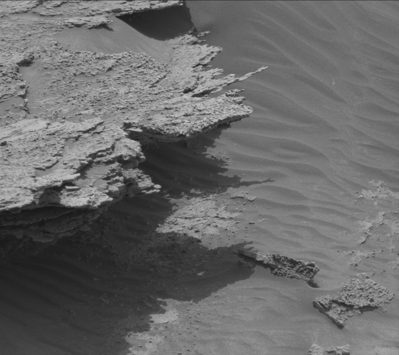
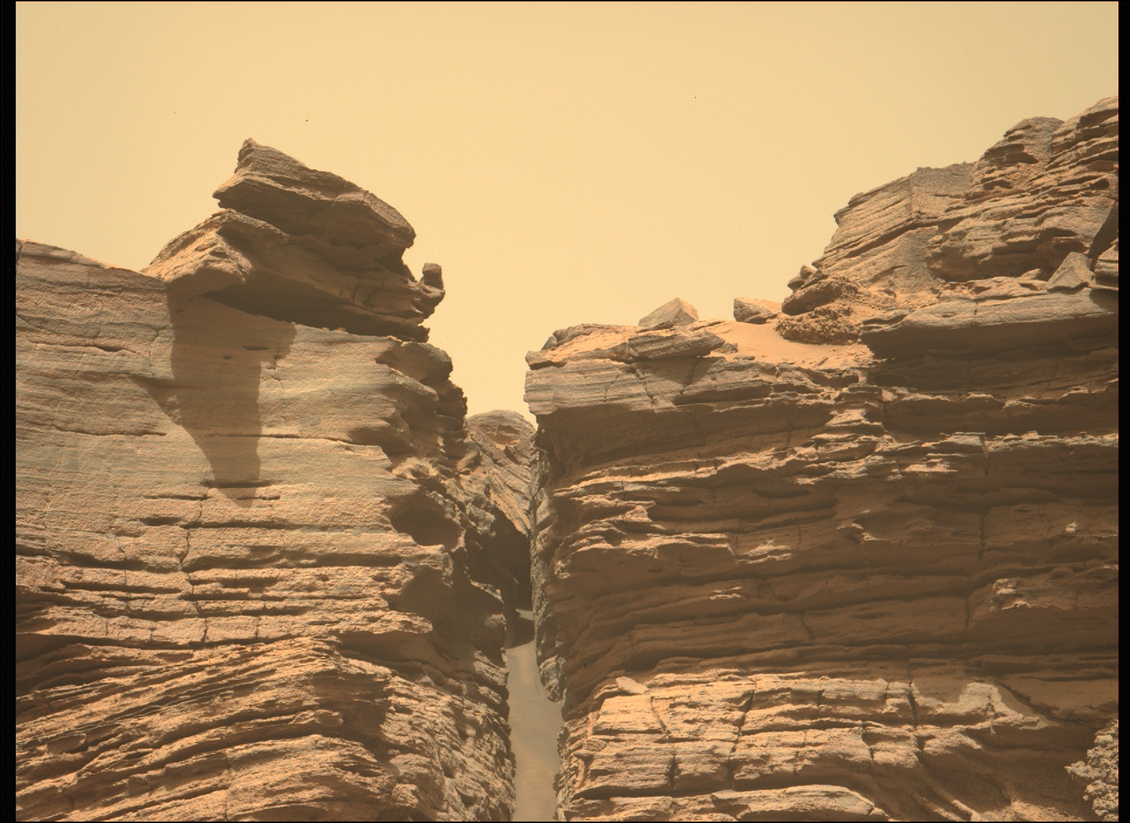
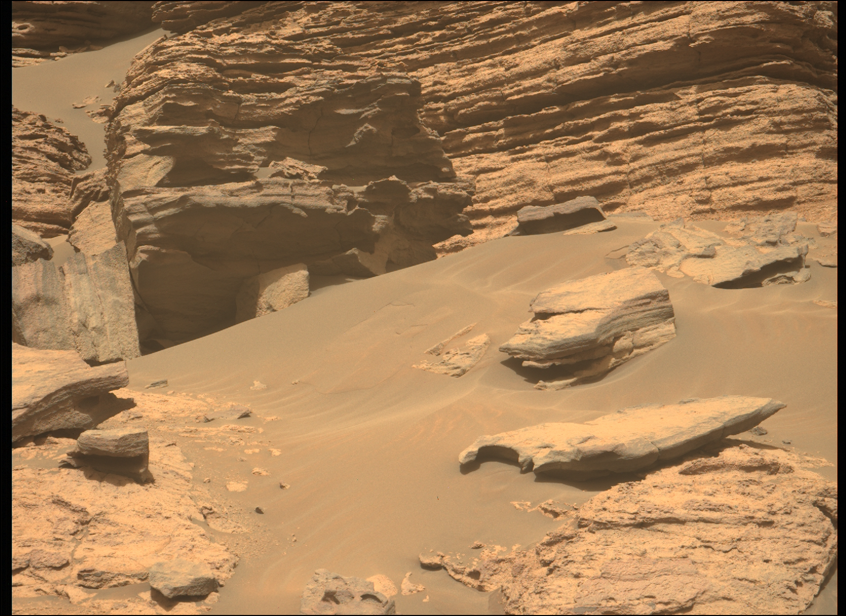
Cool image time! The photo to right, taken by the Mars rover Curiosity on August 9, 2022, provides a nice close-up of what might be a somewhat typical rock on the flanks of Mount Sharp in Gale Crater, many layered with some of those layers extending outward to the side for somewhat ridiculous distances as thin flakes.
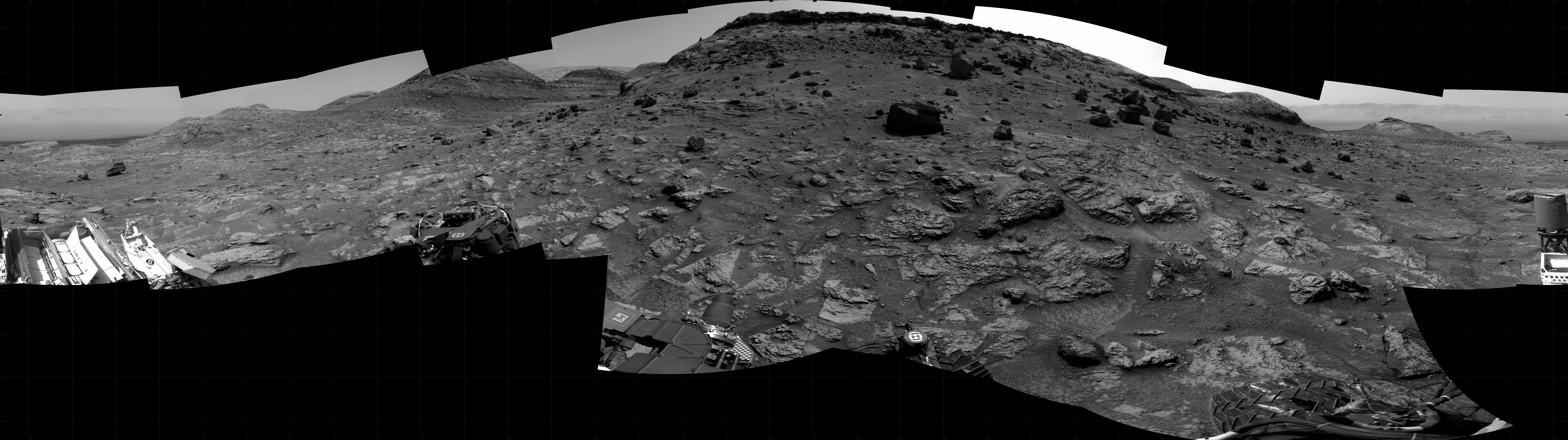
The scientists call it a float rock, because they think it actually fell from the cliff dubbed Bolivar in the panorama above. Thus, it gives geologists data on the layers higher up that are not easily accessible from Curiosity’s present position.
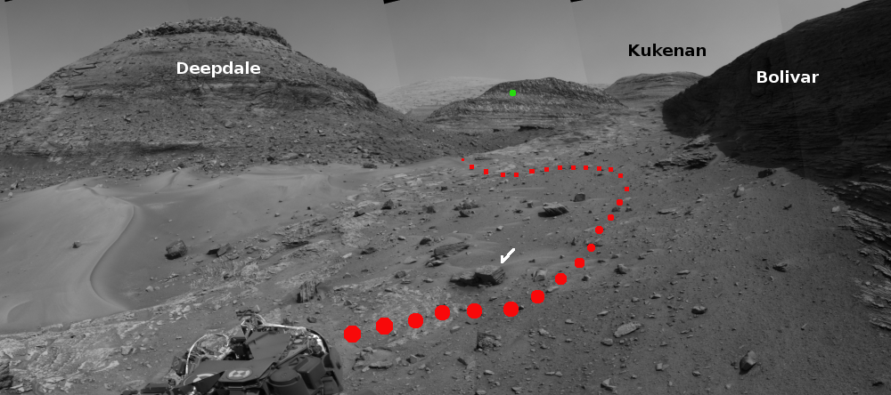
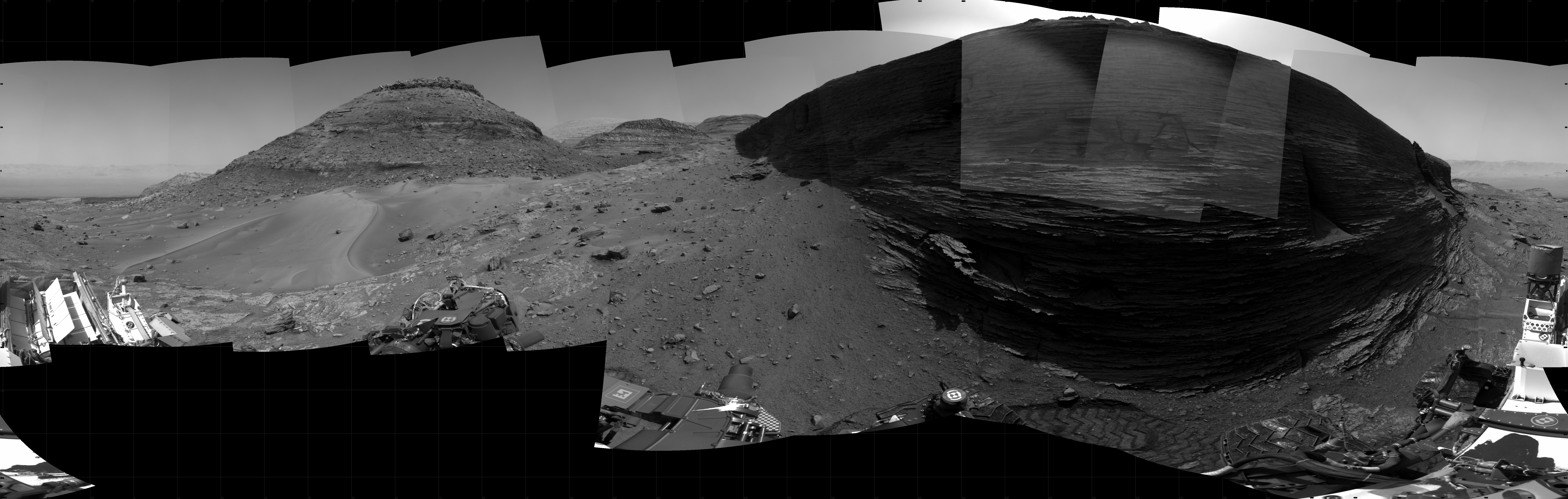
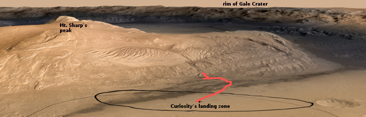
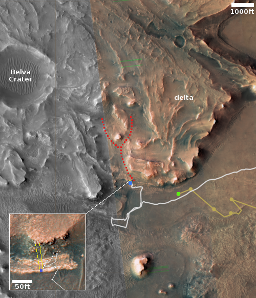
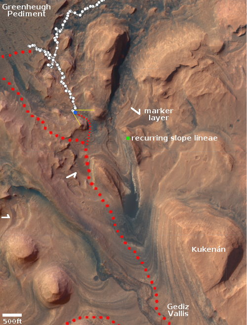
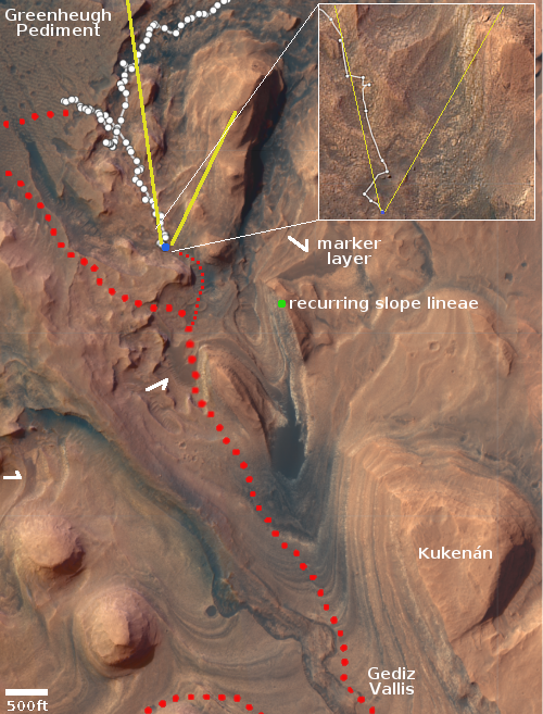
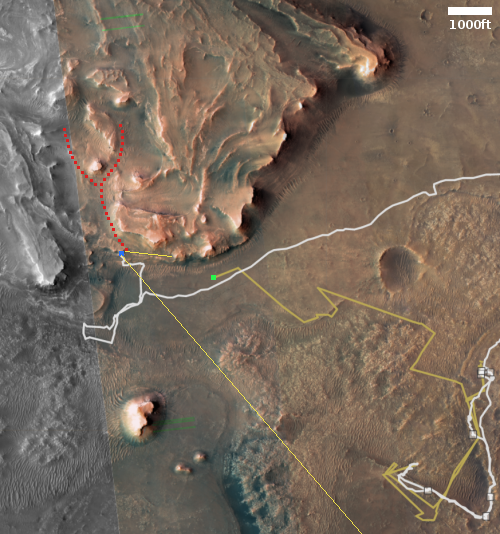
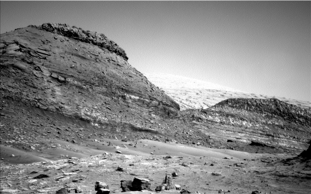
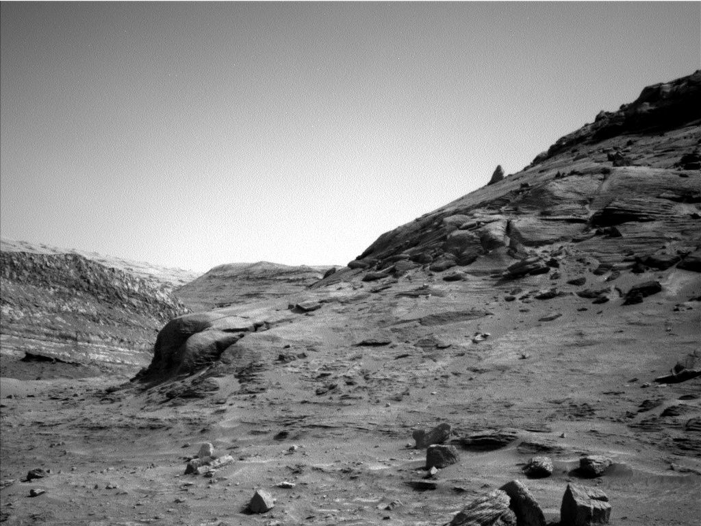
The panorama is a mosaic created from images taken by the rover’s right navigation camera on August 8, 2022. The white arrow marks the rock. The green dot marks the approximate location on the cliff face of a previously observed recurring slope lineae, streaks that appear to come and go seasonally whose origin is still not understood.
The red dots mark my guess as to the route engineers will pick for Curiosity as it weaves its way around the other float rocks ahead.
» Read more
Click for full 360 degree panorama.
Click for full image.
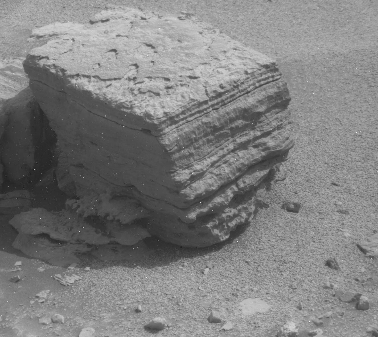
Cool image time! The photo to right, taken by the Mars rover Curiosity on August 9, 2022, provides a nice close-up of what might be a somewhat typical rock on the flanks of Mount Sharp in Gale Crater, many layered with some of those layers extending outward to the side for somewhat ridiculous distances as thin flakes.
The scientists call it a float rock, because they think it actually fell from the cliff dubbed Bolivar in the panorama above. Thus, it gives geologists data on the layers higher up that are not easily accessible from Curiosity’s present position.
The panorama is a mosaic created from images taken by the rover’s right navigation camera on August 8, 2022. The white arrow marks the rock. The green dot marks the approximate location on the cliff face of a previously observed recurring slope lineae, streaks that appear to come and go seasonally whose origin is still not understood.
The red dots mark my guess as to the route engineers will pick for Curiosity as it weaves its way around the other float rocks ahead.
» Read more


