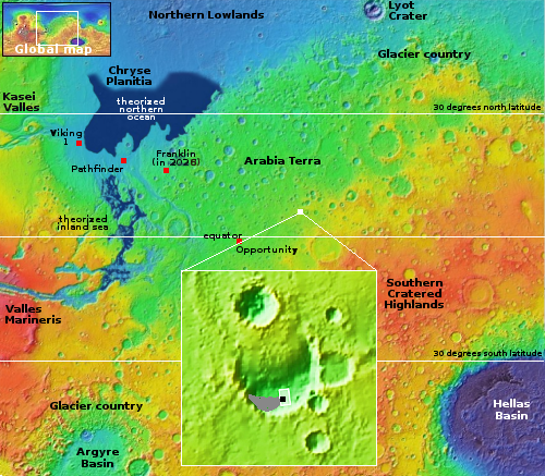
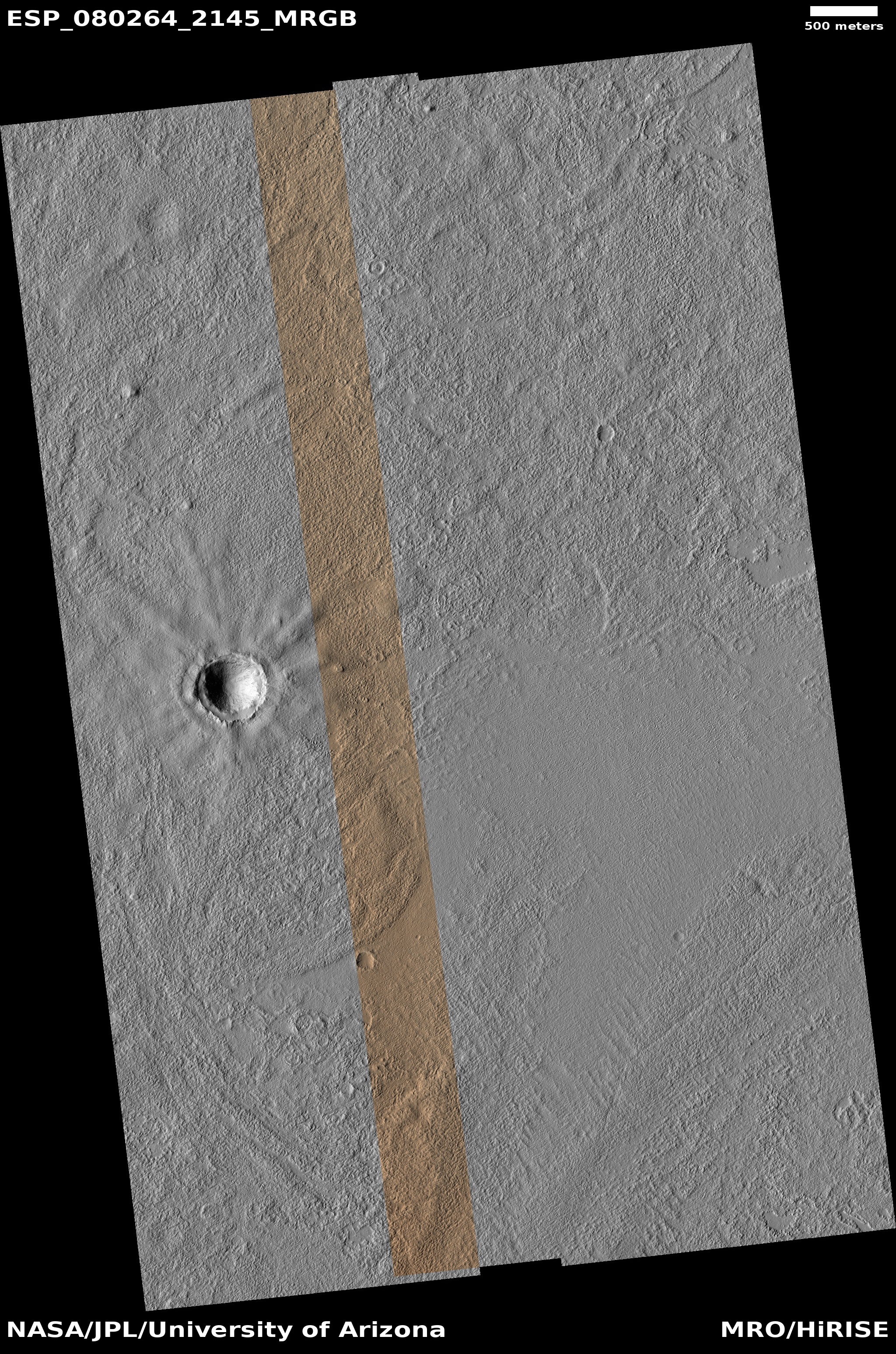
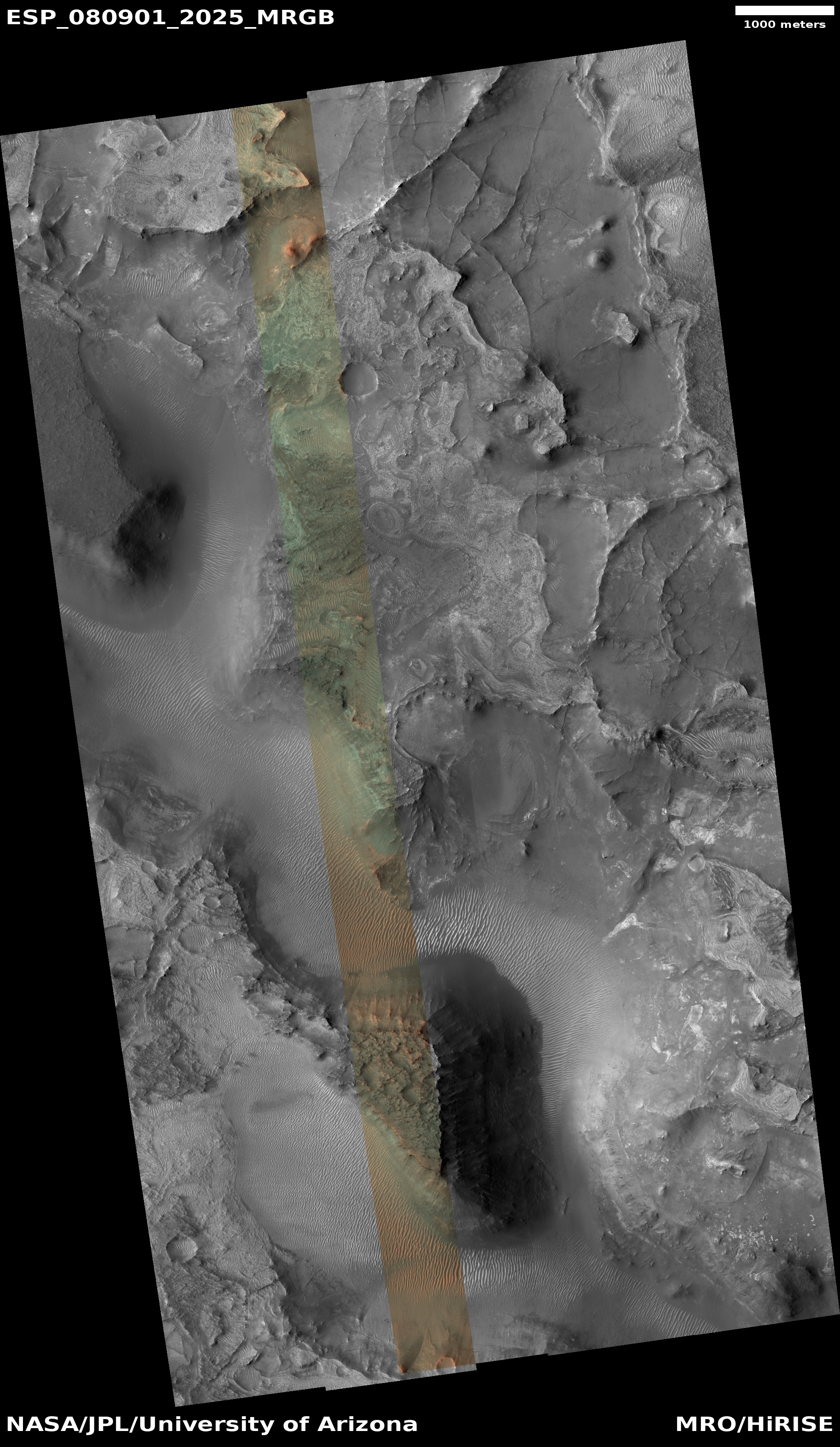
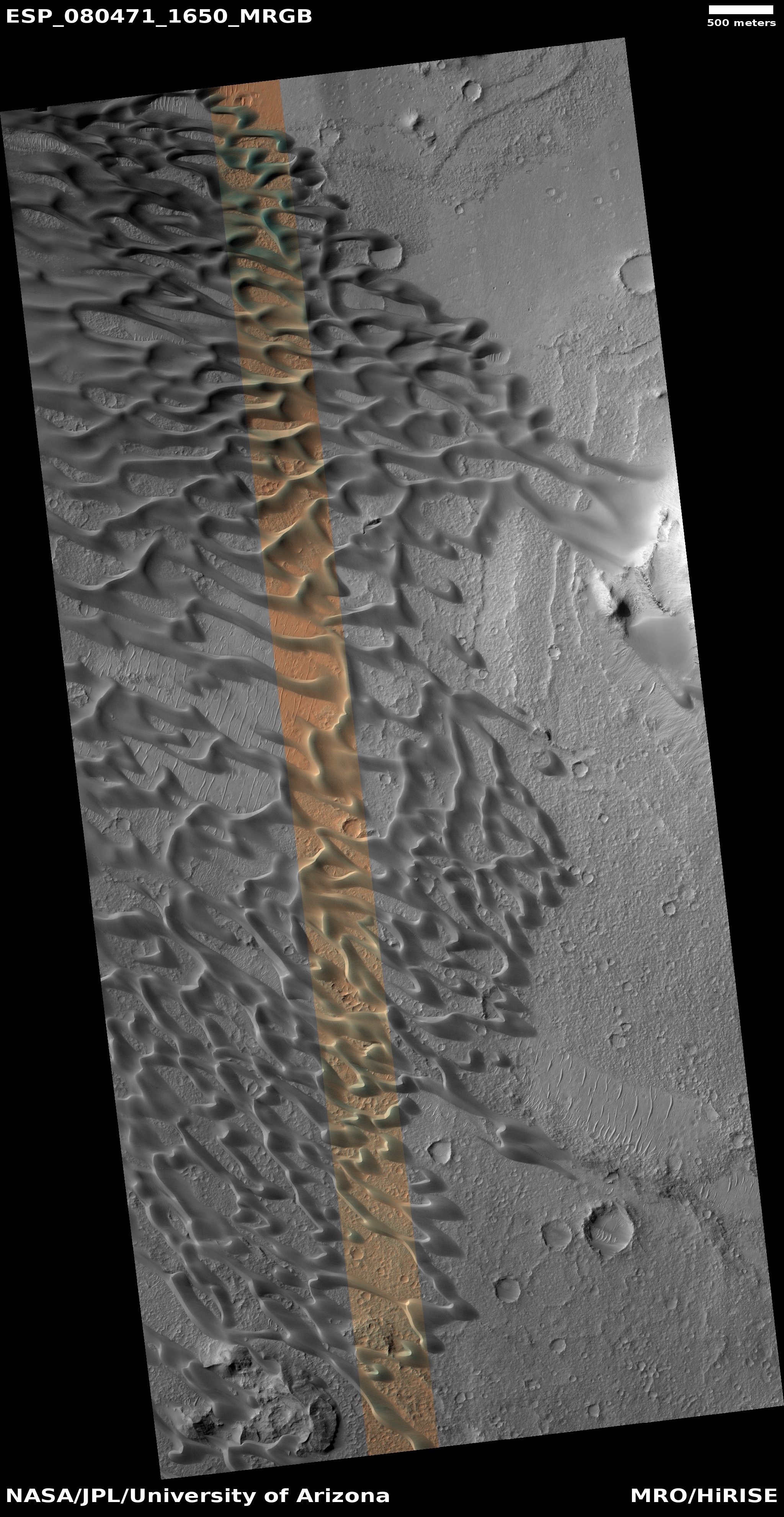
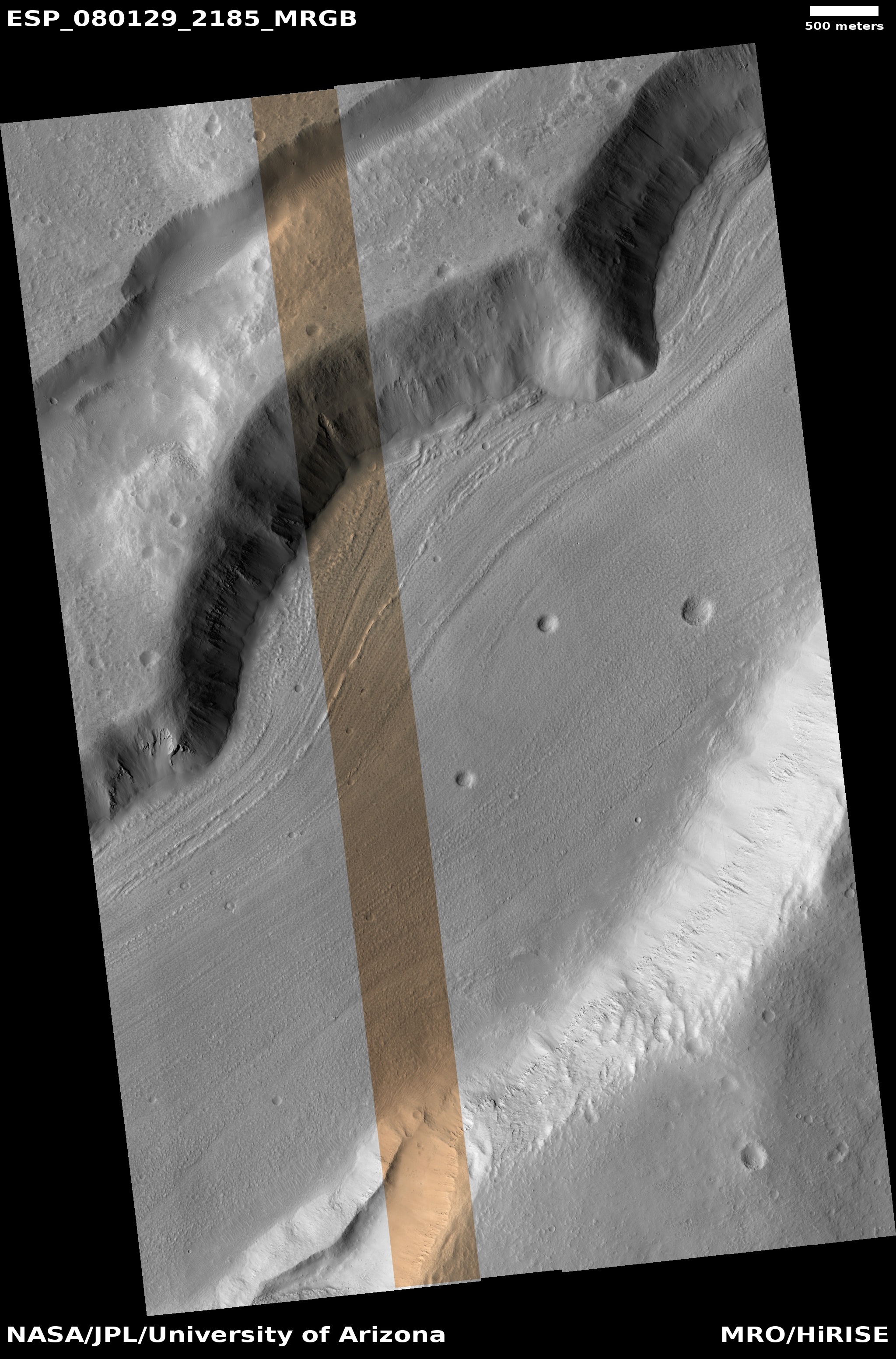
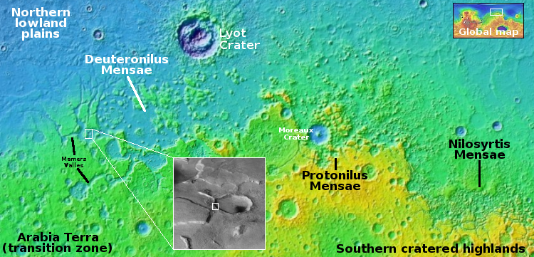
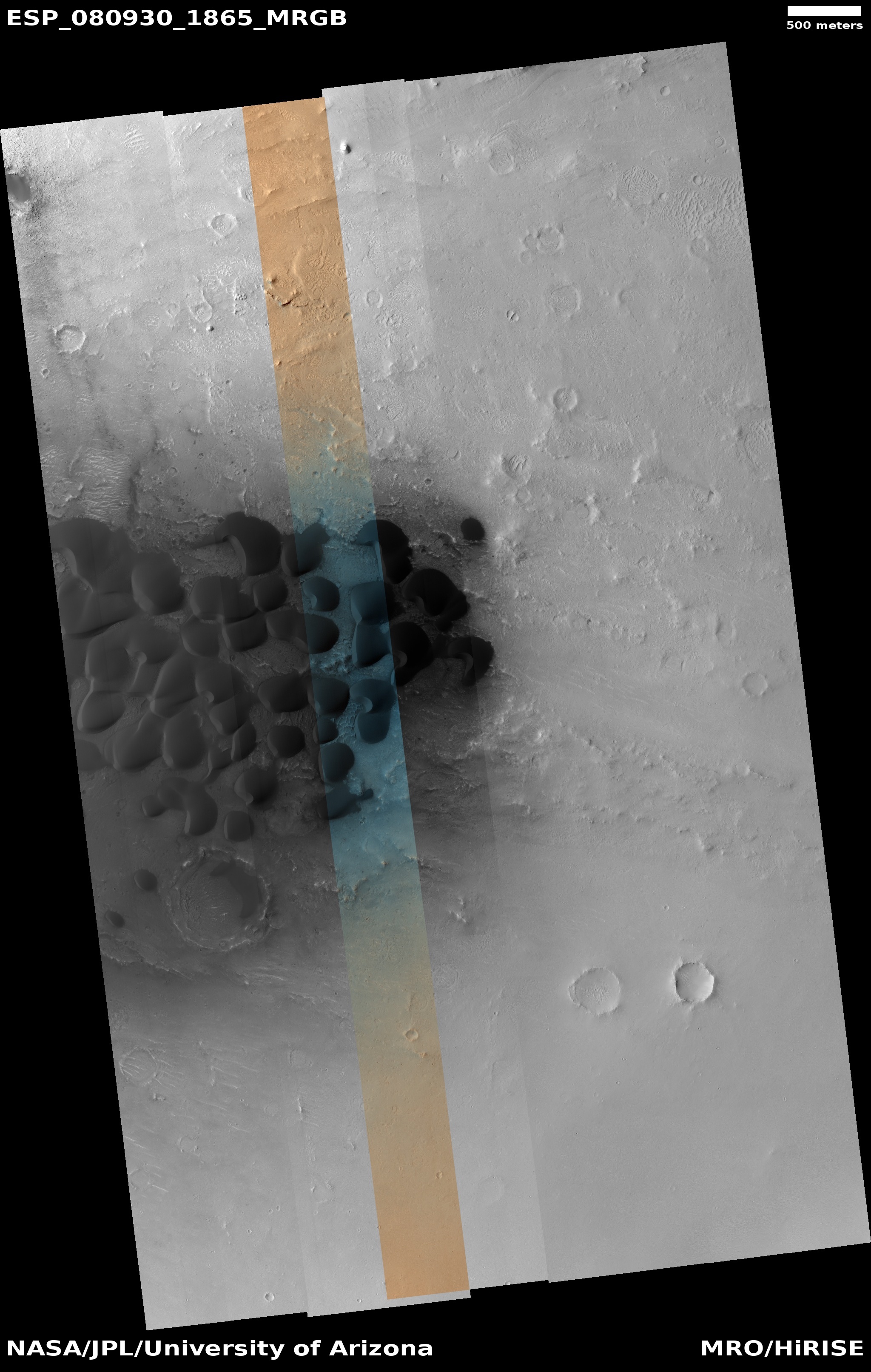
Martian dunes with strange splotches

Martian dunes with splotches

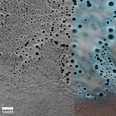
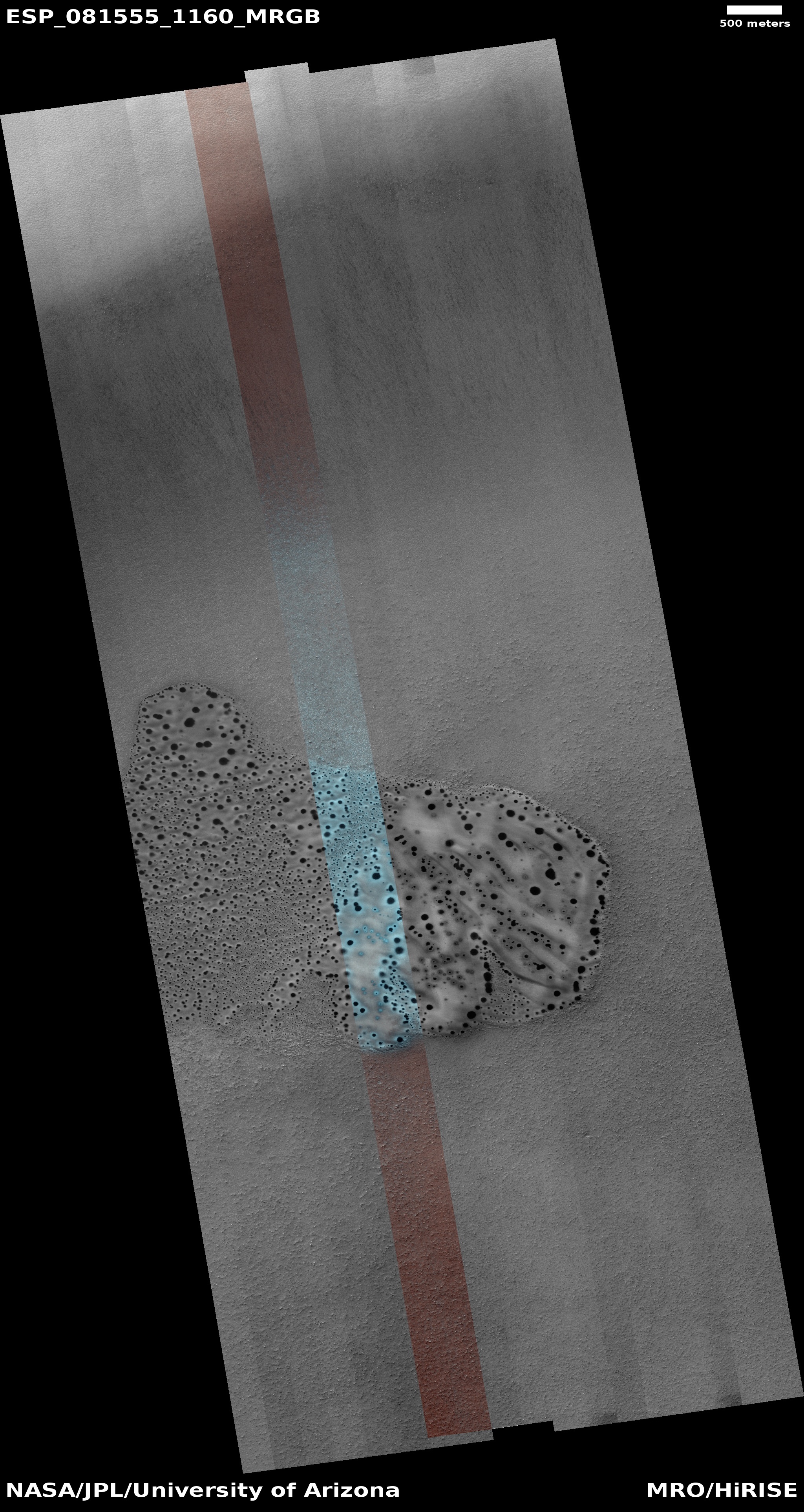
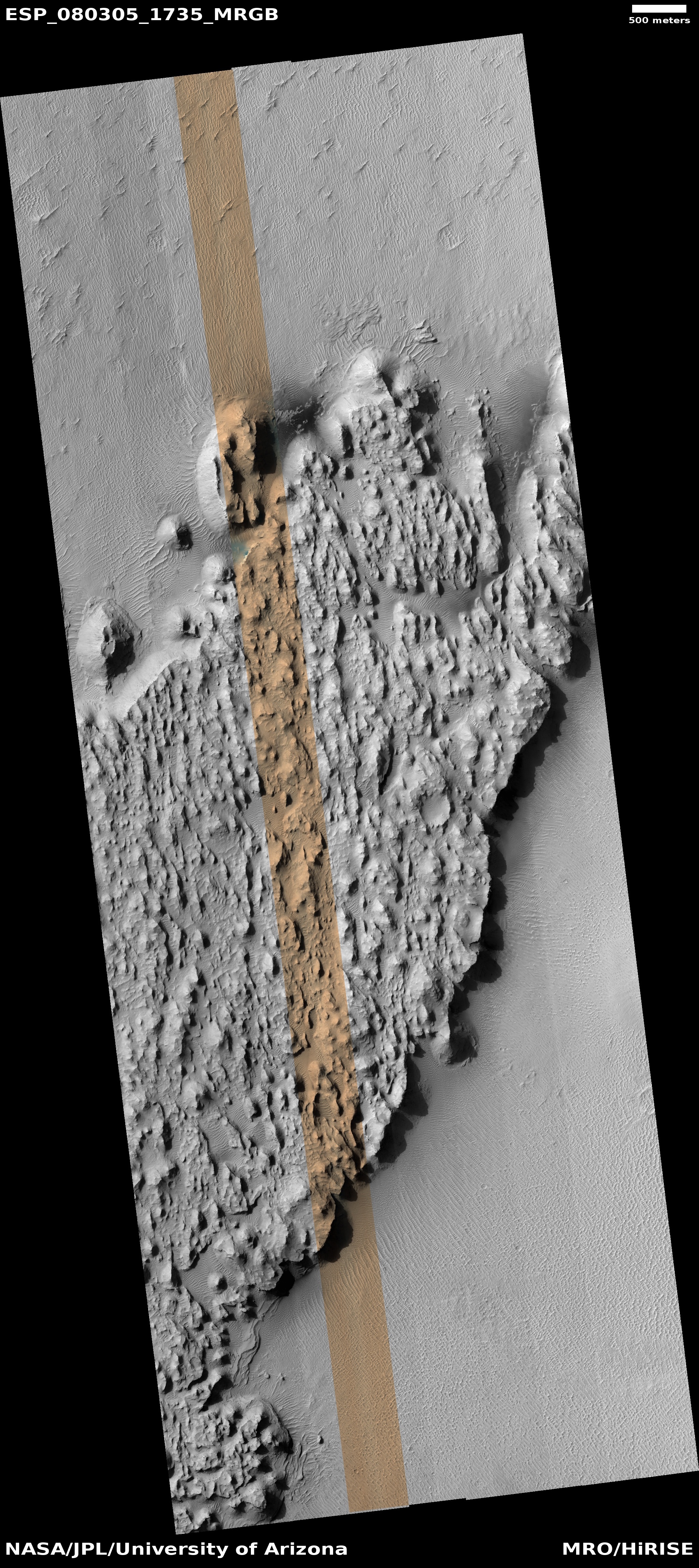
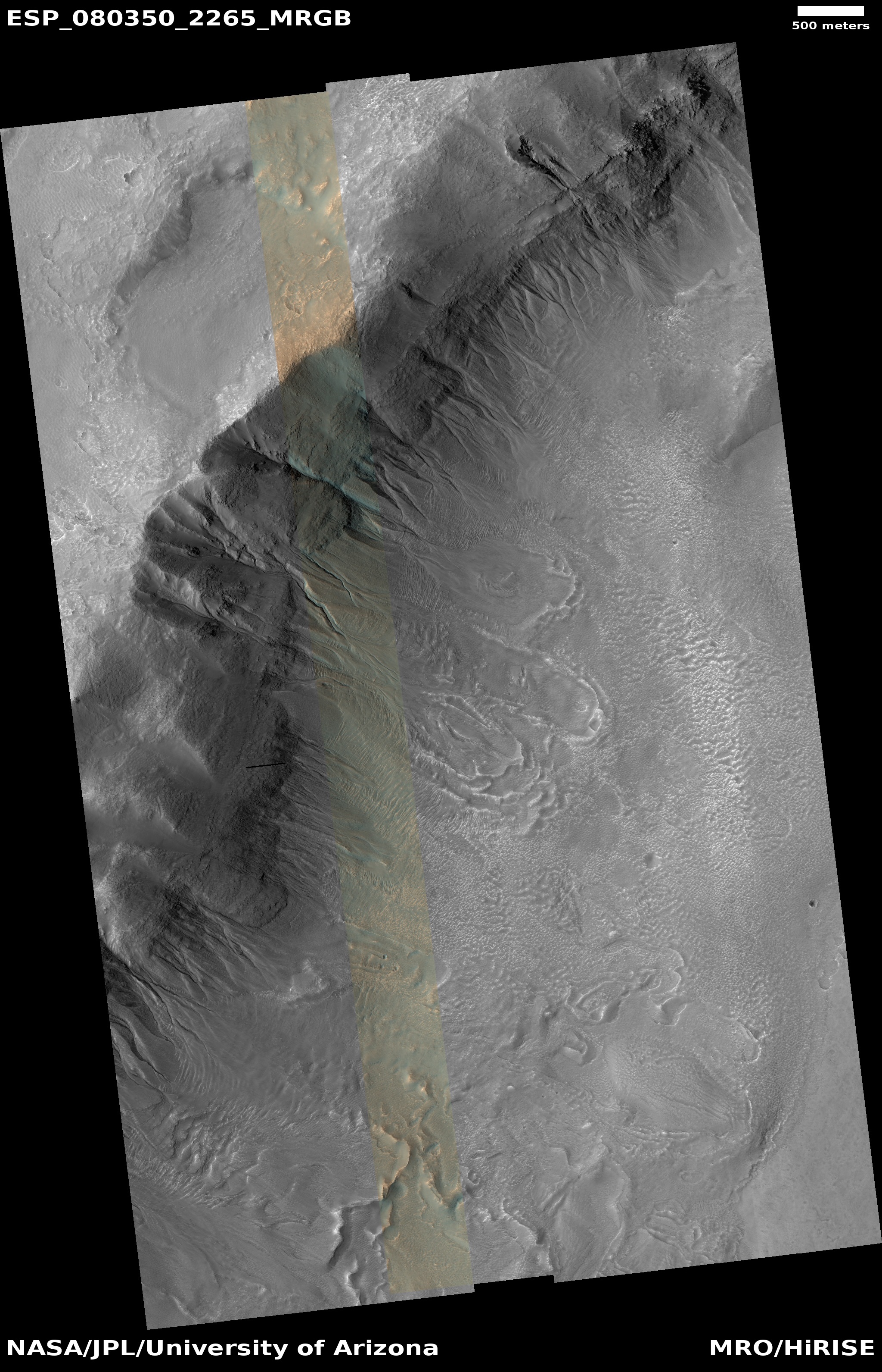
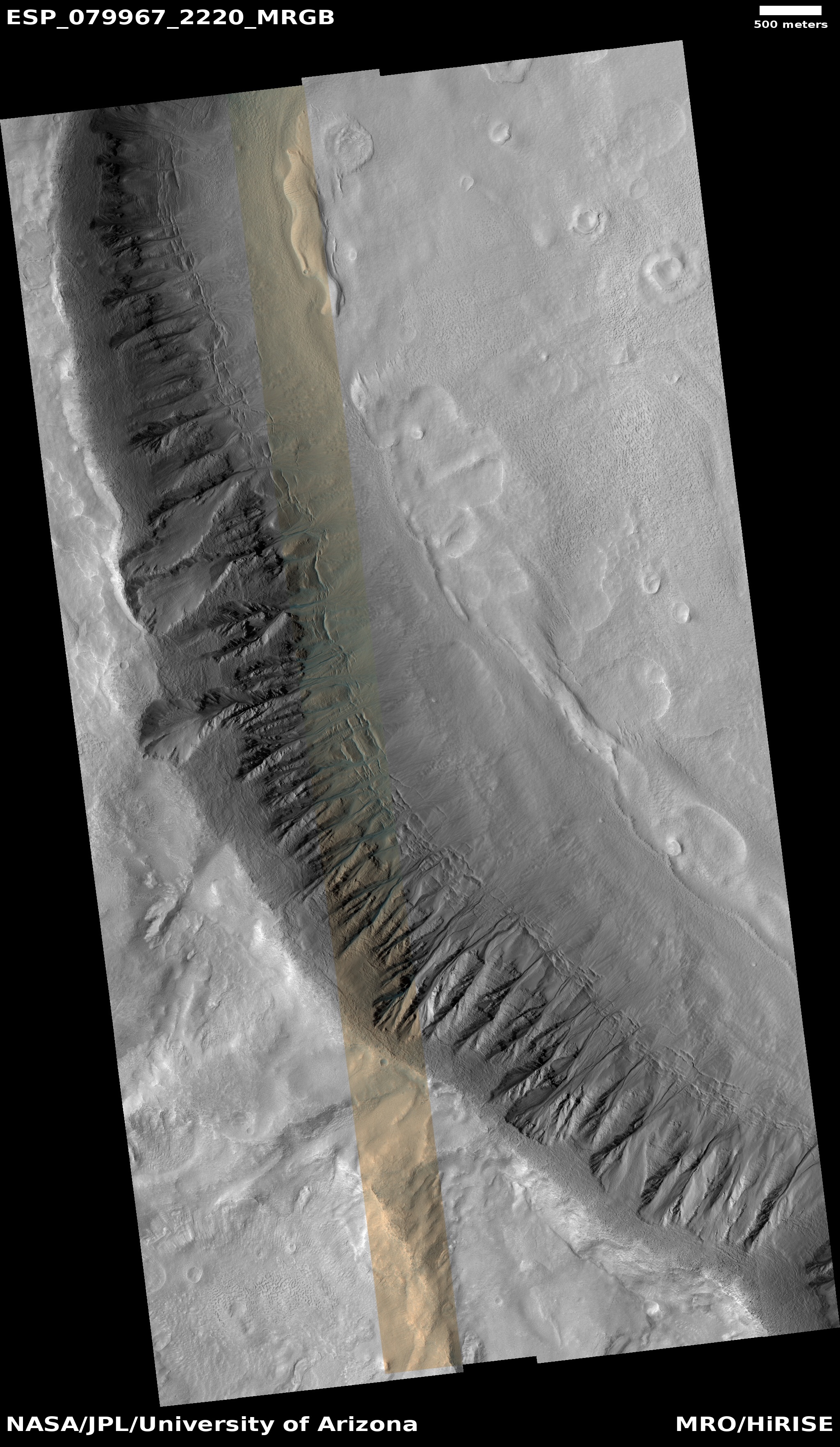
Cool image time! The picture to the right, cropped to post here, was taken on December 20, 2023 by the high resolution camera on Mars Reconnaissance Orbiter (MRO). It shows what the science team labels as “Dunes with Blotches.”

The blotches, or as I call them splotches, are the round dark patches on dunes themselves. Though their darkness is reminiscent of the dark patches that appear as spider features in the south polar regions of Mars, there are problems linking the two. The spiders form when the winter mantle of dry ice that falls as snow begins to weaken when the Sun reappears in the spring. Sunlight travels through the clear dry ice to warm the base of the mantle, causing it to sublimate into carbon dioxide gas. That gas however is trapped at the base, and only escapes when the thin mantle cracks at weak points. As the gas puffs out it carries with it dust, which leaves dark patches on the surface that disappear when the mantle disappears entirely by summer.

In the southern hemisphere at the poles the ground is somewhat stable, so the trapped gas appears to travel along the same paths each year to the same weak spots. This in turn causes it to carve spidery patterns in the ground, like river tributaries, except here the tributaries of gas flow uphill to their escape point. At the north pole the ground is not as stable. Instead we have many dunes, so that the dry ice mantle sublimates away at different places each year. There is no chance to form such spider patterns over time.

Making these splotches more puzzling is the season. This picture was taken in the winter, at a time one would think no dry ice is sublimating away.
» Read more

More hiking possibilities on Mars!

More hiking possibilities on Mars
Click for original image.

Cool image time! The picture to the right, rotated, cropped, reduced, and sharpened to post here, was taken on September 27, 2023 by the high resolution camera on Mars Reconniassance Orbiter (MRO). Dubbed a “terrain sample” by the science team, this picture was likely chosen not as part of any specific research project but to fill a gap in the camera schedule so as to maintain that camera’s proper temperature.

When the team needs to do this they try to pick interesting targets. In this case the location is the region of many many parallel north-south fissures that extend for more than 800 miles south of the giant but relative flat shield volcano Alba Mons. These fissures are grabens, cracks formed when underground pressure pushed the ground up and caused it to spread and crack.

What attracted me to this picture is the ridgeline. It struck me as a wonderful place to hike. I have even indicated in red the likely route any trail-maker would pick to go from the valley below up onto the ridge, and then along its knifelike edge to the south. The height of the cliff down to the east valley averages about six hundred feet, guaranteeing beautiful scenery the entire length.
» Read more

A small Martian volcano?

A small Martian volcano?
Click for original image.

Cool image time! The picture to the right, cropped, reduced, and sharpened to post here, was taken on December 21, 2023 by the high resolution camera on Mars Reconnaissance Orbiter (MRO). The science team labeled it a “fresh crater”, but that description I think is misleading, as it implies a recent impact.

The crater does not look like a fresh impact crater to me. Such things on Mars usually appear very dark, as the impact dredges up dark material. This crater is not dark. More significant is the crater itself. The small 300-foot-wide inner crater, surrounded by a circular plateau and all sitting inside the larger 1,200-foot-wide crater is completely unique compared to any impact crater I have ever seen. Impacts in soft material, such as ice-impregnated ground, can cause concentric ripple rings, but they don’t look like this.

Instead, this crater more resembles the caldera of a volcano, where subsequent eruptions can produce overlapping depressions at the volcano peak. (See for example this picture of Olympus Mons.)

Moreover, the crater sits on top of a peak approximately 300 feet high. While impacts in ice-impregnated ground on Mars can produce splash aprons as seen here, the crater usually sits at about the same elevation as the surrounding terrain, not at the top of a peak. This peak suggests the apron was forned not by a splash but repeated flows coming down from the top.
» Read more

A spot where the surface of Mars cracked

The spot where Mars cracked
Click for original image.

Cool image time! The picture to the right, rotated, cropped, reduced, and sharpened to post here, was taken on September 14, 2023 by the high resolution camera on Mars Reconnaissance Orbiter (MRO). It shows a small section of the Cerberus Fossae cracks, a parallel series of cracks that stretch more than 700 miles across the volcanic plains of Mars.

These cracks formed when the ground spread apart, creating a void in which the surface collapsed. You can see this process illustrated quite clearly by the crater in the lower right, as indicated by the arrow. The crater had existed prior to the crack. When the ground split and collapsed, only the northeast quadrant of the crater was destroyed.

These cracks might also have been the source of Mars’ most recent large volcanic event, as shown by the overview map below.
» Read more

Have these Martian dunes changed in sixteen years?

Comparing two MRO images taken 16 years apart
Click here and here for the original images.

Overview map

Cool image time! The two pictures above, both rotated, cropped, reduced, and enhanced to match and to post here, were taken by the high resolution camera on Mars Reconnaissance Orbiter (MRO) sixteen years apart. The first, on the left, was taken on February 23, 2007, while the second, on the right, was taken on November 1, 2023.

What drew me to both images was the label for the second: “Dune Change in Arabia Region Crater.” To find out if this image had revealed any changes in the dunes I went back and found the earliest MRO picture of this location, and sized and enhanced the dunes in both to match.

Do you see any changes? I don’t. However, that really means nothing. These are not the highest resolution versions that MRO obtains, and a very careful comparison of those best images might detect more subtle changes than our eyes can perceive in the versions above. Also, there might be brightness changes that require careful software analysis.

The white dot on the overview map to the right marks the location, in Arabia Terra, the largest transition region on Mars between the northern lowland plains and the southern cratered highlands. The inset shows the half filled crater in which these dunes sit. The grayed area on the floor of the crater marks the entire dune field, extending eastward to the crater rim from this one spot, indicated by the black dot.

It is likely that the dust is blown into this crater and gets trapped there. Whether the dunes move or change is not clear, though if they do the changes are small, even after almost two decades. Instead, the two pictures suggest these dunes have hardened into a form of sandstone, that can be eroded over time by the wind, but only very very slowly.

A plateau of friable rock on Mars

A plateau of friable rock on Mars
Click for original image.

Cool image time! The picture to the right, rotated, cropped, reduced, and sharpened to post here, was taken on September 13, 2023 by the high resolution camera on Mars Reconnaissance Orbiter (MRO).

The science team labels this “Friable Outcrops in Aeolis Dorsa.” What we are looking at is the northeasternmost tip of a 30-mile long plateau that marks the northern edge of Mars southern cratered highlands. For most of its length the top of that plateau is relatively smooth, broken by some vague surface features and a few scattered craters (suggesting it is relatively young). However, as you approach the plateau’s edges and especially that northeastern tip the surface begins to break up into the rough terrain shown to the right. It appears that the prevailing winds from the north are scouring the soft topsoil here and causing it to wear away, leaving behind those innumerable small ridges, almost all of which are oriented from north-to-south.

But why is the topsoil here soft and so easily scoured?
» Read more

An ancient Martian river system now meandering ridges

Context camera mosaic of river system.

An ancient Martian river system
Click for original image.

Cool image time! The picture to the right, cropped and reduced to post here, was taken on August 27, 2023 by the high resolution camera on Mars Reconnaissance Orbiter (MRO). It was featured by MRO’s science team yesterday, in which Shane Byrne of the Lunar and Planetary Lab University of Arizona wrote the following:

River beds often get filled with gravel and the surrounding terrain is often built up of fine-grained mud from river overflows. The gravely river bottom and the fine-grained surroundings can lead to a strange phenomenon that geologists call inverted channels. After the river disappears, the fine-grained surroundings can be easily eroded away leaving the gravely river bed as a high-standing ridge.

These ridges show the location of the old river beds in Mars’ distant past. The angle at which the ridges join together indicate that these rivers flowed from top-right to bottom-left (i.e. southwest).

The picture above is a mosaic produced from the global survey taken by MRO’s lower resolution context camera. It gives us a fuller picture of this river system, with the rectangle showing the small area covered by the photo on the right. Overall this ancient and extinct river of ridges travels more than thirty miles downhill from the northeast to the southwest.
» Read more

Another apparent splat on Mars

Another apparent splat on Mars
Click for original image.

This cool image poses a mystery that might be important for future colonists. The picture to the right, cropped, reduced, and sharpened to post here, was taken on October 23, 2023 by the high resolution camera on Mars Reconnaissance Orbiter (MRO).

The science team merely labels this vaguely as simply “landforms.” What it appears to be is an ancient flow of mudlike material or a delta that moved from the west to the east. Its nature is even more evident in the full picture. The top of the delta however appears corroded and old, with a number of craters on top suggesting it has been here for a long time.

Its mudlike appearances suggests water was involved, possibly as ice impregnated within the soil. However, the location says no, unless this occurred so long ago that the entire climate of Mars and this region was vastly different. And in fact, it might have been.
» Read more

Gullies and avalanches in Martian crater

Gullies and avalanches in a Martian crater
Click for original image.

Cool image time! The picture to the right, cropped, reduced, and sharpened to post here, was taken on September 17, 2023 by the high resolution camera on Mars Reconnaissance Orbiter (MRO). It shows two significant features, both of which suggest the action of near-surface water ice to change to surface of Mars.

First are the gullies on the cliff wall, which also happens to be the interior slope of a 30-mile-wide crater. Since the first discovery of gullies on Mars, scientists have pondered their origin, with all their hypothesises always pointing to some form of water process. One popular theory [pdf] points to some form of intermittent water flow linked to long term climate cycles caused by the extreme shifts in the red planet’s rotational tilt, from 11 to 60 degrees. Another theory suggests the gullies form from the winter-summer freeze-thaw cycle and the accumulation of frost during winter.

The second feature are the three avalanche debris piles at the base of these gullies. The long extent of each suggests the avalanches flowed more like wet mud than falling rocks. If the ground here was impregnated with ice, than this look makes sense.
» Read more

The divide in a giant Martian lava river

The divide in a giant Martian lava river
Click for original image.

Cool image time! The photo to the right, rotated, cropped, reduced, sharpened, and annotated to post here, was taken on September 24, 2023 by the high resolution camera on Mars Reconnaissance Orbiter (MRO).

As indicated by the arrows, this is a frozen river of lava on Mars, flowing to the southwest and then splitting into two streams, one to the west and the other to the south. Being a Martian lava flow, when it was liquid it flowed much faster than lava on Earth, almost like a thick water. The flow bored into any high features, such as the two mesas in this picture, and streamlined their shapes, tearing material away as the lava moved by quickly. In the process the lava flow exposed many layers in those mesas, indicating many other previous lava flow events.

The crater in the lower mesa, where the stream splits, appears to have been more resistent to the flow, having been compacted into harder and denser material by the impact itself.
» Read more

A cluster of strange terrain in Martian glacier country

Overview map

A cluster of strange terrain on Mars
Click for original image.

Cool image time! The picture to the right, rotated, cropped, reduced, and sharpened to post here, was taken on October 21, 2023 by the high resolution camera on Mars Reconnaissance Orbiter (MRO).

The science team labels this “patterned ground.” I see instead a whole range of inexplicable Martian geological features that, while each has been documented previously, each remains puzzling as to its formation process.

First there is the stucco-like peaks of all sizes on the upper left. This surface really looks like it had been wet plaster covered with Saran Wrap that had its peaks pulled up when that wrap was pulled off quickly.

Then there is brain terrain on the right. Always associated with glacier features on Mars, these convolutions are unique to Mars and as yet not entirely understood.

Next there is the circular arc on the middle left. It appears to be the remains of an impact crater now filled partly, but if so why has its northern rim disappeared so completely?

If you look close at the image above as well as the full image, you will find other mysterious features as well.

The location is the white dot on the overview map above. The rectangle in the inset shows the area covered by this picture, part of the floor of an unnamed eighteen-mile-wide and one-mile deep crater. The glacial material that appears to fill its interior as well as the splash apron that surrounds it all suggest the ground here is impregnated with water ice. Located as it is on the western end of the 2,000-mile-long north mid-latitude strip I dub glacier country — where practically every image shows glacial features — this conclusion is not surprising.

In fact, this photo illustrates well the alieness of Mars. We understand glaciers and ice, but on Mars, with its very cold temperatures, one-third Earth gravity, and thin atmosphere, those glaciers and ice are able to do things that we don’t yet understand. Untangling these geological processes will take decades of work, and likely will not be completed until people can walk the Martian surface and study it up close.

And won’t that be fun?

Double-ringed crater near the Starship landing zone on Mars

Double-ringed crater
Click for original image.

Cool image time! The picture to the right, rotated, cropped, reduced, and sharpened to post here, was taken on September 10, 2023 by the high resolution camera on Mars Reconnaissance Orbiter (MRO). It shows what the scientists label simply as a “double-rim crater.”

If you look close you might not be unreasonable to call this instead a triple-rim crater, as there appear to be two rings on each side of the highest crater rim.

Multple rings in craters are not rare. We see many on the Moon. Most however are associated with very large impacts, and are an expression of the ripples formed at impact, not unlike the ripples seen when you drop a pebble in water. Unlike water ripples, the ripples formed in rock are impact melt that quickly refreezes, thus capturing those ripples as concentric rings.

In this case, these rings likely signal not freezing rock but freezing ice.
» Read more

Endless ash fields on Mars

Endless ash fields on Mars
Click for original image.

Cool image time! The picture to the right, cropped, reduced, and sharpened to post here, was taken on September 18, 2023 by the high resolution camera on Mars Reconnaissance Orbiter (MRO).

It shows the very typical surface on a high plateau in Mars’ dry tropical regions. The dunes you see here, in this very small slice, cover a region about 80 miles square, with the prevailing winds appearing to consistently blow from the northeast to the southwest and forming these endless striations.

The dunes are made of volcanic ash, and the size of this particular ash field gives us a sense of the past volcanic activity that once dominated the red planet. Once, the atmosphere was filled with ash, which covered the ground across large regions. In the subsequent eons the thin Martian atmosphere has reshaped and piled that ash into giant mounds hundreds of miles across, with the surface striated as we see here.
» Read more

Layered volcanic vent on Mars

Layered volcanic vent on Mars
Click for original image.

Cool image time! The picture to the right, rotated, cropped, reduced, and sharpened to post here, was taken on August 31, 2023 by the high resolution camera on Mars Reconnaissance Orbiter (MRO), and shows what the science team labels as a “vent near Olympica Fossae.”

The grade within the fissure is downhill to its center. Outside the vent the grade is downhill to the north and south, with the overall grade sloping to the west as well. Note the layers on each side of the depression. Each indicates another volcanic flood event that laid down another layer of lava. At some point this vent either blew up through those layers, or it had remained opened during all those many events, the lava flowing out and acting like water to erode the layers on the north and the south.

As always, the scale of Martian geology is daunting, as shown by the overview map below.
» Read more

Canyons formed from the giant crack that splits Mars

Canyons formed by the giant crack that splits Mars
Click for original image.

Cool image time! The photo to the right, cropped, reduced, and sharpened to post here, was taken on September 22, 2023 by the high resolution camera on Mars Reconnaissance Orbiter (MRO). It shows a complex of north-south trending canyons, with easternmost cliff about 400 feet high (though the full drop to the large canyon on its east is closer to 800 feet).

These canyons however have nothing to do with ice or water flow. They were formed by underground tectonic forces that pushed the ground upward, forced it to split and form cracks. Those cracks in turn produced these canyons. In some cases, such as the depression on top of the central ridge, the formation process probably occurred because fissures formed below ground, causing the surface to sag.

As always, the hiker in me wants to walk up the nose of that ridge and then along its western edge, with the western canyon on my left and that smaller depression on my right.

The larger context of this location is in itself even more spectacular.
» Read more

The mining potential on Mars

The mining potential on Mars
Click for original image.

Cool image time! The picture to the right, cropped, reduced, and sharpened to post here, was taken on October 30, 2023 by the high resolution camera on Mars Reconnaissance Orbiter (MRO). Labeled simply as a “terrain sample,” it was probably taken not as part of any specific research project but to fill a gap in the schedule in order to properly maintain the camera’s temperature.

Nonetheless, the larger region where this photo is located is one of great interest to scientists as well as to future explorers. First note the colors. The wide variations between the bright orange of that peak (only a few tens of feet high) and the light orange and aqua-green of the bedrock to the north and south suggest a terrain with a lot of different materials within it.

The location is in the dry equatorial regions, so the swirls visible on the plateaus north and south of that small peak are not related to near surface ice. Instead, this is warped bedrock, with those swirls also suggesting material of a varied nature, exposed to the surface by erosion processes.
» Read more

Dunes on the floor of Valles Marineris

Overview map

Dunes on the floor of Valles Marineris
Click for original image.

Cool image time! The picture to the right, cropped, reduced, and sharpened to post here, was taken on September 26, 2023 by the high resolution camera on Mars Reconnaissance Orbiter (MRO). It shows a field of scattered elongated dunes on a flat older surface with craters and what appear to be smaller ripple dunes (in the lower left). The large elongated dunes tend to be oriented in an east-west manner, while the older tiny ripple dunes appear to have a north-south orientation.

Very clearly the larger dunes appear to be traveling across that flat older surface, though whether there is any documented movement is unknown. Generally (though there are exceptions) scientists have found most of the dunes on Mars to be either inactive, or if they are moving because of the wind that movement is very tiny per year. In this case there is one dark spot on the dunes, near the center of the picture, where it appears a collapse might have occurred, suggesting recent change.

On the center right of the picture is the end point of a long ridgeline extending 10 to 12 miles to the east and rising about 7,300 feet, as shown in the overview map above. The small rectangle in the inset shows the area covered by the photograph.

At the base of that ridgeline can be seen a series of terraces descending to the west, suggesting that this hill might be volcanic in nature, with each terrace indicating a separate lava flow. The location is in the dry equatorial regions, so near-surface ice is likely not an explanation.

In the inset the mountain wall to the north is the large mountain chain that bisects this part of Valles Marineris. It overwhelms this small 7,300-foot-high ridge, rising more than 22,000 feet from these dunes with its high point still one or two thousand feet below the rim of Valles Marineris itself.

Once again, the grand scenery of Mars amazes. Imaging hiking a trail along that ridgeline, with the mountains rising far above you to the north and south.

Mapping the major lava flood events in Mars’ volcano country

The volcanic events in Mars' volcano country
Click for original map.

In a paper just released, scientists have used the orbital data from Mars Reconnaissance Orbiter (MRO) to map on Mars forty different past volcanic eruptions of extensive flood lava covering large regions, all within the region I dub “volcano country” because its entire surface seems mostly shaped by flows of lava.

The map above, figure 1 from the paper, shows the study area (within the white rectangle), with its global context and additional information added by me on the right. Most of the largest earthquakes detected by InSight ran from north-to-south down the center of the white box. The named features are all large flood lava events, with the youngest being Athabasca. Within the Cerburus Plains feature the researchers mapped many smaller events which brought the total up to forty. From the abstract:

An area almost as large as Europe was investigated. The study revealed the products of more than 40 volcanic events, with one of the largest flows infilling Athabasca Valles with a volume of 4,000 km3. The surface appearance and material properties suggest that Elysium Planitia is composed of basalt, the most common type of lava on Earth. The area also experienced several large floods of water, and there is evidence that lava and water interacted in the past. However, while there could be ice in the ground today, it likely occurs in small patches.

None of these flood lava events involved the gigantic volcanoes that surround this region. Instead, the lava erupted from vents within this region, and then flowed downgrade to flood large areas, sometimes covering over parts of earlier lava floods. All also flowed much faster than lava on Earth, flooding vast regions — comparable to entire countries — often in mere weeks.

Isolated mesa on Mars

An Isolated mesa on Mars
Click for original image.

Cool image time! The picture to the right, cropped, reduced, and sharpened to post here, was taken on August 13, 2023 by the high resolution camera on Mars Reconnaissance Orbiter (MRO).

The central butte is about 100 feet high. Not only are its flanks terraced, suggesting sedimentary layers, note the many black dots on its northern slopes. Those dots appear to be many boulders that appear to have rolled down the slopes to settle mostly near the mesa’s base.

The boxwork ridges to the west and south suggest the ground was fractured in some event to produce cracks, which were later filled with material that was erosion resistent. As the terrain was worn away by wind it left these ridges behind.

The prevailing winds in this region are believed to blow mostly to the south, which might explain the parallel ridges south of the mesa. Or not. On this I am guessing entirely.
» Read more

A glacial lake on Mars?

A glacial lake in a
Click for original image.

Cool image time! The picture to the right, rotated, cropped, reduced, and sharpened to post here, was taken on August 30, 2023 by the high resolution camera on Mars Reconnaissance Orbiter (MRO).

It shows what appears to be a glacial flow of ice, flowing downhill to the southwest and inside a wide canyon about three miles across. The canyon rims to the north and south are about 2,000 to 2,100 feet above the canyon’s lowest point, indicated by the string of “+” signs.

This close-up view immediately suggests a canyon whose glacier flows outward to the southwest into open lowland terrain, though the three craters, because they are undistorted, suggests that this flow is presently not active. That suggestion however would be wrong. It is always necessary to understand Martian geology to not only take close-in views at high resolution, but to zoom back and see the terrain in context.
» Read more

Glacial layers in Mars’ glacier country

Glacial layers in Mars' glacier country
Click for original image.

Cool image time! The picture to the right, cropped, reduced, and sharpened to post here, was taken on August 20, 2023 by the high resolution camera on Mars Reconnaissance Orbiter (MRO). It features a 250-foot-high north-south cliff that appears to have numerous horizontal layers within it.

Moreover, both on the plateau above the cliff as well as the floor below it, the entire surface seems to resemble a thick snow/ice field, made even more evident by the distortion of many craters and the apparent glacial material inside each crater.

The layers suggest that this ice was laid down in a series of cycles. During cold periods snow fell and accumulated as ice over time. When things became warmer some of that ice sublimated away, but not all. With the next cold cycle a new layer was put down.

The many layers suggest many climate cycles on Mars, none of which were caused by SUVs or coal-firing electrical power stations.
» Read more

A land of buttes on Mars

A land of buttes on Mars
Click for original image.

Cool image time! The picture to the right, cropped, reduced, and sharpened to post here, was taken on October 4, 2023 by the high resolution camera on Mars Reconnaissance Orbiter (MRO). Labeled a “terrain sample” by the science team, it was likely shot not as part of any specific research project but to fill a gap in the schedule so as to maintain the camera’s proper temperature. When the camera team has to do this they try to pick targets that are of some interest. Usually they succeed, considering the enormous gaps we presently have of Mars’ geological history.

This picture is no different. It shows a land of buttes and mesas, all ranging from 20 to 200 feet high, surrounded by canyons filled with ripple dunes of Martian dust. If you look at the floor of those canyons closely, you will notice that where there are no ripple dunes the ground is slightly higher and smooth. It is as if that ground was a kind of sandstone that was eroded away by wind into sand, which then formed the dunes.
» Read more

Another minor canyon on Mars that would be a world wonder on Earth

Another minor canyon on Mars
Click for original image.

Cool image time! The picture to the right, rotated, cropped, reduced, and sharpened to post here, was taken on August 6, 2023 by the high resolution camera on Mars Reconnaissance Orbiter (MRO). It shows the steep north canyon wall of one small part of the Martian canyon complex dubbed Noctis Labyrinthus

The elevation drop in this picture is about 8,000 feet, but the canyon’s lowest point is several miles further south and another 7,000 feet lower down. What is most intriguing about the geology here is its age. If you look at the full resolution image, you will see that there are scattered small craters on the smooth slopes that resemble sand that gravity and wind is shaping into those long streaks heading downhill.

Those craters, however tell us that these smooth slopes are very old, and have not changed in a long time. Furthermore, though the material appears to look like soft sand, the craters also tell us it long ago hardened into a kind of rock. If wind is shaping this material, it must be a very slow process.

The light areas on the rim as well as the ridge peaks below the rim suggest the presence of geological variety, which fits with other data that says Noctis Labyrinthus has a wide variety of minerals.
» Read more

The end of a 400-mile-long Martian escarpment

The end of a 400-mile-long escarpment
Click for original image.

Cool image time! The picture to the right, cropped, reduced, and enhanced to post here, was taken on August 14, 2023 by the high resolution camera on Mars Reconnaissance Orbiter. It shows the cracked top of a enscarpment, with the bottom point to the west about 2,400 feet lower in elevation.

The north-south cracks at the top of the cliff indicate faults. They also suggest that the cliff itself its slowly separating from eastern plateau. North from this point, beyond the edge of this picture, are several places where such a separation has already occurred, with the collapsed cliff leaving a wide pile of landslide debris at the base.

This cliff actually continues north for another 400 miles, suggesting that the ground shifted along this entire distance, with the ground to the east going up and ground to the west going down. Because the cliff is such a distinct and large feature, it has its own name, Claritas Rupes, “rupes” being the Latin word for cliff.
» Read more

Martian crater or mud caldera?

Martian crater or volcano?
Click for original image.

Cool image time! The picture to the right, cropped, reduced, and sharpened to post here, was taken on October 18, 2023 by the high resolution camera on Mars Reconnaissance Orbiter (MRO).

The scientists only call this a “feature,” likely because they don’t wish to guess as to its nature without more data. However, the 2.5 mile wide splash apron around the central double crater certainly merits a closer look. That double crater could be from impact, but it also could be a caldera, with the apron the result of material that flowed from the caldera.

That there appear to be fewer craters on the apron than on the surrounding terrain strengthens this last hypothesis. The apron would have erased many earlier impact craters, resulting in this lower count.

The location however suggests that if this feature was volcanic in origin it might not have been spewing out magma.
» Read more

Craters in a row

Craters in a row
Click for original image.

Cool image time from Mars! The picture to the right, rotated, cropped, reduced, and sharpened to post here, was taken on October 13, 2023 by the high resolution camera on Mars Reconnaissance Orbiter (MRO). It highlights a string of craters, all lined up in an almost straight line.

Were these craters caused by the impact of an asteroid that broke up as it burned its way through the thin Martian atmosphere? The lack of any raised rims argues instead that these are sinks produced not from impact but from a collapse into a void below, possibly a fault line.

Yet, almost all of the craters in this image, even those not part of this crater string, show no raised rims. If sinks, the voids below don’t seem to follow any pattern, which once again argues in favor of random impacts, with the string produced by a bolide breaking up just prior to hitting the ground.
» Read more

The steep mountain slopes inside Valles Marineris

Overview map

The steep mountain slopes inside Valles Marineris
Click for full image.

Time for another cool image showing the dramatically steep terrain of Valles Marineris on Mars, the largest known canyon in the solar system. The picture to the right, cropped, reduced, and enhanced to post here, was taken on October 31, 2023 by the high resolution camera on Mars Reconnaissance Orbiter (MRO).

The scientists rightly label this picture “Steep Slopes in West Melas Chasma”. The red dot marks the high point on this ridgeline. The green dot at the upper left marks the lowest point in the picture, about 4,800 feet below the peak. The blue dot on the right edge marks the low point on the ridge’s eastern flank, about 4,600 feet below the peak. The cliff to the east of the peak drops quickly about 1,300 feet in less than a mile.

On the overview map above, the white dot marks the location. The inset is an oblique view, created from a global mosaic of MRO’s context camera images, with the white rectangle indicating approximately the area covered by the picture above.

The immense scale of Valles Marineris must once again be noted. The elevations in this picture are comparable to the descent you make hiking down from the South Rim of the Grand Canyon. They pale however when compared to Valles Marineris. In the inset I have indicated the rim and floor of Valles Marineris in this part of the canyon. The elevation distance between the two is 18,000 feet.

In other words, the canyon to the east of this ridge is quite comparable in size to the Earth’s Grand Canyon, and it is hardly noticeable within the larger canyon of Valles Marineris.

Big Martian gullies partly filled with glacial material

Overview map

Big Martian gullies partly filled with glacial material

Cool image time! The picture to the right, cropped, reduced, and sharpened to post here, was taken on August 18, 2023 by the high resolution camera on Mars Reconnaissance Orbiter (MRO). It shows what the scientists dub as “large gullies with infilled alcoves.”

Gullies on Mars were one of the first discoveries by orbiters of small-scalle potential water-caused features on the Red Planet. The favorite explanation for their formation today involves the seasonal freeze-thaw cycle, combined with the deposition of ice and dry ice frost in the winter. When that ice and dry ice sublimates away in the spring it causes collapse and erosion, widening the gullies.

These gullies also exhibit evidence that underground and glacial ice might contribute as well. The material in the largest gullies looks like a mixture of glacial material and dust and debris. It could also be that there is ice impregnated in the ground, which can cause large collapses when it sublimates away.

The white rectangle on the overview map and inset above marks the location of this picture, on the western rim of a 13-mile-wide unnamed crater inside the western portion of the 2,000-mile-long mid-latitude strip on Mars I dub glacier country, since every image from orbit shows evidence of glaciers.

This picture is no different, as the horizontal cracks at the base of the crater rim suggests the glacier that fills the crater floor is being pulled apart by gravity at its edges. The elevation drop from the top of the rim to the floor is about 3,200 feet, so any ice on that slope will definitely be stressed by gravity. Such cracks are therefore not surprising.

Mars Reconnaissance Orbiter takes another look at the non-face on Mars

The non-face on Mars
Click for original image

In 2007, shortly after it began science operations in Mars orbit, the science team for Mars Reconnaissance Orbiter (MRO) pointed its high resolution camera at the so-called “Face on Mars”, taking a picture that confirmed (as had Mars Global Surveyor several years earlier) that this “face” was a non-face, simply a mesa whose features made it appear roughly facelike in low resolution imagery.

Now, more than sixteen years later, scientists have used MRO to take a new picture of the non-face mesa. That picture is to the right, cropped, reduced, and sharpened to post here. Compared to the 2007 photo the new photo has far better lighting conditions, revealing many details on the mesa’s eastern half that were mostly obscured by shadows previously.

In fact, these new details strongly suggest that the depression on the mesa’s eastern slopes harbors a decaying glacier. At least, that is what the features there resemble.
» Read more

Lava-filled Martian crater

Lava-filled Martian crater
Click for original image.

Cool image time! The picture to the right, rotated, cropped, reduced, and sharpened to post here, was taken on July 10, 2023 by the high resolution camera on Mars Reconnaissance Orbiter (MRO). It shows the northeast corner of an unnamed 7-mile-wide crater, located near the equator in the dry Martian tropics.

The MRO science team labels this “crater and lava fill”, suggesting that the crater interior is filled with lava material. The nature of that crater floor reinforces this conclusion, as it is relatively smooth and does not have rough aspects of glacial material found in craters in the mid-latitudes. Instead, it looks like a frozen lake of lava that has the peaks of mostly buried features poking up at various spots.

What makes this crater interesting however are the gullies on the northern interior rim. Gullies on Mars are normally thought to be associated with some water-frost-ice process, probably seasonal, where the thaw-freeze cycle causes small collapses and avalanches. Yet, this crater is almost at the equator, in a very dry region where no evidence of near-surface ice is found. Gullies here suggest the hypothesis for explaining the gullies on Mars have not quite solved the mystery.
» Read more

1 2 3 4 29