Curiosity’s future travels as seen in morning light

Curiosity's future travels in morning light
Click for full resolution image.

Overview map
Click for interactive map.

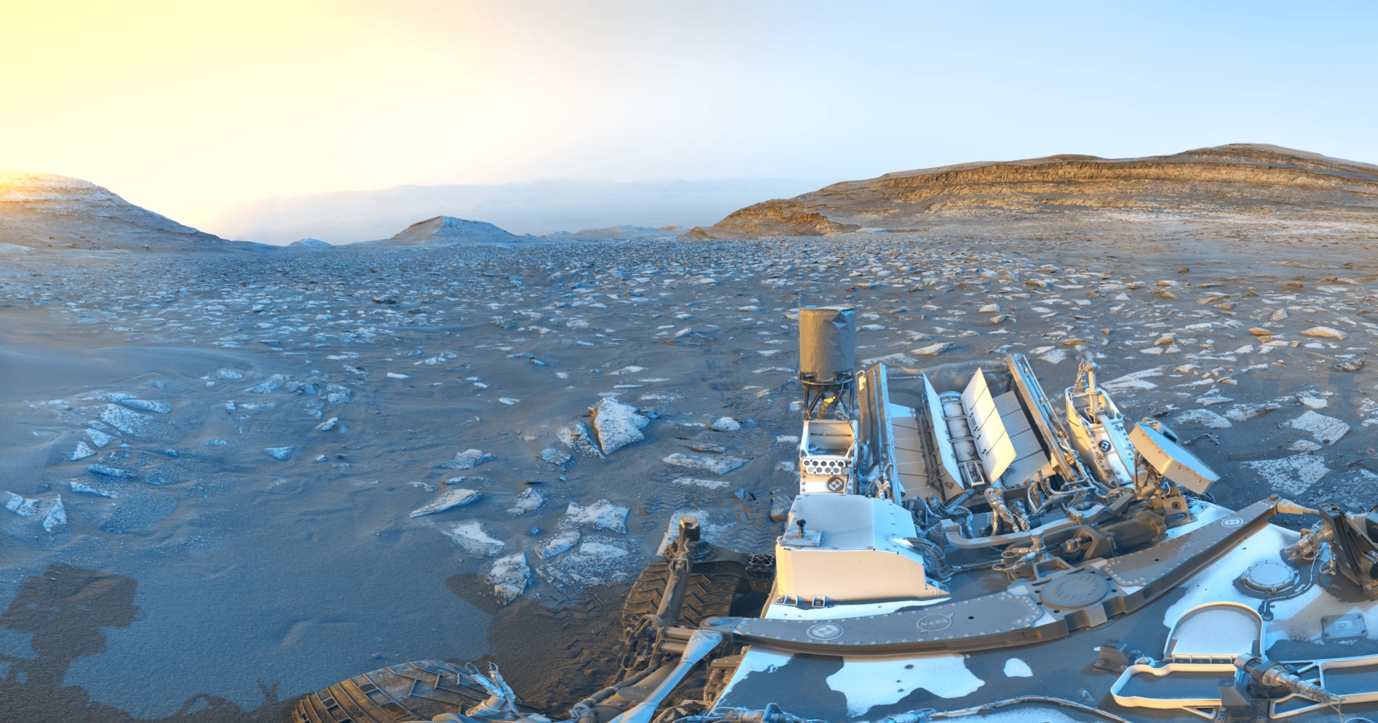
Cool image time! The panorama above, cropped and reduced to post here, was released yesterday by the science team for the Mars rover Curiosity. It looks uphill at the mountains within which the team hopes Curiosity will soon be traveling.

A newly released panorama captured by NASA’s Curiosity rover offers the most detailed view yet of distant, wind-carved Martian cliffs, highlighting features the mission’s scientists have long been waiting to see up close. The scene was snapped at 8:30 a.m. local Mars time, showing striking blue hues in the foreground as bright morning light illuminates crags known as yardangs on the horizon.

The panorama was captured by Curiosity’s Mastcam on Aug. 11, the 4,982nd Martian day, or sol, of the mission, and comprises six individual images that were stitched together after being sent to Earth. Unlike most of Curiosity’s Mastcam images, this one was processed without white balancing, preserving the early morning appearance.

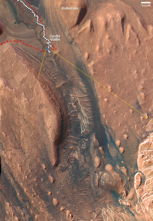
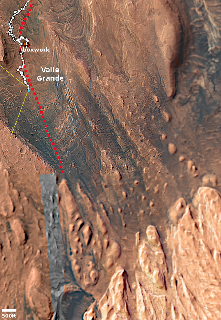
The overview map to the right provides the context. The blue dot marks Curiosity’s present position, while the yellow dot its location when the panorama was taken. The yellow lines indicate approximately the area covered by the panorama. The red dotted line the rover’s planned route, while the white dotted line indicates its actual travels so far.

At this moment the science team has still not released its planned route through those distance jagged hills. I suspect they want to get closer before committing themselves to any particular canyon.

0 comments


Curiosity_Location_Sol5021

» Read more


pia26728-curiosity-croppedreduced

» Read more

Gale Crater in morning light

Gale Crater in morning light
Click for full resolution image.

Overview map
Click for interactive map.

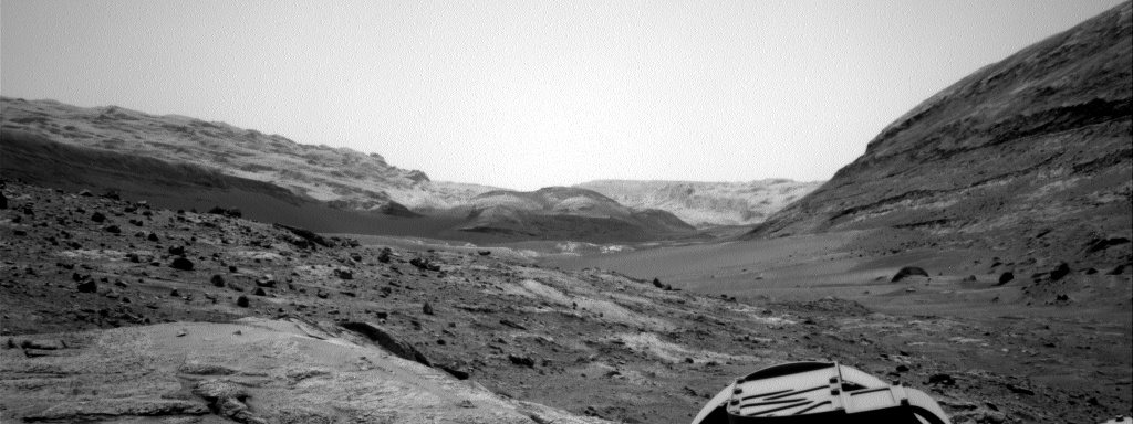
To celebrate Curiosity’s 5,000 day on Mars, NASA this week released two panoramas taken by the rover on the lower flanks of Mount Sharp inside Gale Crater.

While parked at a sand ridge nicknamed “Chocolatal,” NASA’s Curiosity Mars rover used its black-and-white navigation cameras to capture panoramas at two times of day. The first was taken on Aug. 30, 2026, at 9:56 a.m. local Mars time; the second was taken on Sep. 2, 2026, at 5:39 p.m. local Mars time. Those dates correspond to the 5,000th and 5,003rd Martian days, or sols, of the mission.

After being sent back to Earth, the two images were merged together. Color was added for an artistic interpretation of the scene, with blue representing the morning panorama and yellow representing the afternoon one. The resulting “postcard” is similar to past examples created with rover images, such as one taken in November 2021.

The panorama above is the morning image. The overview map to the right gives the context. The blue dot marks Curiosity’s present position, the yellow lines the approximate area covered by the picture. The white dotted line indicates the rover’s actual travels since landing on the floor of Gale Crater in 2012.

2 comments


Curiosity_Location_Sol5016

» Read more

Curiosity has now climbed more than a kilometer on Mount Sharp

Overview map
Click for interactive map.

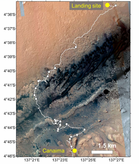
According to an update posted today by William Farrand on the Curiosity science team, the rover on August 26, 2026 achieved a new milestone, in that it has now climbed a total of one kilometer in elevation since it landed in Gale Crater more than eleven years ago.

The overview map to the right shows the rover’s entire journey, now exceeding 23 and a half miles. Though it has climbed 1,000 meters, or about 3,280 feet, it still has about 14,720 feet to go before it reaches the top of Mount Sharp, about 29 miles away to the southeast.

As the rover has been climbing it has found Mars to be a many-layered planet, with layers upon layers, each holding thinner layers within layers, down almost to a microscopic level, implying that the geological history of the red planet is made up of many cycles, repeating endlessly. And along the way the rover keeps finding strange geology, such as the cool image below.
» Read more

0 comments


Curiosity_Location_Sol5008master

» Read more

Floating flakes on the flanks of Mount Sharp on Mars

Floating flakes on Mars
Click for full resolution image.

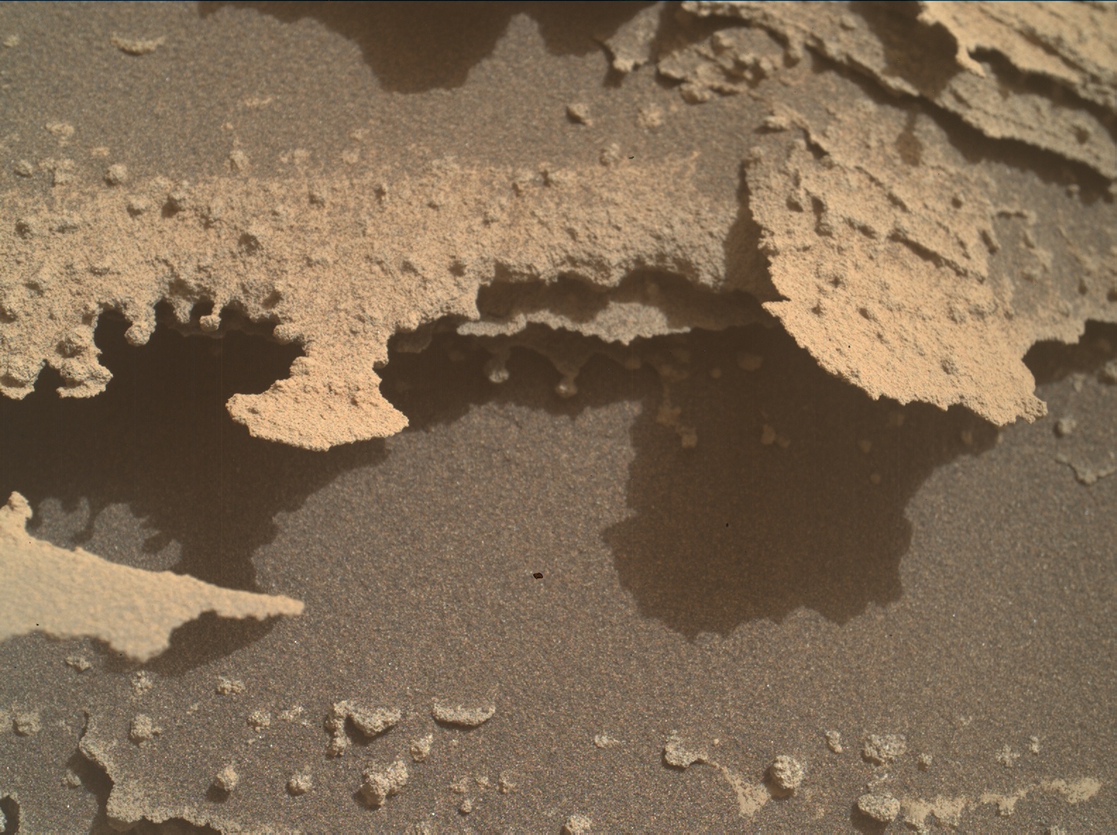
Cool image time! The picture to the right, reduced to post here, was taken on August 9, 2026 by the Mars Hand Lens Imager (MAHLI) on the rover Curiosity.

This camera, designed to take close-ups like this of objects on the ground, is located at the end of Curiosity’s robot arm. According to the science team, when this picture was taken, the camera was approximately eight inches away, making these flakes only inches across and one to three inches long.

Such delicate features are impossible on the surface of the Earth, because rain and wind will destroy them. We do find them inside caves, where the environment is more benign, but even there such things are rare and when found are considered special and unique.
» Read more

1 comment


Curiosity_Location_Sol4983

» Read more

The rocky surface of Gediz Vallis on Mars came from landslides and water-induced debris flows from above

Looking south inside Gediz Vallis
Looking uphill into Gediz Vallis, in 2024, when this research was being done.

Overview map
This map from 2024 provides the context for the panorama above.
Click for interactive map.

Using the data the rover Curiosity gathered during its exploration of the canyon dubbed Gediz Vallis on the lower flanks of Mount Sharp (Aeolis Mons) inside Gale Crater on Mars, scientists have concluded that the rocky material came from above, flowing downhill in the far past in major boulder landslides and water-induced debris flows.

The panorama above was taken when Curiosity was in Gediz Vallis. The overview map to the right provides the context, with the white dotted line showing Curiosity’s actual travels, and the yellow lines indicating the approximate area covered by the panorama. From the paper’s abstract:

Curiosity investigated Gediz Vallis, a canyon within Aeolis Mons, indicating that it must have formed late in Gale’s history. At the center of Gediz Vallis is a topographic ridge, comprised of sedimentary rocks. In the region where Curiosity crossed the ridge, Arc Pass, the rover investigated the processes that formed the ridge.

Curiosity found that rocks in Arc Pass were formed by water flows rich in debris, and landslides, which originated from higher up Aeolis Mons. These transport processes were separated by episodes of wind erosion and alteration of the rocks by groundwater. These observations indicate that liquid water continued to be available for brief periods late in the history of both Gale crater and Mars. [emphasis mine]

As noted by the highlighted sentence, the geology once again says that water in some form shaped the surface. As the scientists add in the paper, however, “Any surface water was likely only intermittently available, interspersed with significant hiatuses of aeolian erosion and dry granular transport processes.” It remains to be seen exactly what state that water was in, whether liquid or ice, considering that Mars has always been too cold with too thin an atmosphere for liquid water to exist on the surface.

Curiosity spent more than a year in this part of Gediz Vallis, then traversed west into the parallel canyon, dubbed Valle Grande, that it has been climbing for the past two years.

0 comments

The present state of NASA’s Artemis program

Artemis logo

The aggressive effort by NASA administrator Jared Isaacman to rationalize and speed up the agency’s Artemis program to get back to the Moon and build a base there has resulted in a plethora of new missions, almost all of which are being built by the private sector.

Today Isaacman and his Moon Base program manager, Carlos García-Galán, held a press conference where they announced four more missions.

  • Astrobotic won a $297.9 million contract to build and fly two more of its smaller Peregrine lunar landers. This lander attempted a landing in 2024, but a fuel leak right after launch made that impossible.
  • Firefly won a $144.2 million contract to build and fly another Blue Ghost lander, the only commercial lander to successfully achieve a lunar soft landing, in 2025.
  • Intuitive Machines won a $148.3 million contract to build and fly another Nova-C lander. This lander attempted two landings, and in both cases it tipped over just after launch. The Nova-D design, under development, has a lower center of gravity, but for reasons not well explained by García-Galán NASA chose to go with the Nova-C design.

All are considered part of the first phase of the Artemis program and thus are targeting a launch by 2028.

In addition, NASA is considering using back-up equipment developed to build the Curiosity and Perseverance Mars rovers to create quickly and relatively inexpensively a lunar rover that they have dubbed “Promise.”

In order to make some sense of this program and these many misssions, I have created below a chronological list of confirmed missions, with their present status indicated (including uncertainties), as well as some unconfirmed missions based on my own speculations. All dates are tentative at this point, even if NASA has provided us a specific target date.

Several things to note as you review this list. While there are handful of missions going elsewhere, Isaacman is attempting to focus the program toward landing at the planned lunar base near the south pole, and to do so as fast as possible in the most effective way. The cargo missions and rovers are to get there ahead of the manned missions, in order to provide the astronauts supplies and surface transportation once they arrive. Those same missions will also do some preliminary scouting, and likely carry power and excavation equpiment needed to build the base.

It is also important to note that this plan is still in its very early stages of development. Many of the rockets and spacecraft and landers needed for these missions are not yet operational. Many have not yet demonstrated the capability to do what is requested. Thus, the program will certainly not follow the plan as presently outlined by the agency. Moreover, there will be failures along the way.

The program however is designed to accelerate development, to accept those failures within the program’s larger scope. If one mission fails, others are on the table to fly quickly to overcome the loss. And since the program is relying on the entire aerospace industry, the agency will have great redundancy from many companies.

I welcome comments and suggested changes or corrections. I fully intend to publish this list repeatedly over the coming years as the Artemis program evolves. And as the private sector begins flying its own missions to the Moon, independent of NASA, I intend to include those as well.
» Read more


6 comments

Tiny polygon ridges on Mars

Tiny polygon ridges on Mars
Click for original image.

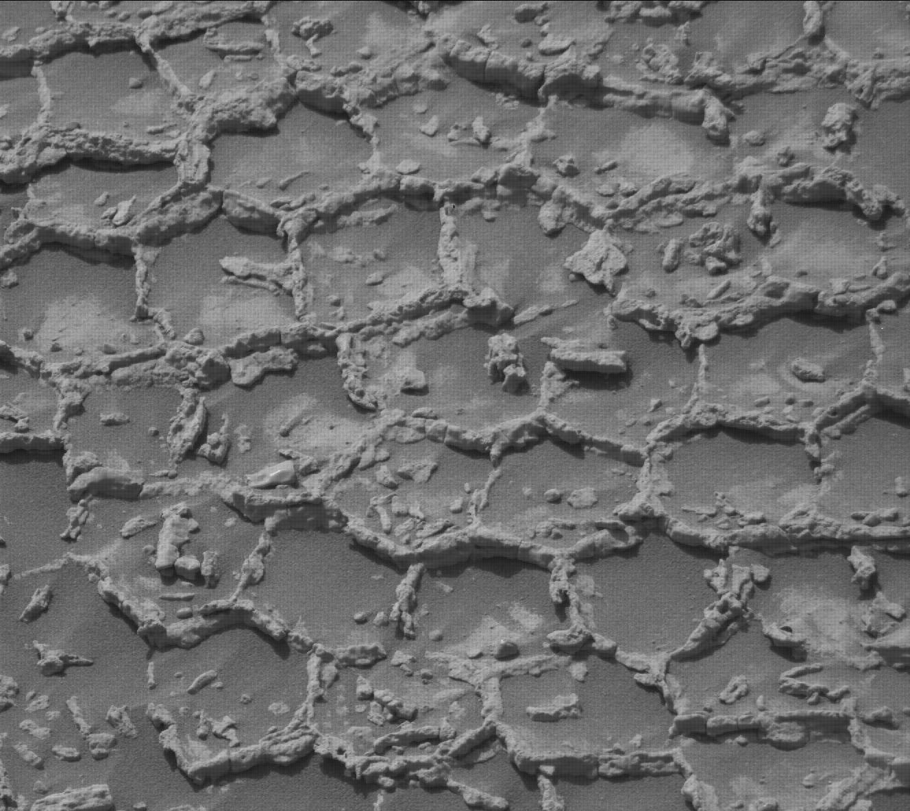
Cool image time! The picture to the right, cropped and reduced slightly to post here, was taken on June 21, 2026 by the high resolution camera on the Mars rover Curiosity. It looks down to provide a close-up of the ground the rover is presently parked over, a surface covered with thousands of these tiny polygon ridges, all of which appear less than three inches across.

For a wider view and the overall context, see my post from June 24, 2026. While from a distance the ground at this point looked smoother than anything the rover has seen in more than five years since it entered the foothills of Mount Sharp, once it got close it discovered the ground was completely covered with these small polygons.

The picture to the right is part of a close-up mosaic of these polygons the science team is gathering using the high resolution camera.

The geology here is certainly puzzling. Polygon cracks are not unusual on both Earth and Mars, in places where the ground was once wet and then dried. In drying the material shrinks, producing polygon-configured cracks. On Earth those cracks often fill later with material that is more resistant, such as lava, which remains to form ridges when the surrounding dirt erodes away. Whether this was the process here on Mars however is not known. For one thing, why are these polygons so small? And why so uniform in size?

5 comments

Smooth on Mars is apparently not so smooth

Panorama on June 17, 2026
Click for full resolution. For original images, go here and here.

Overview map
Click for interactive map.

Last week I noted how the terrain that stood ahead of Curiosity in its travels on Mount Sharp on Mars appeared to be the smoothest the rover had seen in years.

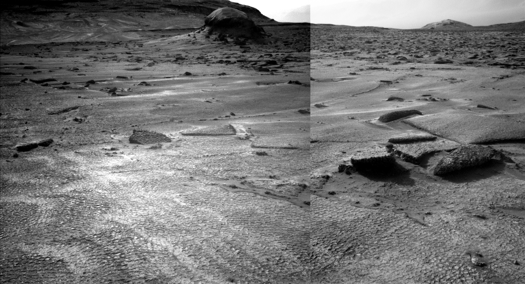
This week it turns out that upon closer inspection, smooth on Mars is not as smooth as it seems. The panorama above, created from two pictures taken by the rover’s left navigation camera on June 17, 2026 (here and here), provides a much closer view of that smooth ground, and revealed that it isn’t actually smooth at all, but covered with small polygons. The inset on the left shows the area in the white rectangle at full resolution, making the patterned nature of the ground very obvious. From today’s update by the science team:

From up close, the parking spot looks anything but smooth. … There are polygons, veins, lamination, and probably more, once we inspect the higher-resolution images taken today. “Higher-resolution” is the key for why we were in for such a surprise! The features are quite small, a few centimeters across, and therefore we could not see them in the orbital images or from a distance in our navigation and mast camera images. The camera resolution from a distance just isn’t enough to see them. But up close, the terrain revealed all its beauty!

The blue dot on the overview map to the right marks Curiosity’s present position, the white dotted line its actual travels, the red dotted line its planned route. The yellow lines indicate roughly the area covered by the panorama above. The rim of Gale Crater can dimly be seen through the dusty atmosphere 20 to 30 miles away.

Explaining the geological process that caused this patterned surface is beyond my pay grade. My first guess would be it is related to the past presence of water, in the form of liquid or ice, but no one should take that guess very seriously.

As I have said many times, Mars is strange, Mars is wonderful, but above all, Mars is alien.

4 comments


Curiosity_Location_Sol4932

» Read more

Curiosity sees smooth ground for the first time in years

June 12, 2026 Curiosity panorama
Click for full resolution version. Click here, here, and here for original images.

Overview mapd
Click for interactive map.

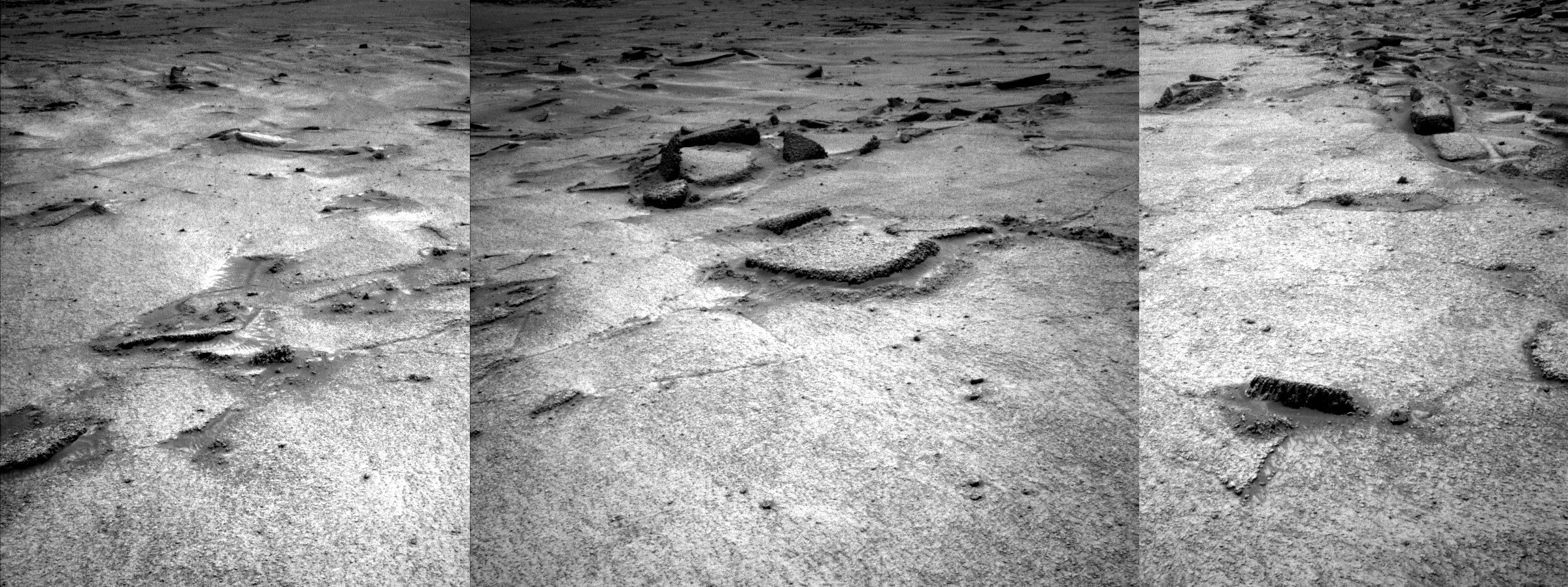
Cool image time! The panorama above was created from three pictures taken on June 12, 2026 by the left navigation camera on the Mars rover Curiosity (see here, here, and here). It shows the immediate ground uphill in front of the rover, which appears to be the smoothest ground that Curiosity has seen in about five years, since it entered the foothills at the base of Mount Sharp in 2021.

Since then the terrain has been routinely boulder strewn. In one case, the ground was so rocky and rough that the science team had to back off from their original plans and find a different route.

The panorama above shows something wholly different, a patch of relatively smooth ground with only a scattering of sharp rocks protruding periodically from below. This ground is likely the rover’s first taste of what the science team calls the “yardang unit”, the light colored hills in the lower right of the overview map to the right. For years that team has looked at those hills, wondering what it would be like to drive Curiosity on them. Their geology suggests a much softer terrain, sand shaped into dunes (yardangs) by the wind. The unknown was always whether the ground was structurally strong enough for the rover to traverse it.

It looks like they are about to get their first clue. Based on the panorama above, the ground appears very promising.

On the overview map, the blue dot marks Curiosity’s present position, with the red-dotted line is planned route and white-dotted line its actual travels. The yellow lines indicate approximately the area covered by the panorama.

1 comment


Curiosity_Location_Sol4923

» Read more

June 8, 2026 Quick space links

Courtesy of BtB’s stringer Jay. This post is also an open thread. I welcome my readers to post any comments or additional links relating to any space issues, even if unrelated to the links below.

17 comments

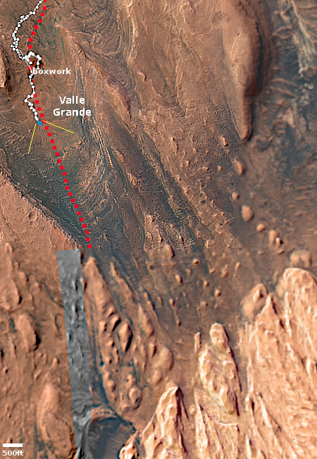
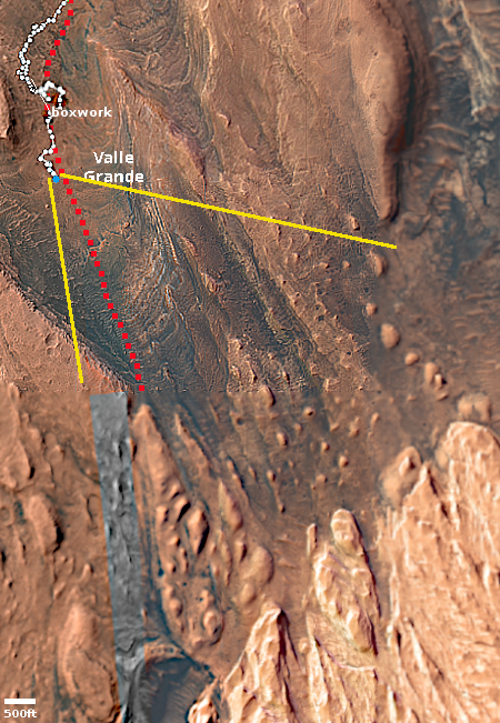
Curiosity’s looks up Valle Grande to its future travels

Panorama, June 8, 2026
Click for high resolution. For original images go here, here, and here.

Overview map
Click for interactive map.

Cool image time! The panorama above was created by me using three pictures taken today by the left navigation camera on the Mars rover Curiosity (see here, here, and here).

The overview map to the right provides the context. The white dotted line indicates Curiosity’s actual travels, while the red dotted lines its planned route, both in the past and in the future. The blue dot marks its approximate position when these images were taken. The yellow lines indicate approximately the view.

The panorama looks up this spectacular valley, which the science team has named Valle Grande. The red dotted line on the panorama is my guess as to the rover’s future route. It will likely not follow such a straight path, but weave back and forth as the science team directs it to look at interesting geological features along the way.

What remains unknown is the route the rover will take once it reaches those light-colored hills in the distance. The science team so far not indicated any chosen route through those hills. I suspect they want to get closer and do some on-site scouting before making any decision. The nature of that light terrain remains unknown. It could be easily traversed, or it could be a problem. From a distance it looks very soft, and thus it will likely required close inspection to make any definite plans.

4 comments


Curiosity_Location_Sol4919

» Read more

Curiosity drill samples taken at different elevations show different Martian climates

Core samples used in study
Figure S1 of the study, showing the location
of the core samples. Click for source.

By comparing 20 different Curiosity drill samples taken during the rover’s fourteen years on Mars, scientists have detected hard evidence that the climate in Gale Crater was distinctly different at different elevations, for long periods.

This study shows that hematite can also be a marker of climate changes based on its crystallite sizes and structures, which change under different temperatures. The scientists found that hematite crystallites from higher elevations in Gale Crater were less than 10 nanometers in size, while crystallites from lower locations were generally larger, reaching up to 65 nanometers. These findings aligned with the observations that samples from higher elevations contained both hematite and goethite, while lower elevation samples lacked goethite.

They concluded that, under warmer conditions when the pH of water is neutral or slightly alkaline, goethite can transform into hematite. These warmer conditions also favored an increase in hematite crystallite size in the deeper layers of Gale Crater through a process known as Ostwald ripening, in which smaller crystallites dissolve and contribute to the growth of larger ones. “This can tell you that the top layers were colder and didn’t have enough water, or the water presence was relatively short-lived, so the crystallites didn’t have sufficient time and conditions to grow in size,” said Peretyazhko. “But the lower layers had longstanding warm water that allowed those crystallites to grow.”

The white dots on the map to the right shows the location of the drill samples used, taken along Curiosity’s travels as it climbed Mount Sharp. Overall Curiosity has climbed about 2,500 feet, so the differences found the samples mark the past climate differences between the crater floor and the mountain’s foothills. According to this data, the crater floor had long-standing water in some form, exceeding millions of years. At higher altitudes there was less and less, and it was there for increasingly shorter periods.

As the press release notes, “A unique highlight of this study is that the data comes from Martian samples, rather than from theoretical modeling.” Similar conclusions from earlier Curiosity data required Earth proxies and computer modeling. This result is from hard data from Mars.

0 comments
1 2 3 … 37