The surface of the Martian south polar ice cap

The Martian south pole
Click for original image.

Overview map

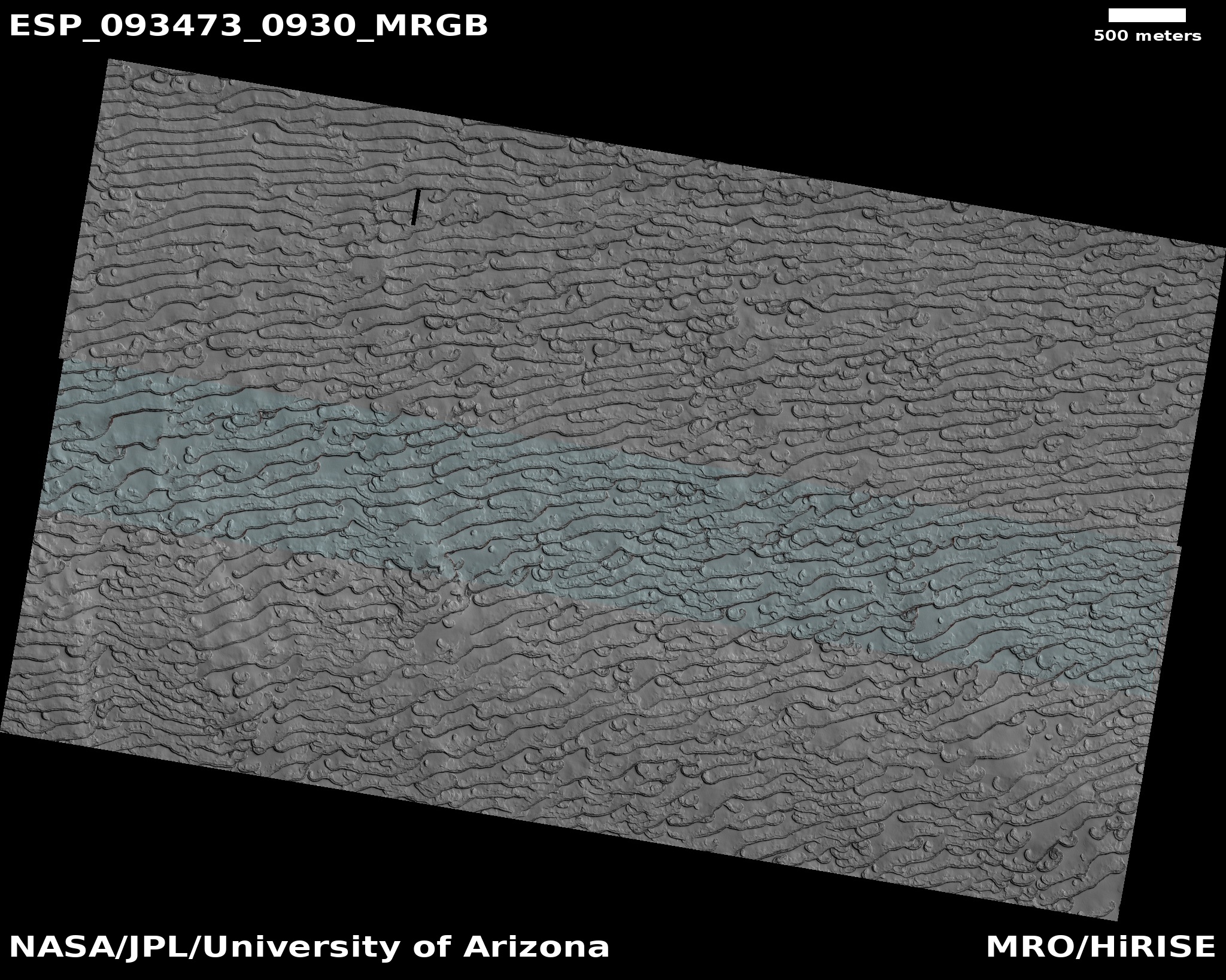
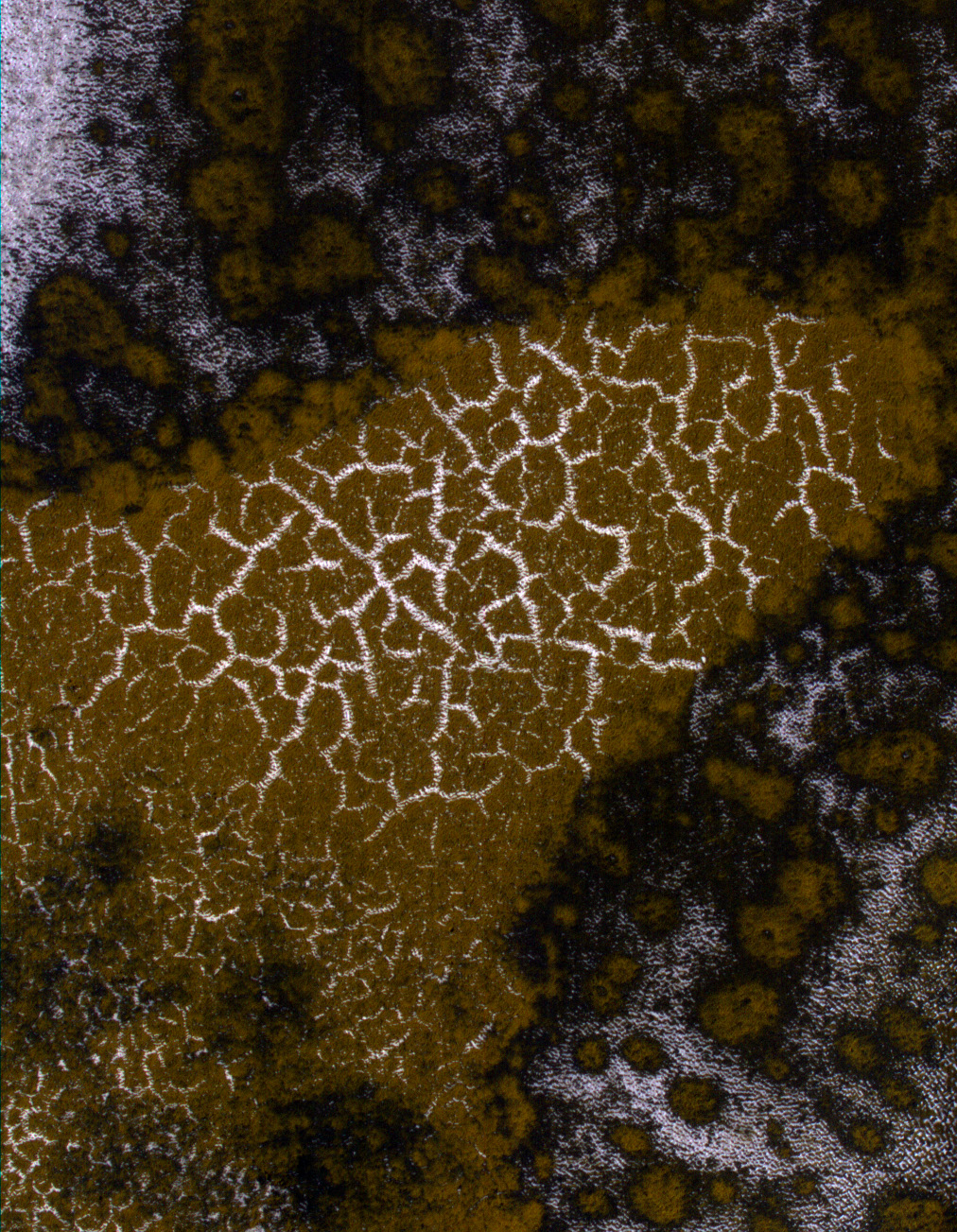
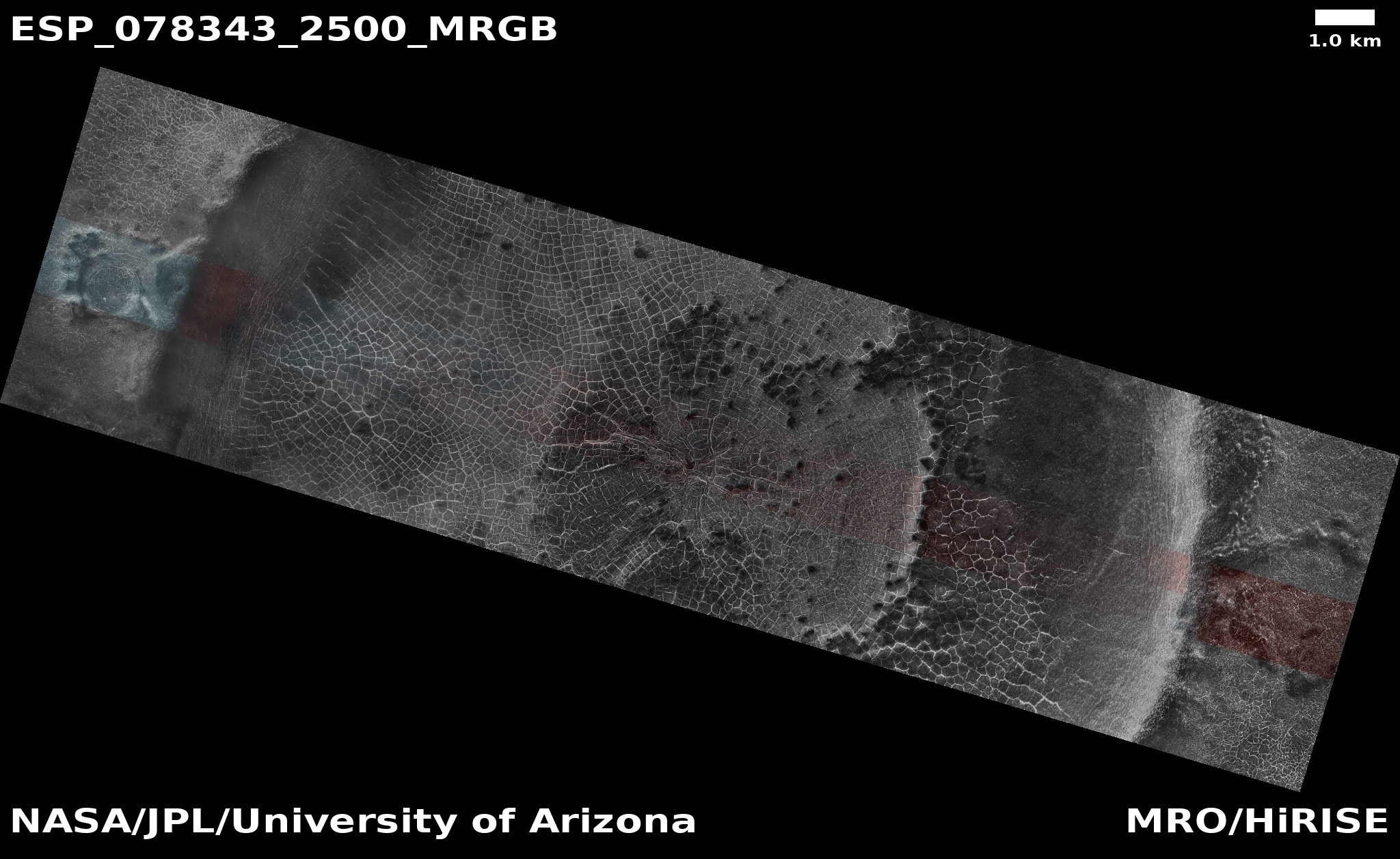
Cool image time! The picture above, cropped and lightened to post here, was taken on July 5, 2026 by the high resolution camera on Mars Reconnaissance Orbiter (MRO).

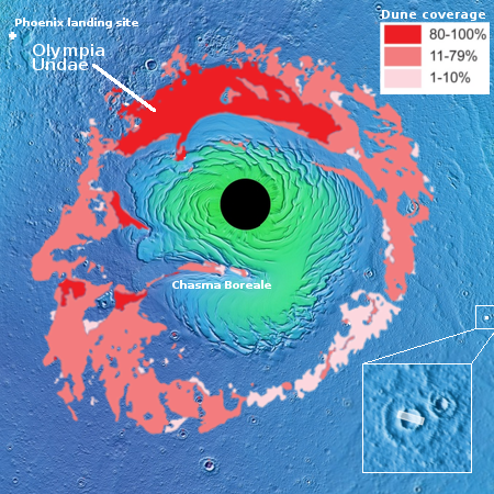
The black dot on the overview map to the right marks the location, deep inside Mars’ perennial south pole cap, with the top layer a thin crust of dry ice sitting on a thick layer of water ice. In this picture we are probably seeing an interaction of both, with the pits and dark fissures indicating places where that dry ice has sublimated away. The location itself is about 114 miles from the pole itself.

Why this process has formed this complex but repeated pattern however is inexplicable to me. It likely relates to the same kind of processes that cause mud to form polygon-shaped cracks as it dries, but that is a pure guess, not to be taken seriously.

3 comments

Tiny polygon ridges on Mars

Tiny polygon ridges on Mars
Click for original image.

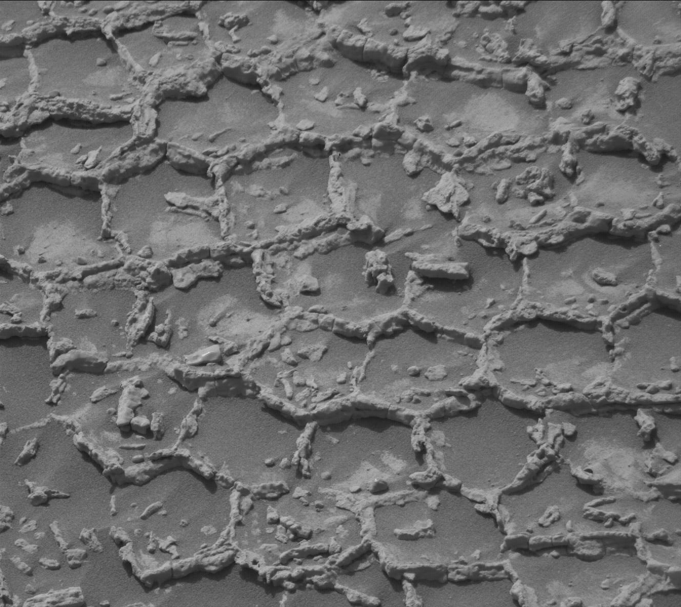
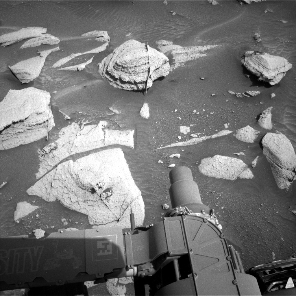
Cool image time! The picture to the right, cropped and reduced slightly to post here, was taken on June 21, 2026 by the high resolution camera on the Mars rover Curiosity. It looks down to provide a close-up of the ground the rover is presently parked over, a surface covered with thousands of these tiny polygon ridges, all of which appear less than three inches across.

For a wider view and the overall context, see my post from June 24, 2026. While from a distance the ground at this point looked smoother than anything the rover has seen in more than five years since it entered the foothills of Mount Sharp, once it got close it discovered the ground was completely covered with these small polygons.

The picture to the right is part of a close-up mosaic of these polygons the science team is gathering using the high resolution camera.

The geology here is certainly puzzling. Polygon cracks are not unusual on both Earth and Mars, in places where the ground was once wet and then dried. In drying the material shrinks, producing polygon-configured cracks. On Earth those cracks often fill later with material that is more resistant, such as lava, which remains to form ridges when the surrounding dirt erodes away. Whether this was the process here on Mars however is not known. For one thing, why are these polygons so small? And why so uniform in size?

5 comments

Smooth on Mars is apparently not so smooth

Panorama on June 17, 2026
Click for full resolution. For original images, go here and here.

Overview map
Click for interactive map.

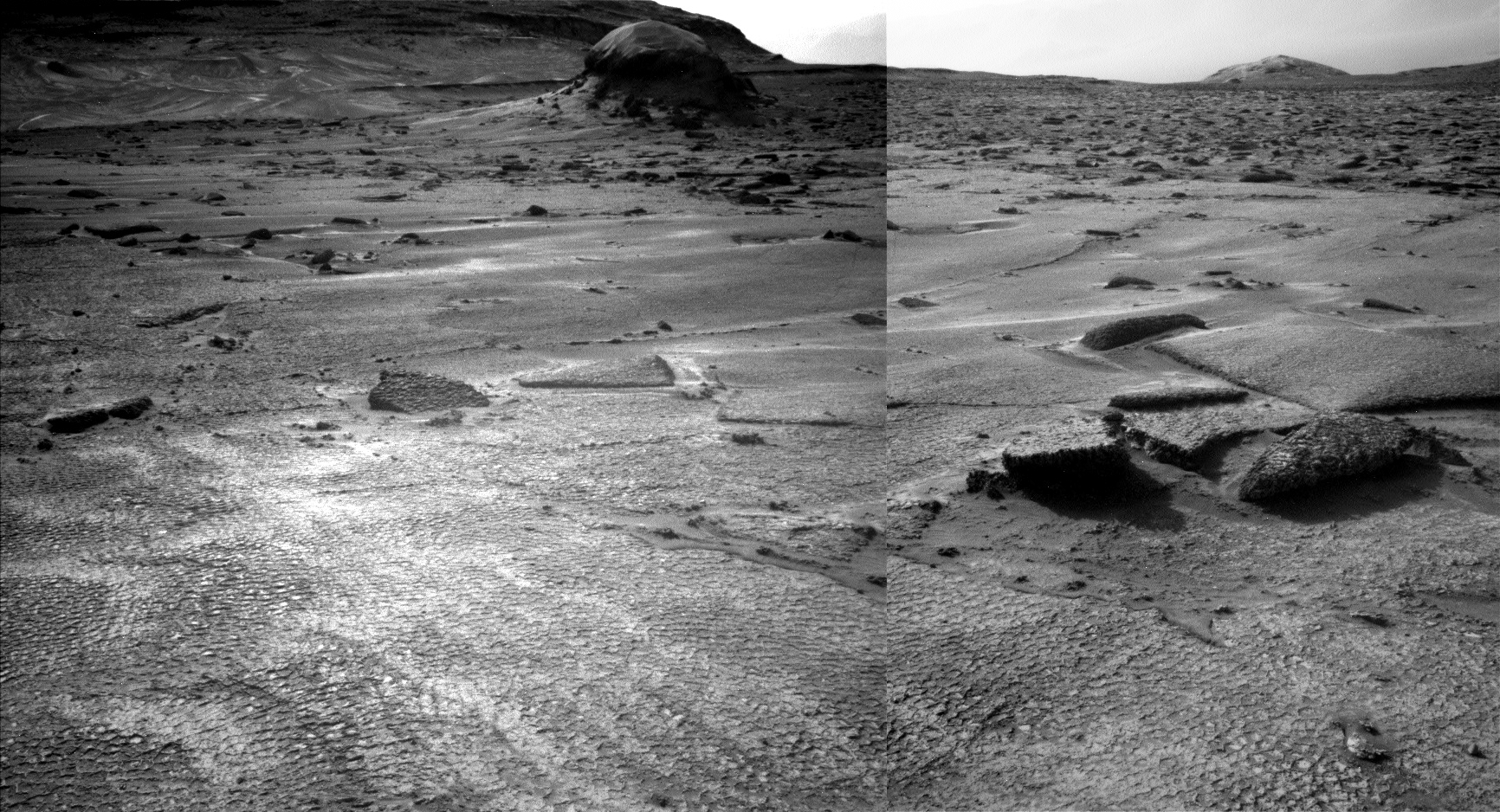
Last week I noted how the terrain that stood ahead of Curiosity in its travels on Mount Sharp on Mars appeared to be the smoothest the rover had seen in years.

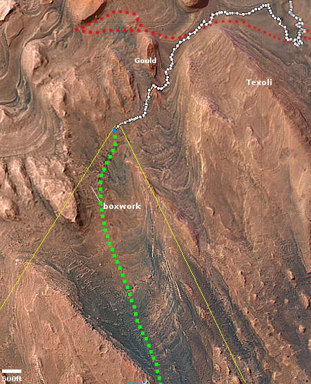
This week it turns out that upon closer inspection, smooth on Mars is not as smooth as it seems. The panorama above, created from two pictures taken by the rover’s left navigation camera on June 17, 2026 (here and here), provides a much closer view of that smooth ground, and revealed that it isn’t actually smooth at all, but covered with small polygons. The inset on the left shows the area in the white rectangle at full resolution, making the patterned nature of the ground very obvious. From today’s update by the science team:

From up close, the parking spot looks anything but smooth. … There are polygons, veins, lamination, and probably more, once we inspect the higher-resolution images taken today. “Higher-resolution” is the key for why we were in for such a surprise! The features are quite small, a few centimeters across, and therefore we could not see them in the orbital images or from a distance in our navigation and mast camera images. The camera resolution from a distance just isn’t enough to see them. But up close, the terrain revealed all its beauty!

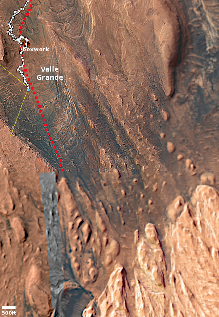
The blue dot on the overview map to the right marks Curiosity’s present position, the white dotted line its actual travels, the red dotted line its planned route. The yellow lines indicate roughly the area covered by the panorama above. The rim of Gale Crater can dimly be seen through the dusty atmosphere 20 to 30 miles away.

Explaining the geological process that caused this patterned surface is beyond my pay grade. My first guess would be it is related to the past presence of water, in the form of liquid or ice, but no one should take that guess very seriously.

As I have said many times, Mars is strange, Mars is wonderful, but above all, Mars is alien.

4 comments

Curiosity’s exploration of boxwork on Mount Sharp

Curiosity panorama, December 18, 2025
Click for high resolution panorama. For original images, go here, here, and here.

Overview map
Click for interactive map.

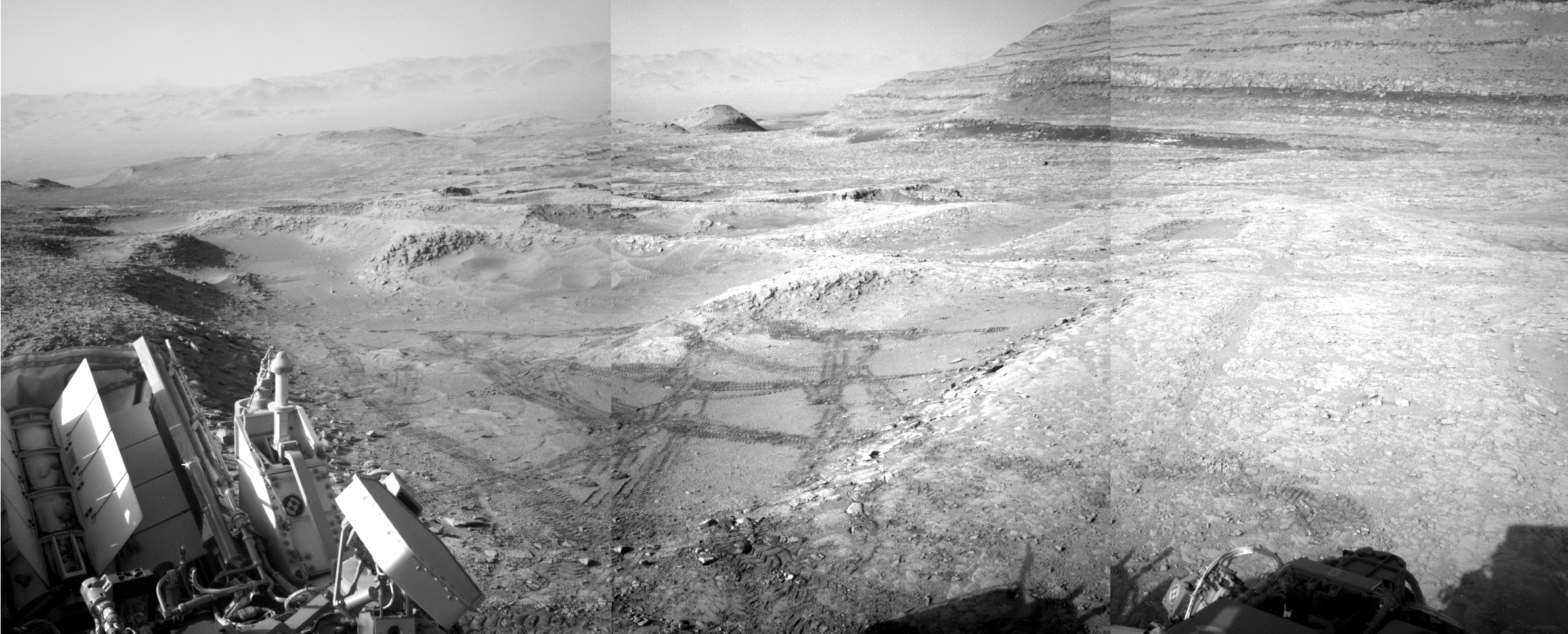
Cool image time! The panorama above was created from three photographs taken on December 18, 2025 (here, here, and here) by the right navigation camera on the Mars rover Curiosity.

The view is north, looking down the flanks of Mount Sharp and across the floor of Gale Crater to its rim about 20 to 30 miles away. In comparing this view with a similar one taken in July, it is obvious that the Martian atmosphere has become far dustier during the last six months. The rim and the mountains beyond are hardly visible now through the haze.

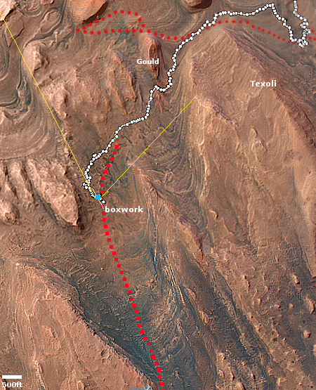
The blue dot on the overview map to the right marks Curiosity’s present position. The yellow lines indicate roughly the area covered by this panorama. The while dotted line indicates the rover’s travels, while the red dotted line its planned routes.

As you can see by both the rover’s tracks in the panorama above and the white dotted line in the overview, Curiosity has been traversing back and forth across the boxwork formation of criss-crossing ridges for more than half a year, as the science team attempts to decipher what caused these ridges and hollows. They have also done some drilling in this effort.

The science team has been getting close to the day it will move on, resuming Curiosity’s climb of Mount Sharp, but they keep finding things amidst this boxwork that requires additional study. For example, consider this from yesterday’s update:
» Read more

2 comments

Weird mottled terrain in the dry tropics of Mars

Mottled ridges
Click for full image.

Cool image time! The picture to the right, cropped, reduced, and enhanced to post here, was taken on October 28, 2025 by the high resolution camera on Mars Reconnaissance Orbiter (MRO). Labeled by the science team as “mottled ridged terrain,” it shows a relatively flat area of scattered broken-up flat-topped ridges and knobs, following no clear pattern of formation.

In trying to research this, I could only find one paper [pdf] discussing this kind of mottled ridges that did a survey of similar features across a large region to the northwest. That paper could not determine what caused such features, but came up with hypothesis. From the abstract:

While it is not possible to determine the precise formation mechanism of these polygonal ridge networks from our new data, their formation can be assessed in terms of three possibly separate processes: (1) polygonal fracture formation, (2) fracture filling and (3) exhumation. We find that polygonal
fracture formation by impact cratering and/or desiccation of sedimentary host deposits is consistent with our results and previous spectral studies. Once the polygonal fractures have formed, fracture filling by clastic dikes and/or mineral precipitation from aqueous circulation is most consistent with our results. Exhumation, probably by aeolian processes that eroded much of these ancient Noachian terrains where the ridges are present caused the filled fractures to lie in relief as ridges today.

To put this in plain terms, the initial polygon-patterned cracks were formed by either an impact or the drying out of the surface (similar to the cracks seen on dried mud here on Earth). Both could have contributed. Then material welled up from below, either lava or mud, that hardened to fill the cracks. Later erosion by wind stripped away the surface, leaving behind these broken ridges.

As always, the location adds some very interesting context.
» Read more

0 comments

Curiosity amid the boxwork

Curiosity amid the boxwork, looking uphill
Click for original image.

Overview map
Click for interactive map.

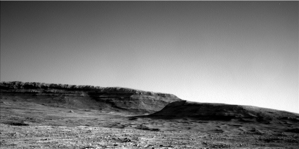
Cool image time! The panorama above, cropped to post here, was taken on July 20, 2025 by the left navigation camera on the Mars rover Curiosity. It looks uphill to the south into the canyon that Curiosity will eventually travel, with the white chaotic upper flanks of Mount Sharp on the horizon. The mountain’s peak itself is out of view, about 25 miles away.

The overview map to the right provides the context. The blue dot marks Curiosity’s present position, on the northern edge of the large patch of very distinct boxwork ridges visible from orbit. You can see these ridges in the foreground of the panorama above.

The yellow lines indicate the approximate area covered by the panorama. The red dotted line roughly indicates the rover’s future travels. At the moment, however, it is going nowhere, as the science team is focused on studying these boxwork ridges in the hope they can determine their origin. Such features are usually associated with cracking later filled with lava, with the polygon-shaped cracking usually associated with a formerly wet environment drying.

0 comments

The canyon that Curiosity will eventually climb

The canyon that Curiosity will eventually climb
Click for full resolution. For original images go here and here.

Overview map
Click for interactive map.

Cool image time! The panorama above, created from two photographs taken on May 23, 2025 by the left navigation camera (here and here) on the Mars rover Curiosity, looks south uphill into the canyon that Curiosity is eventually going to climb.

The overview map to the right provides the context. The blue dot marks Curiosity’s present position, the white dotted line its past travels, the red dotted line its initial planned route, and the green dotted line its future route. The yellow lines indicate the approximate area seen in the panorama above.

If you look on the horizon to the left, you can see very bright terrain higher up the mountain. This is the pure sulfate-bearing unit that is Curiosity’s next major geological goal. It won’t reach that terrain for quite some time however because first the scientists want to spend some time studying the boxwork geology that Curiosity is now approaching. That boxwork suggests two past geological processes, as yet unconfirmed. First it suggests the ground dried like mud, forming a polygon pattern of cracks that then hardened into rock. Second, lava seeped up from below and filled those cracks. The lava, being more resistant to erosion, ended up becoming the boxwork of ridges as the material around eroded away.

This proposed history however is not proven. They hope to find out when Curiosity gets there.

Meanwhile, despite having traveled almost 22 miles, the rover is more than 25 miles from the peak of Mount Sharp, which remains out of sight. That peak is also about 15,000 feet higher.

0 comments

Boxwork in the dry Martian tropics

Boxwork on Mars
Click for original image.

Cool image time! The picture to the right, cropped and enhanced to post here, was taken on July 17, 2024 by the high resolution camera on Mars Reconnaissance Orbiter (MRO). It shows what the scientists label as boxwork, a pattern of intersecting straight ridges criss-crossing each other in a generally random manner.

The ridges themselves are very small, only a few feet high. To make them more visible I have purposely cropped this section without reducing its resolution. I have also increased the contrast.

What caused them? According to this paper [pdf] about similar boxwork found on Mount Sharp in Gale Crater, the boxwork “formed when cements filled existing pore spaces and fractures in fractured rock, and these cements were left as topographic ridges after erosion.”

In other words, the surface hardened, then fractured. Later more resistent material, likely lava, filled the cracks. When erosion later stripped the top surface away, the lava was more resistent and so became the ridges we now see.
» Read more

0 comments

Martian dunes with frost and a sublimating dry ice mantle

Martian dunes surrounded by frost
Click for original image.

Cool image time! The picture to the right, cropped to post here, was taken on March 16, 2024 by the high resolution camera of Mars Reconnaissance Orbiter (MRO). It was released today as a captioned picture from MRO’s camera team. As noted in the caption, written by the camera’s principal investigator Alfred McEwen:

This image shows a field a sand dunes in the Martian springtime while the seasonal carbon dioxide frost is sublimating into the air. This sublimation process is not at all uniform, instead creating a pattern of dark spots.

In addition, the inter-dune areas are also striking, with bright frost persisting in the troughs of polygons. Our enhanced-color cutout is centered on a brownish-colored inter-dune area.

Each winter the carbon dioxide in the Martian atmosphere falls as snow, mantling the surface in the latitudes above 60 degrees with a clear coat of dry ice. When spring arrives the sunlight passes through the mantle to heat the ground below, which in turn causes the base of the dry ice mantle to sublimate into gas. When the pressure builds enough, the gas breaks through the mantle at its weak points, spewing out and bringing with it dust from below, which stains the mantle with the dark spots.
» Read more

0 comments

The taffy terrain in Mars’ death valley

Taffy terrain in Hellas Basin on Mars

Cool image time! The picture to the right, rotated, cropped, reduced, and sharpened to post here, was taken on February 21, 2024 by the high resolution camera on Mars Reconnaissance Orbiter (MRO). Labeled “banded terrain and layering,” it actually is a good example of “taffy terrain,” a weird Martian geological formation unique to the Red Planet that scientists as yet don’t quite understand. This 2014 paper only says this:

The apparent sensitivity to local topography and preference for concentrating in localized depressions is compatible with deformation as a viscous fluid. In addition, the bands display clear signs of degradation and slumping at their margins along with a suite of other features that include fractured mounds, polygonal cracks at variable size-scales, and knobby/hummocky textures. Together, these features suggest an ice-rich composition for at least the upper layers of the terrain, which is currently being heavily modified through loss of ice and intense weathering, possibly by wind.

» Read more

0 comments

The really really strange landscape of Cydonia on Mars

Some really strange terrain on Mars
Click for original image.

Cool image time! The picture to the right, cropped, reduced, and sharpened to post here, was taken on January 3, 2024 by the high resolution camera on Mars Reconnaissance Orbiter (MRO), and shows what the camera team describes merely as “landforms.”

In truth, these features, as well as almost everything in the surrounding terrain beyond the edge of this picture, are possibly the weirdest geological features on Mars. The two mounds, no more than fifteen feet high at the most, resemble pimples. The rough ground to the north actually appears to be some flow that worked its way around the mounds, as indicated by the arrows. The crack to the southeast of the two mounds appears to be an extension of a fault line that cuts through the center of the larger mound, suggesting the mound is some form of eruption belching out of that fissure.

That the latitude is 42 degrees north, these weird features all suggest some form of ice-based volcanic activity, because the ground here is probably impregnated with ice.

As for the bridge connecting the two mounds, who knows what caused it?
» Read more

9 comments

A rock tadpole on Mars

A rock tadpole on Mars

Cool image time! The picture to the right, cropped, reduced, and sharpened to post here, was taken on January 11, 2024 by the left navigation camera of the Mars rover Curiosity.

The picture was highlighted in yesterday’s update from the rover’s science team, describing the team’s upcoming geological goals for the next few days.

We have observed resistant, polygonal fractures/ridges in many recent bedrock blocks. There is much speculation among the team as to the origin of these features. Hypotheses have different implications for past environments, and the polygonal fractures are therefore of high interest. As well as the polygonal fractures, there are more continuous linear veins. The relationship between the polygonal and linear fractures can also help to inform our interpretations

You can see the polygonal fractures in the full image. The thin line of rock sticking up from the tadpole illustrates one of these continuous linear veins. The material that fills the vein is obviously more resistent to erosion, so as the wind (and maybe ancient ice or water activity) scoured the rock into its tadpole shape, the vein material remained.
» Read more

3 comments

The southernmost extent of Mars’ youngest lava flood event

The southernmost edge of Mars' youngest lava event
Click for original image.

Cool image time! The picture to the right, rotated, cropped, reduced, and sharpened to post here, was taken on August 24, 2023 by the high resolution camera on Mars Reconnaissance Orbiter (MRO).

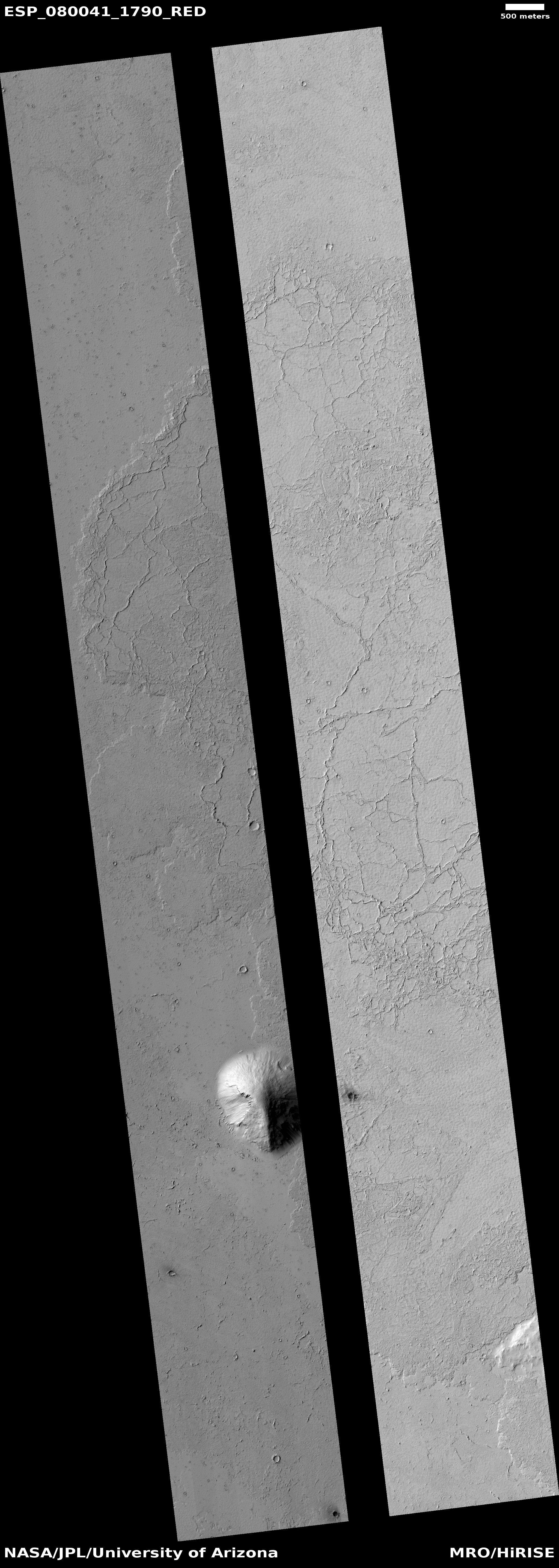
Labeled “flow margin in Elysium Planitia,” it shows the very edge of what scientists believe was the most recent large lava event on Mars, dubbed the Athabasca Valles, that is thought to have occurred only 600 million years ago. In only a matter of weeks the fast flowing lava covered a region about the size of Great Britain. What we see here is the southernmost edge of that flow, with the smooth terrain on the west an older lava flood plain, covered by the new flood lava from Athabasca on the east.

The polygon cracks likely indicate cracks that formed during the hardening process (like the polygon cracks in drying mud). Hot lava then pushed up from below to form the ridges. It is also possible the ridges are what scientists call “wrinkle ridges,” formed when material shrinks during the drying process.
» Read more

1 comment

The fractured floor of the south Utopia Basin

The fracture floor of South Utopia Basin

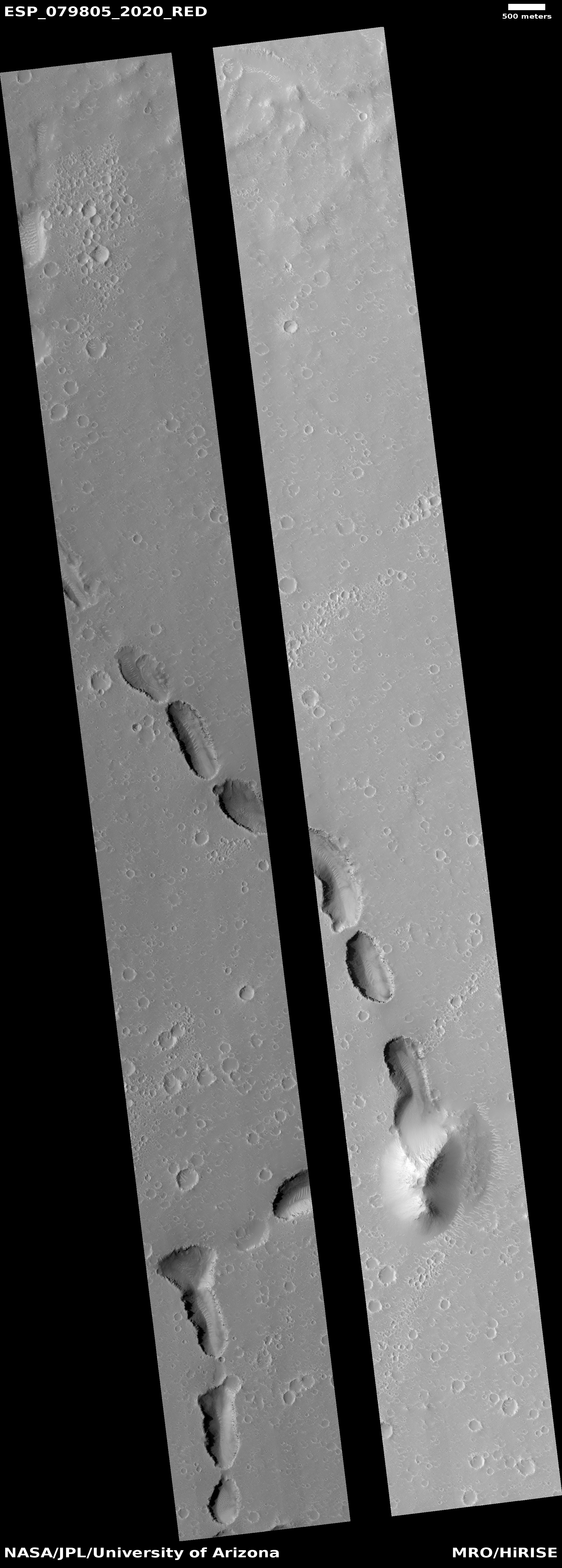
Cool image time! The picture to the right, rotated, cropped, reduced, and enhanced to post here, was taken on August 5, 2023 by the high resolution camera on Mars Reconnaissance Orbiter (MRO). The central darker strip however comes from a September 27, 2008 image by MRO’s lower resolution context camera, inserted to fill in the blank section where one component on the high resolution camera has failed.

The picture focuses on what the scientists call a “pit interacting with a mound.” The 100-foot-deep pit is one of a very long meandering string of such pits, all of which suggest the existence of an buried river canyon into which debris is sinking. Altogether this particular string runs from several dozen miles, and its interaction with the triangular 300-foot-high mound suggests at first glance that the river that created the canyon did a turn to the left to avoid a large underground mountain, now mostly buried but revealed by its still exposed peak.

As is usual in planetary research, the first glance is often wrong. The overview map below provides a different answer, which says the formation of the aligned pits is related to the formation of the mound itself.
» Read more

5 comments

Polygons and scallops in the high mid-latitudes of the Martian lowland plains

Polygons and scallops in the high mid-latitudes of Mars
Click for original image.

Cool image time! Only yesterday I posted an image of polygons in the dry equatorial regions of Mars, where little evidence of near-surface ice is found and are thought to be the remnants from a long-dried lakebed.

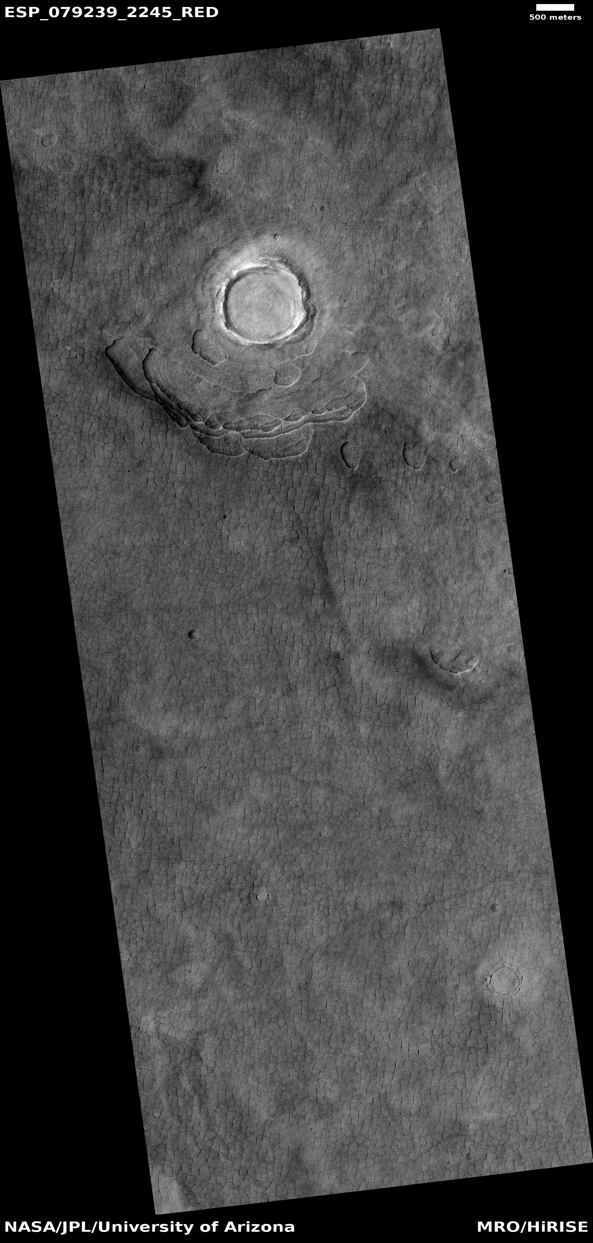
Today we take a look at some polygons in the mid-latitudes of the icy northern lowland plains, where near-surface ice appears ubiquitous and as it sublimates away with the changing seasons causes all kinds of strange formations, including polygons.

The picture to the right, cropped, reduced, and sharpened to post here, is a good example, centered on a 0.6-mile-wide bright crater that appears to be filled with glacial ice. The image was taken on June 22, 2023 by the high resolution camera on Mars Reconnaissance Orbiter (MRO), and is located at 44 degrees north latitude on the western edge of Utopia Basin. As noted by the MRO science team in 2006 for a different MRO picture with similar features:
» Read more

0 comments

The drying out of Mars’ tropics

The drying out of Mars
Click for original image.

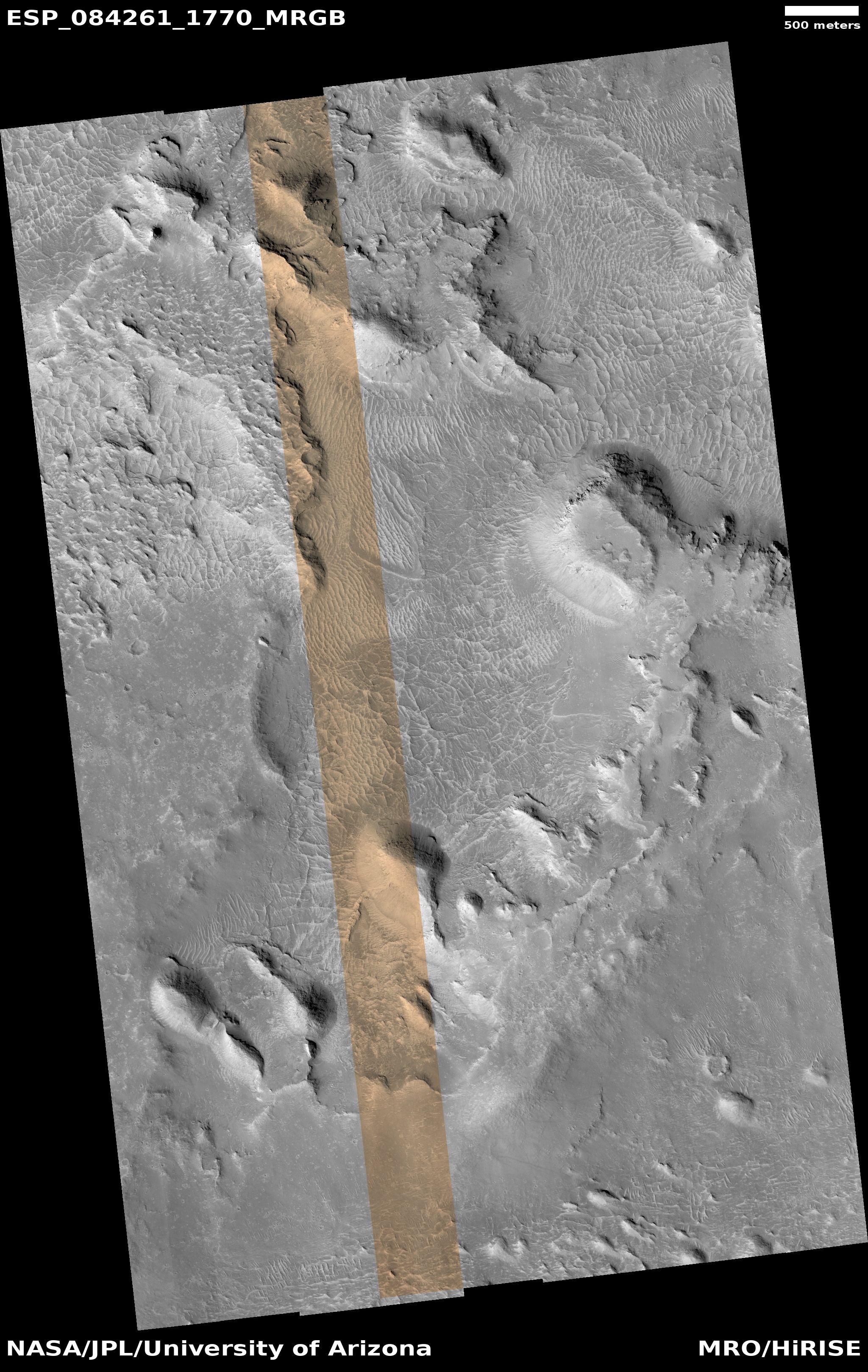
Cool image time! The picture to the right, cropped, reduced, and sharpened to post here, was taken on June 26, 2023 by the high resolution camera on Mars Reconnaissance Orbiter (MRO). The science team calls the features surrounding these small 20 to 60 foot high hills “polygon features,” an apt description and a geological feature that is seen in many places on Mars.

When these features are found in the icy higher latitudes, it is believed they are formed in connection to the freeze-thaw cycle that causes cracks in the near surface ice. When found in the dry equatorial regions, where these polygons are located, they are usually thought to be ancient evidence of past standing water that left behind these cracks, much like the cracks seen in mud after the water has evaporated away on Earth.

The formation of these tiny hills is a bit more complex.
» Read more

0 comments

August 10, 2023 Quick space links

Courtesy of BtB’s stringer Jay.


2 comments

Spring near the Martian north pole

Spring near the Martian north pole
Click for original image.

Overview map

Cool image time! The picture above, rotated, reduced, and brightened slightly to post here, was taken on April 13, 2023 by the high resolution camera on Mars Reconnaissance Orbiter (MRO). It cuts a swath across an eleven-mile-wide crater only about 500 miles from the edge of Mars’ north pole ice cap.

The overview map to the right marks its location, as indicated by the white dot on the right edge of the map. The inset shows the soft and likely icy nature of the surface in which this impact occurred. The crater resulted in a secondary outside ripple, that quickly hardened after impact.

The image was taken during spring, shortly after the sun’s light hit this crater. The cracks in the ice indicate long term sublimation that is slowly reducing the amount of water ice inside the crater. Like mud cracks in the desert after a puddle has evaporated, the ice here is cracking to produce polygon fractures.

It is also very likely that everything here is coated with a thin mantle of clear dry ice, deposited as snow from the atmosphere in the winter and then sublimating away with the coming of spring. That spring dry ice sublimation is likely ongoing, and this picture is probably an attempt by scientists to detect that process.

Why the surface colors shift from aquablue to orange might have to do with that sublimation process, or it might be revealing areas covered with dust (orange). That the northern parts of the strip is blue and the southern parts orange suggests the former. Or not. I don’t have enough information to answer this question with any confidence.

0 comments

Zhurong: Small polygons on light curved dunes indicate regular atmospheric water interaction

Zhurong's full journey on Mars

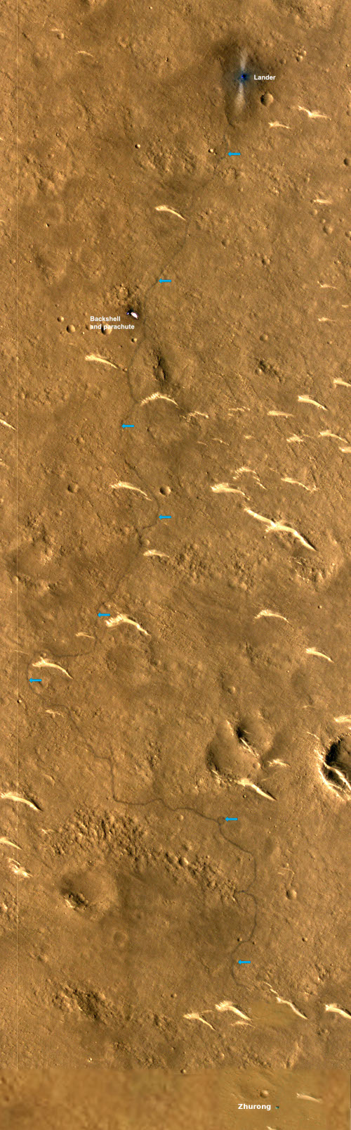
A paper published this week in Geophysical Research Letters by the science team for China Zhurong Martian rover has revealed the discovery of small polygon cracks on the surface of the many curved light-colored small dunes found in the region where Zhurong landed, suggesting the possibility of relatively recent water activity between the atmosphere and the dune surfaces.

Those dunes, dubbed transverse aeolian ridges (TARs) by the science team, are the many light curves visible in the labeled Mars Reconnaissance mosaic to the right. The blue arrows indicate Zhurong’s path south from its landing spot at the top and ending near the bottom of the picture after traveling about 1,400 feet.

According to the paper, the TARs were formed by the prevailing winds over many eons, coming first from the north and then from the northwest. The edges of the ridges, being smaller, are pushed ahead quicker, thus creating the curved shape. The polygons were small, never larger than 4 inches in size, with five to six sides. The scientists theorize that they were formed when atmospheric water interacted with the dune crust, causing fractures “due to temperature/moisture changes or deliquescence/dehydration cycling of salts”. This process could be slow or fast, and could actually be occurring in relatively recent times, as the scientists say it requires only a little water in the atmosphere.

More likely however we are seeing evidence of water from the past, from tens of thousands to several million years ago.

Zhurong meanwhile remains in hibernation, and might never come out of that condition. Orbital images indicate that its solar panels are dust-covered, the result of the heavy winter dust storm season. The project team however is hopeful that with time and the arrival of Martian summer the dust will be blown off and they can reactivate the rover. This hope however entirely depends on the arrival of a dust devil acoss the top of Zhurong, a random event that cannot be predicted. With both the Spirit and Opportunity rovers, such events happened regularly, allowing those missions to last years instead of only 90 days. With InSight it never happened, and the lander died after two-plus years on Mars.

Zhurong’s future fate thus remains unknown, but not promising at this moment.

0 comments

The barren and icy northern lowland plains of Mars

The barren and icy northern lowland plains of Mars
Click for original image.

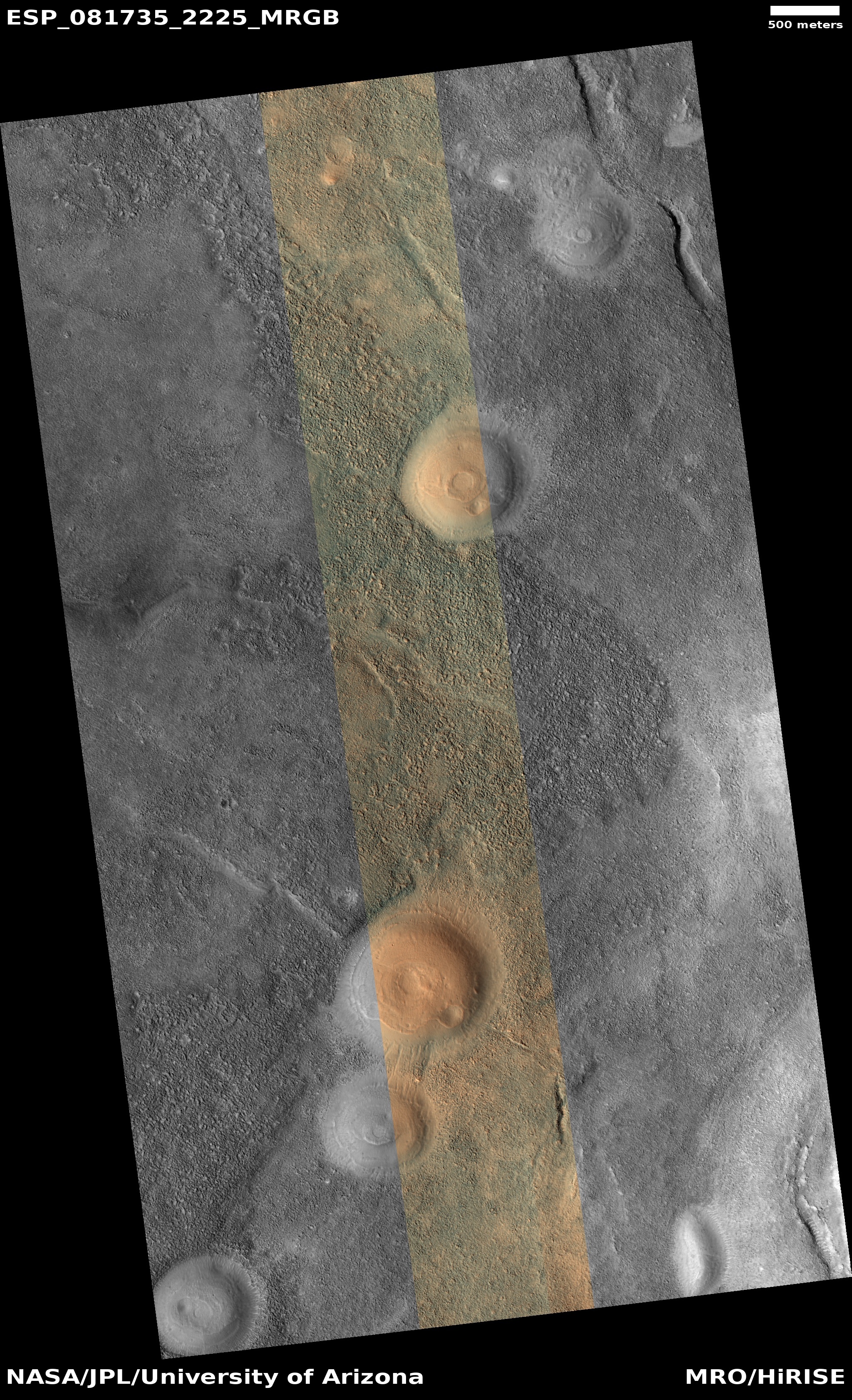
Cool image time! The picture to the right, cropped and sharpened to post here, was taken on January 2, 2023 by the high resolution camera on Mars Reconnaissance Orbiter (MRO). Taken to fill a gap in the camera’s planned image schedule in order to maintain its temperature, the location was in this sense picked not for any particular scientific research project, but because the camera team decided they might find something interesting at this spot.

What they found is a vast flat plain of polygons, a feature found frequently on the surface of Mars and thought to be formed from processes similar to the drying that creates similar polygon cracks in dried mud here on Earth. In this case, the cracks are almost certainly in ice. As Colin Dundas of the U.S. Geological Survey’s Astrogeology Science Center in Arizona explained to me previously,
» Read more

0 comments
1 2 3