China releases movie taken by Chang’e-6 during its lunar descent
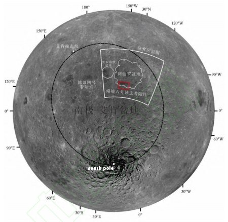
Chang’e-6’s landing zone is indicated by the
red box, on the edge of Apollo Creater
(indicated by the wavy circle).
China’s state-run press yesterday released a short movie created from images taken by its Chang’e-6 lander during its descent to the lunar surface on the far side of the Moon this past weekend.
I have embedded that footage below. The final five frames however are very puzzling, in that they do not appear to show a smooth descent to a specific spot, but appear to jump about wildly. Moreover, the footage does not appear to show the actual landing itself, but appears to stop while the spacecraft is still above the ground.
It is possible that this footage is simply showing the spacecraft’s software searching for a good landing spot, combined with a decision in China not to release footage of the actual touchdown. It could also be that something has gone wrong, and they are stalling about saying so. This last possibility I think very unlikely, but it must be considered, based on the information available.
» Read more