
Astronomers see a quiet galaxy become active for the first time
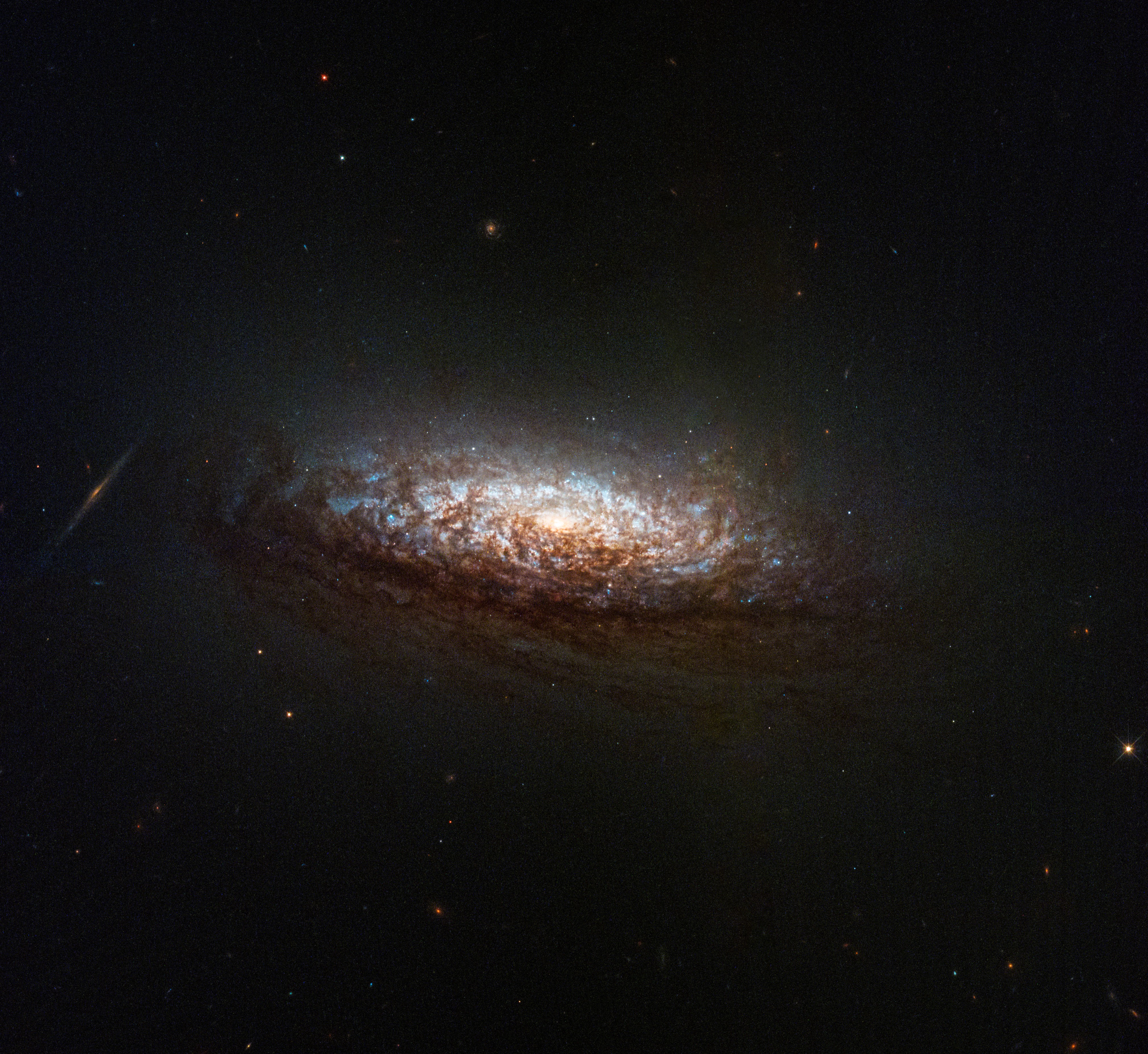
Using a number of space- and ground-based telescopes, astronomers have for the first time seen in real time what had previously been a very inactive and quiet galaxy become active and energetic, suggesting a major event at the galaxy’s center had taken place to change its behavior.
From the abstract of the paper [pdf]:
We conclude that the variations observed in SDSS1335+0728 could be either explained by a ∼ 10 6 M ⊙ AGN [a one million solar mass black hole] that is just turning on or by an exotic tidal disruption event (TDE). If the former is true, SDSS1335+0728 is one of the strongest cases of an AGN observed in the process of activating. If the latter were found to be the case, it would correspond to the longest and faintest TDE ever observed (or another class of still unknown nuclear transient). Future observations of SDSS1335+0728 are crucial to further understand its behaviour.
As noted in the press release:
Some phenomena, like supernova explosions or tidal disruption events — when a star gets too close to a black hole and is torn apart — can make galaxies suddenly light up. But these brightness variations typically last only a few dozen or, at most, a few hundreds of days. SDSS1335+0728 is still growing brighter today, more than four years after it was first seen to ‘switch on’. Moreover, the variations detected in the galaxy, which is located 300 million light-years away in the constellation Virgo, are unlike any seen before.
If the central black hole is switching from being quiet to active, this galaxy is providing astronomers critical information for understanding such changes. This is particularly important to us here in the Milky Way, which has a very inactive central supermassive black hole weighing about 4 million solar masses. It would be very useful to understand what would cause it to become active, especially because such an event might even have an impact — possibly negative — throughout our entire galaxy.


