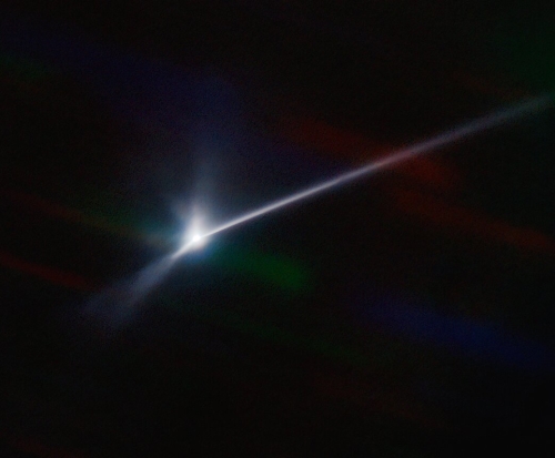
Two days after DART’s impact of Dimorphus, ejected dust extends like a comet tail out more than 6,000 miles
Using a telescope in Chile, astronomers photographed the ejecta two days after the impact of DART into the 525-foot-wide asteroid Dimorphus, and detected a tail of dust extending out more than 6,000 miles.
The picture to the right, cropped and reduced to post here, shows that tail.
In this new image, the dust trail — the ejecta that has been pushed away by the Sun’s radiation pressure, not unlike the tail of a comet — can be seen stretching from the center to the right-hand edge of the field of view. … At Didymos’s distance from Earth at the time of the observation, that would equate to at least 10,000 kilometers (6000 miles) from the point of impact.
Didymos is the larger parent asteroid that Dimorphus orbits.
It is still too soon to get the numbers on how Dimorphus’s path in space was changed by that impact. In fact, we still really don’t have a clear idea what is left of Dimophus itself. The ejecta cloud needs to clear somewhat to see what’s hidden inside it.

