
Weird crater on Moon
Click for full image.
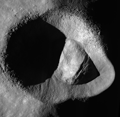
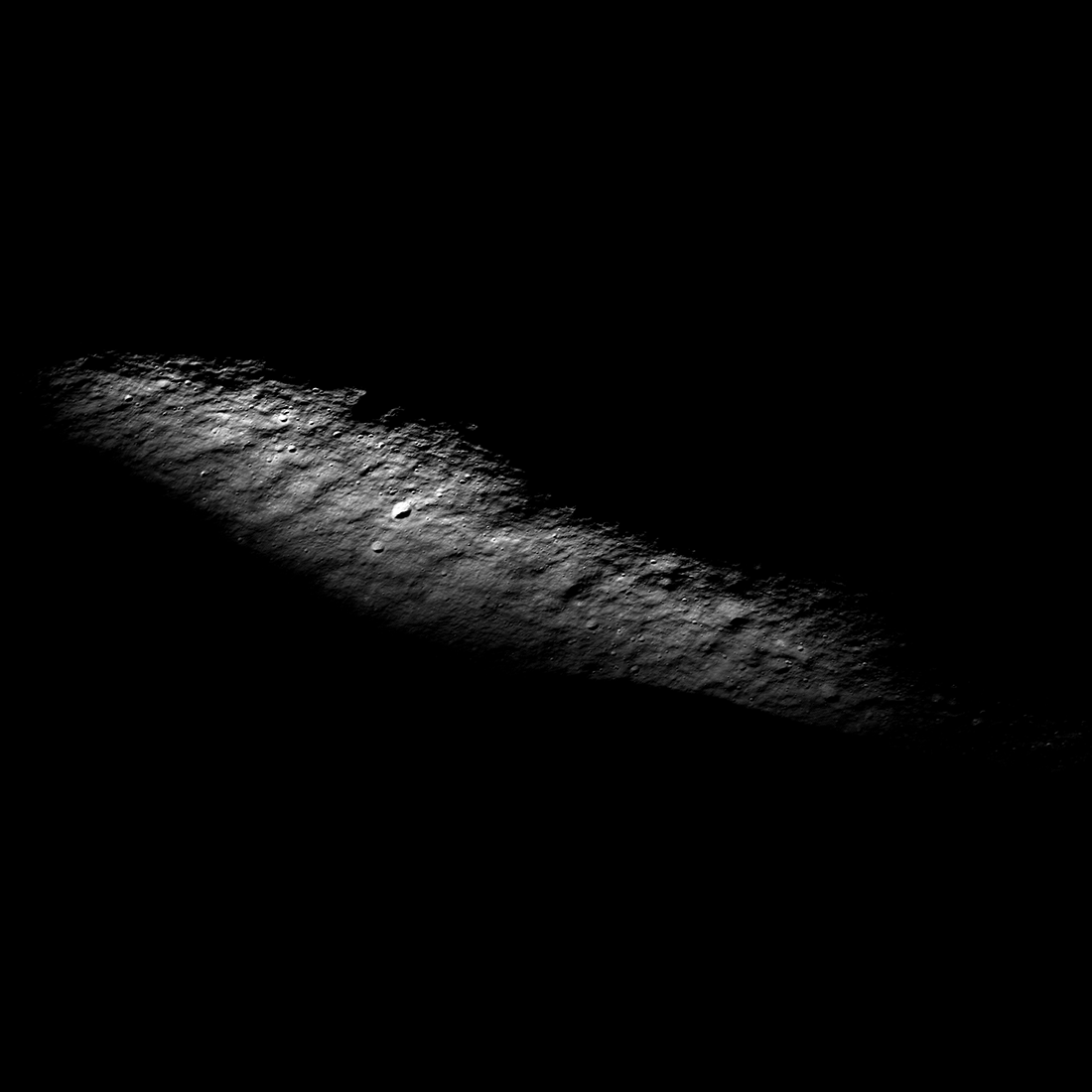
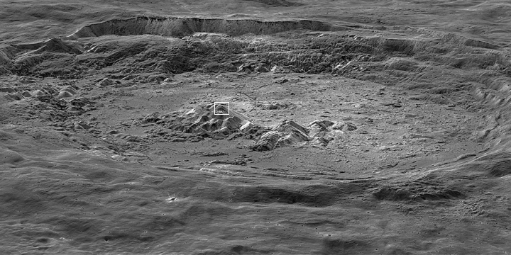
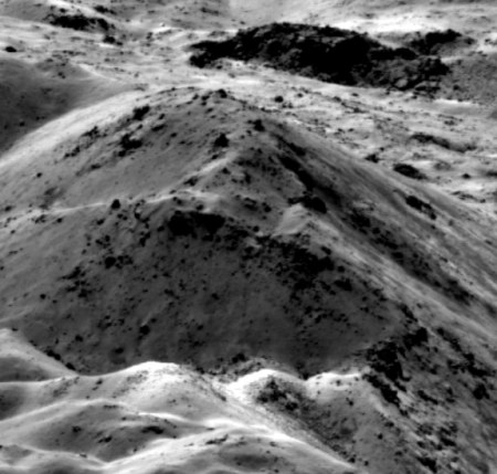
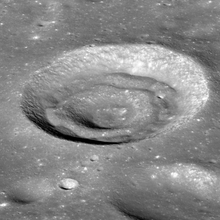
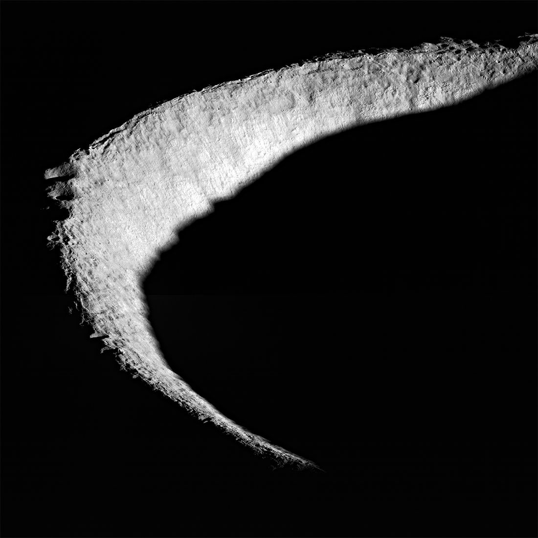
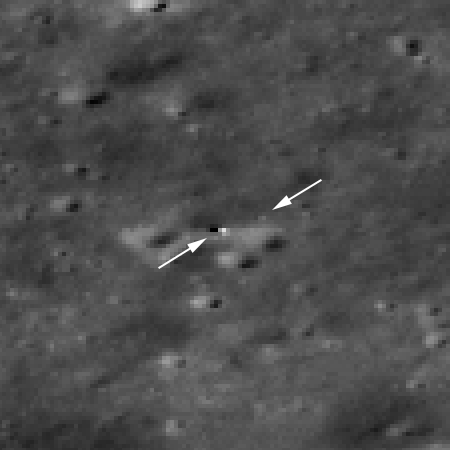
The photo to the right, released today by the science team of Lunar Reconnaissance Orbiter (LRO), takes a overhead view of the unusual crater dubbed Ryder (named after lunar scientist Graham Ryder).
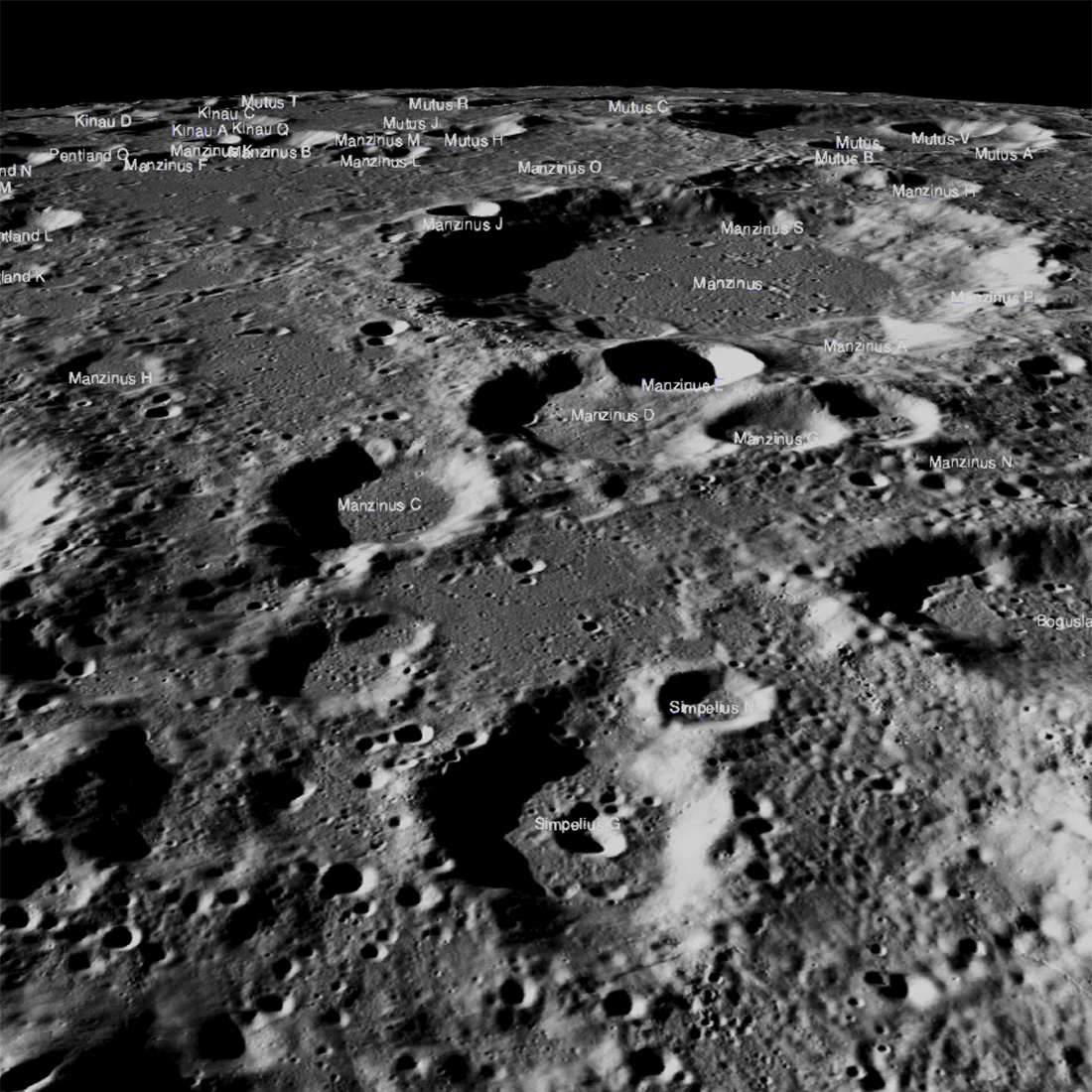
The crater is located on the Moon’s far side, on the edge of the South Pole-Aitken Basin, the Moon’s largest and possibly oldest impact basin. What makes Ryder Crater intriguing is its strange shape, as well as its interior north-south interior ridge.
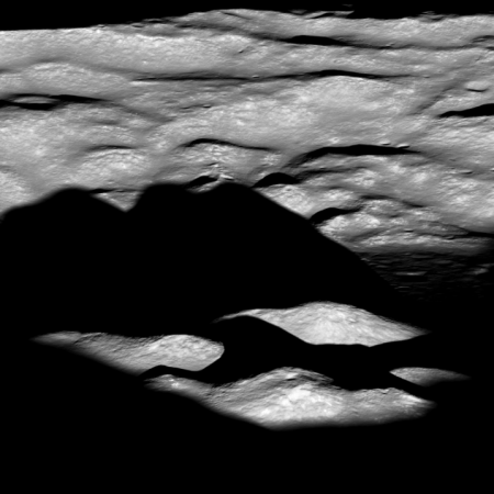
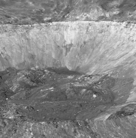
This crater was featured previously in 2012 in a spectacular oblique image looking east across the crater. Then, the scientists theorized its strange shape was caused by two factors, first that the impact was oblique, and second that it occurred on a steep slope.
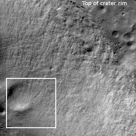
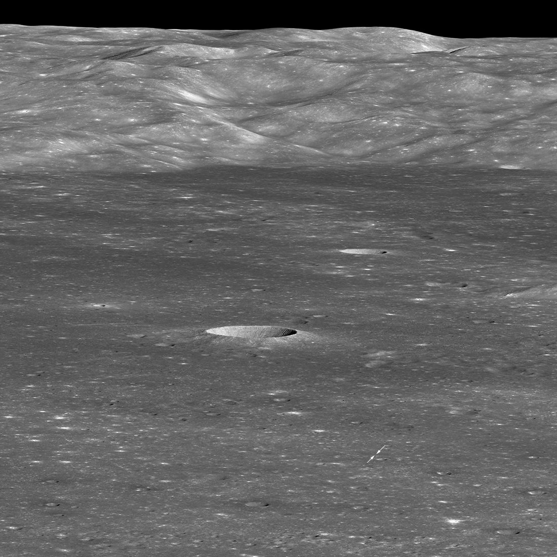
Today’s release adds another factor that might explain the interior ridge. The context map below makes that explanation obvious.
» Read more
Click for full image.
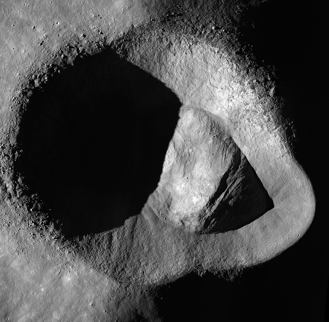
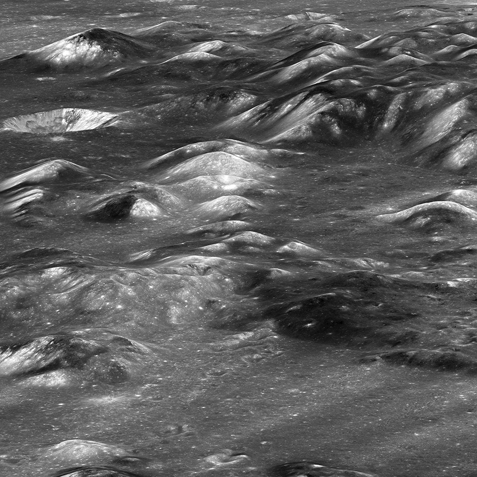
The photo to the right, released today by the science team of Lunar Reconnaissance Orbiter (LRO), takes a overhead view of the unusual crater dubbed Ryder (named after lunar scientist Graham Ryder).
The crater is located on the Moon’s far side, on the edge of the South Pole-Aitken Basin, the Moon’s largest and possibly oldest impact basin. What makes Ryder Crater intriguing is its strange shape, as well as its interior north-south interior ridge.
This crater was featured previously in 2012 in a spectacular oblique image looking east across the crater. Then, the scientists theorized its strange shape was caused by two factors, first that the impact was oblique, and second that it occurred on a steep slope.
Today’s release adds another factor that might explain the interior ridge. The context map below makes that explanation obvious.
» Read more


