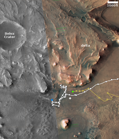
Curiosity begins a detour
Click for interactive map.
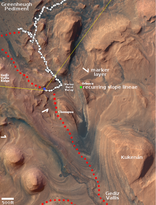
The science team running the Curiosity rover on Mount Sharp on Mars have decided to take the rover on a detour. As shown in the overview map to the right, rather than continue climbing directly up the mountain in the canyon dubbed Gediz Vallis, they have turned the rover to the west in order to put it back on its original planned route, though traveling in the opposite direction. The goal is to get to Gediz Vallis Ridge, which the rover attempted to reach by crossing the Greenheugh Pediment back in the spring, but was forced to retreat because the ground was simply too rough for the rover’s wheels.
From their October 31st update:
We are now officially on our detour, a short round trip to image and capture geochemistry of the “Gediz Vallis ridge” up on the pediment, before coming back down to the “Marker Band valley” and rejoining the MSAR (Mount Sharp Ascent Route). This detour will allow us to access some of the area we’d planned to visit before getting turned around by the ‘gator-back’ terrain on the Greenheugh pediment. For this part of the campaign, we are prioritizing driving, getting to our destination as fast as we can, but imaging as we go and marking areas of interest for contact science as we come back down.
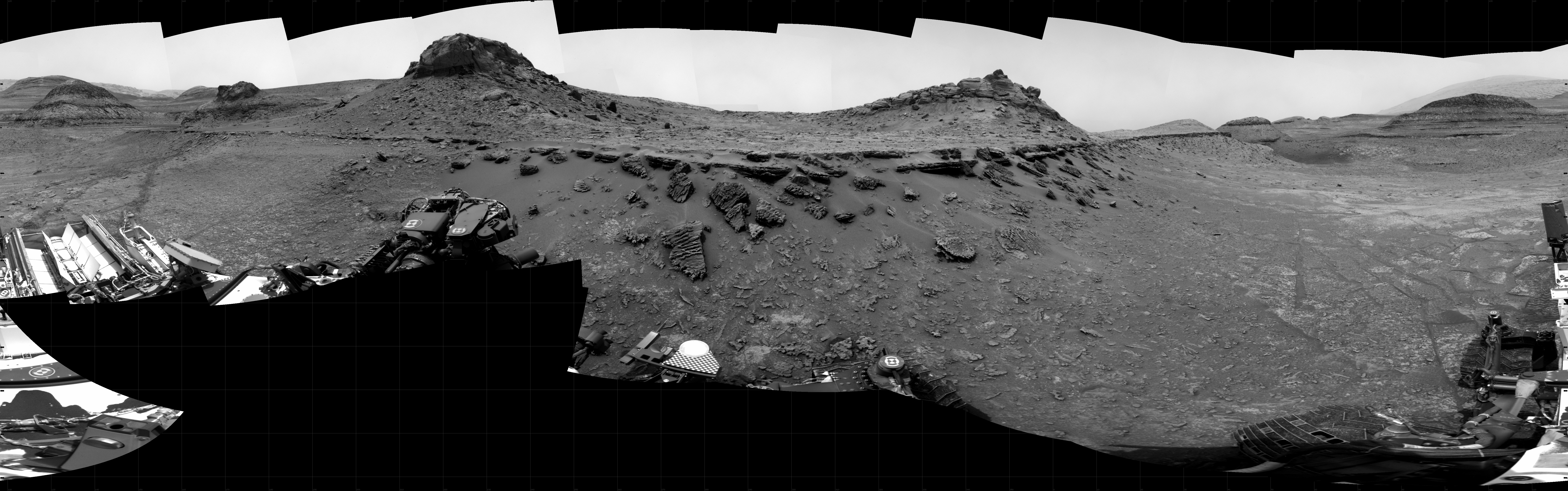
The panorama above, cropped and reduced to post here, shows the rover’s view uphill to get to the ridge. The blue dot marks its present position. The yellow lines mark the approximate area viewed by the panorama above.
I think the rover’s path will take it up through the saddle between the two small peaks on the left. The science team is likely hoping that once they get up over that saddle, the terrain to get to the ridge will be smoother and less treacherous than the very broken and rocky surface of the Greenheugh Pediment.
This route also appears to also get them up on the marker band more safely. That band, marked by the white arrows, is a distinct smooth layer found in many places on the flanks of Mount Sharp.