Catastrophes on Mars and Earth

Big rock break in Kasei Valles
Click for full image.

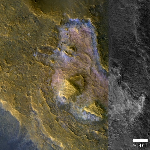
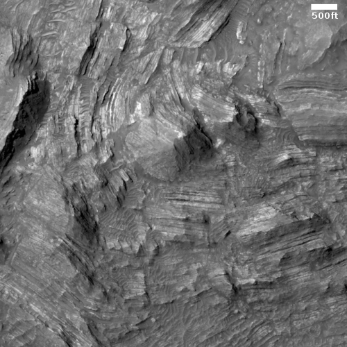
Cool image time! The photo to the right, rotated, cropped, and reduced to post here, was taken by the high resolution camera on Mars Reconnaissance Orbiter (MRO) on May 13, 2020, and shows what appears to be a giant block that at some point was attached to the cliff, and then broke off and fell away to the north. Subsequent erosion over the later eons widened the break until it now looks like a canyon.

Sounds great, but the event that separated this big piece of mountain, almost a mile across, from its cliffside was possibly even more catastrophic. And it might not have involved a sudden break and fall, but something more spectacular, and also still impossible based on everything we know about Mars.

Uncovering what really happened at this spot on Mars will not only help us understand the geological history of the Red Planet, it could also amazingly enough help illustrate the cultural shifts going on right now on Earth, and how to shift them in a more rational and sane direction.

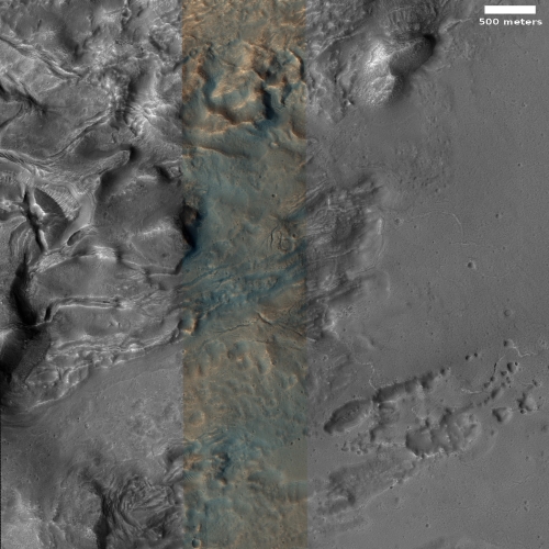
This image is located near the outlet of Kasei Valles, one of the larger valleys draining downward from the Tharsis Bulge where Mars’ giant volcanoes are located. The overview map below shows us what Kasei Valles looks like in this area.
» Read more

Engineers recharge Ingenuity’s batteries on its way to Mars

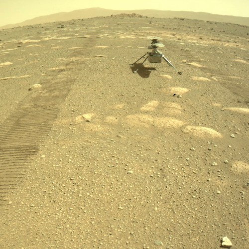
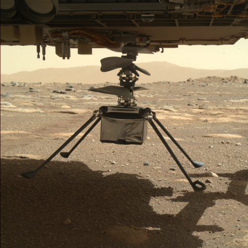
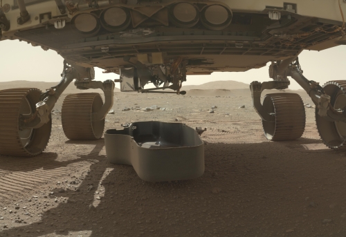
Engineers have successfully completed their first in-flight maintenance recharge of the batteries on Perseverance’s small test helicopter Ingenuity.

NASA’s Ingenuity Mars Helicopter received a checkout and recharge of its power system on Friday, Aug. 7, one week into its near seven-month journey to Mars with the Perseverance rover. This marks the first time the helicopter has been powered up and its batteries have been charged in the space environment.

During the eight-hour operation, the performance of the rotorcraft’s six lithium-ion batteries was analyzed as the team brought their charge level up to 35%. The project has determined a low charge state is optimal for battery health during the cruise to Mars.

They plan to do these partial recharges about once every two weeks during the trip to Mars to keep the battery charged the optimal amount.

About a month after Perseverance has landed in February 2020, it will find a large flat area to deploy Ingenuity, then move away. The helicopter will then begin a 30 day test program to see if it will be able to fly in the very thin Martian atmosphere, only about 1% as thick as Earth’s.

Martian sand traps and elongated dunes

Elongated dunes on Mars
Click for full image.

Cool image time! The photo to the left, rotated, cropped, and reduced to post here, was taken on June 23, 2020 by the high resolution camera on Mars Reconnaissance Orbiter (MRO). I was attracted by the uncaptioned image’s title, “Elongating Linear Dunes at Meroe Patera.” What are elongating linear dunes?

The photo shows two such dunes, stretching out to the southwest away from the pile of sand that abuts the cliff to the northwest. Unlike most dunes, which usually form and travel in groups, these for some reason form single straight lines extending for some distance.

I contacted the scientist who requested this image, Joel Davis of the Natural History Museum in London, hoping he could answer some questions about these strangely shaped dunes, and discovered that he was studying this exact subject for a paper since published. As noted in the paper’s introduction,
» Read more

The edge of Mars’ south polar layered cap

The edge of the Martian south pole layered deposits
Click for full image.

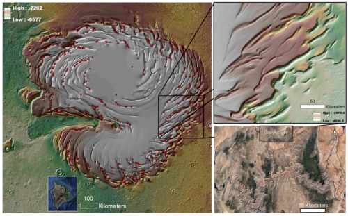
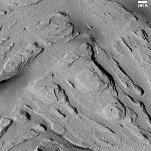
Cool image time! The photo to the right, rotated and cropped to post here, was taken by the high resolution camera on Mars Reconnaissance Orbiter (MRO) on April 10, 2020, and shows the edge of what scientists have dubbed Mars’s south polar layered deposits. The high point, towards the south, is at the bottom, and the terraced layers descend downward to the plains as you move up the image, to the north.

In essence, this spot is the edge of the southern ice cap, though unlike the north polar ice cap, this edge is not the edge of the visible ice cap, but the edge of a much larger field of layered deposits of mixed dust and ice. In the north the ice cap almost entirely covers these layered deposits. In the south the residual ice cap does not. Instead, the layered deposits extend out far beyond the smaller residual ice cap.

The map below provides the geography of the south pole, with the location of this image indicated by the blue cross.
» Read more

Ascraeus Mons, Mars’ second highest mountain

Ascraeus Mons

Today’s cool Mars’ image started out when I came across an interesting image of a depression on the northern flank of the giant Martian volcano Ascraeus Mons, the northernmost of the line of three giant volcanoes just to the east of the biggest of all, Olympus Mons.

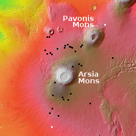
To provide context I created an overview showing the entire volcano (with the white rectangle showing the location of the depression image), and suddenly realized that this overview might actually be more interesting to my readers. To the right is that overview of Ascreaus, with a scale across the bottom to indicate the elevation of the mountain above what scientists have determined to be Mars’ pseudo sea level.

Notice that this volcano, the second highest on Mars, rises more than 43,000 feet above the surrounding plains. Its peak is estimated to be about 59,000 feet high, making it taller than Mt. Everest by about 30,000 feet (more than twice its height). Its diameter is approximately 300 miles across, giving it a much steeper profile than the higher but more spread out Olympus Mons. The map below shows this mountain in relation to Olympus as well as its nearby partner volcanoes.
» Read more

Slushy floor of southern Martian crater?

Knobby floor of southern crater
Click for full image.

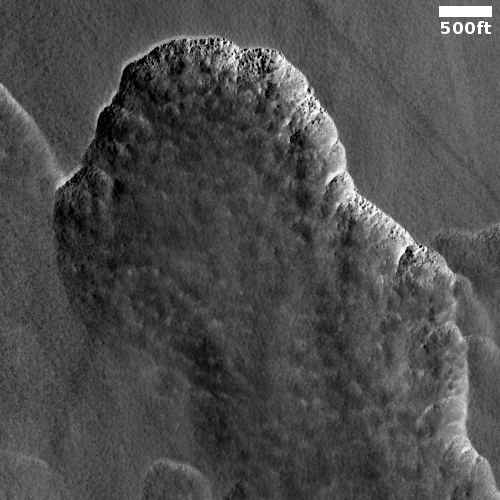
The cool image to the right, rotated, cropped, and reduced to post here, shows the northwest section of the floor of a crater in the southern cratered highlands of Mars, in a mountainous region dubbed Claritus Fossae, located south of Valles Marineris. The photo was taken by the high resolution camera on Mars Reconnaissance Orbiter (MRO) on May 14, 2020.

The entire crater floor appears to be covered by these strings of closely-packed knobs, reminiscent of the brain terrain found in the mid-latitude glacial regions of Mars and thought to be the result of underground ice sublimating upward.

Below is the area in the white box, in full resolution.
» Read more

Study: Lava tubes on Mars and the Moon will be gigantic

A new study comparing lava tubes on the Earth with those detected from orbit on Mars and the Moon now suggests that tubes on those other worlds will be many times larger than on Earth.

Researchers found that Martian and lunar tubes are respectively 100 and 1,000 times wider than those on Earth, which typically have a diameter of 10 to 30 meters. Lower gravity and its effect on volcanism explain these outstanding dimensions (with total volumes exceeding 1 billion of cubic meters on the Moon).

Riccardo Pozzobon adds: “Tubes as wide as these can be longer than 40 kilometres, making the Moon an extraordinary target for subsurface exploration and potential settlement in the wide protected and stable environments of lava tubes. The latter are so big they can contain Padua’s entire city centre”.

Moreover, the data suggests their roofs, even at this size, will be very stable because of the lower gravity, making them excellent locations for large human colonies.

The researchers also suggest that there are many intact such lava tubes under the mare regions on the Moon, their existence only hinted at by the rare skylights created due to asteroid impact.

Filled and distorted craters on Mars

A very distorted and filled crater on Mars
Click for full image.

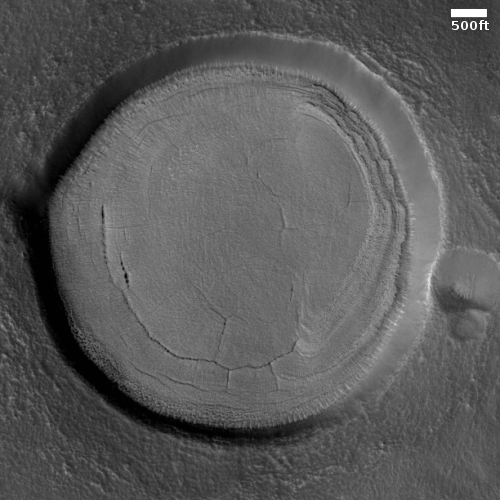
Cool image time! The photo to the right, rotated and cropped to post here, was taken by the high resolution camera on Mars Reconnaissance Orbiter (MRO) on May 25, 2020. The entire image was dubbed “Cluster of Filled Craters”, but I decided to highlight the crater of the cluster that was most strangely distorted of them all. The material that fills all the craters in the full image is almost certainly buried ice and is dubbed concentric crater fill by scientists.

This crater is located in the northern lowland plains the mid-latitudes between 30 and 60 degrees, where planetary scientists have found ample evidence of many such filled craters and glaciers.

Not only does the crater’s interior seemed filled with glacial material, its distorted rim suggests that it has been reshaped by glacial activity that might have covered it entirely over the eons as the mid-latitude glaciers of Mars waxed and waned with the extreme shifts that happen regularly to Mars’ rotational tilt. Moreover, there is strong evidence that in these lowland northern plains an underground ice table exists close to the surface, allowing for more distortion over time.

The overview map below provides some location context.
» Read more

Scientists make first rough estimate of Mars’ internal structure

Artist's cutaway showing theorized Martian interior
Artist’s cutaway of theorized Martian interior

Using data from InSight’s seismometer, scientists have made their first approximation of the internal structure of Mars.

The first boundary Deng and Levander measured is the divide between Mars’ crust and mantle almost 22 miles (35 kilometers) beneath the lander.

The second is a transition zone within the mantle where magnesium iron silicates undergo a geochemical change. Above the zone, the elements form a mineral called olivine, and beneath it, heat and pressure compress them into a new mineral called wadsleyite. Known as the olivine-wadsleyite transition, this zone was found 690-727 miles (1,110-1,170 kilometers) beneath InSight. “The temperature at the olivine-wadsleyite transition is an important key to building thermal models of Mars,” Deng said. “From the depth of the transition, we can easily calculate the pressure, and with that, we can derive the temperature.”

The third boundary he and Levander measured is the border between Mars’ mantle and its iron-rich core, which they found about 945-994 miles (1,520-1,600 kilometers) beneath the lander. Better understanding this boundary “can provide information about the planet’s development from both a chemical and thermal point of view,” Deng said.

Because they only have one seismometer on the planet, this approximation has a great deal of uncertainty. Only when we have multiple such seismic instruments, scattered across the entire Martian globe, will scientists be able to hone their models more accurate of the planet’s interior.

The dry barren plains of Tyrrhena Terra

Tyrrhena Terra badlands
Click for full image.

In a sense today’s cool image is a replay of one I posted in March, showing the dry barren terrain in the vast rough cratered highlands of Tyrrhena Terra, located along the equator of Mars between the giant basins of Isidis and Hellas.

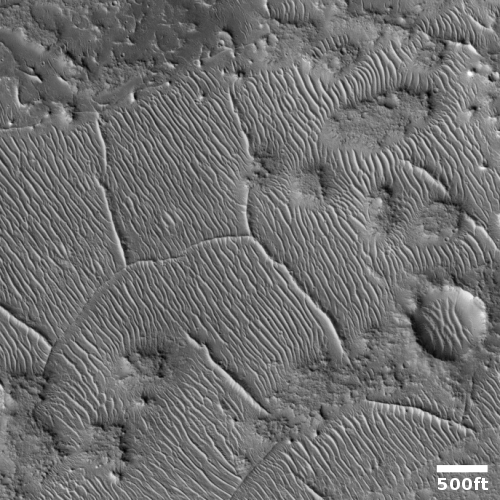
Today’s image on the right, cropped to post here, was taken by the high resolution camera on Mars Reconnaissance Orbiter on March 26, 2020, and shows well the barrenness of this region. The surface appears quite solid, like bedrock, rather than the squishy soft surface of the northern lowland plains. Moreover, there is a lot of dust trapped in the low areas between the ridges, forming ripples that new data suggest move slowly across the surface. If you click on the full image, you will see that this terrain is far from local, and goes on in this manner for quite a distance in all directions.

This is a dry and forbidding place, about the size of the American southwest, from Texas to California.

The overview map below provides some context of Tyrrhena Terra’s location on Mars.
» Read more

Study: Mars’ meandering canyons formed under ice

A new study comparing Mars’ meandering canyons with those found in the Arctic regions on Earth suggests that the Martian valleys were formed by water melting under large ice sheets, not flowing water on the surface.

A large number of the valley networks scarring the surface of Mars were carved by water melting beneath glacial ice, not by free-flowing rivers as previously thought, according to new research published in Nature Geoscience. The findings effectively throw cold water on the dominant “warm and wet ancient Mars” hypothesis, which postulates that rivers, rainfall and oceans once existed on the red planet.

To reach this conclusion, lead author and postdoctoral research scholar Anna Grau Galofre of Arizona State University’s School of Earth and Space Exploration developed and used new techniques to examine thousands of Martian valleys. She and her co-authors also compared the Martian valleys to the subglacial channels in the Canadian Arctic Archipelago and uncovered striking similarities. The western edge of the Devon ice cap on the Canadian Arctic Archipelago.

I have noted previously on Behind the Black my sense that the planetary science community was beginning to shift away from the hypothesis of flowing liquid surface water on Mars as an explanation for the planet’s riverlike and oceanlike features to some form or ice/glacial activity. For a half century the scientists have tried and failed to come up with some scenario that could allow water to flow on the surface in Mars’ cold climate and thin atmosphere.

Ice or glacial activity rather than flowing liquid water might solve this problem, and today’s paper is a push in this direction.

Perseverance’s planned journey in Jezero Crater

Jezero Crater delta
Jezero Crater delta

If all goes right, on February 18, 2021 the rover Perseverance will gently settle down onto the floor of Jezero Crater on Mars. The image to the right is probably the most reproduced of this site, as it shows the spectacular delta that some scientists believe might be hardened mud that had once flowed like liquid or lava from the break in the rim to the west.

They hope to put Perseverance down to the southeast of that delta, as shown in the overview map below.
» Read more

Glacier country on Mars

Glacial flow in Protonilus Mensae
Click for full image.

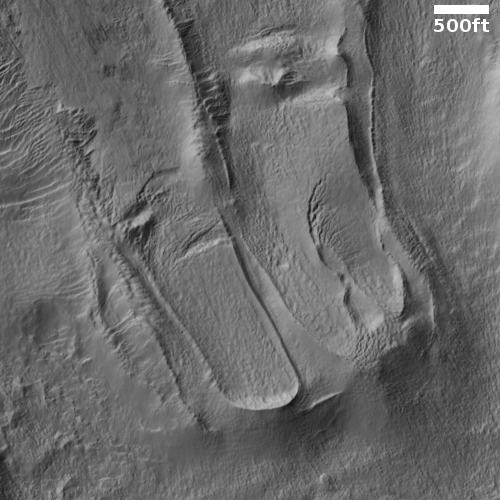
Cool image time! The photo to the right, rotated, cropped, and reduced to post here, was taken on May 24, 2020 by the high resolution camera on Mars Reconnaissance Orbiter (MRO), and provides a wonderful example of the kind of evidence of buried glaciers found extensively in the mid-latitudes of Mars.

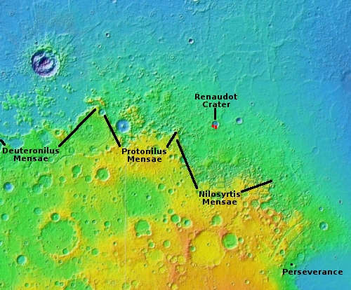
This particular region, called Protonilus Mensae, is a region of chaos terrain at the transition zone between the southern cratered highlands and the northern lowland plains. I have featured a number of cool images in Protonilus, all of which show some form of buried glacial flow, now inactive.

The last cool image above was one that the MRO science team had picked to illustrate how to spot a glacier on Mars.

In this particular image are several obvious glacier features. First, we can see a series of moraines at the foot of each glacier in the photo, each moraine indicating the farthest extent of the glacier when it was active and growing. It also appears that there are two major layers of buried ice, the younger-smaller layer near the image’s bottom and sitting on top of a larger more extensive glacier flow sheet. This suggests that there was more ice in the past here, and with each succeeding ice age the glaciers grew less extensive.

Second, at the edges of the flows can be seen parallel ridges, suggestive also of repeated flows, each pushing to the side a new layer of debris.

Third, the interior of the glacier has parallel fractures in many places, similar to what is seen on Earth glaciers.

Protonilus Mensae, as well as the neighboring chaos regions Deuteronilus to the west and Nilosyrtis to the east, could very well be called Mars’ glacier country. Do a search on Behind the Black for all three regions and you will come up with numerous images showing glacial features.

Below is an overview of Protonilus, the red box showing the location of this image. Also highlighted by number are the locations of the three features previously posted and listed above.
» Read more

Martian eroding ridges amid brain terrain

Brain terrain and bisected ridges on Mars
Click for full image.

Today’s very cool image is cool because of how inexplicable it is. To the right, cropped to post here, is a photo taken by the high resolution camera on Mars Reconnaissance Orbiter (MRO) of an area of what they call “Ribbed Terrain and Brain Terrain”.

I call it baffling.

Nor am I alone. At the moment the processes that create brain terrain (the undulations between the ridges) remain a complete mystery. There are theories, all relating to ice sublimating into gas, but none really explains the overall look of this terrain.

Making this geology even more baffling are the larger ridges surrounding the brain terrain, all of which appear to have depressions along their crests. Here too some form of sublimation process appears involved, but the details remain somewhat mysterious.
» Read more

Slip-sliding away – on Mars

Faults on Mars
Click for full image.

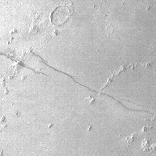
Today’s cool Martian image, rotated, cropped, and reduced to post here, comes from the camera on Mars Odyssey and was taken on May 18, 2020. It shows an area on Mars where faults and cracks in the ground have caused criss-crossing depressions. In this particular case we can see that the north-south trending fissure at some point got cut in half by east-west trending fault, its northern and southern halves thus getting shifted sideways from each other. For scale the straight section of the northern canyon is about five miles long, with the sideways shift about a mile in length.

As the caption notes, “With time and erosion this region of fault blocks will become chaos terrain,” regions of canyons often cutting at right angles to each other with flat-topped mesas and buttes in between.

Now for the mystery.
» Read more

Moving ripples on Mars

Using Mars Reconnaissance Orbiter (MRO) high resolution images, scientists have now determined that the giant ripples seen from space are actually moving, albeit very slowly.

Megaripples are found in deserts on Earth, often between dunes. Waves in the sand spaced up to tens of meters apart, they’re a larger version of ripples that undulate every 10 centimeters or so on many sand dunes. But unlike dunes, megaripples are made up of two sizes of sand grains. Coarser, heavier grains cap the crests of megaripples, making it harder for wind to move these features around, says Simone Silvestro, a planetary scientist at Italy’s National Institute of Astrophysics in Naples.

Since the early 2000s, Mars rovers and orbiters have repeatedly spotted megaripples on the Red Planet. But they didn’t seem to change in any measurable way, which led some scientists to think they were relics from Mars’s past, when its thicker atmosphere permitted stronger winds.

Now, using images captured by NASA’s Mars Reconnaissance Orbiter, Silvestro and his colleagues have shown that some megaripples do creep along—just very slowly.

They found that the ripples shift position about four inches per year, which astonished them since they had not believed the winds of Mars were strong enough to move them at all.

Tianwen-1 successfully launched, on its way to Mars

UPDATE: According to news reports, China tonight successfully launched Tianwen-1 towards Mars, with arrival expected in February 2021.

Below the fold is a live stream of the launch of the Long March 5 rocket. It is not in English, and since it was not linked to China’s mission control, it only covers the first two minutes or so, after which the rocket went out of sight.

The leaders in the 2020 launch race:

17 China
11 SpaceX
7 Russia
3 ULA
3 Japan

The U.S. still leads China 18 to 17 in the national rankings.
» Read more

Rover update: Curiosity pauses to drill

Curiosity's entire journey so far in Gale Crater

Overview map of Curiosity's recent travels

The artist’s oblique drawing above, as well as the map to the right, provide some context as to Curiosity’s present location and its entire journey in Gale Crater. For the overall context of Curiosity’s travels, see my March 2016 post, Pinpointing Curiosity’s location in Gale Crater. For all rover updates since then through May 2020, go here.

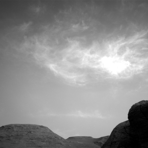
Since my last update on July 7, 2020, Curiosity has quickly moved a considerable distance to the east, as planned, skirting the large sand field to the south in its journey to the best path upward onto Mt. Sharp. The science team however has detoured away from their planned route, shown in red on the map, heading downhill a bit in order to find one last good location in the clay unit to drill. They are at that location now and are presently scouting for the best drilling spot.

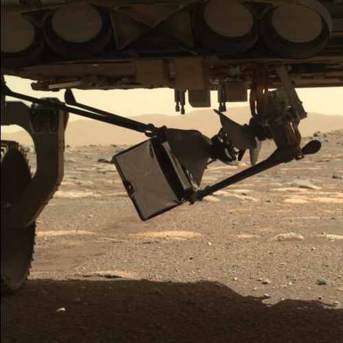
About a week ago, before heading downhill, they had stopped to take a set of new images of Curiosity’s wheels. » Read more

Tianwen-1 launch set for July 23rd

China has rolled out its Long March 5 rocket and is now preparing to launch its Tianwen-1 orbiter/lander/rover to Mars this coming Thursday, July 23rd, some time between 12 am and 3 am (Eastern).

A Long March 5 rocket is set for liftoff with China’s Tianwen 1 mission some time between 12 a.m. and 3 a.m. EDT (0400-0700 GMT) Thursday, according to public notices warning ships to steer clear of downrange drop zones along the launcher’s flight path.

Chinese officials have not officially publicized the launch date. Chinese state media outlets have only reported the launch is scheduled for late July or early August, and officials have not confirmed whether the launch will be broadcast live on state television.

This will be the first operational launch of the Long March 5, which has had three previous test launches, with the first two failing. The success of the December launch, as well as the May success of the related Long March 5B, made this Mars mission possible.

After achieving orbit in February 2021 and spending two months scouting the landing site, the lander will descend to the surface, bringing the rover with it. The prime landing site is Utopia Planitia, in the northern lowland plains.

Utopia Planitia, the prime landing site for China’s Tianwen-1 Mars rover

More blobs in Utopia Planitia
Click for full image.

Today’s cool image is not only cool, it gives a nice feel for the likely shallow ice table that is probably found close to the surface throughout the lowland northern plains of Utopia Planitia, which is also the prime landing site for China’s Taenwen-1 Mars lander/rover, scheduled for launch sometime in the next four days. [Update: there are now indications the launch will not occur until early August.]

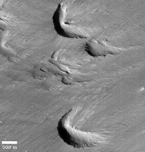
The photo to the right, rotated, cropped, and reduced to post here, was taken on May 9, 2020 and shows a nice collection of strange land forms on the western edge of Utopia Planitia. In this one picture we can see large mounds that might be evidence of cryovolcanic activity (mud volcanoes), strings of small mounds that might be the same but that also suggest underground faults and voids, and distorted and eroded craters that could have buried glacial material in the interiors.

The largest crater in the upper left looks like it is actually filled with ice that has also spilled over to fill the adjacent and linked depression.

This location is quite typical of Utopia Planitia. See for example this post from May 13, 2020: The blobby wettish flows of Mars. In the mid-latitudes here we find ample evidence that buried very close to the surface is an ice table that when hit by an impact melts to form these strangely shaped craters.

China’s actual target landing area is far to the east of today’s cool image, in an area that is appears far less rough. » Read more

Why the UAE’s Hope Mars Orbiter is really a US mission for UAE’s students

Today there were many many news stories touting the successful launch of the United Arab Emirates’ (UAE) first interplanetary probe, Hope, (al-Amal in Arabic), successfully launched yesterday from Japan. This story at collectSpace is typical, describing the mission in detail and noting its overall goals not only to study the Martian atmosphere but to inspire the young people in the UAE to pursue futures in the fields of science and engineering.

What most of these reports gloss over is how little of Hope was really built by the UAE. The UAE paid the bills, but during design and construction almost everything was done by American universities as part of their education programs, though arranged so that it was UAE’s students and engineers who were getting the education.
» Read more

UAE’s Hope Mars Orbiter successfully launched

The new colonial movement: The United Arab Emirates first interplanetary probe, its Hope Mars Orbiter, was successfully launched by a Mitsubishi H-2A rocket today from Japan, and is now on its way to Mars.

It will arrive in February 2021, when it will attempt to inject itself into orbit, where it will then be used to study the Martian weather.

The leaders in the 2020 launch race:

16 China
10 SpaceX
7 Russia
3 ULA
3 Japan

The U.S. still leads China in the national rankings, 17 to 16.

More polygons on Mars!

Lava polygons on Mars?
Click for full image.

Today’s cool image, rotated, cropped, and contrast-enhanced to post here, focuses on polygons found near the equator of Mars. It was taken by the high resolution camera on Mars Reconnaissance Orbiter (MRO) on May 22, 2020, and shows what the science team labels as “well-preserved polygons.”

Previously I have posted cool images showing polygons (here and here), but those images were located in the northern mid-latitudes, and were thought to have been formed in connection with some form of freeze-melt-drying water process in permafrost.

Today’s image however is likely not related to water. It is located in the equatorial regions, where little water is expected. It also has a more permanent nature, which suggests that it is the result of some sort of volcanic or tectonic process. That the polygons are depressions suggests the latter, since a volcanic process is more likely to have filled cracks and left ridges more resistant to erosion, as explained by this article.

In this case the topography suggests instead some form of spreading and cracking process that left behind these polygon-shaped cracks. In mud, such polygons are found when the mud dries, but once again, these are in a very dry region. If formed in that manner they must have formed a very very long time ago, when the climate here was very different, and were somehow preserved for eons since.

The location, as shown in the overview map below provides some context, though it really doesn’t answer any questions..
» Read more

Launch update on Mars missions

The launch status of the three missions to Mars:

First, the launch of UAE’s Hope orbiter by Mitsubishi’s H-2A rocket has been pushed back to July 20th due to bad weather. Their launch window extends to August 3rd, so they still have two weeks before it closes.

Second, China has rolled to the launchpad the Long March 5 rocket, with the Tienwen-1 orbiter/lander/rover. Though they have only said that the launch will occur between July 20th and July 25th, based on past operations, they usually launch six days after roll-out, putting the launch date as July 23.

China has also provided some clarity as to Tienwen-1’s landing site on Mars. According to this Nature Astronomy paper [pdf], published on July 13th, their primary landing site is in the northern lowland plains of Utopia Planitia. The Tienwen-1 science team has also considered [pdf] the northern lowland plains in Chryse Planitia, on the other side of Mars.

Since they will spend two to three months in Mars orbit before sending the lander and rover to the surface, it could very well be that they won’t make a final decision until they get into orbit.

Finally, on July 7th Perseverance was mounted on top of its Atlas-5 rocket for its July 30th launch. Its launch window closes on August 15.

Seismic signal from recent Martian impact detected by InSight?

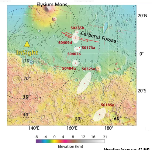
According to a science paper released today, a small impact that occurred about 25 miles south from the InSight lander between February 21st and April 6, 2019 might have been detected by the spacecraft’s seismometer.

From the paper’s abstract:

During this time period, three seismic events were identified in InSight data. We derive expected seismic signal characteristics and use them to evaluate each of the seismic events. However, none of them can definitively be associated with this source. Atmospheric perturbations are generally expected to be generated during impacts; however, in this case, no signal could be identified as related to the known impact. Using scaling relationships based on the terrestrial and lunar analogs and numerical modeling, we predict the amplitude, peak frequency, and duration of the seismic signal that would have emanated from this impact. The predicted amplitude falls near the lowest levels of the measured seismometer noise for the predicted frequency. Hence it is not surprising this impact event was not positively identified in the seismic data.

Based on this data, they now think they will only be able to detect about two impacts per year with InSight’s seismometer, a decrease from the previous estimate of as many as ten.

Martian acne?

Acne on Mars?
Click for full image.

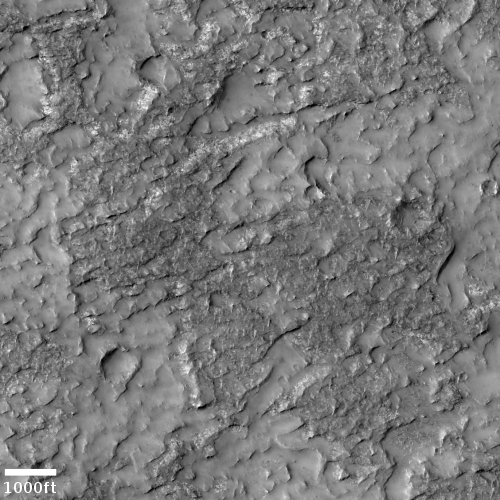
Cool image time! The photo to the right, rotated, cropped, and reduced to post here, shows what the scientists from the high resolution camera on Mars Reconnaissance Orbiter (MRO) label “fretted terrain.” In an earlier post describing evidence found by Europe’s Mars Express orbiter of glaciers in the northern mid-latitudes of Mars, fretted terrain was described as follows:

As is common with fretted terrain, it contains a mix of cliffs, canyons, scarps, steep-sided and flat-topped mounds (mesa), furrows, fractured ridges and more, a selection of which can be seen dotted across the frame.

These features were created as flowing material dissected the area, cutting through the existing landscape and carving out a web of winding channels. In the case of Deuteronilus Mensae, flowing ice is the most likely culprit. Scientists believe that this terrain has experienced extensive past glacial activity across numerous martian epochs.

In that case the fretted terrain was in the transition zone between the northern lowland plains and the southern cratered highlands, and actually resembled chaos terrain. What we see here looks far different, a surface that resembles the bubbly surface of a vat of thick molten stew.

This image is also deep in the cratered southern highlands, though still in the mid-latitudes at 41 degrees south latitude. While the presence of ice close to the surface is possible at this latitude and could definitely explain what this image shows, it would be a big mistake to accept this explanation without skepticism. A lot is going on here, and much of it suggests volcanic-type processes. The volcanoes might have been spewing mud or ice instead of molten lava, but then again, all is uncertain.

What is certain is that I can’t help thinking of the pock-marked skin of an adolescent teenager when I look at this photo. And for all we know, the processes that produce both surfaces could be in many ways similar.

1 39 40 41 42 43 78