Communications restored with Curiosity

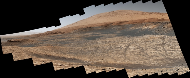
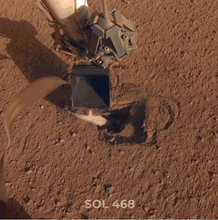
The most recent Curiosity drill hole
Click for full resolution image.

With Mars moving out from behind the Sun yesterday, the Curiosity science team has successfully reestablished communications with the rover.

The focus of Curiosity’s activities since returning to operations after conjunction, now that Mars has safely moved out from behind the sun, is to finish up the analyses associated with the drilling campaign at “Glen Etive 1.”

The image to the right, cropped and reduced to post here, was among the first images downloaded from the rover once communications were reestablished. It was taken by a camera at the end of the robot arm that the scientists had positioned above the hole in order to get a close-up.

Before continuing up the mountain they now plan a second drill hole close-by, to better constrain the data at this location obtained from this first hole.

More parachute problems for ExoMars 2020?

Space is hard: Eric Berger at Ars Technica reported yesterday that the parachute issues for Europe’s ExoMars 2020 mission are far more serious that publicly announced.

The project has had two parachute failures during test flights in May and then August. However,

The problems with the parachutes may be worse than has publicly been reported, however. Ars has learned of at least one other parachute failure during testing of the ExoMars lander. Moreover, the agency has yet to conduct even a single successful test of the parachute canopy that is supposed to deploy at supersonic speeds, higher in the Martian atmosphere.

Repeated efforts to get comments from the project about this issue have gone unanswered.

Their launch window opens in July 2020, only about ten months from now. This is very little time to redesign and test a parachute design. Furthermore, they will only begin the assembly of the spacecraft at the end of this year, which is very very late in the game.

When the August test failure was confirmed, I predicted that there is a 50-50 chance they will launch in 2020. The lack of response from the project above makes me now think that their chances have further dropped, to less than 25%.

Taking a look back at a Martian pit

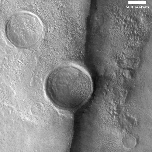
Pavonis Mons pit
Click for full image.

The pit to the right could almost be considered the first “cool image” on Behind the Black. It was first posted on June 20, 2011. Though I had already posted a number of very interesting images, this appears to be the first that I specifically labeled as “cool.”

The image, taken by the high resolution camera on Mars Reconnaissance Orbiter (MRO), had been requested by a seventh grade Mars student team at Evergreen Middle School in Cottonwood, California, and shows a pit on the southeastern flank of the volcano Pavonis Mons, the middle volcano in Mars’ well-known chain of three giant volcanoes. A close look at the shadowed area with the exposure cranked up suggests that this pit does not open up into a more extensive lava tube.

What inspired me to repost this image today was the release of a new image from Mars Odyssey of this pit and the surrounding terrain, taken on July 31, 2019 and shown below to the right.
» Read more

Terraced and banded hills on Mars

Banded or terraced hills in eastern Hellas
Click for full image.

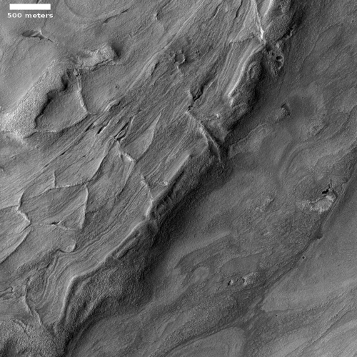
Cool image time! In my review of the most recent download of images from Mars Reconnaissance Orbiter’s (MRO) the high resolution camera, I found a very startling (and cool) image of some dramatic terraced Martian hills, taken on July 30, 2019. I wanted to post it here, but decided to first do some more digging, and found that an earlier image, taken in 2017, showed more of this particular hill. It is this earlier image posted to the right, cropped and reduced.

Don’t ask me to explain the geology that caused this hill to look as it does. I can provide some basic knowledge, but the details and better theories will have to come from the scientists who are studying this feature (who unfortunately did not respond to my request for further information).

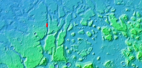
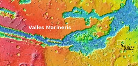
What I can do is lay out what is known about this location, as indicated by the red box in the overview map below and to the right, and let my readers come up with their own theories. The odds of anyone being right might not be great, but it will be fun for everyone to speculate.
» Read more

Mars’ mysterious slope streaks become even more mysterious

Bright slope streaks in Arabia Terra
Click for full image.

Mars is an alien planet. This fact needs to be restated over and over, because we humans have an uncontrolled and unconscious tendency to view the things we find on Mars and assume they are caused by and resemble phenomenon we see all the time here on Earth.

Not. Mars has a very different climate, a significantly weaker gravitational field (about one third of Earth’s), and a geological and environmental make-up very alien from Earth’s. While many phenomenon there might have parallels on Earth, it is very dangerous to assume they are the same, because more often than not, they are exceedingly dissimilar and mysterious.

The image on the right is another example of this, reduced and cropped to post here. It is of some slope streaks in the Arabia Terra region on Mars, the largest most extensive region in the transition zone between the northern lowland plains and the southern highlands. I found it in my review of the August 30th release of new images from the high resolution camera on Mars Reconnaissance Orbiter.

As I already noted in my previous article about the mysterious slope streaks of Mars:

The bottom line, as noted in one paper, “The processes that form slope streaks remain obscure. No proposed mechanism readily accounts for all of their observed characteristics and peculiarities.”

Mars is strange. Mars is alien. Mars epitomizes the universe in all its glory.

The image above only reinforces this conclusion.
» Read more

Cliff collapse on Mars

Cliff collapse on Mars
Click for full image.

Cool image time! The photograph to the left, rotated, cropped, and reduced to post here, was found in the August image release of the high resolution camera on Mars Reconnaissance Orbiter (MRO).

This was an uncaptioned image, with a title “Cataract and Grooves in Kasei Valles.” Kasei Valles is the giant canyon north of Marineris Valles. Though it is not as well known or maybe as dramatic, it is about as long and vast as its more famous southern canyon. It also has some very intriguing features, including what I consider to so far be the pit on Mars with the highest priority for exploration.

The image on the right shows the result when a giant section of this cliff face broke off and collapsed into the canyon. It also shows that the collapse occurred a long time ago. Not only are there newer craters on the collapse debris, the breakdown at the cliff base looks well eroded, as if many eons have passed since it piled up there.

When this section broke off however it was a very big event. The width of the collapse is about a mile across, with its depth about 600 feet. The height of the cliff is approximately 3000 feet, give or take a few hundred feet. Thus the chunk that broke off was about 600 feet wide, 5,000 feet long, and about 3,000 feet high. That’s one very big rock.

SpaceX begins hunt for Starship landing sites on Mars

Candidate landing sites for SpaceX's Starship

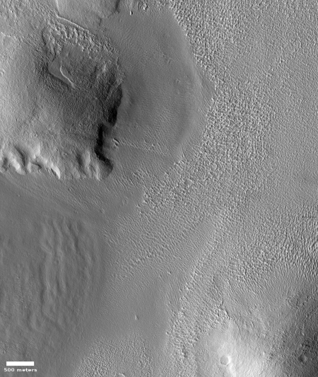
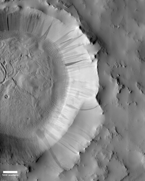
In the August image release from the high resolution camera of Mars Reconnaissance Orbiter (MRO) were five images whose title immediately caught my interest:

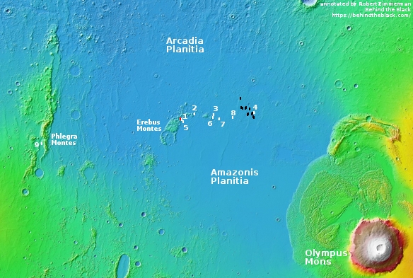
The overview map on the right shows the location on Mars for these five photographs. The second and third images are of the same location, taken to produce a stereo pair.

To put it mildly, it is most intriguing to discover that SpaceX is beginning to research a place where it can land Starship on Mars. I immediately emailed Nathan Williams, the JPL scientist who requested these images from SpaceX, but he was bound by a non-disclosure agreement with SpaceX and could not comment. I have since tried to get some information directly from SpaceX but so far the company has not responded. A 2017 news story had indicated the company’s interest in this Mars’ location, but gave no details either.

Based on what we now know of Mars, however, it is possible to figure out why they favor this location, on the border between the two large northern lowland plains Arcadia and Amazonis Planitia.
» Read more

Engineers attach test helicopter to Mars 2020

Engineers have now attached to the Mars 2020 rover the test helicopter that will attempt to make the first air-born flight on another world.

The Mars Helicopter is considered a high-risk, high-reward technology demonstration. If the small craft encounters difficulties, the science-gathering of the Mars 2020 mission won’t be impacted. If the helicopter does take flight as designed, future Mars missions could enlist second-generation helicopters to add an aerial dimension to their explorations.

“Our job is to prove that autonomous, controlled flight can be executed in the extremely thin Martian atmosphere,” said JPL’s MiMi Aung, the Mars Helicopter project manager. “Since our helicopter is designed as a flight test of experimental technology, it carries no science instruments. But if we prove powered flight on Mars can work, we look forward to the day when Mars helicopters can play an important role in future explorations of the Red Planet.”

If this works on Mars, MiMi Aung will be in a position to win contracts for similar helicopters for the rest of her life. It seems to me that this project has been her baby from the beginning.

Elementary students to name NASA’s 2020 Mars rover

NASA announced today a contest among the nation’s elementary students to find a name for its Mars 2020 rover.

Starting Tuesday, Aug. 27, K-12 students in U.S. public, private and home schools can enter the Mars 2020 Name the Rover essay contest. One grand prize winner will name the rover and be invited to see the spacecraft launch in July 2020 from Cape Canaveral Air Force Station in Florida.

To enter the contest, students must submit by Nov. 1 their proposed rover name and a short essay, no more than 150 words, explaining why their proposed name should be chosen. The essays will be divided into three groups, by grade level – K-4, 5-8, and 9-12 – and judged on the appropriateness, significance and originality of their proposed name, and the originality and quality of their essay, and/or finalist interview presentation.

Fifty-two semifinalists will be selected per group, each representing their respective state or U.S. territory. Three finalists then will be selected from each group to advance to the final round.

As part of the final selection process, the public will have an opportunity to vote online on the nine finalists in January 2020. NASA plans to announce the selected name on Feb. 18, 2020 – exactly one year before the rover will land on the surface of Mars.

Obviously, there is a bit of hokum in this contest. The kids will make suggestions, the public will vote, but in the end NASA will make the selection. Requiring them to write short essays justifying their suggestion however is an excellent educational idea, and for this kudos to NASA.

Assembly complete on Europe’s Franklin Mars rover

Engineers have completed the assembly of Europe’s Rosalind Franklin rover that is scheduled for launch to Mars in July 2020

Rosalind Franklin, which is the result of cutting edge work from UK, European and Canadian scientists and engineers will now be shipped from the Airbus factory in Stevenage, Hertfordshire to Toulouse in France for testing to ensure it survives its launch from Earth next summer and the freezing conditions of Mars when it lands on the planet in March 2021.

Whether they can meet this schedule remains unknown because of the problems that occurred during testing of the spacecraft’s landing parachutes.

Curiosity’s future travels

Curiosity's planned route up Mt Sharp
Click for full image.

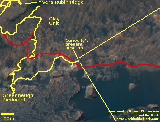
The Curiosity science team has released a new map showing an update of their planned route for Curiosity in the coming year or so, showing how they plan on leaving Gediz Vallis Channel after spending some time exploring the numerous geological layers exposed on its eroded surface.

The new information in this map is the route near the bottom of the image, showing more precisely the route up the canyon and then their retreat through the gap in the canyon’s western wall.

To get a better idea of what this means, I have updated my annotations on this Mars Reconnaissance Orbiter image of Gediz Vallis Channel, posted previously in my May 30, 2019 rover update.
» Read more

Melting rocks on Mars

Melt pools near Mohave Crater
Click for full image.

Cool image time! The image to the right, reduced, cropped, and annotated by me to post here, was part of the July image download from the high resolution camera on Mars Reconnaissance Orbiter (MRO) and was titled “Melt Pools around Mojave Crater”.

You can see that the flow began to the south, flowed northward (in the middle of the image), and then pooled in the two places as indicated. In the full photograph you can also see that the flow continued to the north, forming more pools.

The title to me suggests that this flow and the melt pools were lava, not ice. The low latitude, 7 degrees north, also suggests this is not ice. Though I was unable to reach the person who requested these images, it appears his research is aimed understanding the melt events that occur in the vicinity of craters upon impact. From his website:
» Read more

Scientists resolve one Mars methane mystery

Scientists have now figured out why the methane data from Curiosity on the Martian surface did not match the methane data from Trace Gas Orbiter in orbit around Mars.

Last year, scientists learned that methane concentrations changed over the course of the seasons with a repeatable annual cycle. “This most recent work suggests that the methane concentration changes over the course of each day,” Dr Moores said. “We were able – for the first time – to calculate a single number for the rate of seepage of methane at Gale crater on Mars that is equivalent to an average of 2.8 kg per Martian day.”

Dr Moores said the team was able to reconcile the data from the ExoMars Trace Gas Orbiter and the Curiosity Rover, which appeared to contradict each other with wildly different detections of methane. “We were able to resolve these differences by showing how concentrations of methane were much lower in the atmosphere during the day and significantly higher near the planet’s surface at night, as heat transfer lessens,” he said.

Solving that data conflict helps them get a better grip on the real question: Why is the methane fluctuating in this manner?

An eroding Martian glacier?

An eroded glacier on Mars?

Close-up of an eroded glacier on Mars?
Click for full image.

Cool image time! In my never-ending review of new images downloaded each month from the high resolution camera of Mars Reconnaissance Orbiter (MRO), I came upon an image dubbed merely “Terrain Sample” in the August release. To the right, cropped and rotated to post here, is the weird terrain from that image, with the section in the white box shown below at full resolution.

To keep MRO functioning properly, they need to take images on a regular basis, even if they have no planned features coming into view. As noted by Singleton Thibodeaux-Yost, the HiRISE Targeting Specialist at the University of Arizona who requested this image,

It was not taken in response to a suggestion from the public or our team database. This image was a ride-along with another instrument on MRO. [The scientists for that other instrument] targeted this region for a particular reason and we just turned on our camera as well to gather more data while they collected their data. I title these types of images “terrain sample” as we don’t always know what the results will be.

In other words, the scientists running the high resolution camera have no inkling what they will see until see it.

This image shows the inside rim of a crater, with the crater rim to the south just beyond the image’s bottom edge. This somewhat large crater is located in the middle of Arabia Terra, one of the largest regions of the transition zone between the southern highlands and the northern lowlands (where some scientists believe an intermittent ocean might have once existed). This transition zone has many features that suggest a tidal basin on the edge of that ocean.

A few months ago I would have been entirely baffled by what we see here. I might have speculated that these strange features were another variation of that shoreline region. Maybe these features are the erosion one sees on a dried lakebed after the water has drained away.

I might have also speculated that these shapes looked like the kind of frozen ice blocks one sees in the icecap of the Arctic here on Earth.

Both speculations then would have been complete guesses.

I now know, based on things I have recently learned in writing about several other images from MRO, that the second guess is likely right (though of course my opinion as a very amateur planetary geologist should not be taken very seriously). My reasons?
» Read more

ESA confirms ExoMars parachute test failure

You heard it hear first! The European Space Agency (ESA) today confirmed earlier stories from last week that the parachutes for its ExoMars 2020 spacecraft had failed during a high altitude drop test on August 5.

I reported this on Saturday, August 10, noting that ESA had not confirmed it. It apparently took them a week to write the press release.

This was the second consecutive test failure for these parachutes, as noted in the release.

On 28 May this year, the deployment sequence of all four parachutes was tested for the first time from a height of 29 km – released from a stratospheric helium balloon. While the deployment mechanisms activated correctly, and the overall sequence was completed, both main parachute canopies suffered damage.

Following hardware inspection, adaptations were implemented to the design of the parachutes and bags ready for the next high-altitude test, which was conducted on 5 August, this time just focusing on the larger, 35 m diameter, parachute.

Preliminary assessment shows that the initial steps were completed correctly, however damages to the canopy were observed prior to inflation, similar to the previous test. As a result, the test module descended under the drag of the pilot chute alone.

The tests occur at high altitude where the Earth’s atmosphere mimics the thin atmosphere of Mars. In both cases it appears the parachutes became damaged very early in their deployment process, possibly during deployment. This means there might be a design problem with the deployment process. It also means that both tests were unable to test the chutes themselves, as they were damaged before inflation, meaning that the engineers still do not know if they would work as intended once filled with air.

All this puts incredible time pressure on the mission, which needs to launch in the summer of 2020 to meet its launch window. There is very little time to redesign and retest these chutes. I would rate their chances of meeting that launch date as less than 50-50.

Monitoring Martian pits not near Arsia Mons

Second look at Hephaestus Fossae pit
Click for full image.

In reviewing the August image release from the high resolution camera on Mars Reconnaissance Orbiter (MRO), I came upon two different new pit images, the more interesting of which is highlighted on the right, cropped to post here..

Finding new pit images from MRO isn’t surprising, since the spacecraft has been photographing pits almost monthly since November (see: November 12, 2018, January 30, 2019, February 22, 2019, April 2, 2019, May 7, 2019, and July 1, 2019).

What makes these two new pit images more intriguing are their location, and the fact that both pits were previously photographed by MRO and posted on Behind the Black on June 5, 2018 and July 24, 2018. Both are located in Hephaestus Fossae, a region of fissures on the edge of the great Martian northern lowlands to the west of the great volcano Elysium Mons.

Almost all the pits from past MRO images have been found on the slopes of Arsia Mons, the southernmost of the three giant volcanoes southeast of Olympus Mons. In fact, last month I even asked the question, “Why so many pits there, and so few pits elsewhere?” The explanation from Chris Okubo of the U.S. Geological Survey, who is requesting these images, was that maybe it was due to geology, or maybe it was because we simply do not yet have enough information and might not have identified the many caves/pits elsewhere.

It appears that this same question had already been on the minds of Okubo and his partner, Glen Cushing, also of the USGS. As Okubo wrote me when I asked him about these new images:
» Read more

Watching the yearly vanishing of Mars’ north pole dry icecap

Buzzell dunes, March 19, 2019
Click for full image.

Buzzel dunes, April 4, 2019
Click for full image.

Buzzell dunes, June 4, 2019
Click for full image.

For the northern hemisphere of Mars it is presently spring. The season began sometime in April 2019 and will last until about October, twice as long as on Earth because of the Martian year is twice as long.

During the fall and winter the permanent water-icecap, which forms the bulk of the Martian icecap, gets covered by a mantle of dry ice, settling there as a layer of carbon dioxide snow about six feet thick. With the arrival of spring that dry icecap slowly begins sublimate away entirely.

Using the high resolution camera on Mars Reconnaissance Orbiter (MRO) planetary scientists are monitoring this process, taking pictures periodically.

On June 6, 2019 I had written a detailed story describing the Martian North Pole and outlining the process by which this sublimation of the dry icecap mantle takes place.

When winter ends and the sun reappears at this Arctic location, a small percentage of that sunlight, about 10%, goes through the dry ice and warms the sand that the dry ice mantles. This in turn warms the bottom of the dry ice layer, causing this to sublimate into a gas that is now trapped.

When the pressure builds sufficiently, that gas breaks free at the weakest spots in the dry ice layer, which are either at the dune crest or at its base, or sometimes on its face where cracks form. When it does so the CO2 gas carries with it material from below, which appears dark relative to the bright dry ice on the surface. As the summer season progresses and more dry ice sublimates away, the dark smudges disappear as they slowly blend in with the now-exposed original sand surface.

The first two pictures to the right were posted in that June 6, 2019 story, showing the initial evidence of sublimation on a set of dunes that the scientists have dubbed Buzzell. Below these, I have now added the newest image of the Buzzell dunes, taken on June 4, 2019 and just released in the August MRO image dump.

When this third image was taken, spring was only about two months old. Yet, this sublimation process is clearly accelerating. You can see many more dark patches at the crests and bases of many dunes, especially in the upper left of the image. According to Dr. Candice Hansen of the Planetary Science Institute in Tucson, Arizona, who is requesting these monitoring images, by sometime in October “you’ll see how the entire spring progresses from dunes completely covered with dry ice to the summer when they are just bare sand. Then you could comment on the whole spring series.”

I fully intend to do this. No harm however in providing an interim report or two. Stay tuned to Behind the Black for future on-going and up-to-date reports on the shrinking north pole dry icecap of Mars!

Crater on the Basement of Mars

Crater in the bottom of Hellas Basin
Click for full image.

Cool image time! In the July release of images from the high resolution camera of Mars Reconnaissance Orbiter (MRO) was the image to the right, cropped to post here, showing what I suspect is a relatively young crater located in the lowest part of Hellas Basin, what I call the bottom of Mars.

Though this crater is not located at the lowest point in Hellas, it is not far off from there. What makes it important to geologists are two facts. First, there are not a lot of craters in Hellas, which helps indicate it is a relatively young feature. Second, and more important, the impact has made accessible material from below the surface, indicated by the different colors in this image. From this information they can better constrain their theories about the Basin’s formation and where it fits in Mars’s overall geological history.

Make sure you take a look at the full photograph by clicking of the image, and compare it with the earlier Hellas Basin images I posted here. The surface of Hellas appears to have a lot of flow features, as if it was laid down by volcanic activity, or by the motion of water that covered it. In either case that would explain the overall lack of craters.

A bullseye on Mars

Layered crater at equator
Click for full image.

Cool image time! In researching my piece last week on the glaciers of Mars I had wanted to include a picture of a typical concentric glacier-filled crater, the most widespread glacial feature on the Martian surface, found in a band at latitudes between 30 and 60 degrees. (You can see the example I found at the link above, near the end of the article.)

To find that picture I searched the Mars Reconnaissance Orbiter (MRO) archive. Among the images I found was a captioned image taken very early in MRO’s mission showing a crater with concentric rings very similar to the concentric glacial-filled craters. The image at the right is that crater, the image reduced and cropped to post here. As described in that caption,
» Read more

The glaciers of Mars

The glaciers on Mars

For the future colonists of Mars, the question of finding water will not be that much of a problem. Not only have planetary geologists mapped out the existence of extensive water-ice in the Martian poles, they have found that the planet apparently has widespread glacier deposits in two mid-latitude belts from 30 to 60 degrees latitude.

The question will be whether those Martian settlers will be able to easily access this water. The data so far suggests that much of the Martian underground water at high latitudes is likely mixed with dust and debris. Extracting it might not be straightforward. There are hints that the ice table at latitudes about 55 degrees might be more pure, but could be somewhat deep below ground, requiring the settlers to become miners to obtain their water. Moreover, all these high latitude locations are in environments that are more hostile, and therefore more difficult to establish a colony.

What about the glaciers? The global map of Mars above, reduced and annotated to post here, shows what are believed to be extensive glacial deposits at lower latitudes, and comes from a recently published paper on the subject. The different colors indicate the different types of glacial deposits the scientists have identified.

Green and yellow indicate what scientists call lineated valley fill (LVF) and lobate debris aprons (LDA) respectively, glacial deposits found in the transition zone between the southern highlands and either the northern lowland plains or the basins of the southern hemisphere, Hellas and Argyre. These glaciers are in many ways most similar to glaciers found on Earth, flows heading downhill along natural geographic features.

Magenta represents concentric crater fill (CCF), glacier features which seem very evenly distributed across both the northern and southern lower mid-latitude belts. Here scientists appear to have detected buried ice within the floors of craters.

The paper which included this map focused on describing a new glacial feature, something they dubbed valley fill deposits (VFD), that they had found so far in only one place, as indicated by the black square on the map.

The photograph below and on the right, reduced and cropped to post here, is from figure two of the linked paper.
» Read more

Tsunamis on Mars?

New research has found further evidence of past tsunamis on Mars along the transition zone between the northern lowlands (where an intermittent ocean might have once existed) and the southern highlands, caused when a bolide crashed into that ocean.

The new research simulated the height of the tsunami waves and their propagation direction, run-up elevation and distance for three potential sea levels and compared these models with the Martian deposits.

The study’s results suggest several potential impact craters, 30 to 50 kilometers (19 to 31 miles) in diameter, as the source of the tsunami events. The largest tsunami waves may have been 300 meters (984 feet) high – nearly as tall as the Eiffel Tower – following the impact, and waves up to 75 meters (246 feet) high – nearly as tall as the Statue of Liberty. The waves ultimately reached the Martian coast, potentially traveling up to 150 kilometers (93 miles) past the shoreline.

Below the fold is a video showing the simulation of one such impact and tsunami.
» Read more

Mars Reconnaissance Orbiter image of Curiosity

Curiosity as seen from orbit

The Mars Reconnaissance Orbiter (MRO) science team today released an image taken on May 31, 2019 by the orbiter’s HiRISE high resolution camera of Curiosity when it was nestled against the cliff at the bottom of Vera Rubin Ridge.

The image above is that enhanced color image, reduced and annotated to post here. I have added the track of Curiosity’s route down from Vera Rubin Ridge leading up to the point where this picture was snapped.

In the image, Curiosity appears as a bluish speck. Vera Rubin Ridge cuts across the scene north of the rover, while a dark patch of sand lies to the northeast.

Look carefully at the inset image, and you can make out what it is likely Curiosity’s “head,” technically known as the remote sensing mast. A bright spot appears in the upper-left corner of the rover. At the time this image was acquired, the rover was facing 65 degrees counterclockwise from north, which would put the mast in about the right location to produce this bright spot.

Mirror-like reflections off smooth surfaces show up as especially bright spots in HiRISE images. For the camera to see these reflections on the rover, the Sun and MRO need to be in just the right locations. This enhanced-color image of Curiosity shows three or four distinct bright spots that are likely such reflections.

From this location Curiosity first continued along the cliff’s base to study that dark patch of sand to the northeast, then it turned almost due south in order to get back to its nominal route into Gediz Valles canyon, as shown in my May 30, 2019 rover update.

Wheel update on Curiosity

Periodically, the Curiosity science team stops from its research to reassess the condition of the rover’s wheels. To do this they use the rover’s color camera, dubbed the Mast Camera (Mastcam), taking close-up pictures of the wheels to compare those with earlier photographs see if there has been any additional damage and deterioration over time.

Yesterday Mastcam took a new series of images of the rover’s wheels. Below are two pictures, the left taken on August 27, 2017, the right taken on July 7, 2019. I have annotated the images to help indicate where they match.
» Read more

ExoMars 2020 parachutes damaged during test

Bad news: The parachutes for the European/Russian ExoMars 2020 mission were damaged during a parachute test.

A May 28 test of the parachute system used a high-altitude balloon above the Swedish Space Corporation’s Esrange test site in northern Sweden. The test was intended to demonstrate the end-to-end performance of the entire system, including both the pilot and main chutes as well as the mortars used to extract the pilot chutes.

ESA said that the first main parachute suffered several radial tears in its fabric, all occurring before reaching its maximum load. The second main parachute also suffered a single tear, also before peak loading.

The other parts of the parachute system worked as expected, and ESA said “a good level of the expected aerodynamic drag was nevertheless achieved” despite the damage sustained by the parachutes. However, the agency acknowledged that the problem needs to be understood and corrected prior to the mission’s launch in one year.

They can easily get the parachutes repaired before the July 2020 launch. The problem is figuring out what caused the damage and fixing that in the time left. They already had planned two more parachute tests, but these cannot happen prior to all the fixes, and then they have to work.

Considering that they will only assemble the spacecraft at the end of this year, I am increasingly thinking that ExoMars 2020 will not launch in 2020. And if it does, I will not be surprised if it turns out to be a failure.

The Martian seabed?

Cones and strange blobs
Click for full image.

Cool image time! Above is an image taken by the high resolution camera of Mars Reconnaissance Orbiter (MRO) in November 2018 of an area in the vast relatively featureless northern lowlands of Mars. I have rotated, cropped, and reduced it to post here.

I have also indicated two sections, indicated by the white boxes, that I have cropped out of the full resolution image to highlight some interesting features. Both images can be seen in full resolution below.

While the northern lowlands seem featureless from a distance, with few craters, a closer look always reveals many things that are both baffling and fascinating. In this case the region is called Galaxias Colles, a region of mesas and knobby hills. This particular image was dubbed “Cones in Galaxias Colles,” and was clearly taken to get a better look at these strange blobby features.
» Read more

Where are the caves on Mars?

Overview map of pits near Arsia Mons

Each month I go through the monthly download of new images from the high resolution camera on Mars Reconnaissance Orbiter (MRO). And each month since November I have found a bunch of newly discovered pits photographed in the region around the volcano Arsia Mons (see: November 12, 2018, January 30, 2019, February 22, 2019, April 2, 2019, and May 7, 2019). The map on the right has been updated to include all those previous pits, indicated by the black boxes, with the new pits from June shown by the numbered white boxes.

To the right are the first three pits in the June archive, with the link to each image site found here (#1), here (#2), and here (#3).

Pits 1 through 3
For full images: Number 1, Number 2, Number 3.

All three are what the scientists doing this research call Atypical Pit Craters:

These Atypical Pit Craters (APCs) generally have sharp and distinct rims, vertical or overhanging walls that extend down to their floors, surface diameters of ~50–350 m, and high depth to diameter (d/D) ratios that are usually greater than 0.3 (which is an upper range value for impacts and bowl-shaped pit craters) and can exceed values of 1.8. Observations by the Mars Odyssey Thermal Emission Imaging System (THEMIS) show that APC floor temperatures are warmer at night and fluctuate with much lower diurnal amplitudes than nearby surfaces or adjacent bowl-shaped pit craters.

The fourth pit, shown in the reduced and cropped image below, might actually be the most interesting of the June lot.
» Read more

Insight engineers get first look at hole

InSight Mole hole
Click for full image.

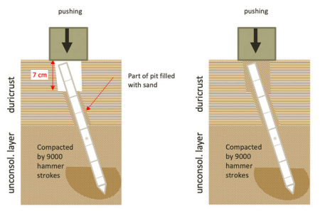
The Insight engineering team has successfully lifted the mole structure allowing them to see the hole the mole was pounding into the Martian ground in their effort to diagnose why the mole has been unable to drill more than a foot or so down.

The image to the right shows the mole, the white tubelike structure, inside the hole. As noted by Instrument Lead Tilman Spohn,

I along with others from the team were a bit shocked when we saw how large the pit actually is. Its diameter is about two times the diameter of the mole. The bottom of the pit is difficult to see (we expect better images once the lift is complete) but it seems that it is about 2-2.5 mole diameters deep. A mole diameter is 27mm. So the mole must have compacted the regolith quite a bit. In addition to its own volume it must have displaced about half of its buried volume.

There seems to be a little rim surrounding the pit but most of the displacement likely was compaction. We cannot see the inclination of the wall very well but it at least seems to me that the mole was “precessing” (like a spinning top) and carved a conical hole. This is consistent with the recordings of our tiltmeter STATIL during the hammering in March. We will have to wait for better images to confirm or disprove that. In any case, the apparent compaction seems to be compatible with a large porosity, relatively low density.

What they do next is unknown. From what I understand, they do not have the option of lifting the mole out and trying a different location. Moreover, the images and data suggest it wouldn’t matter anyway. The mole is apparently not designed to drill a shaft in this kind of ground.

Chaos on Mars

Aurorae Chaos in Margaritifer Terra
Click for full image.

The Mars Express science team today released a digital perspective view of the chaos terrain located in the outlet region for the vast drainages, which include Marineris Valles, coming down from the Tharsis Bulge volcanic region that holds Mars’ largest volcanos.

The view, reduced to post here on the right, was created from a image taken by Mars Express on October 31, 2018. This chaos terrain is south of the various examples of chaos terrain previously highlighted here on Behind the Black (May 14, 2018, June 26, 2018, March 11, 2019, March 14, 2019). As they note,

The division between the chaotic terrain and plains can also be seen clearly in these images. The left (south) side of the image is notably smoother and more featureless than the jumbled right (north) side, and the two regions are split by a prominent line carving diagonally across the frame. The transition area around this scarp is especially broken and fractured; this is thought to be caused as the martian crust stretched and moved.


The ancient chaotic terrain we see on Mars holds information about how water once permeated and interacted with the planetary surface, including how it was transported, stored, and released.

Chaotic terrain is thought to have formed as chunks of the martian surface collapsed in dramatic events triggered by the heating of material containing ice or water-bearing minerals – possibly due to climatic or volcanic heat sources, or an impact from an asteroid or comet. This released large amounts of water, causing the terrain above to subside. The water then drained away quickly, leaving behind the messy, broken patterns seen in regions such as Aurorae Chaos, which is thought to have formed some 3.5 billion years ago.

Mars Express images don’t quite have the resolution of the high resolution images from Mars Reconnaissance Orbiter, but they cover a wider area, so that the spacecraft has now photographed almost the entire Martian surface since its arrival in Mars orbit in December 2003.

The expanding range for Martian ice scarps

Another ice scarp
Click for full image.
/p>

The discovery in January 2018 of a number of Martian cliff faces, or scarps as the scientists dubbed them, with a visible and apparently very accessible underground layer of ice, had significant ramifications.

First, it proved that, in at least one area south of Hellas Basin and one spot in the northern hemisphere, an underground ice table existed on Mars at latitudes as far south as 55 degrees. Scientists had theorized that this ice table, comparable to the water table on Earth, existed, but here was visible proof.

Second, the discovery showed places where water could be accessed relatively easily by future colonists. There are plenty of indications from orbiter images and lander/rover data that water is present in many places on Mars, but here the water appeared almost pure and could be obtained without major digging or processing. Whether that ice table extends even farther south, making it even more accessible, remains as yet a scientific question.

In the next few months the scientists involved in this research located more ice scarps in areas beyond the range of those initial discoveries. Since then however even more scarps have been found, including the scarp in the image above and to the right, cropped, reduced, and annotated to post here.

This particular scarp is located inside a crater. The uncaptioned release from the high resolution camera on Mars Reconnaissance Orbiter (MRO), described it as a “Scarp in mantling material.” According to Colin Dundas of the U.S. Geological Survey’s Astrogeology Science Center in Arizona,
» Read more

Another odd crater on Mars

Odd shaped crater
Click for full image.

Cool image time! In a sense, to announce that scientists have found an oddly shaped crater on Mars is to state the obvious. In the years since the first Martian fly-by by Mariner 4 in 1965, scientists have been discovering numerous odd-shaped craters on Mars, every single of which has challenged our assumptions about the planet’s geology. I myself have posted a half dozen such posts since January (January 7, January 10, January 14, March 26, March 27, June 12).

Yet, it is always worth looking when another one crops up, because of the fact that they challenge our assumptions about Martian geology. They are also always cool to look at! On the right, cropped and reduced to post here, is an image taken by the high resolution camera on Mars Reconnaissance Orbiter (MRO) on April 19, 2019 of what the scientists have dubbed an “Odd Shaped Crater in Arabia Terra.”

Overview map

Arabia Terra is one of the largest regions of the transition zone between the northern lowlands and the southern highlands. This crater is located, as shown by the red cross in the overview map to the right, near its northern edge, in an area where the descent into the northern lowlands is somewhat abrupt and broken up by large craters and chaos terrain.

The crater itself holds numerous geological mysteries. Its shape suggests two impacts of different sizes overlapping each other, but without any remnant of the inner rim of the second impact. Where did that remnant go? Or maybe this wasn’t caused by two impacts, but by one impact that reshaped the surface in this odd and inexplicable way.

Then there is the three teardrop-shaped patterns in the crater’s floor. They look like the brushstrokes of a giant-sized painter. Were they caused by the wind? And if so, why in this pattern?

Planetary geologists could probably come up with a dozen more questions. The number tells us how little we know about Mars.

1 46 47 48 49 50 78