
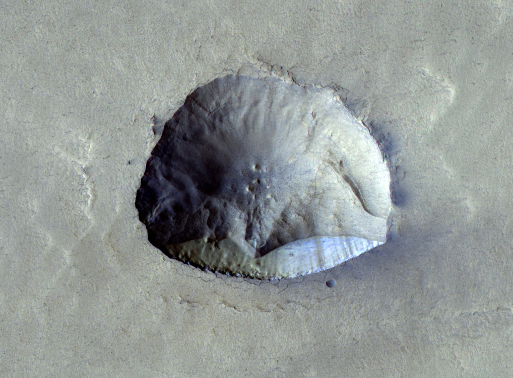
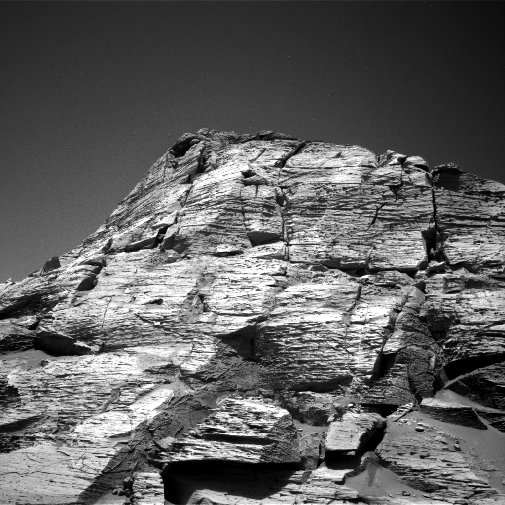
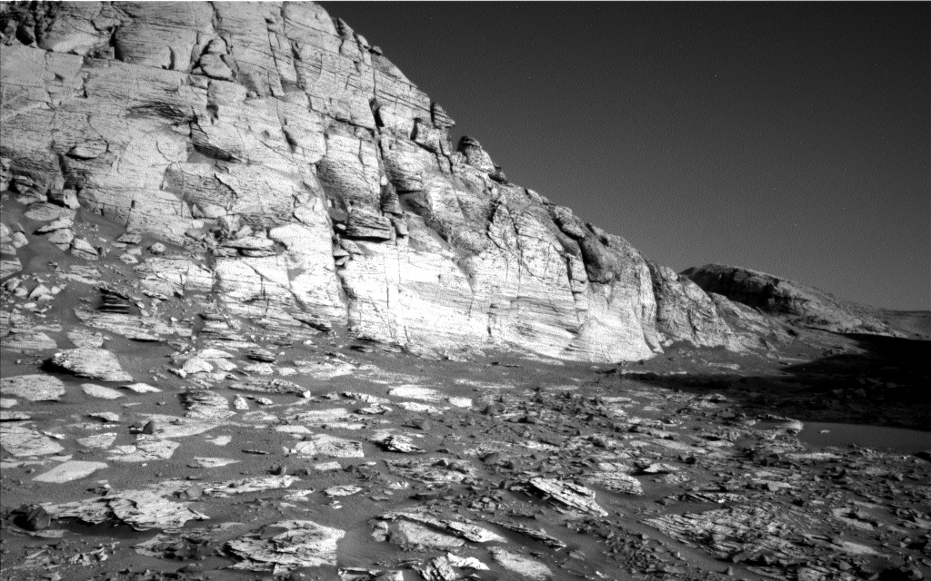
The badlands on the floor of Valles Marineris
Click for full image.
Cool image time! The recent discovery that there might be a near surface reservoir of ice on the floor the canyon Valles Marineris, near the Martian equator, immediately brought this location to the forefront as a possible site for establishing colonies. The weather will be less harsh than higher latitudes, the low elevation means a thicker atmosphere, and the terrain will be more appealing than the boring flat northern lowlands.
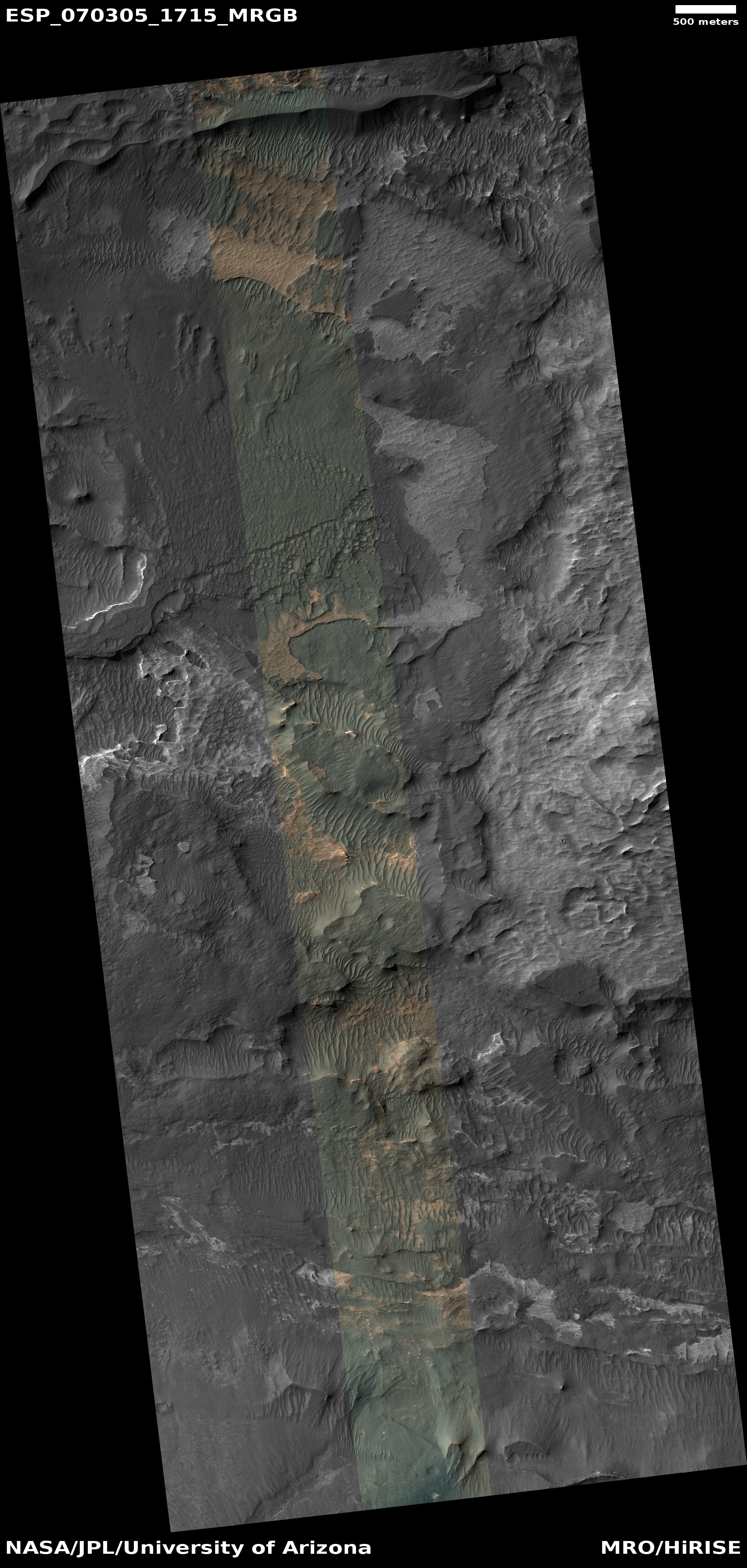
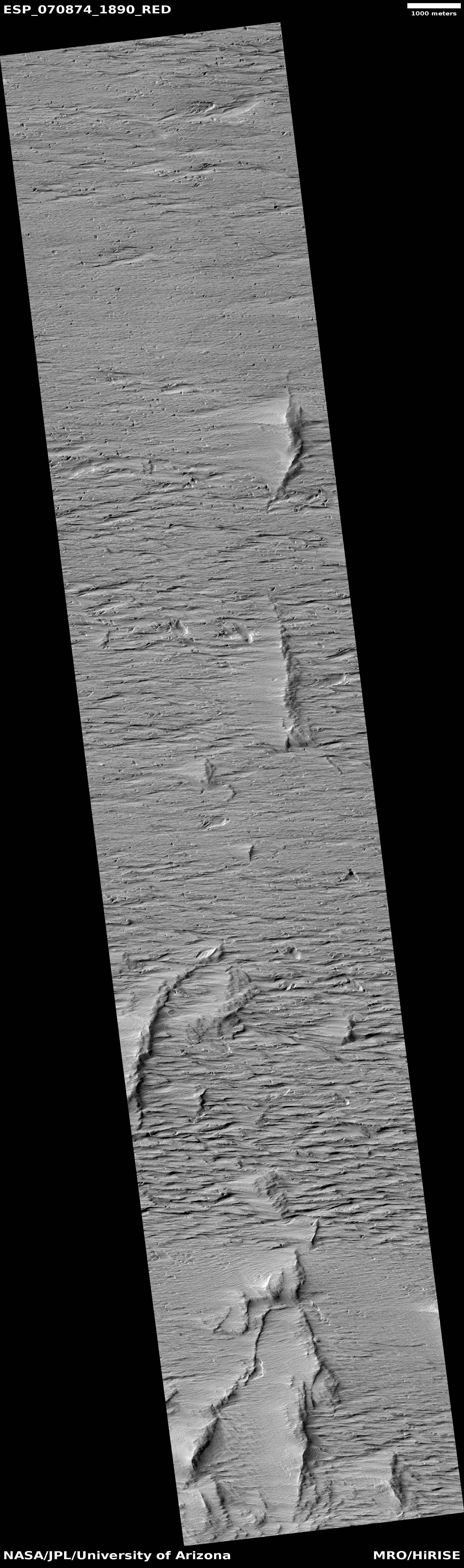
The picture to the right, cropped and reduced to post here, illustrates however the likely difficulties of landing and living on the floor of Valles Marineris. Taken on July 26, 2021 by the high resolution camera on Mars Reconnaissance Orbiter (MRO), the photo shows just one small area of the floor of Ius Chasm, the western part of Valles Marineris and about 300 miles to the east of that water reserve.
In this one picture we can see trapped sand dunes in hollows, eroded depressions, mottled terrain resembling stucco, and innumerable cliffs and sinks and plateaus. For the first manned spacecraft to land on Mars, this is not a good first choice. Even later, when the first bases have been built, this terrain would still be forbidding for the early colonists to land in and traverse.
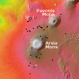
The overview map below shows exactly where this picture is relative to the rest of the Valles Marineris.
» Read more


