
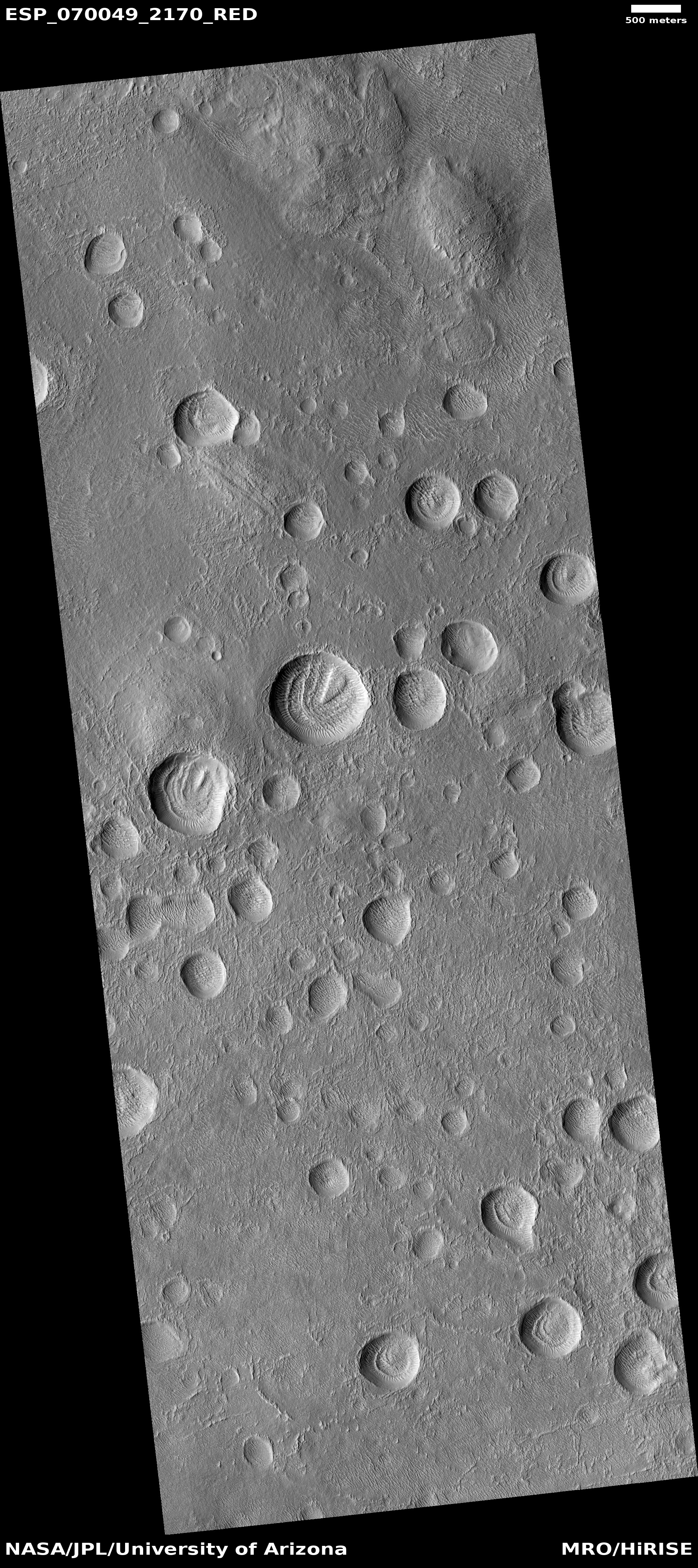
Strange eroded glacial flows in unnamed crater on Mars

Click for full resolution image.
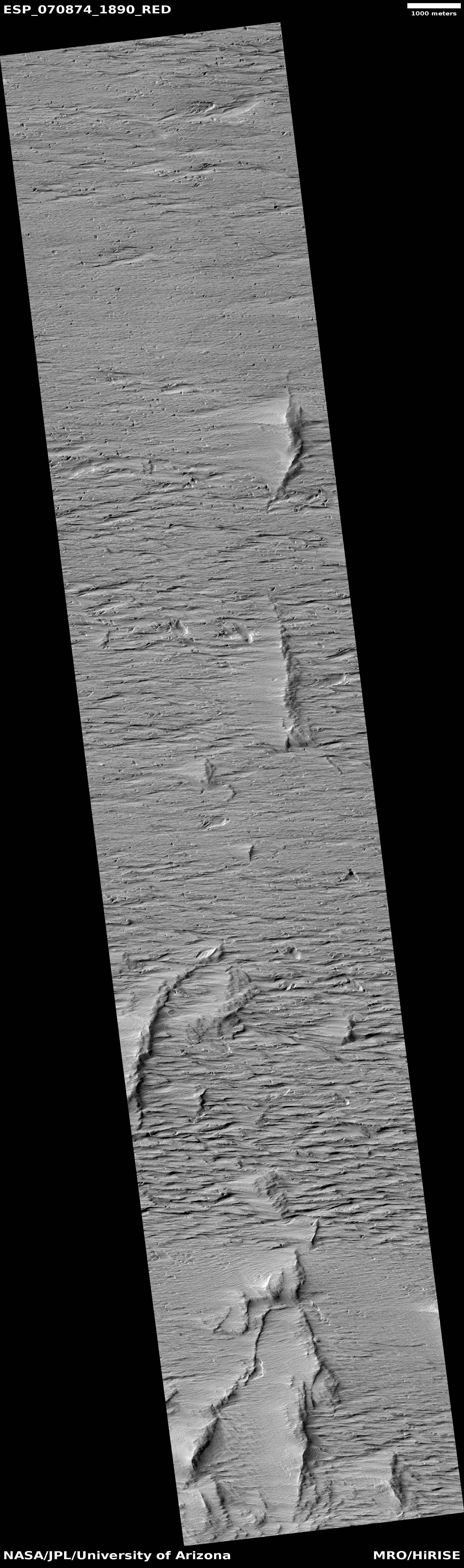
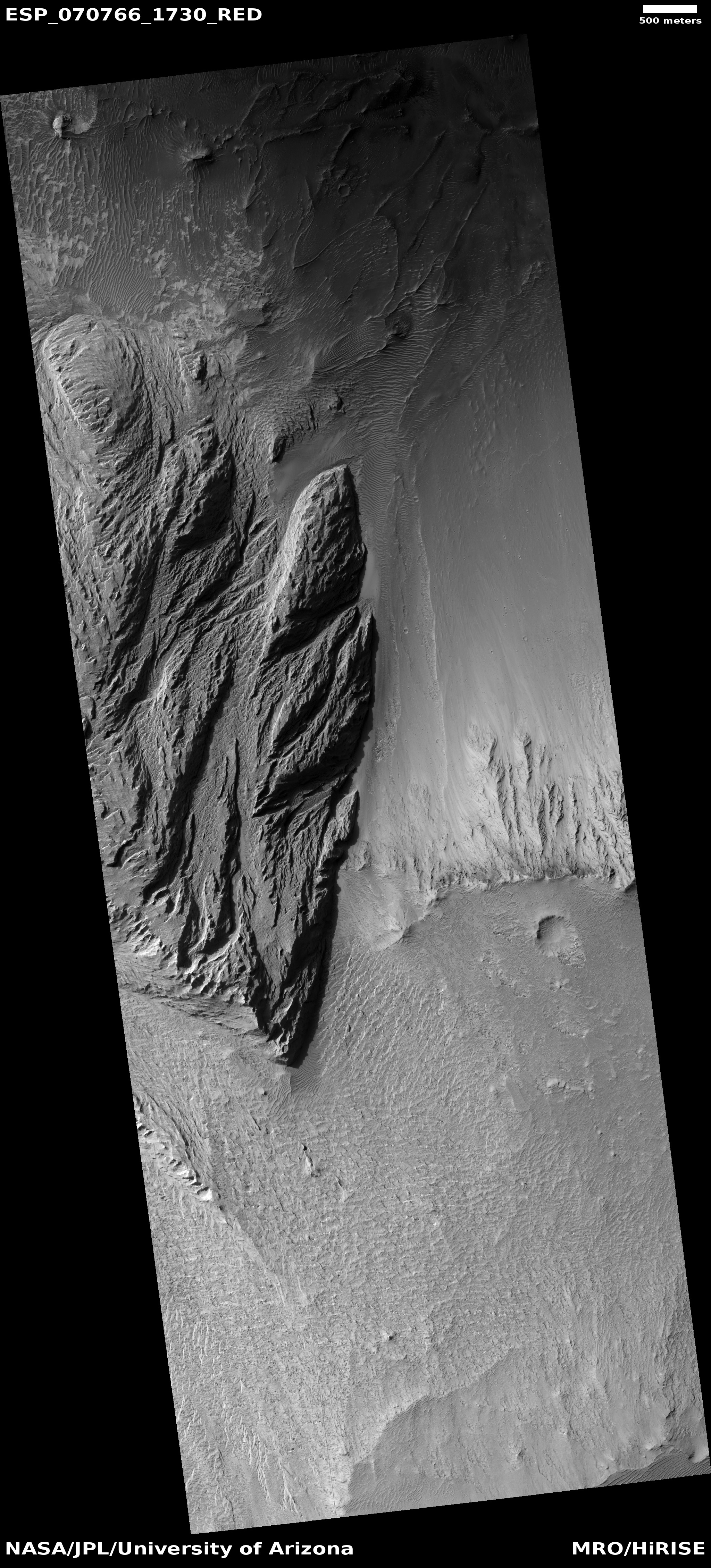
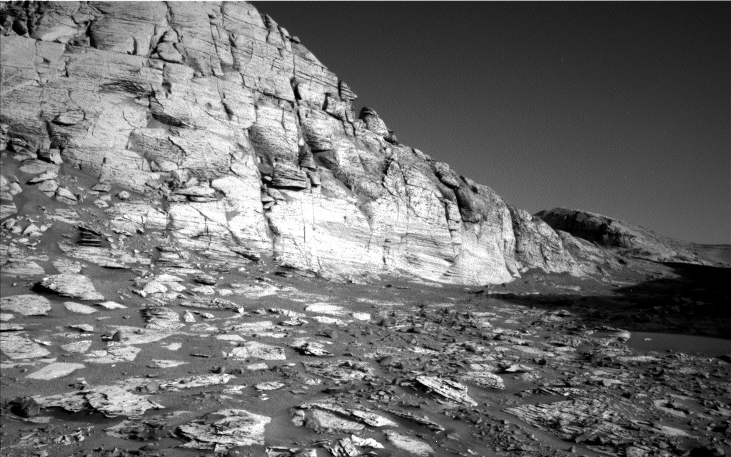
Cool image time! The photo to the right, rotated, cropped, and reduced to post here, was taken on November 1, 2021 by the high resolution camera on Mars Reconnaissance Orbiter (MRO). It shows a series of strange glacial-like flows coming off the western slopes of the central peak of a 40-mile-wide unnamed crater, located smack dab in what I call Mars’ glacier country, that 2,000 long mid-latitude strip where almost every image shows evidence of glaciers.
The cropped section to the right doesn’t really do these strange flows justice. Make sure you click on the image to see the full resolution version. There are numerous separate flows coming off that central peak. Each appears to show that as time passed, each flow traveled a shorter distance down the mountain, leaving a moraine behind at higher and higher points.
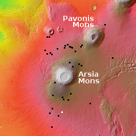
The overview map below provides the context.
» Read more


