First interplanetary image from a cubesat

One of the two MarCO cubesats launched with the InSight Mars lander has successfully taken its first picture of Mars, the first such image ever taken by an interplanetary cubesat.

The image itself is not that interesting, with Mars not much more than a dot. What makes this significant is that it proves that a small, inexpensive cubesat can be built with the capability to accurately point and take photographs during an interplanetary mission. This means that the entire field of interplanetary probes is prime for major changes, shifting from big expensive and rarely launched spacecraft to small inexpensive cubesats launching frequently and it large numbers.

Land of swiss cheese and spiders

Swiss cheese on Martian south polar cap

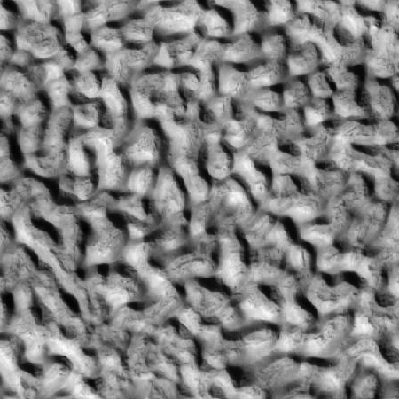
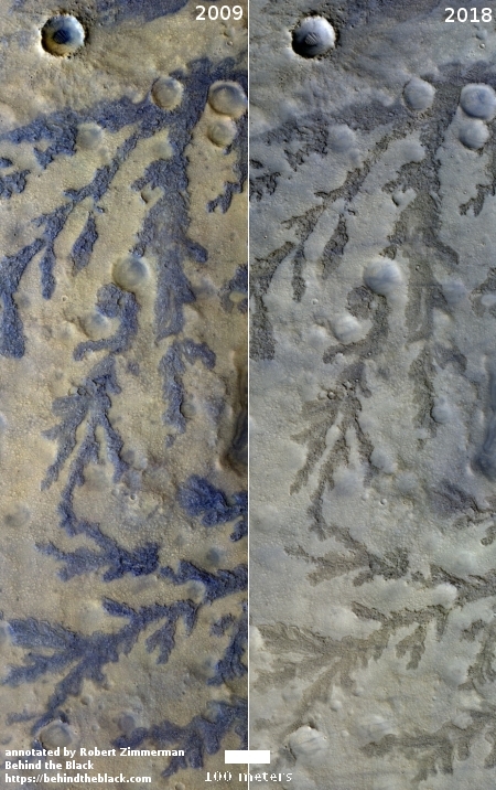
Time for some cool images! In one of their periodic captioned releases of an interesting high resolution image, the Mars Reconnaissance Orbiter (MRO) science team this week released a picture of the strange “swiss cheese” terrain found throughout the Martian southern polar cap. (I have already highlighted in an early post the spiders that form in the south pole as the carbon dioxide evaporates.) The image to the right is a cropped section of that image, which you can see in its entirety if you click on it.

The South Polar residual cap is composed of carbon dioxide ice that persists through each Martian summer. However, it is constantly changing shape.

The slopes get more direct illumination at this polar location, so they warm up and sublimate, going directly from a solid state to a gaseous state. The gas then re-condenses as frost over flat areas, building new layers as the older layers are destroyed.

The captioned link above also included a link to a gif animation showing how this terrain has changed since 2009. The holes have become bigger, their cliffs retreating with time.

The section I highlight above not only shows the retreating swiss cheese dry ice, you can also see ghosts of several buried craters slowly becoming visible as the dry ice evaporates away.

This is only one of many images taken of the south pole by MRO. In the October archive release, I found almost two dozen, and that’s only the images taken during August of this summer. MRO takes images of the south pole regularly to track its changes, though I suspect it took more this summer because the global dust storm blocked imagery in the middle latitudes. Below and to the right is just one of these images, a particularly good illustration of the swiss cheese formation.
» Read more

Curiosity sends down images for the first time in weeks

Good news! For the first time since September 15 Curiosity has sent back images.

The last raw images were received on Sol 2171, equivalent to September 15. Today’s images (Sol 2199) from the front and rear hazard cameras and the two navigation cameras suggest that the engineers have solved the computer issues that prevented the rover from sending its science data to Earth.

No press release has yet been released, but I suspect we shall see something shortly.

A vent on Mars?

A vent on Mars?

Cool image time! In their exploration of the surface of Mars using Mars Reconnaissance Orbiter (MRO), scientists often image geological features that strongly resemble Earth features. Sometimes, if real, the resemblances are significant, as they indicate important geological activity on Mars that can tell us a lot about the conditions and environment there.

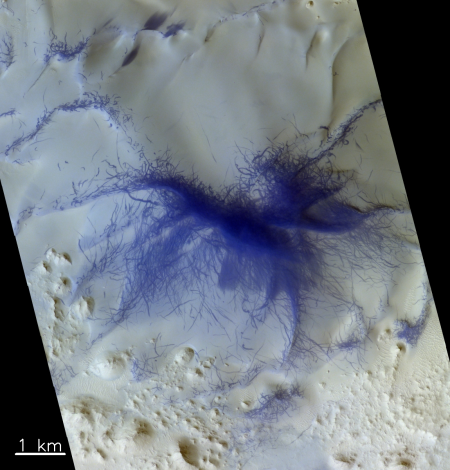
The image on the right, cropped and reduced in resolution to post here, is a good example of this. It was taken by MRO on June 14, 2018, just before the global dust storm obscured the planet’s middle latitudes for most of the summer, and was part of the monthly release of new images from the spacecraft. (If you click on the image you can see the full resolution picture.) The release website, which includes no caption, describes this feature as an “apparent vent,” a determination that certainly seems reasonable. The shadowed dark features suggest an abrupt oblong pit near the edge of a cliff, formed in the center of a collapsed sink. The tear-drop shape of the collapse sink and surrounding darkened areas also suggests that something is venting from it and then blowing away to the east and south, forming the darker stained ground. Some of the dark features to the southeast might also be smaller vents, releasing their own materials into the atmosphere.

The location also reinforces this suggestion, located on the southeast lava slopes of one of Mars’ larger volcanoes, Elysium Mons. This is also a region, dubbed Athabasca Valles, that some planetary scientists believe is one of the youngest lava flows on Mars.

Finally, it appears that the pit here has darkened considerably recently. MRO has taken images of this pit twice previously, in 2008 and 2010, and in both images the pit is much lighter in color, with its sandy dune-covered floor much easier to see. In the new image the floor is now very dark. This might be caused by shadows and the angle of the Sun, but I don’t believe so. It is also clear when comparing all three images that the surrounding area, including the flow to the southeast, has also darkened with time.

All this data suggests that the pit is venting something into the air, and it is settling on the ground to the southeast, blown there by the prevailing winds. Nor is this pit the only such feature in this region. Other images by MRO show a lot of similar dark splotches.

The problem is that this feature is not on Earth but on Mars. Determining what is being vented, and why, is therefore made more difficult. Based on Earth data you would assume this is some form of volcanic vent, releasing gases from below the surface. On Mars that assumption might not hold. We might instead be seeing the venting of any number of possible materials, such as underground water-ice, carrying with it other underground materials and thus darkening the surface.

We also can’t assume that the venting is occurring because of volcanic processes. On Mars the evidence so far gathered suggests that active volcanic activity ceased a very long time ago, even for this very young lava region. The venting is likely caused by something else, a fact that in itself is probably the most significant take-away from these images.

Something appears to be causing an active vent on the surface of Mars. Finding out the root cause of that venting is probably one of the more interesting questions facing researchers who study the Martian surface.

Curiosity to switch computers in effort to restore operations

The Curiosity engineering team have decided to switch on-board computers in effort to figure out why the rover has been unable to store and send any data since September 15.

After reviewing several options, JPL engineers recommended that the rover switch from Side B to Side A, the computer the rover used initially after landing.

The rover continues to send limited engineering data stored in short-term memory when it connects to a relay orbiter. It is otherwise healthy and receiving commands. But whatever is preventing Curiosity from storing science data in long-term memory is also preventing the storage of the rover’s event records, a journal of all its actions that engineers need in order to make a diagnosis. The computer swap will allow data and event records to be stored on the Side-A computer.

Side A experienced hardware and software issues over five years ago on sol 200 of the mission, leaving the rover uncommandable and running down its battery. At that time, the team successfully switched to Side B. Engineers have since diagnosed and quarantined the part of Side A’s memory that was affected so that computer is again available to support the mission. [emphasis mine]

As indicated by the highlighted paragraph, the switch does carry some risk. Though they say they have isolated the problems with the A computer, they might be surprised when they turn it on.

Meanwhile, silence continues from Opportunity. After fourteen years of almost continuous rover operations on Mars, the United States have been roverless now for more than two weeks.

Mars Reconnaissance Orbiter spots Opportunity through dust

Mars Reconnaissance Orbiter has taken a picture through the fading Martian dust storm that spots Opportunity about halfway down Perseverance Valley in the rim of Endeavour Crater.

Engineers have been increasing the number of times per day they are attempting to communicate with the rover, so far all to no avail. The picture thus only really tells us that the storm is lifting and that MRO’s high resolution camera is operating normally after three months of limited picture taking because of the dust storm.

Curiosity has problem sending back its stored data

The science team running Curiosity found this week that the rover is suddenly unable to send back its stored data.

Over the past few days, engineers here at JPL have been working to address an issue on Curiosity that is preventing it from sending much of the science and engineering data stored in its memory. The rover remains in its normal mode and is otherwise healthy and responsive.

The issue first appeared Saturday night while Curiosity was running through the weekend plan. Besides transmitting data recorded in its memory, the rover can transmit “real-time” data when it links to a relay orbiter or Deep Space Network antenna. These real-time data are transmitting normally, and include various details about the rover’s status. Engineers are expanding the details the rover transmits in these real-time data to better diagnose the issue. Because the amount of data coming down is limited, it might take some time for the engineering team to diagnose the problem.

On Monday and Tuesday, engineers discussed which real-time details would be the most useful to have. They also commanded the rover to turn off science instruments that were still on, since their data are not being stored. They’re also preparing to use the rover’s backup computer in case they need to use it to diagnose the primary computer. That backup computer was the rover’s primary one until Sol 200, when it experienced both a hardware failure and software issue that have since been addressed.

In other words, the rover is functioning, they can communicate with it in real time, but any data stored on board for some reason is not being transmitted.

New data says going to Mars involves significant radiation exposure

New data from Trace Gas Orbiter, part of Europe’s ExoMars project, says a journey to Mars will expose humans to significant radiation.

The results imply that on a six-month journey to the Red Planet, and assuming six-months back again, an astronaut could be exposed to at least 60% of the total radiation dose limit recommended for their entire career.

The ExoMars data, which is in good agreement with data from Mars Science Laboratory’s cruise to Mars in 2011–2012 and with other particle detectors currently in space – taking into account the different solar conditions – will be used to verify radiation environment models and assessments of the radiation risk to the crewmembers of future exploration missions.

This data was gathered during the spacecraft’s journey to Mars during a time of falling solar activity. Thus, the radiation exposure came more from cosmic rays than from solar activity.

A Martian shoreline?

Collapsing cliff in Tempe Fossae

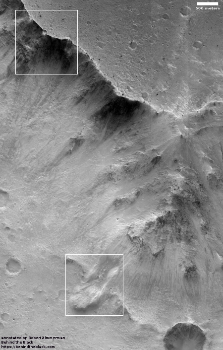
Cool image time! The image on the right, reduced and cropped to post here, was part of the August 31 image release from the high resolution camera of Mars Reconnaissance Orbiter (MRO). (Click on the image to see the full image.) It shows a slowly separating cliff feature in a region dubbed Tempe Fossae

As part of that monthly mass release, no caption was provided for this image. However, we can gain some understanding by looking at the larger context.

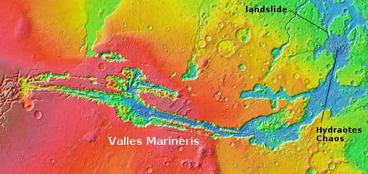
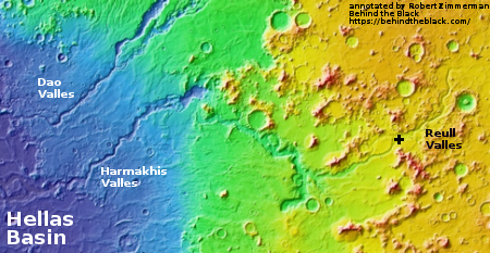
Tempe Fossae is located at the margins between the low flat northern plains and the high southern highlands. The location is also part of the vast drainage region to the east of Mars’ gigantic volcanoes. This is obvious from the overview image below and on the right. The location of this image is indicated by the white cross.

Mars overview

In this area of that drainage the canyons appear to follow southwest to northeast trending fault lines. Tempe Fossae is one of the smaller of these canyon complexes. All however appear to drain out into the northern plains.

Most of the MRO images of features in this area focus on the canyon cliffs. This image however focused on this one isolated small cliff in the middle of the canyon. To my eye it appears that these features document the slow drying of that vast intermittent ocean in Mars’s northern plains. The cliff is actually two steps, with the higher one appearing to mark an older shoreline. The lower cliff is abutted by a low flat area where it appears as if there had once been ponded water, now dried.

close-up of cracked area

The cracks in the cliff itself suggest it is slowly breaking apart and falling down towards that low flat area. In fact, the entire feature reminds me of the sand cliffs that are sometimes found along shorelines. The sand is not very strong structurally, and with time sections will separate and then fall down. The image to the right zooms in on this cracked region. The presence of sand dunes reinforces my impression.

I imagine that as the water drained down from the glaciers on the sides of the volcanoes and filled that intermittent sea, the shoreline regions would have had the most water. At Tempe Fossae the canyons might have been partly filled. As the water level drained out and lowered, first the upper cliff edge was exposed, then the lower. The draining water probably helped created these cracks as it flowed down through them.

Finally, the last remaining pits of water ponded at the base of the cliff, eventually drying out. With time, the weakly structured sand cliffs, already carved partly by the flowing water, began to slump apart and fall downward, producing the cracks we now see. I expect that some time in the near future, on geological time scales, there will be a landslide and the outer section will collapse downward.

Curiosity fails again to drill into Vera Rubin Ridge

For the third time Curiosity has failed to drill into the rock on top of Vera Rubin Ridge.

Last night we learned that our drill attempt on “Inverness” was not successful, reaching only 4 mm into the rock.

The only successful drill attempt on the ridge occurred when they moved down off the top of the ridge to a slightly lower geological layer.

They are moving Curiosity to another candidate drill site on the ridge, where they will try again. While they imply in their reports that it is solely the hardness of the ground that is stopping them, I still wonder if the improvised drill technique, using the robot arm to push down rather than the drill’s jammed feed mechanism, is partly to blame. I would think that they have placed limits on how hard the arm can push to protect it.

NASA resets listening plan for Opportunity

NASA has rearranged its listening plans for the rover Opportunity so that it will extend into the dust devil season beginning in November.

The science team is also sending a command three times a week to elicit a beep if the rover happens to be awake, and will soon be expanding the commanding to include “sweep and beeps” to address a possible complexity with certain conditions within the mission clock fault. These will continue through January of 2019.

The dust storm on Mars continues its decay with atmospheric opacity (tau) over the rover site continuing to decrease. Once the tau has fallen below an estimated measurement of 1.5 twice – with one week apart between measurements – a period of 45 days will begin representing the best time for us to hear from the rover.

This also represents the best time to attempt active commanding during a specific mission clock fault condition. Back during the attempted recovery of the Spirit rover, a technical issue required the team to actively command the rover to communicate. Opportunity has no such issue; if we hear from it, it will likely be from listening passively as we have been, and as we will continue to do through January.

We will also actively attempt to command the rover to communicate during the 45-day listening period to cover the clock fault condition. After that, we will report to NASA on our efforts.

In other words, the final 45 day listening period will not officially begin until the Martian atmosphere has cleared more, rather than begin about now and thus end about the middle of November, before the dust devil season begins.

The reasons they want to listen through the dust devil season is that they believe it likely that the rover’s solar panels have been covered with dust, and will need a nearby dust devil to blow this away. This might sound unlikely, but it has happened several times with both Spirit and Opportunity during both of their spectacularly extended missions.

Baby volcanoes on Mars

Pitted cones on Mars

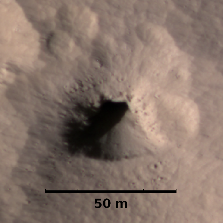
Most people are very aware of Mars’ giant volcanoes. This week the science team for Mars Reconnaissance Orbiter (MRO) decided to highlight instead a location on Mars filled with relatively tiny volcanoes. The image on the right is only one small section from the full image, and shows some of these pitted cones, as well the strange nearby badlands. From their caption:

The origins of these pitted mounds or cratered cones are uncertain. They could be the result of the interaction of lava and water, or perhaps formed from the eruption of hot mud originating from beneath the surface.

These features are very interesting to scientists who study Mars, especially to those involved in the ExoMars Trace Gas Orbiter mission. If these mounds are indeed mud–related, they may be one of the long sought after sources for transient methane on Mars.

The age of these pitted cones is not known. They might be still active, or have sat on Mars unchanged for eons.

Overview map

As always, context is crucial for gaining a better understanding of what we are looking at. The map on the right shows that these particular cones, indicated by the white cross, are located in an area of those plains dubbed Chryse Planitia, part of the vast northern plains of Mars, an area where some scientists think an intermittent ocean might have once existed. As you can see, this is also the region that took most of the apparent drainage running off the slopes of the planet’s giant volcanoes.

Nor are these cones unique in this region. MRO has taken a good scattering of images at this general location (41 degrees north, 332 degrees east), and throughout the surrounding terrain are many more of these pitted cones.

If these cones are a source of the transient methane on Mars, then the Trace Gas Orbiter should eventually see a concentration of methane above them. This would not prove them to be the source, but it would make them a much more intriguing target for a later rover mission.

Curiosity to drill twice more on Vera Rubin Ridge

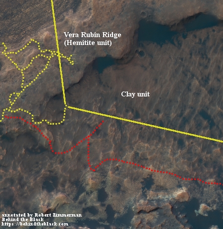
Before they will resume the journey up Mount Sharp the Curiosity science team now plans two more drilling attempts on Vera Rubin Ridge.

The rover has never encountered a place with so much variation in color and texture, according to Ashwin Vasavada, Curiosity’s project scientist at NASA’s Jet Propulsion Laboratory in Pasadena, California. JPL leads the Mars Science Laboratory mission that Curiosity is a part of.

“The ridge isn’t this monolithic thing — it has two distinct sections, each of which has a variety of colors,” Vasavada said. “Some are visible to the eye and even more show up when we look in near-infrared, just beyond what our eyes can see. Some seem related to how hard the rocks are.”

Part of this drilling campaign will also include gaining a better understanding better their improvised drilling technique.

SpaceX’s Big Falcon Rocket and the colonization of Mars

Link here. Lots of details about what SpaceX wants to do, as well as the company’s request for help in areas it is weak.

Below the fold is the youtube video from the Mars Society conference last week which forms the basis of the article at the link.

I only have one comment at this time: I worry that SpaceX is developing a rocket, the BFR, that has no marketable value, at this time. They succeeded with the Falcon 9 and the Falcon Heavy because they could market them and make money from them. The commercial space industry needed these rockets that could fly at lower cost, and that has paved the way for SpaceX’s success.

There are real questions whether a similar market exists for BFR. To paraphrase a line from the movie Field of Dreams, it is possible that if they build it the customers will come, but few businesses succeed with that market strategy.
» Read more

Some debate at NASA over Opportunity

This story yesterday had the following interesting paragraph:

Members of Opportunity’s engineering team recommended a different plan, the person close to the mission says. Their idea was to actively try to communicate with Opportunity until the end of January 2019 — the end of the seasonal cleaning period. After that, they suggested passive listening until the end of 2019. But these recommendations were ignored by management in order to save money, this person says, meaning the agency could be risking abandoning a still-functioning rover. The Opportunity team reportedly didn’t receive formal notice of the plan until “minutes before JPL published its press release,” according to The Atlantic.

It appears that some on the science team do not feel that the present plan to listen closely for only 45 days, through mid-October, is sufficient, as it will likely require a dust devil to clear Opportunity’s solar panels, and dust devil season will not begin until November.

However, it is very likely wrong to blame the resistance by NASA management to this plan solely to a desire to save money. There are other considerations, such as tying up the Deep Space Network for this one rover when, as I noted yesterday, the October to January time period will be a very very very busy time for that network, with many important new planetary probe events. Seven different spacecraft will either be landing or doing fly-bys on four different solar system targets during that time. Tying the network up to listen for Opportunity will likely not work.

It seems to me that Opportunity should be recovered, if possible, but it also must receive a lower priority during this time period. After New Horizons’ January 1st fly-by of Ultima Thule it might be possible to devote more time then to listening, but I can see the logic, at least in this context, for reducing the listening time from October to January.

Hat tip Kirk Hilliard.

How the Curiosity science team found soft rock for drilling

Link here. They very much wanted drill samples on Vera Rubin Ridge, but had twice found the rock too hard for Curiosity’s drill. So how did they pinpoint the spot, dubbed Stoer, where the drill finally worked?

In the absence of direct data on rock mechanical properties, we came up with three criteria that we could use to try to find a softer rock. (1) Did the bristles of the DRT brush leave scratches on the rocks’ surfaces? While not necessarily a direct indicator of what the rock strength would be when we drilled into it, we could at least say rocks that got scratched with the DRT had a softer surface than those that didn’t. (2) How well exposed are the white calcium sulfate veins? On some rock targets, like Stoer, we clearly see veins. On other targets, like Voyageurs, the veins are recessed into the rock. Recessed veins erode much faster than the surrounding bedrock because the surrounding bedrock is harder. Non-recessed veins tells us the bedrock may be similar in strength to the veins, or, if the veins stick out, the bedrock may be lower in strength. (3) What does the large-scale topography tell us? Broadly, Vera Rubin Ridge is a ridge because it is composed of hard rocks that are more resistant to erosion than their surroundings. We realized we might use this same logic to find softer rocks within the ridge by trying to drill in local topographic lows or at bases of scarps where the bottom of the scarp is eroding more quickly than the hard rocks on top.

The successful drill hole, Stoer, was thus down somewhat from to top of the ridge. As they prepare to move on, it appears they want to try again to drill at the top of the ridge. It also appears that the work described above has maybe found another location there where the rock might be soft enough for the drill.

As Mars dust storm clears, Opportunity remains silent

The Opportunity science team today provided a new update on the rover, noting that it remains silent even as the Martian dust storm is clearing.

With skies clearing, mission managers are hopeful the rover will attempt to call home, but they are also prepared for an extended period of silence. “If we do not hear back after 45 days, the team will be forced to conclude that the Sun-blocking dust and the Martian cold have conspired to cause some type of fault from which the rover will more than likely not recover,” said Callas. “At that point our active phase of reaching out to Opportunity will be at an end. However, in the unlikely chance that there is a large amount of dust sitting on the solar arrays that is blocking the Sun’s energy, we will continue passive listening efforts for several months.”

The additional several months for passive listening are an allowance for the possibility that a Red Planet dust devil could come along and literally dust off Opportunity’s solar arrays. Such “cleaning events” were first discovered by Mars rover teams in 2004 when, on several occasions, battery power levels aboard both Spirit and Opportunity increased by several percent during a single Martian night, when the logical expectation was that they would continue to decrease. These cleaning dust devils have even been imaged by both rovers on the surface and spacecraft in orbit (see https://mars.nasa.gov/resources/5307/the-serpent-dust-devil-of-mars/).

It appears however that if nothing is heard from Opportunity by sometime in mid-October, they will be very prepared at that time to begin shutting down ground-based operations here on Earth.

Looking for Marsquakes

After eight and a half years of study of one particular very young fault system on Mars using high resolution images from Mars Reconnaissance Orbiter, scientists have found no evidence that any quakes occurred there in that time.

The team studied images of Mars’s surface over nearly a decade to look for changes that might have been caused by marsquakes. The researchers used images of Mars’s surface from the High Resolution Imaging Science Experiment (HiRISE) and applied Co-registration of Optically Sensed Images and Correlation (COSI-Corr)—software that has been validated to track terrestrial glaciers, landslides, and quakes on Earth, as well as dune movement on Mars itself—to hunt for signs of displacement near fault zones.

The researchers focused on the Cerberus Fossae fault system, the youngest fault system on the Red Planet and thus the most likely to still be active. They used the average coregistration performance of each study image to determine that this method should be able to detect fault slip rates of 0.1–10 millimeters a year.

The team identified only one displacement signal that could have been interpreted as evidence of a marsquake—but dismissed it as the result of a topographic artifact. Their results suggest that no seismic movement occurred in the Cerberus Fossae area over the course of the study, which spanned 8.5 Earth years’ worth of images from the planet.

This suggests, but does not prove, that Mars has very few quakes. We shall know more when InSight lands on Mars on November 26.

The search for Mars Polar Lander

A small section where Polar Lander might have crashed

In December 1999 the U.S. lander Mars Polar Lander was to set down near the southern polar cap of Mars. After an almost routine eleven month journey to Mars, all efforts to contact the spacecraft after its landing failed. A NASA review eventually concluded that the spacecraft had prematurely shut down its landing engines while the spacecraft was still far above the surface, and had therefore crashed to the ground.

Since then there have been extensive efforts to locate the lander’s remains on the surface, all to no avail. Though Mars Global Surveyor, in orbit at the time, tried to find it, its resolution was not sufficient. In recent years Mars Reconnaissance Orbiter (MRO) has taken several dozen high resolution images of the estimated landing area, two of the most recent were included in the August 2018 image release. The image on the right is a cropped section of one of those images, illustrating the difficulty of the search. (If you click on the image you can explore the full version.) The other image is quite similar.

As the southern polar cap shrinks and grows seasonally, it produces endless numbers of black spots from the release of underground dust as the carbon dioxide dry ice sublimates into gas. Moreover, the growth and retreat of the dry ice cap changes the landscape, periodically covering any remains of the rover as well as quickly removing many of the ground disturbances that the crash might have caused. In the almost two decades since the lander’s crash landing, about ten Martian years have passed, meaning that cap has melted and frozen ten times over this region in that time.

Images taken by MRO of Mars Polar Lander landing area

The image on the right shows the footprint of all the images that MRO has so far taken of the Mars Polar Lander landing area. If you are ambitious and want to get your name in the news, all you have to do is spend some time combing through those images and find the lander there. Every one of these images is available for public download at full resolution. Go to HiRise image archive, hover your mouse over latitude 77 degrees south, longitude 166 degrees east, and click several times to zoom in. You then change the selector icon at the top from “+” to “the arrow”. When next you click on any portion of that footprint it will show you a bunch of the images taken, all of which you can now download and inspect.

If you are successful and find the lander, please let me know. It would be nice to make that announcement here on Behind the Black.

Inexplicable high latitude Martian terrain

Inexplicable high southern latitude Martian terrain

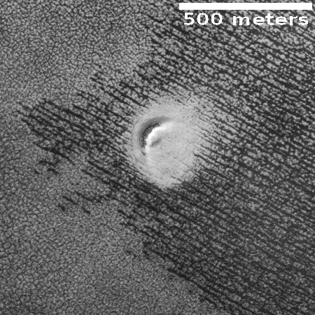
Strange image time! The image on the right, reduced in resolution to post here, comes from the August 1, 2018 image release from the high resolution camera on Mars Reconnaissance Orbiter (MRO). (If you click on the image you can see the full resolution version.) I have not cropped this image at all, so that you can see all of its swirling terrain.

This image did not come with a caption. The image site merely describes this terrain as having an “interesting morphology.” The location, in the very high southern latitudes (78 degrees south) just outside the southern rim of a very large crater, provides a slight explanation, as the growth and retreat of the Martian carbon dioxide polar caps is known to create very strange landforms. These swirling flows are obviously an example of one such landform.

The crater rim is just off of the top of the image and parallel with it. Therefore, the apparent erosional flows going around the hills and mesas are running parallel to the rim, not down from it. The black specks scattered about are probably points where dust was released as the carbon dioxide turned from ice to gas, a process that at the high latitudes on Mars often causes what planetary scientists call “spiders.”

I will not even try to make a guess at the process that formed what we see here. The image itself was taken on June 16, 2018 as part of a seasonal monitoring effort, which means scientists expect there to be changes occurring here from year to year as the polar cap shrinks and grown. An almost identical image had been taken two years ago, on December 18, 2016, and shows almost no black specks, probably because of the different time in the Martian year. A much closer comparison of both high resolution images would be necessary to tease out any more subtle changes.

Volcanic rills and lava tubes on Mars

Rills and lava tubes on Pavonis Mons

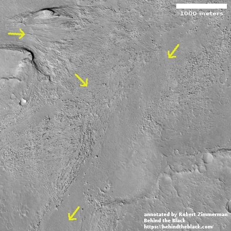
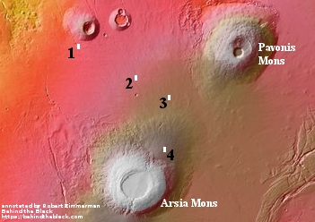
Cool image time! The image on the right, cropped somewhat to show here, was taken by Mars Odyssey of the southwestern slope of Pavonis Mons, the middle volcano of the line of three giant volcanoes located between the biggest volcano in the solar system, Olympus Mons, and the biggest canyon in the solar system, Marineris Valles. The slope goes down to the south, from the top to the bottom of the image. As noted on the image page,

The channel and nearby oval depressions are both related to the flow of lava. Narrow lava flows can create channels. The cooling of the top of the channel will form a roof over the flow, creating a tube beneath the surface. After the lava stops flowing the tube can empty, leaving a subsurface void. The roof will then collapse into the void forming the oval surface features.

I have added arrows to the image to draw your eye to the features that extend south in line with those oval depressions, eventually widening out to resemble a river delta, with the obvious rill probably indicating the lowest point in that delta.

Though the oval depressions are likely sections of a lava tube that collapsed, the features in line with those depressions suggest that the tube itself might still exist below the surface to the south, feeding into that delta where the rill meanders. It is also possible that my desire to find underground voids here, where glacier ice might possibly exist, might be skewing my conclusion. It could also be that the lava tube ended at these depressions, and what the features indicate is a wide surface flow, later embellished by the smaller flow of the meandering rill.

A strange bulge on Mars

Pollack Crater

Cool image time! The image on the right is not the cool image, but a context image of 59-mile-wide Pollack Crater, located slightly south of the Martian equator in the planet’s southern cratered highlands. What makes this crater intriguing to planetary scientists, and has prompted them to take many images over the decades, is the bulge in the southwest part of the crater’s floor. You don’t normally see a rise off-center like this inside craters. If there were any peaks, you’d expect them to be in the center, formed during the impact, when the crater floor melts and acts more like water in a pond when you drop a pebble into it, forming ripples with an uplifting drop in the dead center.

It therefore isn’t surprising that planetary scientists have taken a lot of pictures of this bulge, going back to the Mariner 9 orbiter in 1972, which first discovered it. Scientists then dubbed it “White Rock” because in the first black & white images it looked much brighter than the surrounding terrain. Later color images revealed that it is actually somewhat reddish in color, not white. As noted at this Mars Global Surveyor webpage,
» Read more

Opportunity’s uncertain future

Link here. This article from JPL provides a detailed status report on the rover, as well as what will happen if they should regain communications.

After the first time engineers hear from Opportunity, there could be a lag of several weeks before a second time. It’s like a patient coming out of a coma: It takes time to fully recover. It may take several communication sessions before engineers have enough information to take action.

The first thing to do is learn more about the state of the rover. Opportunity’s team will ask for a history of the rover’s battery and solar cells and take its temperature. If the clock lost track of time, it will be reset. The rover would take pictures of itself to see whether dust might be caked on sensitive parts, and test actuators to see if dust slipped inside, affecting its joints.

Once they’ve gathered all this data, the team would take a poll about whether they’re ready to attempt a full recovery.

Even if engineers hear back from Opportunity, there’s a real possibility the rover won’t be the same. The rover’s batteries could have discharged so much power — and stayed inactive so long — that their capacity is reduced. If those batteries can’t hold as much charge, it could affect the rover’s continued operations. It could also mean that energy-draining behavior, like running its heaters during winter, could cause the batteries to brown out.

They remain hopeful, but this article is clearly meant to prepare the public for the possibility that Opportunity’s long journey on Mars might have finally ended.

Ancient drainage on Mars?

Drainage on Mars?

Cool image time! The image on the right, cropped from the original to post here, was taken by Mars Odyssey on May 13, 2018, and shows what clearly looks like a point where a south-to-north drainage broke through a cliff wall to allow a liquid to flow down into the larger and deeper east-west flowing canyon.

The caption at the website for this image provides only a little analysis.

The right angle intersection of the depressions in this VIS image is one of the graben that form Sacra Fossae. The fossae are located on Sacra Mensa, near the beginning of Kasei Valles. Graben are depressions caused by parallel faults where a block of material drops down along the fault face.

According to this geological interpretation, the depressions initially formed due to this geological process. The image however suggests that a flow of liquid also played a part.

Overview map

This region, indicated by the white cross on the map to the right, is part of the vast drainages that flow down from Mars’ four giant Martian volcanoes. It is located north of Valles Marineris, the largest of all these drainages. This region is also where you find a lot of chaos terrain, which is what the hummocky depression at the bottom of the image resembles. Much of this mysterious geology is thought to have been formed by the liquid water that is theorized to have once flowed down from the volcanoes. Here, it appears that the liquid ponded in the depression at the bottom of the image until it found a path along the north-south graben to break through into the east-west deeper graben.

Cryptic terrain in Martian high southern latitudes

Cryptic terrain in Reynolds Crater near Mars south pole

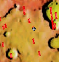
Cool image time! The image on the right is a small cropped section from a larger image taken of the floor of Reynolds Crater, near the margins of the Martian southern polar carbon dioxide icecap.

The image was part of the August 1, 2018 image release from the high resolution camera on Mars Reconnaissance Orbiter (MRO) and was taken on July 5, 2018. Because that was during the peak of now clearing global dust storm, a large majority of MRO’s images were obscured. Only images taken at high latitudes appeared clear and sharp.

The image link, which has no caption, calls this “cryptic terrain.” Since this is at the margin of the polar cap, the white areas are almost certainly still-frozen dry ice. The white strip down the center of the image appears to be a low drainage gully, made even more evident on the full image.

What are the dark spots however? These are probably related to the dark spiders that appear wherever the carbon dioxide starts to melt and evaporate into gas, releasing the darker dust from below to coat the surface. The dark spots in this image are probably that same darker dust, but why it is scattered about as spots and splotches is a mystery. It does appear that the dark areas more completely cover the higher terrain, but why and if so is definitely unclear.

Back in 1999 I attended a press conference just prior to the failure of Mars Polar Lander. One of the mission’s investigators explained that, based on the orbiter images available at the time, they expected the lander to see some very weird land forms once it reached the surface, shaped in ways that are not seen on Earth. Unfortunately, contact with the spacecraft was lost just before it entered the Martian atmosphere, and was never recovered.

This image however remains me of that scientist’s lost expectation. The seasonal growth and retreat of the Martian icecaps will likely create some strange geology, which is only hinted at in this particular MRO image.

Curiosity successfully drills another hole

Successful drill hole on Vera Rubin Ridge

Curiosity has finally drilled its first successful hole in the geology layer found on Vera Rubin Ridge.

This weekend’s plan is focused on the Stoer drill hole, the tailings derived from the drill and on portion characterization observations. The portion characterization is done prior to sending samples to the analytical instruments, SAM and CheMin, to ensure that the materials will not pose any threat to the instruments. ChemCam passive and Mastcam multispectral imaging will be taken of the drill tailings, to identify any potential differences between the surface and material from deeper within the drill hole. The ChemCam laser (LIBS) will be used to characterize the Stoer drill hole and a bedrock target “Greian,” which appears to show some colour variations. Mastcam will provide colour documentation for Greian.

In order to find rock soft enough on Vera Rubin Ridge, they had to once again retrace their route, retreating back down off the ridge slightly, to a lower point. The image on the right, cropped to post here, shows the drill hole. If you click on the image you can see the full picture.

With this successful drilling, I suspect they will now finally cross Vera Rubin Ridge and head up Mount Sharp.

Weird Martian crater?

Weird crater on Mars

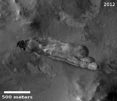
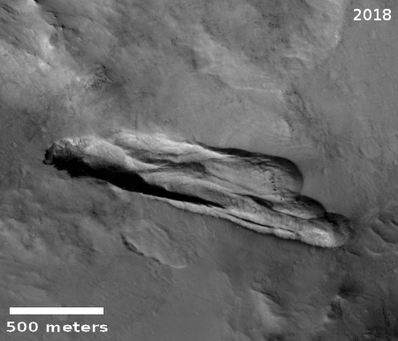
Time for another cool image! The image on the left, cropped to post here, was taken by the high resolution camera on Mars Reconnaissance Orbiter (MRO) on May 31, 2018, and shows a very strange layered mesa sitting in what looks like a crater or collapse feature. If you click on the image you can see the entire picture.

The location of this image is out in the middle of the vast northern plains of Mars. This region has few pronounced features, and generally sits at a lower elevation to the rest of Mars. It is suspected by some scientists that an intermittent ocean was once here, and that we are looking at the floor of a now dry sea.

This image was part of the July image release from MRO, and thus included no caption. They simply refer to it as a layered feature. It sits about a half mile (about 800 meters) to the west of a rough and indistinct cliff that drops down into an area of rougher terrain. This suggests that if this was formed by an impact, it cut down into that lower rougher layer, and since the impact there has been some upwelling from below creating the layered mesa.

I would not take my hypothesis very seriously, however. This feature could have nothing to do with an impact. It might also have been a mesa that now sits in a collapsed sinkhole. Or not. I could come up with many theories, all of which are likely wrong. What I do see here is something that geologically is very strange and baffling.

The shrinking and growth of the poles of Mars

Using infrared data from several Mars orbiters over a period of a full Martian year, equivalent to two Earth years, scientists have created an animation showing the growth and retreat and regrowth of the carbon dioxide icecaps of the red planet’s two poles.

This animation shows a side-by-side comparison of CO2 ice at the north (left) and south (right) Martian poles over the course of a typical year (two Earth years). This simulation isn’t based on photos; instead, the data used to create it came from two infrared instruments capable of studying the poles even when they’re in complete darkness.

As Mars enters fall and winter, reduced sunlight allows CO2 ice to grow, covering each pole. While ice at the north pole is fairly symmetrical, it’s somewhat asymmetrical during its retreat from the south pole for reasons scientists still don’t understand. Scientists are especially interested in studying how global dust events affect the growth and retreat of this polar ice. Mars’ seasons are caused by a tilt in the planet, resulting in winter at one of the planet’s poles while it’s summer at the other.

I have embedded the animation below the fold.
» Read more

How to build a scaled-down version of Curiosity, all by yourself!

JPL has released open-source plans for building a scaled down version of the rover Curiosity at a total cost of only $2,500.

This project is a successor to an earlier educational rover model called “ROV-E,” which received positive responses in schools and museums, NASA said. The Open Source Rover offers a more affordable, less complicated model, and according to agency officials, people can assemble the new model with off-the-shelf parts for about $2,500.

“While the OSR [Open Source Rover] instructions are quite detailed, they still allow the builder the option of making their own design choices,” JPL officials said. “For example, builders can decide what controllers to use, weigh the trade-offs of adding USB cameras or solar panels and even attach science payloads. The baseline design of OSR … will allow users to choose how they want to customize and add to their rover, touching on multiple hardware and software principles along the way.”

I wonder how heavy a home-built rover would be, and whether it could be launched on a Falcon Heavy to Mars.

1 55 56 57 58 59 81