
How the blobby craters on Mars help map the planet’s existing accessible water
Click for full image.
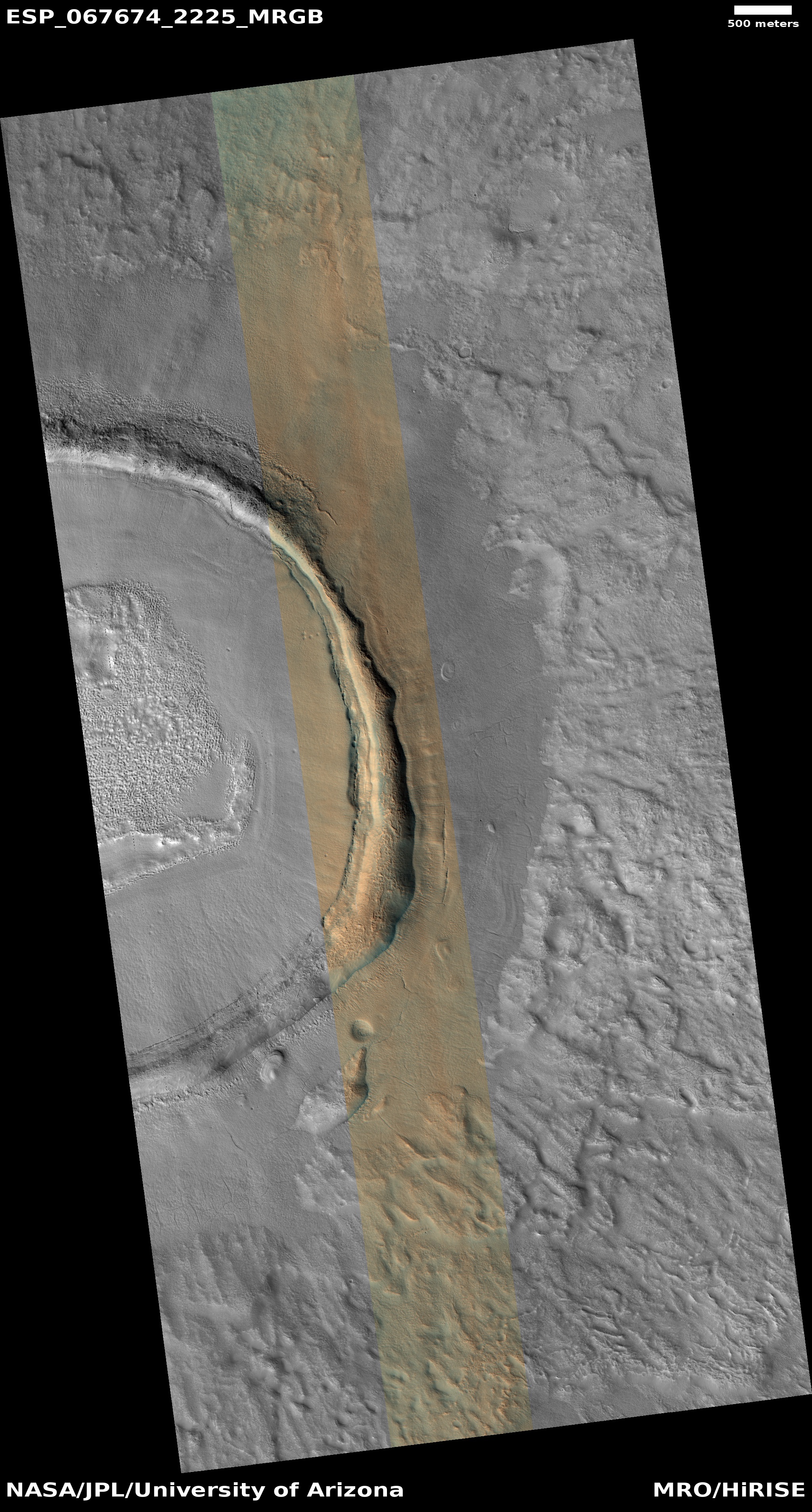
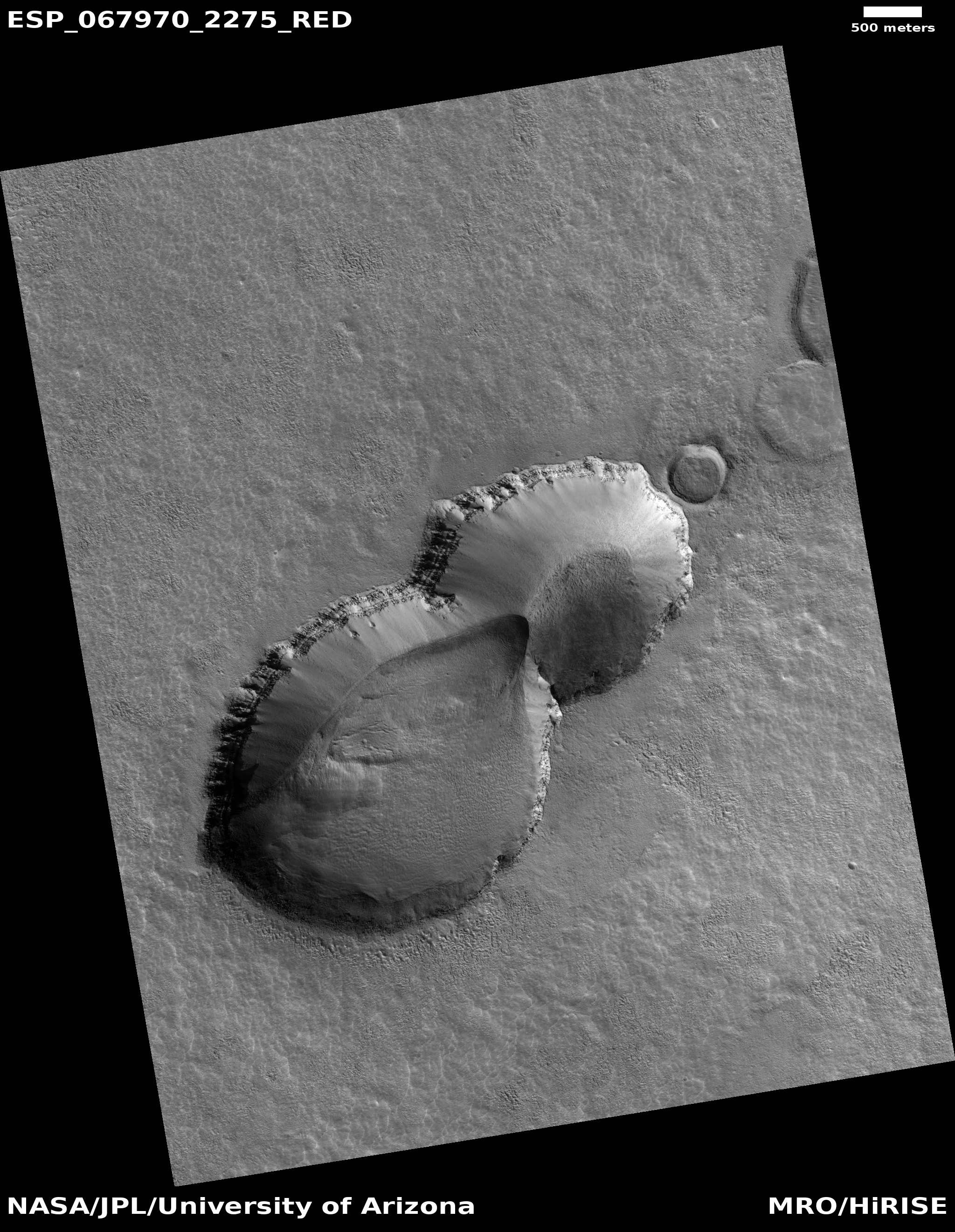
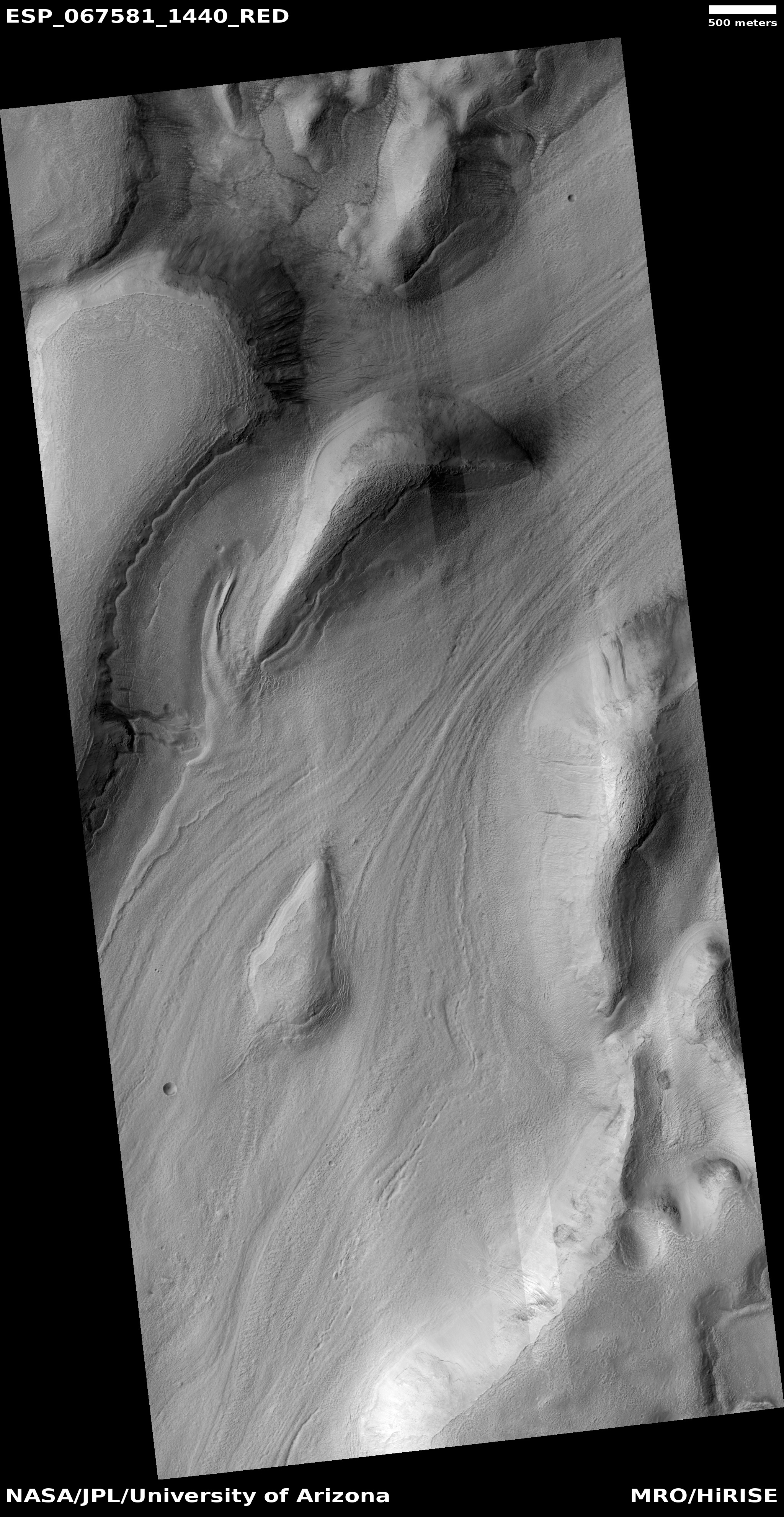
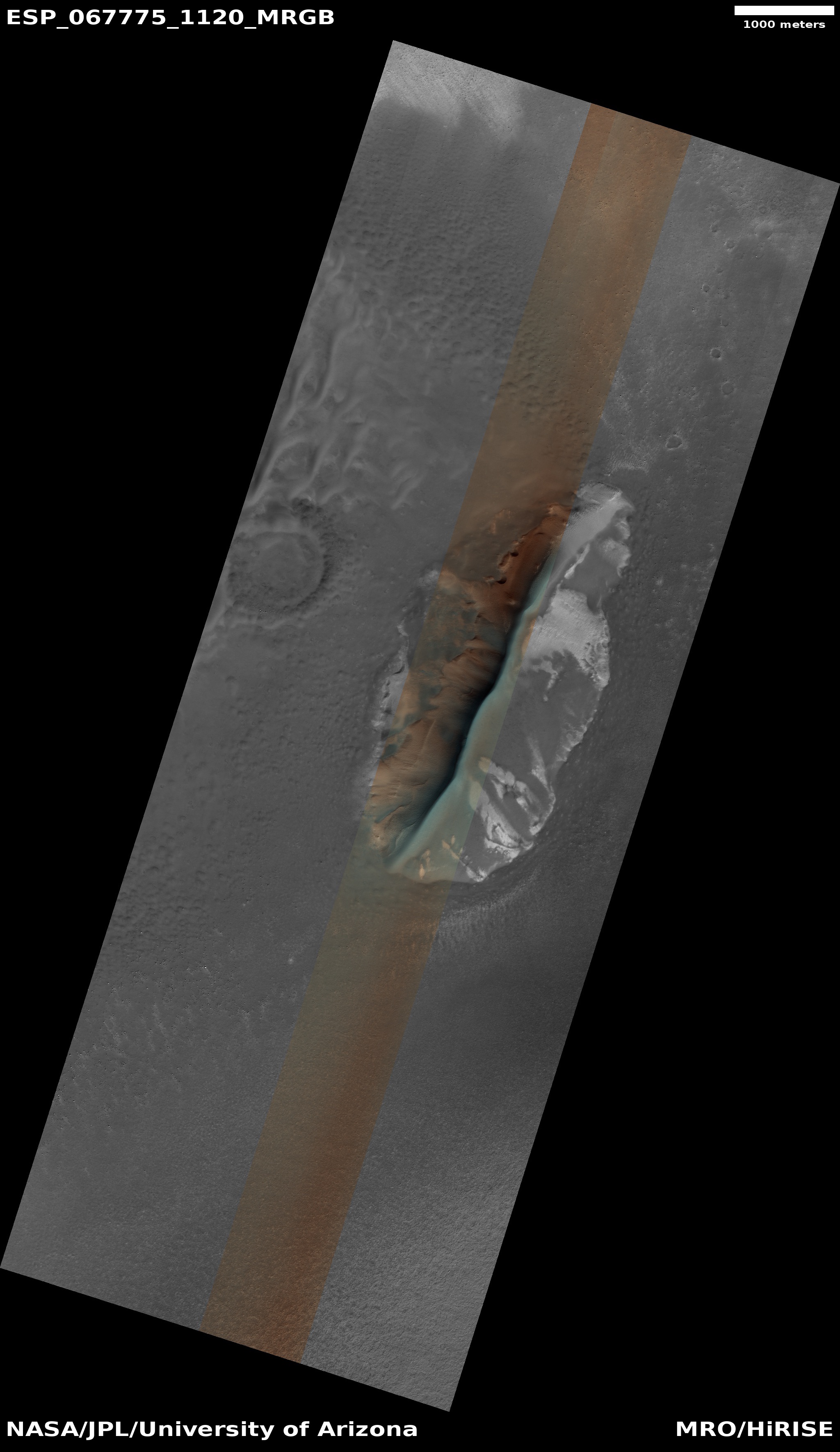
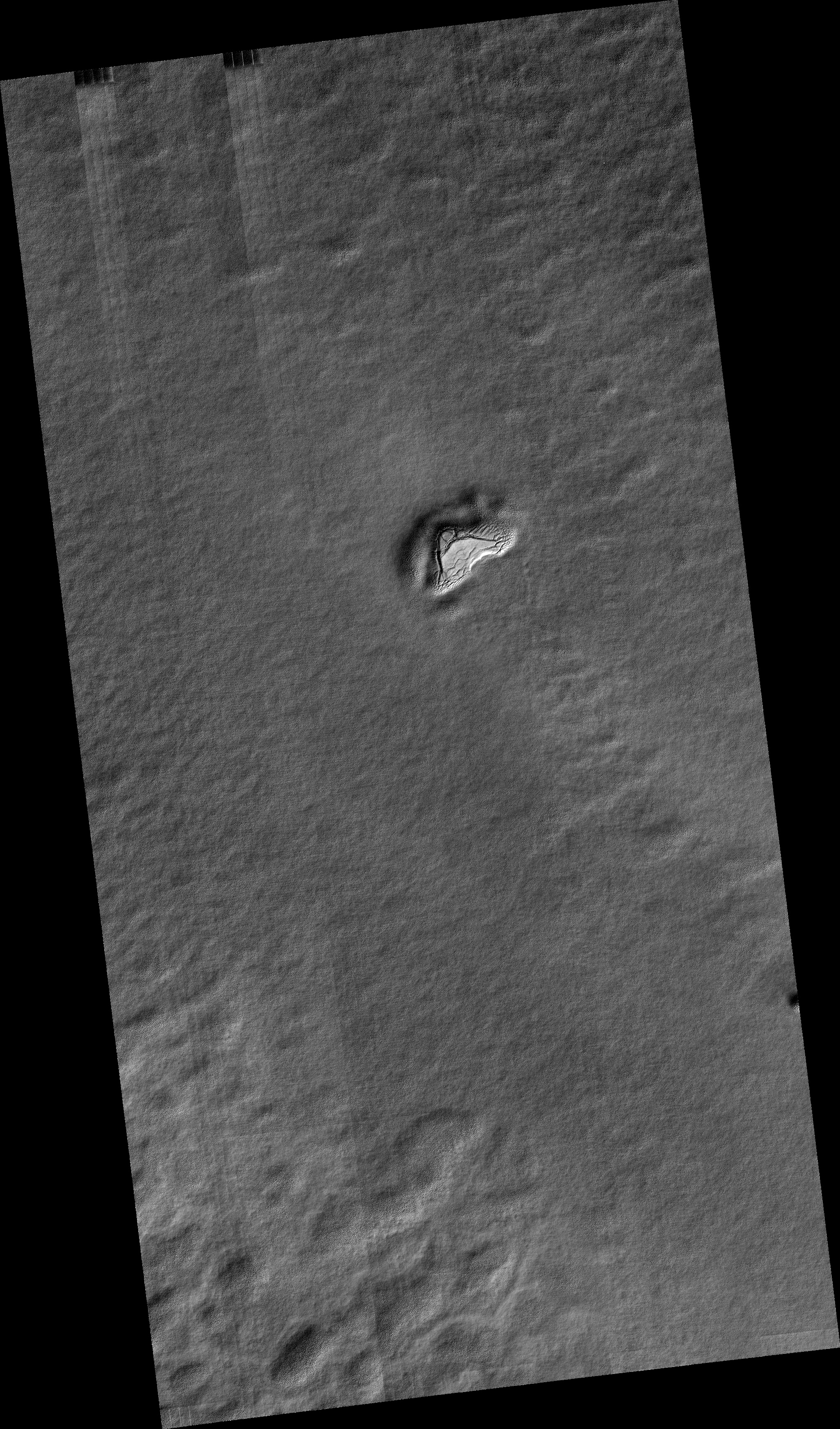
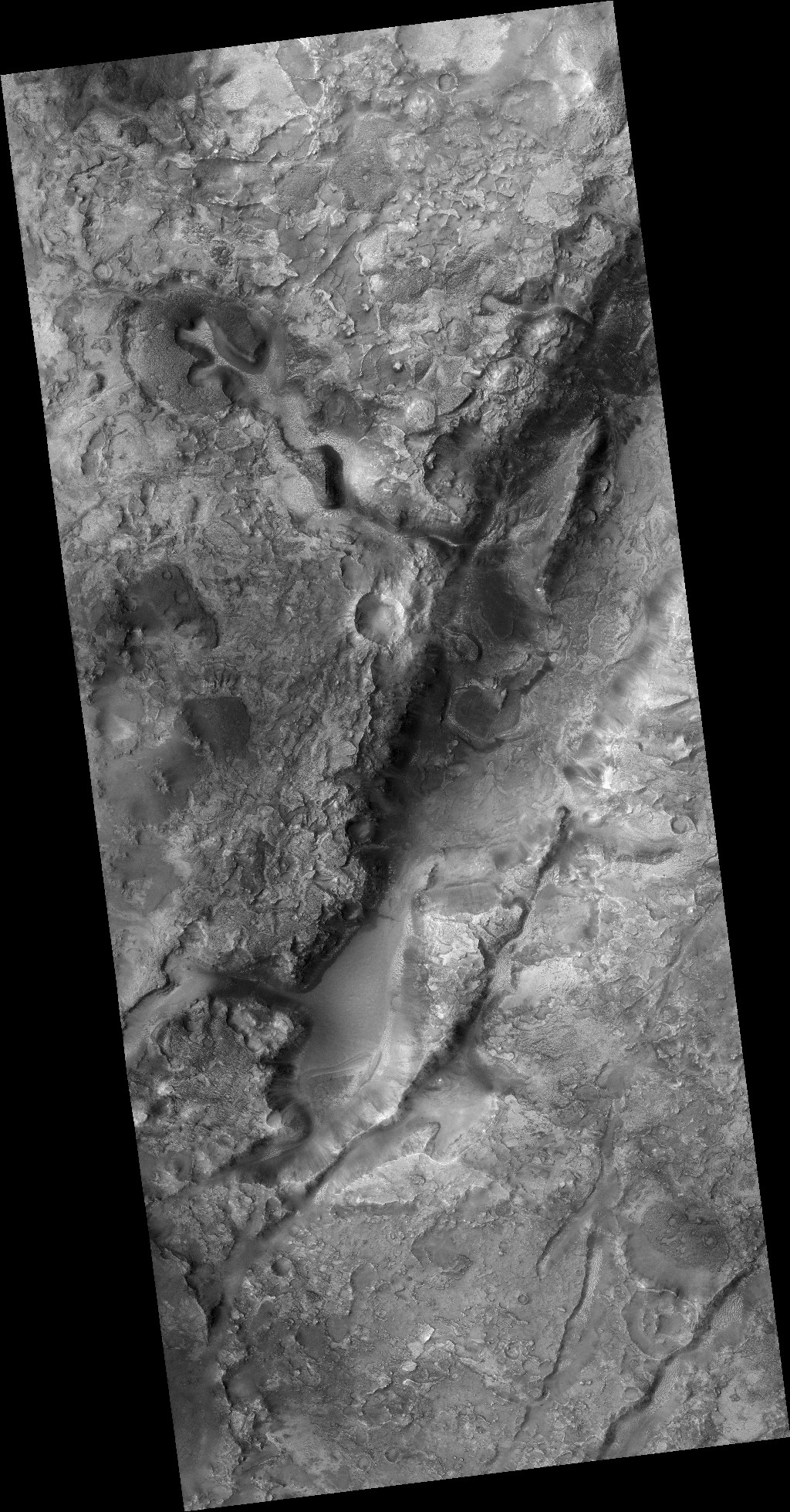
Today’s cool image on the right, rotated, cropped, and reduced to post here, is part of a series of cool images that have repeatedly shown the blobby and squishy look of crater impact sites in the Martian northern lowland plain dubbed Utopia Planitia. Taken on January 2, 2021 by the high resolution camera on Mars Reconnaissance Orbiter (MRO), it shows the southeast rim of a very distorted crater that appears filled with glacial material and is also surrounded by an apron of smooth material.
At 42 degrees north latitude, it is somewhat expected to find evidence of glacial-like features in such a crater. Moreover, throughout the 30 to 60 degree mid-latitude band in Utopia Planitia are found numerous such blobby craters (other examples found here, here, and here), all suggesting that the impact occurred on a flat plain with a layer of water ice close to the surface. The heat of the impact melted that ice layer. In such a circumstance, the crater rims were easily deformed because as liquid water (for a short time) it could flow into any number of shapes.
At least that’s my theory. According to Colin Dundas of the U.S. Geological Survey’s Astrogeology Science Center in Arizona,
The exact processes that create the patterns are still debated. The flattened/degraded rims are not necessarily related to this morphology, as such craters can have sharp rims, so they may relate to post-impact modification.
In other words, later erosion after the crater formed could have rounded the rim and maybe even distorted it from a circle.
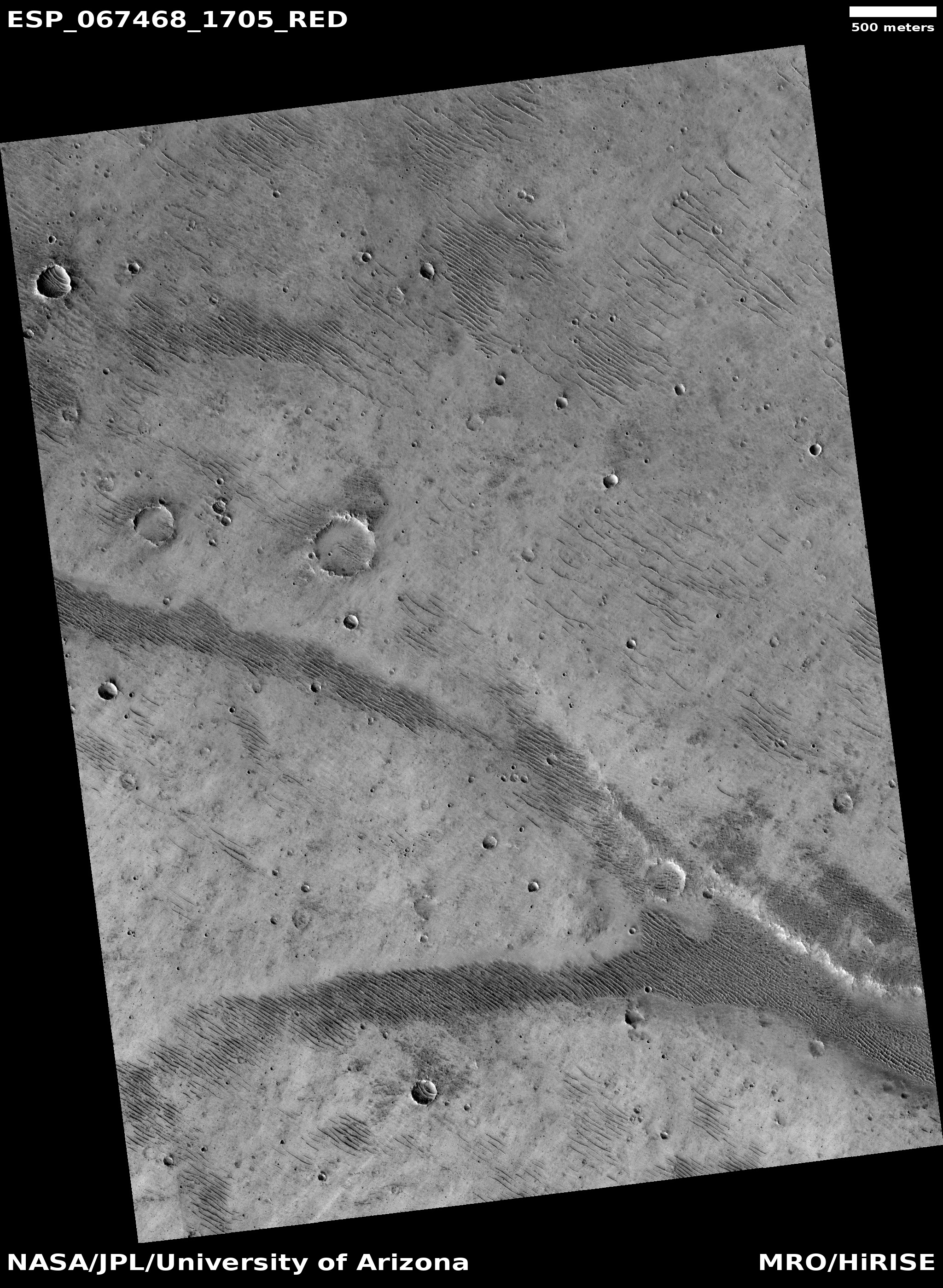
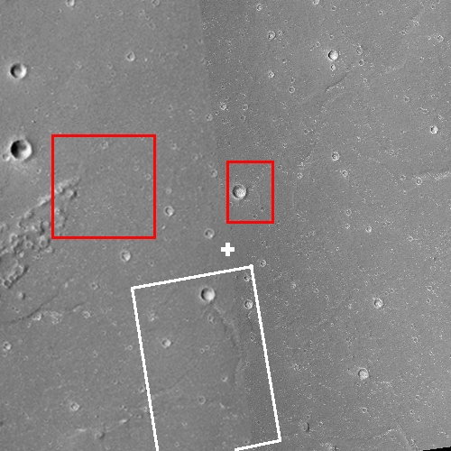
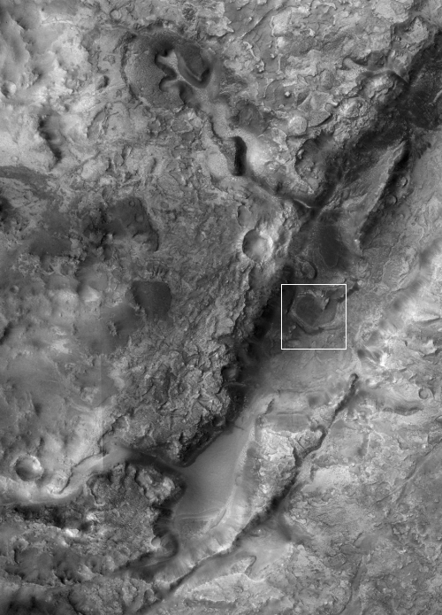
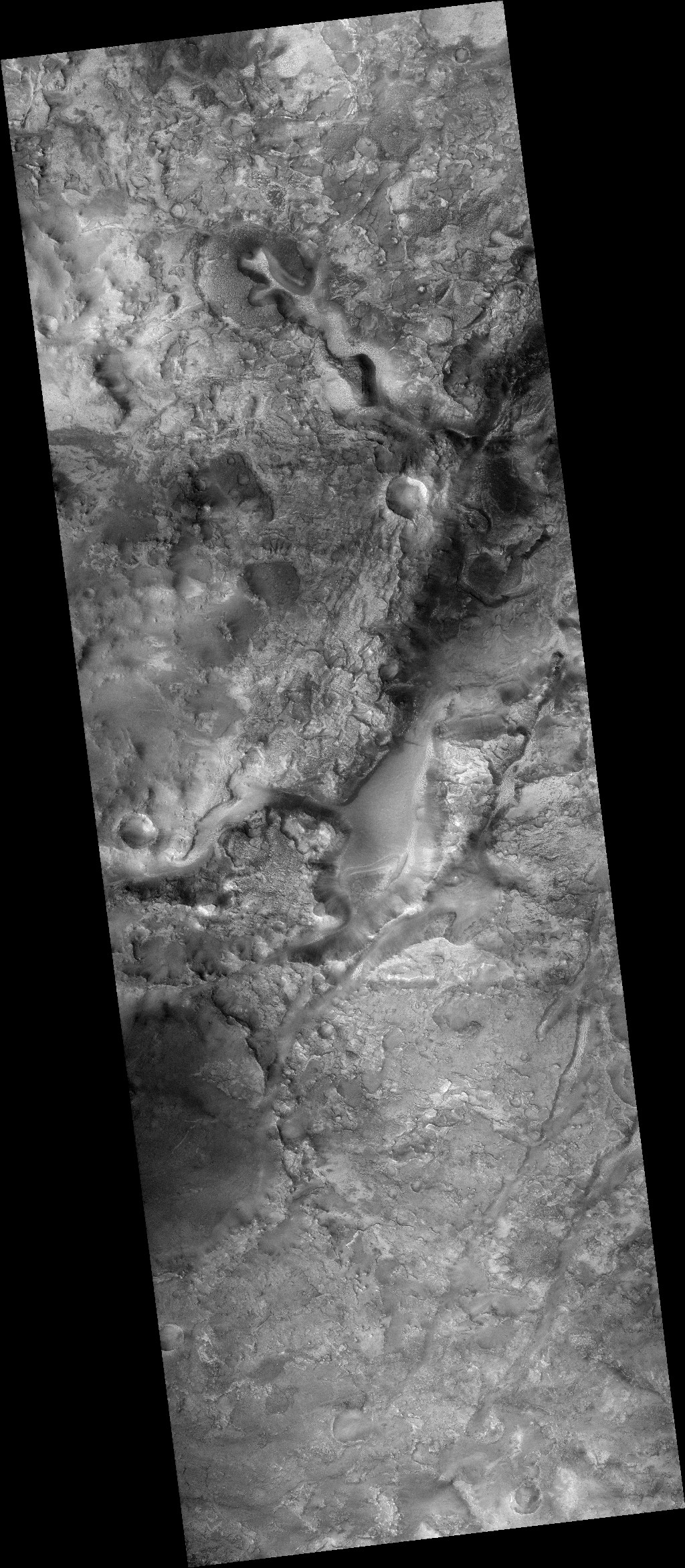
Regardless, the processes that made this crater rim look as it does were clearly widespread, as shown in the wider view below, provided by the context camera on MRO.
» Read more

