
Pluto’s splotched surface
For original images go here and here.
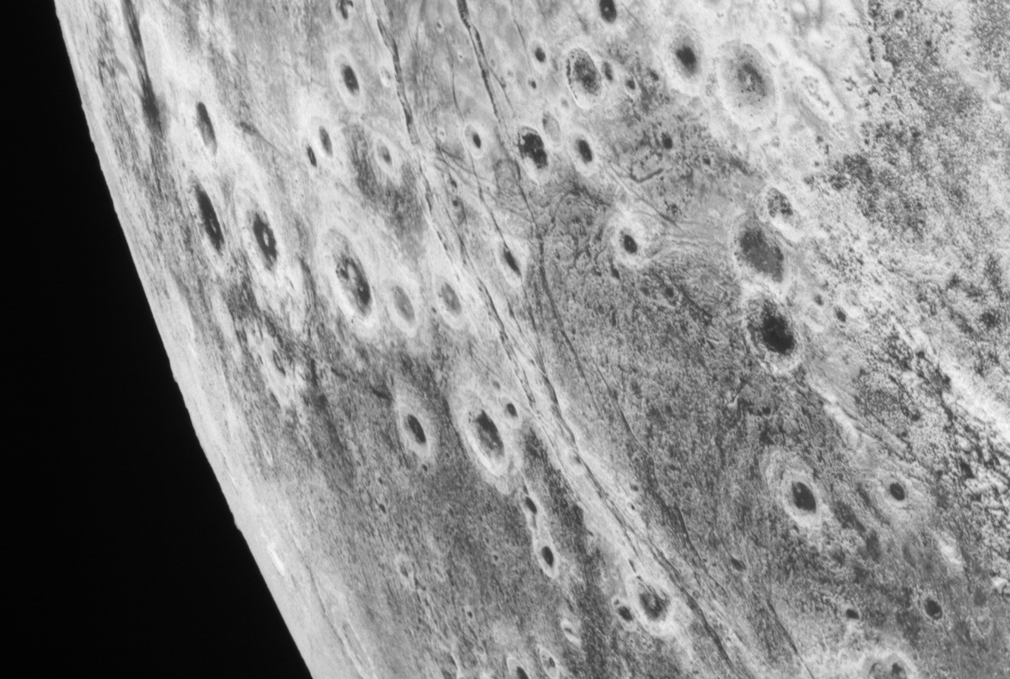
Cool image time! The panorama above was created using two photographs (found here and here) taken by New Horizons during its close fly-by of Pluto on July 14, 2015. It looks at Pluto’s western limb, well lit by the Sun, from a distance of approximately 60,000 miles.
I pulled these images from the New Horizons’ archive specifically because I don’t remember ever seeing them publicly released by the science team. More important, they show a surface far more alien than other more well-known New Horizon pictures. Are those round splotches impact craters or some alien type of volcanic caldera? Note also the vertical cracks that appear to divide this terrain near the center.
It would be a serious mistake to make any conclusions. In the emptiness of the outer solar system, the impact rates are going to be far less than in the inner solar system, so assuming impacts is dangerous. Pluto meanwhile has an alien surface of frozen nitrogen seas often filled with floating mountains of frozen water ice. For it to also produce weird volcanic eruptions of nitrogen, sublimating away like bubbling tomato sauce when it is simmering, is quite possible.


.jpg)


