
Japan’s Hayabusa-2 successfully flies past asteroid Torifune
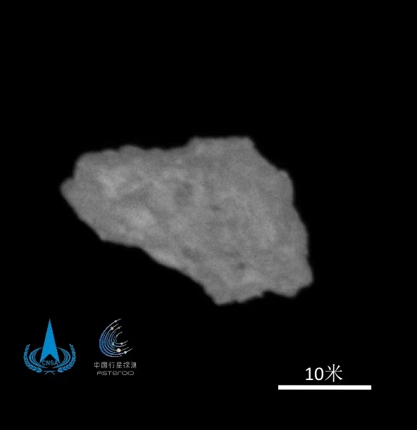
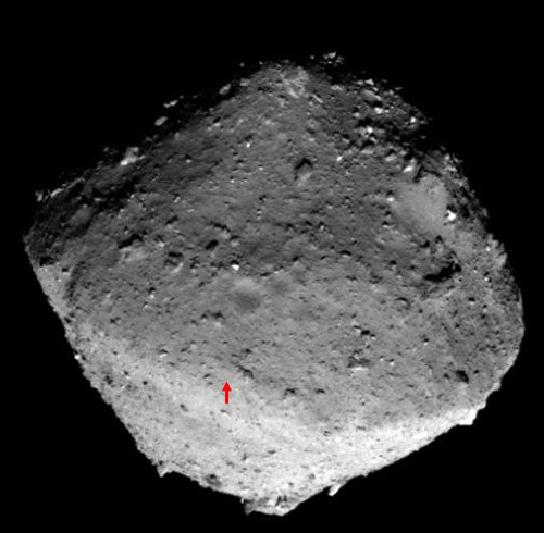
Japan’s Hayabusa-2 asteroid probe successfully flew past the asteroid Torifune yesterday, getting less than 2,000 feet from its surface as it zipped past at a relative speed of more than 10,000 miles per hour.
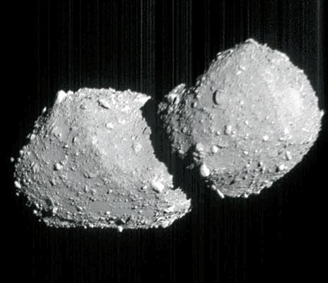
The picture to the right is the first image released by Japan’s space agency, JAXA. It shows that Torifune appears to be a contact binary, made up of two rubble-pile asteroids that gentle fused together in their dance in space. Contact binaries are presently thought to comprise about 15% of all asteroids, but that estimate might prove to be an understatement as we gather more information. This is the first seen close-up that appears made up of two rubble piles.
While Japan’s press and its space agency touted this fly-by success loudly, both failed to mention the technical problems facing Hayabusa-2, which made the fly-by even more impressive. The spacecraft, which was launched in 2014, rendezvoused and grabbed samples from the asteroid Ryugu from 2018 to 2019, and then returned those samples to Earth in 2020, has been flying somewhat crippled. It has four ion engines for maneuvering, three of which no longer work and a fourth that is showing signs of failure. Thus, it could not do much during this fly-by to control its path or orientation. That it could grab this image as it zipped by is a testament to its engineers.
Hayabusa-2 is on its way to asteroid 1998 KY26 in 2031. Whether it will be capable of doing much when it gets there remains at this moment an unknown.

.jpg)


