Lucy discovers second small asteroid orbiting Dinkinesh

Dinkinesh as seen by Lucy

During its November 1, 2023 fly-by of the asteroid Dinkinesh the asteroid probe Lucy surprisingly discovered that the asteroid was actually a binary, with a second smaller asteroid orbiting it.

The picture to the right, cropped, reduced, and sharpened to post here, was taken by Lucy’s camera within a minute of the probe’s closest approach of 270 miles. The second asteroid is partly blocked by Dinkinesh.

In the weeks prior to the spacecraft’s encounter with Dinkinesh, the Lucy team had wondered if Dinkinesh might be a binary system, given how Lucy’s instruments were seeing the asteroid’s brightness changing with time. The first images from the encounter removed all doubt. Dinkinesh is a close binary. From a preliminary analysis of the first available images, the team estimates that the larger body is approximately 0.5 miles (790 m) at its widest, while the smaller is about 0.15 miles (220 m) in size.

The nature of both asteroids appears to lie between a rubble pile (like Bennu) or a solid smooth rock (like Eros), suggesting we are now beginning to see aspects of the overall evolution of asteroids over time.

So far only a few images from this fly-by have been released. It will take a week for the rest of the data from the fly-by to beamed back to Earth. However, these images prove that the prime purpose of this fly-by was successful, proving that Lucy is operating as planned, able to point, manuever, and obtain its data during such a fly-by. When it arrives in the Trojan asteroids in 2027 it will be able to do its prime mission.

During landing Shenzhou’s single parachute appeared damaged

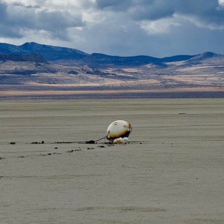
A closer look at imagery during the descent by parachute of China’s manned Shenzhou capsule, bringing three astronauts back from Tiangong-3 after a five month mission on October 31, 2023, shows that the capsule’s single parachute had a ripped hole.

In some of the footage, a patch of blue sky can be seen through the red-and-white-banded parachute. Inside the capsule were Shenzhou 16 mission commander Jing Haipeng and crewmates Zhu Yangzhu and Gui Haichao — the latter pair returning to Earth after their first mission to space.

Such a sizable hole, which was visible before a white cloud of vented propellant left the Shenzhou capsule, has not been reported during earlier missions. It did not, however, seem to affect operations.

The landing however was very rough, with the capsule tumbling several times after hitting the ground.

Considering that China presently as three astronauts on Tiangong-3 that have to come home in their own Shenzhou capsule, using this same parachute system, finding out what happened seems imperative. Developing its next generation larger capsule, which will return using three parachutes, also appears essential.

A seasonal map of the cloudy parts of Mars

Seasonal map of the cloudy parts of Mars
Click for original image.

Though Mars’ very thin atmosphere (1/thousandth that of Earth) is generally clear, it does have clouds that come and go. A project begun in 2022 using citizen scientists to identify these clouds and the seasons they appear the most, dubbed Cloudspotting on Mars, has now published its first paper, available here.

The graph to the left, Figure 9 in the paper, shows two seasonal Mars maps, one indicating the daytime seasonal frequency of clouds and the other their nightime frequency. From the paper:

The seasonal evolution of all clouds as a function of latitude for both daytime and nighttime are shown in Fig. 9. During the clear season until [mid-summer in the northern hemisphere] … there are several regions where clouds occur frequently: in the equatorial region (annotated as 1), at mid-latitudes (2), in the southern polar region (3), and to a lesser extent in the northern polar region [at the start of summer]. From [late fall to mid-autumn in the north], daytime clouds occur primarily at mid-latitudes, but are observed at nearly all latitudes between 70°S and 60°N (4). At night, there is one broad population from 30°S to 30°N (clouds are more frequent in the equatorial region at night), but [in autumn], clouds occur frequently between 30°N and 50°N as well. [In mid-spring] the number of observed nighttime clouds increases in the southern hemisphere, especially near 50°S. There is a strong decrease in the number of peaks just before [the late northern autumn and the late southern sping] at nearly all latitudes except around 50°S and 20°N at night. [Once northern winter arrives], clouds are observed between about 60°S and 60°N as well as both polar regions, although nighttime clouds between 0°N and 30°N occur relatively less frequently.

The low-latitude clouds during the clear season (1), which are observed more frequently at night, occur at high altitudes, 65–80 km during the day and 55–70 km at night; this is the aphelion equatorial mesospheric cloud population studied in depth by Slipski et al. (2022) and in which previous observations have spectrally confirmed CO2-ice.

Martian seasons

The bracketed words indicating seasons above replace the longitudal numbers the scientists use to indicate the seasons, and are used on these two graphs. The figure to the right shows what the longitude numbers represent in the graphs’ X-axis.

The project continues if any of my readers want to join in.

Sunspot update: October activity drops almost to predicted levels

NOAA today posted its updated monthly graph tracking the number of sunspots on the Sun’s Earth-facing hemisphere. As I do every month, I have posted this graph below, with several additional details to provide some larger context.

In October the sunspot count dropped so much from the activity in September that the total count was for the first time since the middle of 2021 actually very close to the predicted numbers first put forth by NOAA’s solar science panel in April 2020.

» Read more

Lucy completes fly-by of main belt asteroid Dinkinesh

Lucy's route through the solar system
Lucy’s route through the solar system

The Lucy science team has confirmed that the spacecraft has successfully completed its fly-by of the asteroid Dinkinesh (the white dot in the lower left of the main asteroid belt in the graphic to the right) and is in good health.

Based on the information received, the team has determined that the spacecraft is in good health and the team has commanded the spacecraft to start downlinking the data collected during the encounter. It will take up to a week for all the data collected during the encounter to be downlinked to Earth.

Though the images and data of Dinkinesh obtained during this fly-by have science value, the real purpose of the fly-by was to test the operations of Lucy for when it reaches the Trojan asteroids in Jupiter’s orbit, as shown by the graphic. The spacecraft will now do a flyby of Earth in 2025 to slingshot it to the orbit of Jupiter, where it will do its main work exploring the Trojan asteroids there. On the way it will fly past a second main belt asteroid, dubbed Donaldjohanson.

A Martian splash crater in the northern lowland plains

A Martian splash crater
Click for original image.

Cool image time (necessary when there is no real space news to report)! The picture to the right, cropped, reduced, and sharpened to post here, was taken on June 29, 2023 by the high resolution camera on Mars Reconnaissance Orbiter (MRO). It shows what the scientists label as “steep crater walls.”

And the interior slopes of this 5-mile-wide unnamed crater are steep, about 600 feet high and descending at a grade of 10 to 13 degrees, getting steeper as you go down. In fact, the floor of the crater itself continues that slope downward to the west until it reaches the base of its western interior wall. For some reason the glacial material within it is piled up higher on its eastern end.

The dark streaks on the crater interior walls are either slope streaks or recurring slope lineae, with the former appearing somewhat randomly and the latter seasonal in nature. Both remain unexplained unique phenomenons of Mars. This new picture was likely a follow-up of a January 2014 MRO picture to see if anything had changed in the past decade.

To my eye it is difficult to detect any changes, but I am not looking at the highest resolution version of the picture. The lack of changes suggests the streaks are seasonal lineae, as both images were taken in the northern spring and the streaks in both appear much the same.
» Read more

Scour pits of volcanic Martian ash

Scour pits in volcanic ash
Click for original image.

Cool image time! The picture to the right, cropped, reduced, and sharpened to post here, was taken on June 16, 2023 by the high resolution camera on Mars Reconnaissance Orbiter (MRO). The science team describes this as “clusters of scour pits,” which means the pits here were formed by the prevailing winds, which according to a global analysis of dunes on Mars, is probably blowing from the west to the east at this location.

This image only covers a small section of these scour pits. The full field extends about 20 by 18 miles across, and appears to be the southeastern flank of a mile-high dome. The scour marks could therefore also be evidence of some sagging of this material downhill along that flank.

It is also possible that the flow of the prevailing winds across this southeastern downhill slope is causing the pit formation. Unlike this flank, the rest of this dome is relatively smooth.
» Read more

Ingenuity completes 64th flight on Mars

Overview map
Click for interactive map.

Ingenuity's view just before landing
Click for original image.

In a pattern that is beginning to be almost routine, on October 27, 2023 the Mars helicopter Ingenuity completed its 64th flight on Mars, flying 1,348 feet at a speed of 13 mph for 139 seconds at an altitude of 39 feet.

As with most of its recent flights, the distance and time was slightly longer than the flight plan, likely because the helicopter took extra time finding a good landing spot.

On the overview map above, the green line marks the flight path, and the green dot the helicopter’s present position. The blue dot marks Perseverance’s present position. The yellow lines indicate the area covered by the color image to the right, cropped, reduced, and enhanced to post here. This image was taken by Ingenuity just a few seconds before landing, and looks across the floor of Neretva Vallis, where Perseverance will soon be traveling.

Scientists detect salts and carbon-based molecules on Ganymede

Ganymede as seen by Juno
A close-up image taken during the June 7, 2021
Juno fly-by of Ganymede Click for original image.

Using data obtained during a close fly-by of Ganymede by Juno in June 2021, scientists have detected evidence of salts and organic carbon-based molecules.

On June 7, 2021, Juno flew over Ganymede at a minimum altitude of 650 miles (1,046 kilometers). Shortly after the time of closest approach, the JIRAM instrument acquired infrared images and infrared spectra (essentially the chemical fingerprints of materials, based on how they reflect light) of the moon’s surface. Built by the Italian Space Agency, Agenzia Spaziale Italiana, JIRAM was designed to capture the infrared light (invisible to the naked eye) that emerges from deep inside Jupiter, probing the weather layer down to 30 to 45 miles (50 to 70 kilometers) below the gas giant’s cloud tops. But the instrument has also been used to offer insights into the terrain of moons Io, Europa, Ganymede, and Callisto (known collectively as the Galilean moons for their discoverer, Galileo).

The JIRAM data of Ganymede obtained during the flyby achieved an unprecedented spatial resolution for infrared spectroscopy – better than 0.62 miles (1 kilometer) per pixel. With it, Juno scientists were able to detect and analyze the unique spectral features of non-water-ice materials, including hydrated sodium chloride, ammonium chloride, sodium bicarbonate, and possibly aliphatic aldehydes.

The data indicated that the salts and organics were most concentrated in Ganymede’s equatorial regions, which are less impacted by Jupiter’s strong magnetic field. The scientists think these materials originally came from the brine of an underground ocean that somehow reached the surface, though this hypothesis remains unconfirmed.

Chinese crew completes five-month mission on Tiangong-3 after return to Earth

The new colonial movement: A three-man Chinese crew successfully landed today in north China in their Shenzhou capsule, completing a five-month mission on the Tiangong-3 space station.

The full mission length was 154 days. China claims that one of the astronauts was a civilian, but that really means nothing considering the security required to participate in these missions.

The crew that has taken over on Tiangong-3 are expected to do a mission of comparable length, probably pushing the length to six-months.

Chandra X-rays a giant hand in space

A cosmic hand
Click for original image.

Cool image time! The picture to the right, cropped, reduced, and sharpened to post here, was taken by the Chandra X-ray Observatory, with data from the orbiting IXPE producing the lines that indicate the orientation of the magnetic field lines.

The image was part of research studying what the scientists call Pulsar Wind Nebulae (PWNe).

[E]arly-on when the new-born pulsar is still deep in its parent supernova remnant, or at late times after it has escaped to the relatively uniform interstellar medium, the pulsar wind is often uniform around the pulsar spin or velocity axis. In projection on the sky such structures have bilateral symmetry, that is, the two halves mirror each other. This makes them look (vaguely) like animals. This has led to many PWNe collecting animal monikers (‘The Mouse’, ‘The Dragonfly’, ‘The Rabbit’ – we are guilty of some of these…).

In between these early and late phases, the story is often more complex and the PWN interaction with the supernova shock wave leads to complicated morphologies. One of the prime examples is the PWN in the supernova remnant RCW 89 (also known as MSH 15-5(2)). Here the complex interactions form the PWN into the `Cosmic Hand’. Wanting to map the magnetic fields which structure this hand, the IXPE team took a long hard stare at MSH 15-5(2) and its central pulsar.

The scientists admit that the match between IXPE’s data and the structure of the hand is not really a surprise, but confirming the match was necessary if they are ever going to figure out the fundamental laws that govern magnetic fields, laws that presently are not well understood, at all.

A spiral galaxy giving birth to a lot of stars

A spiral galaxy giving birth to a lot of stars
Click for original image.

Time for another cool galaxy image! The picture to the right, reduced and sharpened to post here, was taken by the Hubble Space Telescope, and shows what some informally refer to as the “‘Spanish Dancer Galaxy’ because the “vivid and dramatic swirling lines of its spiral arms … evoke the shapes and colours of a dancer’s moving form. ”

Though this galaxy’s two main arms cause it to resemble a barred galaxy, it lacks a central bar, suggesting it is young. The numerous reddish and pink regions in the arms, all of which are thought to be star-forming regions, also suggest the galaxy is young, still giving birth to many stars.

It is located about 60 million light years away, and is part of what scientists label the Doradus galaxy group, which contains less than a hundred galaxies. In comparison, a galaxy cluster is much larger, containing hundreds to thousands of galaxies.

Two mouse embryos successfully grown on ISS

Mouse embryos from experiment
Taken from figure 2 of the paper

In a paper just published, scientists reveal that in 2021 they successfully grew two mouse embryos in weightlessness on ISS, suggesting that “perhaps mammalian space reproduction is possible, although it may be somewhat affected,” as they note in the conclusion of their paper [pdf].

From the papers abstract:

The embryos cultured under microgravity conditions developed into blastocysts with normal cell numbers, ICM, trophectoderm, and gene expression profiles similar to those cultured under artificial-1 g control on the International Space Station and ground-1 g control, which clearly demonstrated that gravity had no significant effect on the blastocyst formation and initial differentiation of mammalian embryos.

The images to the right come from the paper’s second figure, and compare the blastocysts from a ground control (top), an 1g artificial sample on ISS (middle), and the weightless result (bottom).

The experiment has many uncertainties, with the low number of embryos tested the most important. Quoting the paper’s conclusion again, the possibilities of refining this experiment for better results are great:

Unfortunately, the number of blastocysts obtained from the ISS experiment was not abundant; and we have not been able to confirm the impact on offspring because we have not produced offspring from embryos developed in space. We believe that the ETC [the experiment itself] will allow blastocysts to be frozen on the ISS if a cryoprotectant is used in place of PFA [a solution of formaldehyde]. Then, the frozen blastocysts could be brought back to Earth for transfer to a female recipient, and the viability of the blastocysts could be evaluated. Moreover, we could design a device to launch frozen oocytes and spermatozoa to the ISS, where in vitro fertilization experiments could be performed in microgravity. The use of this approach would be cheaper. Furthermore, the study of mammalian reproduction in space is essential to start the space age, making it necessary to study and clarify the effect of space environment before the ISS is no longer operational.

Despite the uncertainties, these results are significant. They suggest that human reproduction in zero gravity is possible, which also suggests it will be even more possible in lower gravity environments like the Moon or Mars.

An infrared view of the Crab Nebula by Webb

Webb's image of the Crabb compared to Hubble's
Click for original image.

Using the Webb Space Telescope astronomers have taken the first detailed infrared image of the Crab Nebula, the remnant from a supernova that occurred in 1054 AD.

The two pictures on the right compare Webb’s false color infrared view with a natural light Hubble image in optical wavelengths, taken in 2005. From the press release:

The supernova remnant is comprised of several different components, including doubly ionized sulfur (represented in red-orange), ionized iron (blue), dust (yellow-white and green), and synchrotron emission (white). In this image, colors were assigned to different filters from Webb’s NIRCam and MIRI: blue (F162M), light blue (F480M), cyan (F560W), green (F1130W), orange (F1800W), and red (F2100W).

In comparing the images, it appears the scientists chose colors for the Webb image to more or less match those of Hubble’s natural color picture. However, as the press release notes:

Additional aspects of the inner workings of the Crab Nebula become more prominent and are seen in greater detail in the infrared light captured by Webb. In particular, Webb highlights what is known as synchrotron radiation: emission produced from charged particles, like electrons, moving around magnetic field lines at relativistic speeds. The radiation appears here as milky smoke-like material throughout the majority of the Crab Nebula’s interior.

This feature is a product of the nebula’s pulsar, a rapidly rotating neutron star. The pulsar’s strong magnetic field accelerates particles to extremely high speeds and causes them to emit radiation as they wind around magnetic field lines. Though emitted across the electromagnetic spectrum, the synchrotron radiation is seen in unprecedented detail with Webb’s NIRCam instrument.

The release also notes this remarkable but somewhat unfortunate fact:

Scientists will have newer Hubble data to review within the next year or so from the telescope’s reimaging of the supernova remnant. This will mark Hubble’s first look at emission lines from the Crab Nebula in over 20 years, and will enable astronomers to more accurately compare Webb and Hubble’s findings.

In 2005 repeated Hubble images of the Crab revealed that its filaments and radiation were stormy, with constant activity. The scientists actually produced a movie of those changes. It was expected that new images would be taken at regular intervals to track that activity. Apparently it was not, either because no scientist was interested or the committee that assigns time on Hubble decided this wasn’t important enough reseach.

Intuitive Machines delays launch of its Nova-C lunar lander two months

South Pole of Moon with landing sites

Intuitive Machines yesterday announced that it has decided to delay the launch of its Nova-C lunar lander from in November launch window to a new window beginning on January 12, 2023.

The company did not elaborate on the reasons for the delay. However, executives warned at a media event Oct. 3 that “pad congestion” at LC-39A could delay their launch. The mission has to launch from that pad, rather than nearby Space Launch Complex 40, because only LC-39A is equipped to fuel the lander with methane and liquid oxygen propellants on the pad shortly before liftoff.

That pad is used for Falcon 9 crew and cargo missions to the International Space Station as well as Falcon Heavy launches. The pad is scheduled to host the Falcon 9 launch of the CRS-29 cargo mission Nov. 5 followed by a Falcon Heavy mission for the Space Force in late November. Converting the pad between Falcon 9 and Falcon Heavy launches can take up to three weeks.

The landing site is indicated by the green dot on the map of the south pole to the right. Note that this landing will be the closest to the south pole yet, though not at the south pole. It will also be the first to land next to a crater that has a permanently shadowed interior, though Nova-C will not be able to enter it because it carries no rover and is only designed to last through the first lunar day.

Based on the present launch schedule, Astrobotic now gets the first chance to successfully land a privately built lunar lander. It is scheduled to launch on December 24, 2023 on a Vulcan rocket. The Japanese company Ispace attempted and failed to land its Hakuto-R1 spacecraft in April.

A new global map of the near-surface ice on Mars

Global map of near-surface ice on Mars
Click for interactive map.

A project begun in 2019 to use all the presently available orbital data to compile a global map of the near-surface ice on Mars has now been released that global map, shown by the graphic above, taken from Figure 16.7 from the project’s science paper.

The various areas in blue show the evidence of ice down to about 5 meters, or about 15 feet, with darker blue areas indicated ice at greater depth. The study focused on latitudes below 60 degrees latitude, while also blocking out areas above one kilometer in elevation (as indicated in black on the map above). As the paper noted,
» Read more

Is a recently discovered near Earth asteroid a piece from the Moon?

The uncertainty of science: Researchers now think they have enough information to claim that a recently discovered near Earth asteroid, dubbed Kamo`oalewa, could actually be a piece of the Moon, flung from it during a asteroid impact in the past few million years.

The 2021 study found that Kamo`oalewa’s spectrum was unlike that of other near-Earth asteroids but matched most closely that of the moon. Based on this, the team hypothesized that the asteroid could have been ejected from the lunar surface as a result of a meteoroidal impact.

In the new study, Malhotra and her team wanted to determine the feasibility for a knocked-off piece of the moon to get into this quasi-satellite orbit – a phenomenon that is quite unlikely, Malhotra said. Moon fragments that have enough kinetic energy to escape the Earth-moon system also have too much energy to land in the Earth-like orbits of quasi-satellites, she said.

With numerical simulations that accurately account for the gravitational forces of all the solar system’s planets, Malhotra’s group found that some lucky lunar fragments could actually find their way to such orbits. Kamo`oalewa could be one of those fragments created during an impact on the moon in the past few million years, according to the study.

The scientists add that the asteroid’s solar orbit, which keeps its flying in relative formation with the Earth for millions of years, strengthens this hypothesis.

It must be noted that this remains an unconfirmed hypothesis. A spacecraft would have to visit Kamo’oalewa and obtain samples to study to confirm it.

The icy terrain near one of Starship’s prime candidate landing spots on Mars

The icy terrain near Starship's prime landing spot on Mars
Click for original image.

Cool image time! The picture to the right, cropped to post here, was taken on August 22, 2023 by the high resolution camera on Mars Reconnaissance Orbiter (MRO). The camera team labeled the picture a “terrain sample,” which generally means it was not taken as part of any scientist’s specific research request, but to fill a gap in the schedule so as to maintain the camera’s proper temperature. When the team needs to do this, they try to pick a location in the gap that might have some interesting features. Sometimes such pictures show relatively boring features. Sometimes the results are fascinating.

In this case the location chosen was in the northern lowland plains of Mars, in a region called Amazonis Planitia. At 38 degrees north latitude it is not surprising that the photo shows ice features. All the depressions here appear to have an eroding glacier, while the surrounding plateau resembles an untouched snow field in the very early spring, the snow beginning to sublimate away to leave the top rough and stuccoed. Note too that these depressions are likely not impact craters (they have no upraised rims and many are distorted in shape), but were likely formed by that same sublimation process.
» Read more

New data better maps the supernova remnant SN1006

SN1006, as seen in X-rays
Click for original image.

Using data from both the Chandra X-ray Observatory and the Imaging X-ray Polarimetry Explorer (IXPE), scientists have now better mapped the magnetic field and the remnant from the supernova that occurred in 1006 AD.

The false color image to the right shows this data. From the caption:

The red, green, and blue elements reflect low, medium, and high energy X-rays, respectively, as detected by Chandra. The IXPE data, which measure the polarization of the X-ray light, is show in purple in the upper left corner, with the addition of lines representing the outward movement of the remnant’s magnetic field.

From the press release:

Researchers say the results demonstrate a connection between the magnetic fields and the remnant’s high-energy particle outflow. The magnetic fields in SN 1006’s shell are somewhat disorganized, per IXPE’s findings, yet still have a preferred orientation. As the shock wave from the original explosion passes through the surrounding gas, the magnetic fields become aligned with the shock wave’s motion. Charged particles are trapped by the magnetic fields around the original point of the blast, where they quickly receive bursts of acceleration. Those speeding high-energy particles, in turn, transfer energy to keep the magnetic fields strong and turbulent.

At present scientists really do not understand the behavior of stellar-sized magnetic fields. It is very complex, involving three dimensional movements that are hard to measure, as well as electromagnetic processes that are not well understood. While this new data doesn’t provide an explanation, it does tell us better what is actually happening. The theories will follow.

Swirling galactic-sized streams surrounding a pair of supermassive black holes

Swirling galactic arms surrounding two supermassive black holes

Time for another galactic cool image! The picture to the right, reduced and sharpened to post here, was released today by the Gemini South ground-based telescope in Chile. It shows the streams of gas and stars that swirl around a pair of supermassive black holes at the center of this galaxy, located only 90 million light years away.

The image reveals vast swirling bands of interstellar dust and gas resembling freshly-spun cotton candy as they wrap around the merging cores of the progenitor galaxies. From the aftermath has emerged a scattered mix of active starburst regions and sedentary dust lanes encircling the system.

What is most noteworthy about NGC 7727 is undoubtedly its twin galactic nuclei, each of which houses a supermassive black hole, as confirmed by astronomers using the European Southern Observatory’s Very Large Telescope (VLT). Astronomers now surmise the galaxy originated as a pair of spiral galaxies that became embroiled in a celestial dance about one billion years ago. Stars and nebulae spilled out and were pulled back together at the mercy of the black holes’ gravitational tug-of-war until the irregular tangled knots we see here were created.

The black holes themselves are 154 and 6.3 million solar masses respectively, and are presently about 1,600 light years apart. Scientists calculate that they will merge in about 250 million years. Each once formed the center of its own galaxy. Now both galaxies have merged, creating this three-dimensional whirlpool of arms.

A dance of three galaxies

Three galaxies merging
Click for original image.

Cool image time! The picture to the right, cropped, reduced, and sharpened to post here, was taken by the Hubble Space Telescope. Though it appears to show two galaxies interacting with each other, other spectroscopic data proves there are actually three large galaxies in the picture. From the caption:

The two clearly defined galaxies are NGC 7733 (smaller, lower right) and NGC 7734 (larger, upper left). The third galaxy is currently referred to as NGC 7733N, and can actually be spotted in this picture if you look carefully at the upper arm of NGC 7733, where there is a visually notable knot-like structure, glowing with a different colour to the arm and obscured by dark dust. This could easily pass as part of NGC 7733, but analysis of the velocities (speed, but also considering direction) involved in the galaxy shows that this knot has a considerable additional redshift, meaning that it is very likely its own entity and not part of NGC 7733.

All three galaxies are quite close to each other, which means they are in the long process of merging together into one larger galaxy.

More Io images by Juno, enhanced by citizen scientists

Io in natural and enhance colors
Click here for original of top image,
here for bottom.

Since Juno completed its 55th close swing past Jupiter on October 15, 2023, including the closest fly by of its volcano-covered moon Io since the 1990s, citizen scientists have been grabbing the spacecraft’s raw images of the moon and enhancing them to bring out the details.

Immediately after the fly-by I posted on October 17, 2023 the top image to the right, processed by Ted Stryk. This version attempted to capture the view of Juno is natural color. As I noted then, “The dark patches are lava flows, with the dimensions of mountains along the terminator line between night and day clearly distinguishable.”

The bottom picture to the right was first processed by citizen scientist Gerald Eichstädt, who like Stryk attempted to capture Io’s natural colors. Thomas Thomopoulos then took Eichstädt’s image and enhanced the colors as well as reduced the brightness, in order to bring out the details as much as possible.

I have rotated, cropped, and reduced this bottom image further to post it here.

In comparing this image with earlier pictures of Io, taken by both Juno and Galileo in the 1990s, there is evidence that some of the lava flows visible now have changed significantly in the intevening time. This is not a surprise, as volcanic eruptions take place on Io so frequently that it has not unusual to capture one in the rare times close up images are possible, going back to the discovery of volcanic activity by Voyager-1 in 1979.

It will take a bit of time for scientists, both professional and amateur, to pick out the specific changes. That work will be further aided by Juno’s next fly-by on December 30, 2023, where it will dip to less than 1,000 miles of the surface.

Scientists: The solar cycle was only 8 years long during the Maunder Minimum in the 1600s

Using archival records gathered in Korea during the 1600s when the Sun was undergoing a long period of almost no sunspots — called the Maunder Minimum — scientists have discovered evidence that the solar cycle during that time was only 8 years long.

You can read their paper here. Since almost no sunspots were visible at that time, the scientists used reports of aurora in Korea to determine periods when the Sun was more active. From their abstract:

By analyzing the variations in solar activity-related equatorial auroras recorded in Korean historical books in the vicinity of a low-intensity paleo-West Pacific geomagnetic anomaly, we find clear evidence of an 8-year solar cycle rather than the normal 11-year cycle during the Maunder Minimum.

This 8-year cycle is shorter than the 9-year cycle that other researchers had estimated based on the few sunspots that did appear during this grand minimum. Both conclusions however challenge what is known of the Sun. Since the 11-year cycle resumed in the 1700s, short cycles have generally been associated with very active periods, the opposite of what has been found during Maunder.

In other words, we know better what happened, but have no understanding of why. Since the Maunder Minimum appears associated with the Little Ice Age of the 1600s, and fits other data that says the climate cools when the Sun produces few sunspots, gaining some understanding of this process is important for understanding past and future changes to the global climate.

Lucy’s first asteroid fly-by coming on November 1st

Lucy's route through the solar system
Lucy’s route through the solar system

The asteroid probe Lucy is about to do its first asteroid fly-by on November 1, 2023, the first of a planned ten asteroids it will see close-up during its twelve year mission.

The half-mile-wide asteroid, Dinkinesh, is indicated on the graphic to the right by the white dot in the lower left of the main asteroid belt. It was a late addition to the spacecraft’s plan in order to provide a perfect testbed for doing a dress rehearsal of the many later fly-bys.

As this encounter is intended as a test of Lucy’s systems, scientific observations will be simpler than for the mission’s main targets. The spacecraft and the platform that holds the instruments will move into position two hours before the closest approach to Dinkinesh. Once in place, the spacecraft will begin collecting data with its high-resolution camera (L’LORRI) and its thermal-infrared camera (L’TES). One hour before closest approach, the spacecraft will begin tracking the asteroid with the terminal-tracking system. Only in the last eight minutes will Lucy be able to collect data with MVIC and LEISA, the color imager and infrared spectrometer that comprise the L’Ralph instrument. Lucy’s closest approach is expected to occur at 12:54 p.m. EDT, when the spacecraft will be within 270 miles (430 kilometers) of the asteroid. Lucy will perform continuous imaging and tracking of Dinkinesh for almost another hour. After that time, the spacecraft will reorient itself to resume communications with Earth but will continue to periodically image Dinkinesh with L’LORRI for the next four days.

After this close encounter the spacecraft will return to do a flyby of Earth in 2025 to slingshot it to the orbit of Jupiter, where it will do its main work exploring the Trojan asteroids there. On the way it will fly past a second main belt asteroid, dubbed Donaldjohanson.

A low mid-latitude crater on Mars apparently filled to overflowing with ice

ice filling a Martian crater to overflowing
Click for original image.

Cool image time! The picture to the right, rotated, cropped, reduced, and sharpened to post here, was taken on June 18, 2023 by the high resolution camera on Mars Reconnaissance Orbiter (MRO). It shows a steep 1,000-foot-high cliff with what appears to be extensive glacial material at its base.

The many layers all suggest past climate cycles, where snow was deposited and the glacier grew, followed by a period when no snow fell and the glacier either shrank or remained unchanged. The terraced nature of the layers near the base of the cliff suggest that with each active cycle less snow was deposited and the glacier grew less.

The latitude is 33 degrees south, which puts it just outside the dry equatorial regions of Mars and inside the mid-latitude region where many such glacial features are found. Its closeness to the tropics however is significant, because by this point we should be seeing a diminishment of such features. Instead, the wider view shows us that the near surface ice in this region is extensive and in fact appears to cover everything.
» Read more

Ingenuity completes 63rd flight on Mars

Overview map
Click for interactive map.

On October 19, 2023 the Mars helicopter Ingenuity successfully completed its 63rd flight on Mars, traveling 1,901 feet (its third longest flight) for 142.6 seconds.

On the overview map above the two dots and the green line mark the flight path, to the southwest and landing about 2,000 feet to the west of where the rover Perseverance presently sits (indicated by the blue dot).

Both the flight time and distance were slightly longer than the flight plan, likely caused by the helicopter making sure it had a safe landing spot before lowering itself to the ground.

Ingenuity is no longer simply an engineering test of whether flight is possible on Mars. It is now serving wholly as a scout for Perseverance, either moving ahead of its planned route (the red dotted line) in order to provide pictures of the ground so that the rover’s science team can better plan their future travels, or going into territory that the rover is not intended to travel in order to gather data that would previously been unavailable.

First Bennu asteroid samples recovered from OSIRIS-REx return capsule

Scientists have successfully removed the asteroid samples from the OSIRIS-REx return capsule that the spacecraft obtained from the asteroid Bennu in 2020.

What is more exciting is that though they now have slightly more material than the mission hoped to bring back, they haven’t even opened the capsule’s sample compartment.

The curation team processing NASA’s asteroid Bennu sample has removed and collected 2.48 ounces (70.3 grams) of rocks and dust from the sampler hardware – surpassing the agency’s goal of bringing at least 60 grams to Earth.

And the good news is, there’s still more of NASA’s OSIRIS-REx (Origins, Spectral Interpretation, Resource Identification, and Security–Regolith Explorer) sample to collect.

The sample processed so far includes the rocks and dust found on the outside of the sampler head, as well as a portion of the bulk sample from inside the head, which was accessed through the head’s mylar flap. Additional material remaining inside the sampler head, called the Touch-and-Go Sample Acquisition Mechanism, or TAGSAM, is set for removal later, adding to the mass total.

The large amount of material means there will be plenty to distribute to many scientists for study.

The reason the recovery process is going so slowly is to ensure the samples do not get contaminated by the Earth’s atmosphere. The capsule is inside a glovebox filled with nitrogen. The only way any work can be done is by inserting hands inside gloves that extend into the box. This keeps the samples protected but prevents any direct contact, which makes work slow and difficult.

The fractured floor of the south Utopia Basin

The fracture floor of South Utopia Basin

Cool image time! The picture to the right, rotated, cropped, reduced, and enhanced to post here, was taken on August 5, 2023 by the high resolution camera on Mars Reconnaissance Orbiter (MRO). The central darker strip however comes from a September 27, 2008 image by MRO’s lower resolution context camera, inserted to fill in the blank section where one component on the high resolution camera has failed.

The picture focuses on what the scientists call a “pit interacting with a mound.” The 100-foot-deep pit is one of a very long meandering string of such pits, all of which suggest the existence of an buried river canyon into which debris is sinking. Altogether this particular string runs from several dozen miles, and its interaction with the triangular 300-foot-high mound suggests at first glance that the river that created the canyon did a turn to the left to avoid a large underground mountain, now mostly buried but revealed by its still exposed peak.

As is usual in planetary research, the first glance is often wrong. The overview map below provides a different answer, which says the formation of the aligned pits is related to the formation of the mound itself.
» Read more

1 19 20 21 22 23 271