
A Webb false color image of a planetary nebula
Click for original image.
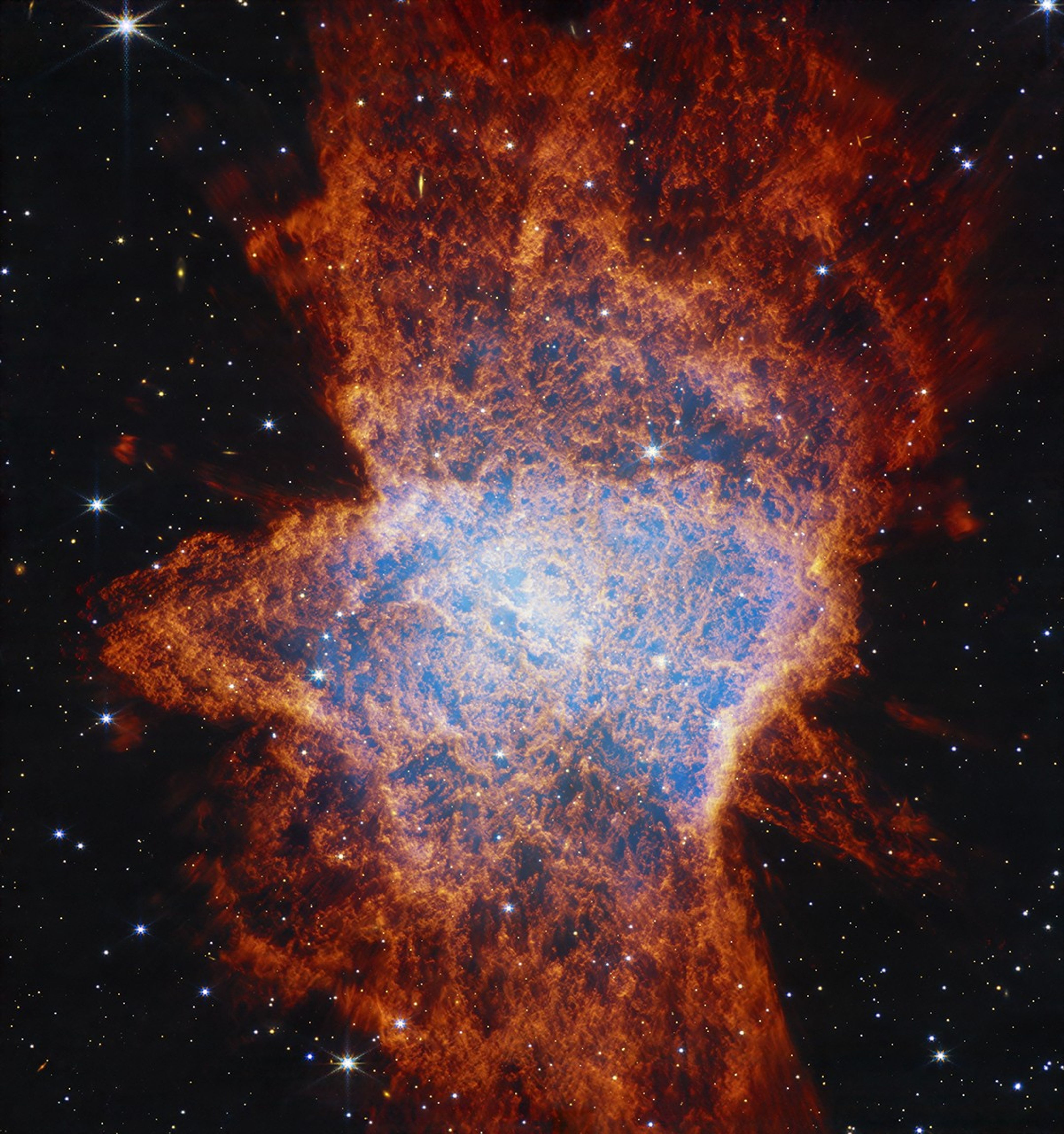
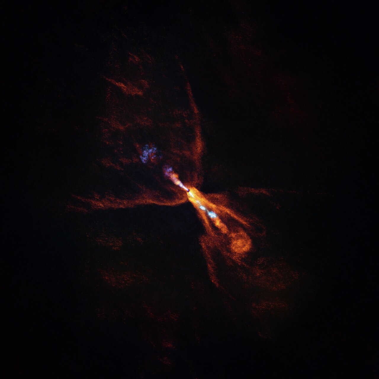
Cool image time! The picture to the right, reduced and sharpened to post here, was released today by the science team of the Webb Space Telescope, showing the planetary nebula NGC 6072 in infrared false color.
This particular image was one of two taken by Webb, and looked at the nebula in the near infrared.
[I]t’s readily apparent that this nebula is multi-polar. This means there are several different elliptical outflows jetting out either way from the center, one from 11 o’clock to 5 o’clock, another from 1 o’clock to 7 o’clock, and possibly a third from 12 o’clock to 6 o’clock. The outflows may compress material as they go, resulting in a disk seen perpendicular to it. Astronomers say this is evidence that there are likely at least two stars at the center of this scene. Specifically, a companion star is interacting with an aging star that had already begun to shed some of its outer layers of gas and dust.
The central region of the planetary nebula glows from the hot stellar core, seen as a light blue hue in near-infrared light. The dark orange material, which is made up of gas and dust, follows pockets or open areas that appear dark blue. This clumpiness could be created when dense molecular clouds formed while being shielded from hot radiation from the central star. There could also be a time element at play. Over thousands of years, inner fast winds could be ploughing through the halo cast off from the main star when it first started to lose mass.
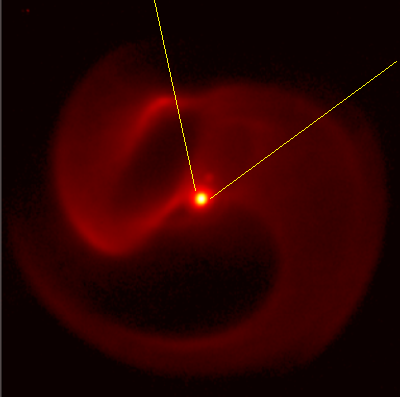
The second image, taken in the mid-infrared, shows expanding dust shells, with some forming an encircling ring around the central nebula.
It is believed that the two stars at the center of this nebula act to churn the expanding material to form this complex shape. Imagine them functioning almost like the blades in a blender.

