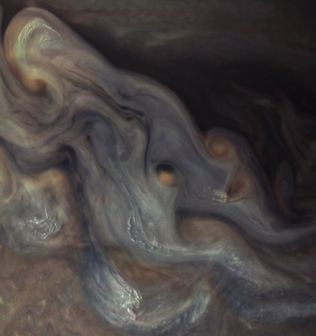
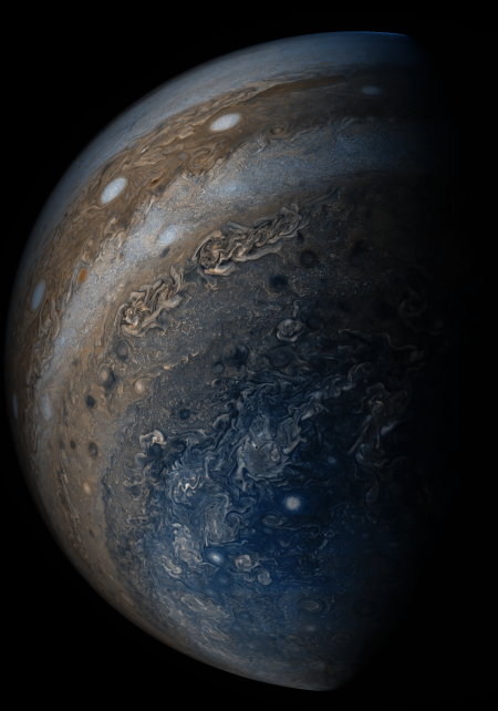
Layers upon layers of Martian volcanic ash

Layers upon layers of Martian volcanic ash
Click for full image.

Today’s cool image provides I think a hint at the vast amount of time that has passed on Mars, allowing uncounted major events to occur which each lay down a bit of the geological history, a history that is now piled up on the surface so deeply that it will take decades of research to untangle it.

The photo to the right, cropped and reduced to post here, was taken on December 23, 2020 by the high resolution camera on Mars Reconnaissance Orbiter (MRO). It shows the layered nature of the Medusae Fossae Formation, the largest volcanic ash deposit on Mars (about the land area of India) and thought by some to be the source of most of the dust across the entire red planet.
» Read more

0 comments

Scientists: Mars is losing water seasonally through its atmosphere

The uncertainty of science: Two new studies using data Europe’s Trace Gas Orbiter and Mars Express orbiters have found that Mars is losing water seasonally through its atmosphere.

The studies also found that global dust storms accelerate the process.

Anna and colleagues found that water vapour remained confined to below 60 km when Mars was far from the Sun but extended up to 90 km in altitude when Mars was closest to the Sun. Across a full orbit, the distance between the Sun and the Red Planet ranges from 207 million to 249 million km.

Near the Sun, the warmer temperatures and more intensive circulation in the atmosphere prevented water from freezing out at a certain altitude. โ€œThen, the upper atmosphere becomes moistened and saturated with water, explaining why water escape rates speed up during this season โ€“ water is carried higher, aiding its escape to space,โ€ adds Anna.

In years when Mars experienced a global dust storm the upper atmosphere became even wetter, accumulating water in excess at altitudes of over 80 km.

But wait, didn’t planetary scientists just announce that Mars hasn’t lost its water through the atmosphere, but instead lost it when it became chemical trapped in the planet’s soil? Yup, they did, but that was a model based on new ground data. This new result is based on atmospheric data.

Or to put it another way, the model was incomplete. While it could be true that a large bulk of Mars’ water is trapped chemically in the ground, that is not proven, only hypothesized. What has been proven, and is now confirmed by these two studies, is that, depending on weather and season, the water of Mars does leak into its upper atmosphere where it can escape into space, never to return.

What remains unknown is how much water escaped into space, and when. Moreover, the ground-based model could still be right, even if it is true that Mars is losing water through its atmosphere. At the moment the data is too incomplete to answer these questions with any certainty.

Meanwhile, this press release once again gives the false impression that the only water left on Mars is at its poles (and in this case, only the south pole). This is not accurate, based on numerous studies finding evidence of buried ice and glaciers everywhere on the planet down to the 30th latitude, in both the north and south hemispheres. Mars might have far less water now than it did billions of years ago, but it still has plenty, and that water is not found only at the poles.

2 comments

A data-based broad look at the entire COVID epidemic, one year later

The Scream by Edvard Munch

One year ago I posted an essay entitled COVID-19: the unwarranted panic. At that time we had just begun a “15-day-lockdown” to slow the spread of the virus, a lockdown that has ended up lasting a year with literally no signs of ending, even though vaccines for the coronavirus are now available and are being administrated widely to millions.

In that essay I reviewed four early science studies that provided some solid initial data about the coronavirus, all of which strongly suggested that it was not the plague many government healthy officials at that time were proclaiming it to be. Instead, these studies showed that it was only a threat to the elderly sick, that it was relatively harmless to a young population, and that the death rate was low, likely well below 1% and possibly very comparable to the flu.

These data strongly suggested to me that lockdowns, social distancing, masks, and restrictions on the freedom of the healthy and young were all a bad idea. Better to follow the traditional response to past such epidemics in which you quarantine the sick, protect the vulnerable (the elderly), and allow everyone else to go about their lives as normal.

We did not do this, however. Instead, as a society we chose in the past year to do the exact oppose, imposing strict lockdowns, mandating social distancing and mask use everywhere, while quarantining the healthy. We did this based on the worst scenarios and models put forth by health officials, who firmly believed COVID-19 was far worse than any past epidemic, and required a new, radical, and much harsher response.

I now want to ask, one year later: Whose conclusions about the seriousness of COVID-19 were more accurate? Was it just another type of flu, though maybe somewhat worse, as I posited, or was it the deadly pestilence predicted by the world’s health authorities?
» Read more

22 comments

Twisted and tilted bedrock in Martian crater

tilted strata in Martin Crater
Click for full image.

Cool image time! The photo to the right, rotated cropped, and reduced to post here, is only a small example of the strangely tilted and twisted strata in the central peak region of 38-mile-wide Martin Crater on Mars. The full image shows more.

The picture was taken on January 12, 2021 by the high resolution camera on Mars Reconnaissance Orbiter (MRO). The section I’ve cropped out shows a series of stratified strata that are are not only significantly tipped from the horizontal, but have also been bent and deformed.

The crater itself is located about 260 miles south of Valles Marineris, as shown on the overview map below.
» Read more

2 comments

Perseverance dumps debris shield in preparation for Ingenuity deployment

Dumped debris shield under Perseverance
Click for full image.

On March 21st the Perseverance engineering team released the debris shield that had been attached to the bottom of the rover to protect the Ingenuity helicopter during its journey to Mars, and thus began the deployment process for releasing the helicopter itself.

The photo to the right, cropped and reduced to post here, shows that debris shield on the ground. The rover will next drive away from this spot and find the flat area where the helicopter will be placed on the ground for its April flight.

9 comments

Yutu-2 & Chang’e-4 complete 28th lunar day on Moon

The new colonial movement: China’s lunar rover Yutu-2 and its lander Chang’e-4 have successfully completed their 28th lunar day on the far side of the Moon, and have been placed in hibernation for the long lunar night.

According to this article from China’s state-run press, Yutu-2 has now traveled 683 meters (2,241 feet) since its landing. In the past two lunar days the rover has traveled about 180 feet, continuing its journey to the northwest away from Chang’e-5. Their pace continues to be about 80 to 100 feet per lunar day.

0 comments

A visit to Cydonia on Mars

Strange geology in Cydonia on Mars
Click for full image.

Cool image time! The Cydonia region on Mars, located at around 30-40 degrees north latitude in the northern lowland plains just beyond the transition zone up to the southern cratered highlands, is well known to many on Earth because it was here that the Viking-1 orbiter took a picture of a mesa that, because of the sun angle, made its shadows resemble a face. Thus was born the “Face on Mars” that consumed the shallow-minded among us — and thus the culture, media, and Hollywood — absurdly for decades, until Mars Global Surveyor took the first high resolution image and proved without doubt what was really obvious from the beginning, that it was nothing more than a mesa.

Cydonia however remains a very intriguing region of Mars, mostly because it is home to a lot of strange geology, as shown by the photo to the right, rotated, cropped, and reduced to post here. Taken on January 16, 2021 by the high resolution camera on Mars Reconnaissance Orbiter (MRO), it shows some of that strange and inexplicable geology.

While Cydonia is inside that 30-60 degree latitude band where MRO has imaged numerous glacial-type features, I do not know if many such features have been found there. Except for the pits and depressions in the photo’s lower right — which suggest decay in an ice sheet — little else at first glance in the picture clearly invokes any of the obvious glacial features one comes to expect. There appear to be what might be lobate flows in the image’s center going from the west to the east, but if they are glacial, they are so decayed to as leave much doubt.

The overview image below shows where Cydonia is on Mars, and helps explain partly what is found here.
» Read more

6 comments

Volcanic badlands on Mars

Volcanic badlands on Mars
Click for full image.

Cool image time! The photo to the right, cropped and reduced to post here, was taken on January 29, 2021 by the high resolution camera on Mars Reconnaissance Orbiter (MRO). It shows a particularly ugly region of rough terrain located about 900 miles to the southwest of the giant volcano Arsia Mons, the southernmost of the chain of three giant volcanoes between Olympus Mons and Valles Marineris. The picture sits inside the floor of a very old and degraded 185-mile-wide crater dubbed Koval’sky.

The section I cropped out was picked at random, because the entire full image looked like this. Though only a handful of images have been taken of the floor of Koval’sky Crater by MRO’s high resolution camera, all show similar rough terrain. In June 2017 the MRO science team posted one of those few such photos with the following caption:
» Read more

4 comments

NASA confident Webb will launch in October

In a briefing held yesterday, NASA officials — in summarizing the status of the James Webb Space Telescope — stated they were presently confident that its launch will take place in October this year, as presently planned.

[Eric Smith, JWST program scientist> said the program is dealing with one new technical issue. Two communications transponders suffered separate problems during testing in January. Engineers have tracked down the problems with the two units and started repairs this week. โ€œThose boxes will be back in time for us to make our planned shipping date,โ€ he said.

That issue, he acknowledged, will use some of the remaining schedule margin. โ€œThe plan right now is that weโ€™ll get them back in time so that we donโ€™t have to use all of it,โ€ he said. โ€œThatโ€™s the main thing that weโ€™re watching regarding the margin.โ€

If launched in October, Webb will only be a decade behind schedule and a mere 20 times over budget, having been initially proposed to launch in 2011 for a cost of $500 million. Instead, it will cost about $10 billion.

The article also notes that the Biden administration might change the telescope’s name because Webb as a bureaucrat early in his career apparently publicly opposed homosexual rights. Such opinions can no longer be allowed, and anyone who has them must be blackballed as quickly as possible.

No matter. Webb was merely NASA’s administrator through almost its entire first decade, leading the agency in its triumph over the Soviets in the race to the Moon. Such achievements cannot be honored as they illustrate the past greatness of America. Moreover, Webb was a white man, and this makes him totally unqualified to receive any laurels. Today’s modern America hates itself and all white men.

The article also notes a variety of issues that will cause more delays of the new big astronomy boondoggle at NASA, the Roman Space Telescope. They say its launch will likely be delayed to 2026 because of the Wuhan flu panic. I predict this is only a foretaste. Expect many more delays and budget overruns, probably pushing its launch into the 2030s.

But no matter. What is really important is that this new boondoggle is named for a woman!

11 comments

SpaceX narrows Mars landing site for Starship to four prime locations

The prime and secondary Martian landing sites for Starship

Capitalism in space: During this week’s 52nd Lunar and Planetary Science Conference, one poster [pdf] caught my eye as something significant. It was titled “SpaceX Starship Landing Sites on Mars.” The map to the right is figure 1 from that poster, annotated slightly by me based my earlier stories about SpaceX’s use of the high resolution camera on Mars Reconnaissance Orbiter (MRO) to research potential Martian landing sites for its Starship spacecraft. The stars indicate MRO images, most of which were described and linked to in my last major post about this SpaceX effort in November 2019.

The red spots covering some stars are the big story: SpaceX has narrowed its choice for its Starship landing site to four prime locations (indicated by the bright red spots) and three backup locations (indicated by the dark red spots). The images under the red spots numbered 2, 4, and 6 were linked to in my November 2019 post. The images under red spots marked by a “D” are earlier images taken by MRO when SpaceX was researching a potential Dragon landing site. The images under red spots labeled 1P and MRO are subsequent images taken by MRO since November 2019, with the 1P image previously linked to in a post in April 2020 entitled “The icy Phlegra Mountains: Marsโ€™ future second city.”

The poster outlined why the prime candidate sites — PM1, EM16, AP1, and AP9 — were favored. For example, PM-1 in the Phlegra Mountains “…has the lowest latitude and elevation of the group, a clear association with LDAs [lobate debris aprons that resemble glacial features], well developed polygons, and has the highest SWIM [Subsurface Water Ice Mapping] score for geomorphic indicators of ice.”

EM 16 “…has a clear association with an LDA with nearby brain terrain and the strongest radar return for shallow ice and the highest combined SWIM score.”

AP1 “…appears to be the safest site and has a moderate combined SWIM score for ice.”

AP9 “…has the thickest ice from radar returns and geomorphology indicating shallow ice. It has the highest combined SWIM score for ice, but appears slightly rocky and rough.”

Below the fold are images, rotated, cropped, and reduced to post here, of the four primary landing sites, as well as links to the full images of all four plus the three back-up sites (AP8, EM15, and PM7).
» Read more

15 comments

The changing seasons of Saturn

Saturn changing
Click for full image.

Images of Saturn taken by the Hubble Space Telescope since 2018 now reveal the slow seasonal changes to the gas giant’s atmosphere during its lengthy year, twenty-nine Earth years long.

The Hubble data show that from 2018 to 2020 the equator got 5 to 10 percent brighter, and the winds changed slightly. In 2018, winds measured near the equator were about 1,000 miles per hour (roughly 1,600 kilometers per hour), higher than those measured by NASAโ€™s Cassini spacecraft during 2004-2009, when they were about 800 miles per hour (roughly 1,300 kilometers per hour). In 2019 and 2020 they decreased back to the Cassini speeds. Saturnโ€™s winds also vary with altitude, so the change in measured speeds could possibly mean the clouds in 2018 were around 37 miles (about 60 kilometers) deeper than those measured during the Cassini mission. Further observations are needed to tell which is happening.

The photo above shows Saturn’s northern hemisphere in 2018, 2019, and 2020. Note how the darker region at the pole grows with time.

This data supplements the data obtained by Cassini when it was in orbit around Saturn, and is presently the best information we can get since the Cassini mission ended.

0 comments

A drainage channel on Mars

A drainage channel on Mars
Click for full image.

Today’s cool image from Mars highlights what is probably the biggest geological conundrum the red planet presents for planetary scientists. The photo to the right, rotated, cropped, and reduced to post here, was taken on February 1, 2021 by the high resolution camera on Mars Reconnaissance Orbiter (MRO). Though I have cropped it, I have cropped out very little, because the entire meandering drainage valley is its most interesting feature, and that takes up almost the entire image.

The photo was simply labeled by the camera team a “terrain sample northwest of Sytinskaya Crater”, so I suspect this was taken not in connection with any specific research but because they must use the camera at a regular intervals to maintain its temperature, and when they have gaps in their schedule they try to pick spots of interest in areas that have not had many high resolution photos taken. In this case however I suspect the location choice was very far from random, as they clearly wanted to capture this drainage system, in its entirety.

I called this merely a drainage channel without indicating what caused the channel, be it liquid water, ice, or wind, because in this case that is a main question. At first glance an Earthman will immediately suspect water, which is what scientists supposed for the last half century. The problem with that conclusion is that the Martian atmosphere is too cold and thin for liquid water to exist on its surface, and though there seems to be plenty of evidence that liquid water once existed there, no scientist has yet come up with a completely accepted climate model that allows for such conditions in anytime in Mars’ past.

The rover Opportunity found that some channels it explored might have been carved by wind, though to our human eyes it seems unlikely that a meandering tributary system such as this could have been carved by wind. The possibility however must not be dismissed out of hand, since Mars is an alien planet and alien things (to Earth) happen there.

The overview map below might provide some context.
» Read more

0 comments
1 237 238 239 240 241 729