
Astronomers discover a star radiating in X-rays and radio in ways that fit no known explanation
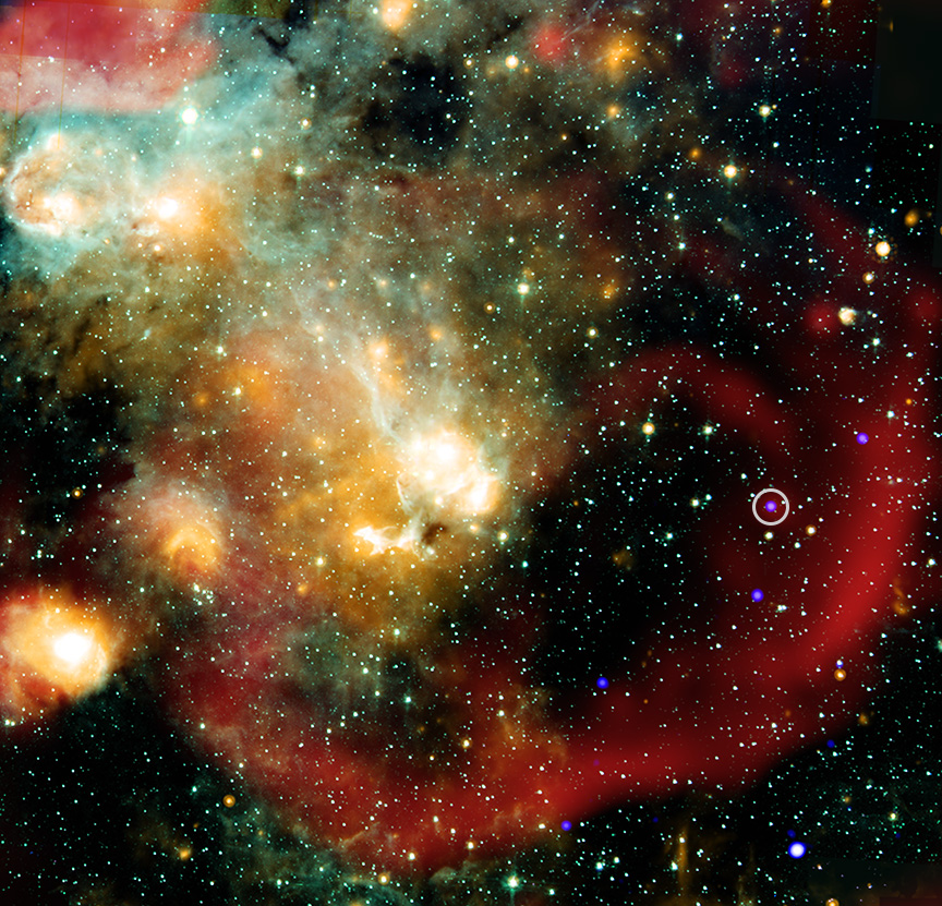
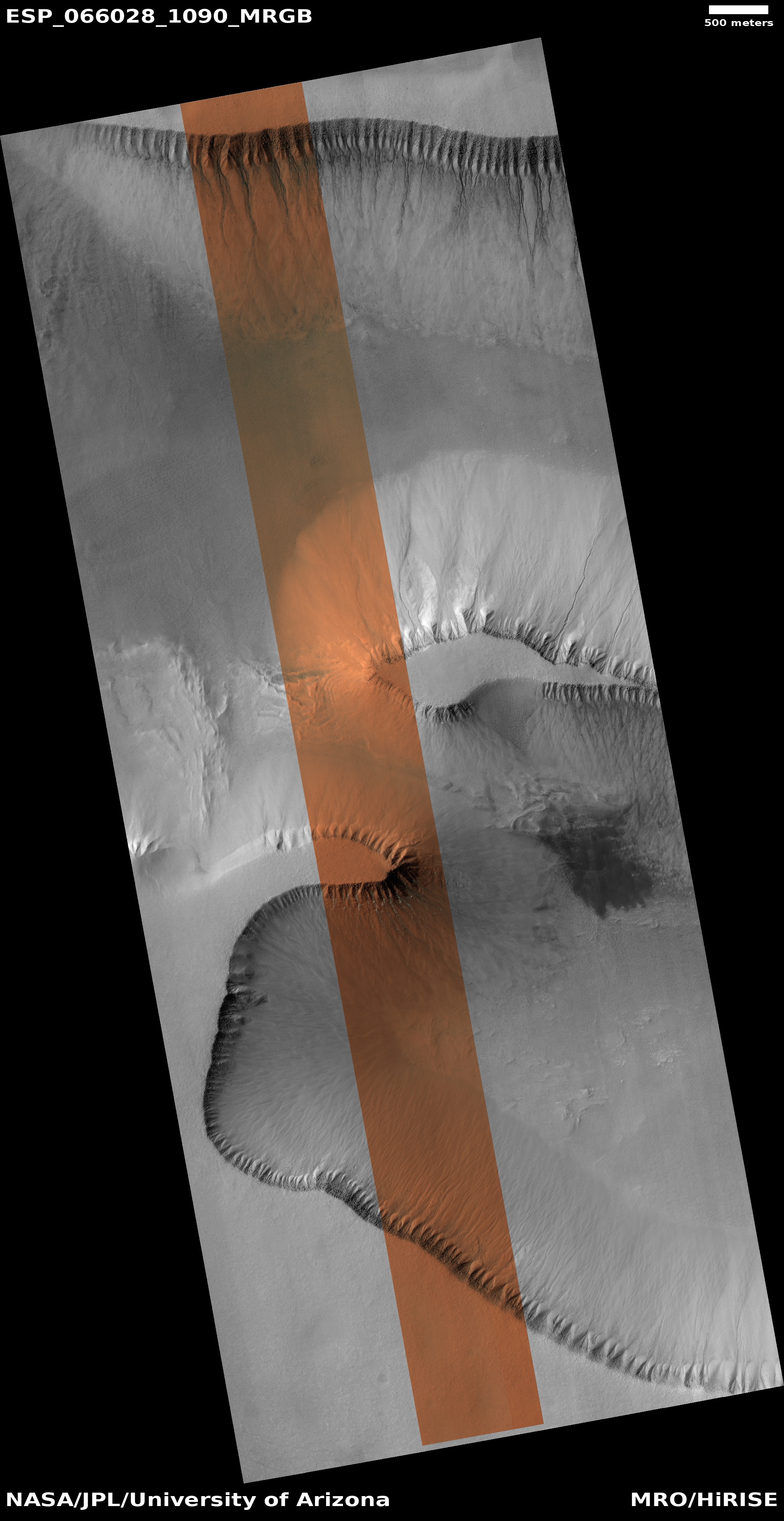
ASKAP J1832 circled. Note the red arc denoting
the supernovae remnant. Click for original image.
Using both the Chandra X-Ray Observatory and the Square Kilometer Array in Australia, astronomers have discovered a star that pulses in both X-rays and and radio frequencies in a manner previously unseen and that fit no known theory.
ASKAP J1832 belongs to a class of objects called “long period radio transients,” discovered in 2022, that vary in radio wave intensity in a regular way over tens of minutes. This is thousands of times longer than the length of the repeated variations seen in pulsars, which are rapidly spinning neutron stars that have repeated variations multiple times a second. ASKAP J1832 cycles in radio wave intensity every 44 minutes, placing it into this category of long period radio transients.
Using Chandra, the team discovered that ASKAP J1832 is also regularly varying in X-rays every 44 minutes. This is the first time that such an X-ray signal has been found in a long period radio transient.
…However, that is not all ASKAP J1832 does. Using Chandra and the SKA Pathfinder, the team found that ASKAP J1832 also dropped off in X-rays and radio waves dramatically over the course of six months. This combination of the 44-minute cycle in X-rays and radio waves in addition to the months-long changes is unlike anything astronomers have seen in the Milky Way galaxy.
The false-color X-ray/radio image to the right shows the star (circled). Based on the data, it is unlikely that the star is a neutron star or a pulsar. Its properties also do not fit with a magnetar (a pulsar with a very strong magnetic field). Though located within a supernova remnant, the astronomers determined this to be a coincidence, the star unrelated to the remnant.
The best explanation so far is that this is a white dwarf with a companion and the strongest magnetic field ever conceived. The astronomers however do not appear enthused by that explanation either.


