Eta Carina, in focus, after 1993 repair mission
As part of its celebration of the telescope’s 35th anniversary, NASA on April 25, 2025 re-released what it called 27 key images from the history of the Hubble Space Telescope.
More than half the images are historical, showing the telescope’s conception by astrophysicist Lyman Spitzer, its construction, its launch in 1990, and its repair in 1993 of its faulty optics. The subsequent sharp astronomical images include only a few of Hubble’s most famous and significant later photographs, including the first Hubble Deep Field, the Hourglass planetary nebula, and the Pillars of Creation snapshot.
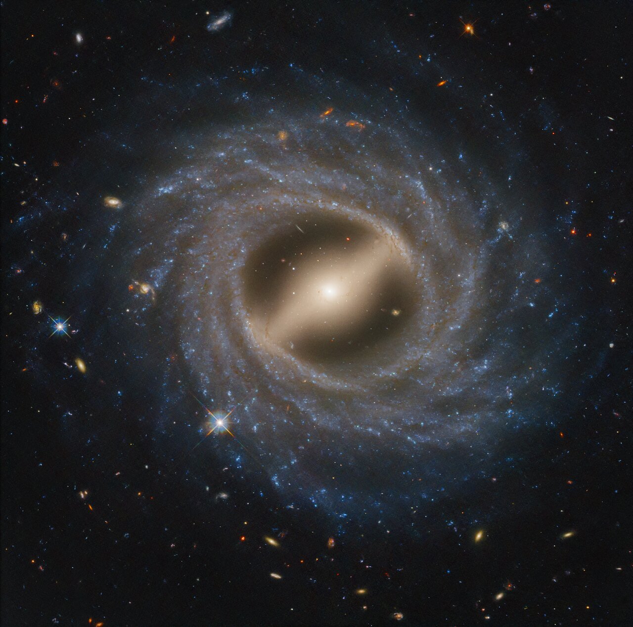
What NASA did not include in this collection however was without doubt to those alive at the time after Hubble was finally repaired its most historically significant photo. That picture is to the right. It shows the exploding star Eta Carina as taken by Hubble in 1993 right after its repair.
For the very first time, we had a telescope above the Earth’s fuzzy atmosphere capable of taking sharp in-focus images of the mysteries of the heavens. And for the first time, we could see in this star its actual nature. It wasn’t simply surrounded by a pretty cloud — as all previous ground-based images had suggested — that cloud was formed by eruptions from the star itself. Those earlier eruptions, which had occurred in the previous century, had spewed from the star’s poles, forming two bi-polar clouds that were expanding away from the star most dramatically.
In the three decades since astronomers have used Hubble and its later upgraded cameras to track those expanding clouds, with the most recent photo taken in 2019. Hubble has shown that such massive heavenly objects are not static, but evolving, and with the right high resolution telescopes in space we can track that evolution, in real time.
At the moment no comparable replacement of Hubble is planned, or even on the drawing board. The Einstein space telescope, just launched, will provide magnificent optical images at a slight lower resolution. So will China’s planned Xuntian space telescope, set for launch in 2027. Neither however matches Hubble’s capabilities.
And Hubble is now long past its original lifespan of fifteen years. Though engineers say it is in good shape, this is not true. It presently has only two trustworthy working gyroscopes. To extend its lift, the telescope is operated on only one gyroscope, with a second held back in reserve. When these go, however, so will Hubble.
Meanwhile, the astronomy community continues to put most of its energy in building giant ground-based telescopes that not only cannot match Hubble but are threatened by the coming wave of new communication constellations. Do they rethink their approach and shift to orbital astronomy?
Nah. Instead, the astronomical community demands new powers to to ban those constellations!
Of all people, one would think astronomers more than anyone else would not put their head in the sand. But that’s what they continue to do.