Click for original image.
In the past decade orbital images from Mars have shown unequivocally that the Red Planet is not the dry desert imagined by sci-fi writers for many decades prior to the space age. Nor is it the dry desert that planetary scientists had first concluded based on the first few decades of planetary missions there.
No, what the orbiters Mars Reconnaissance Orbiter (MRO) and Mars Express have clearly shown is that, except for the planet’s equatorial regions below 30 degrees latitude, the Martian surface is almost entirely covered by water ice, though it is almost always buried by a thin layer of protective dust and debris. Getting to that ice will be somewhat trivial, however, as it is almost always near the surface.
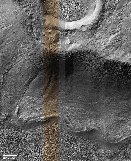
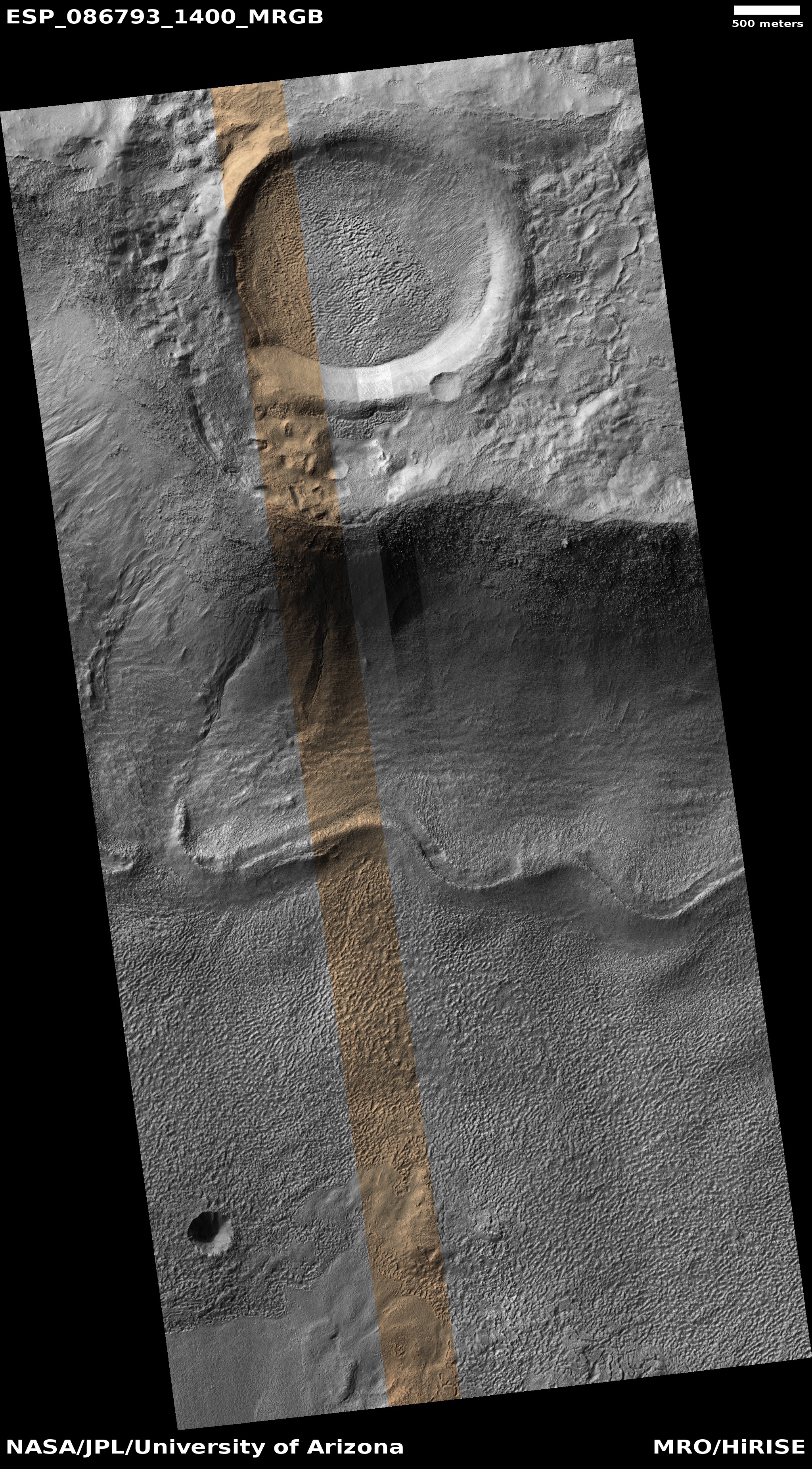
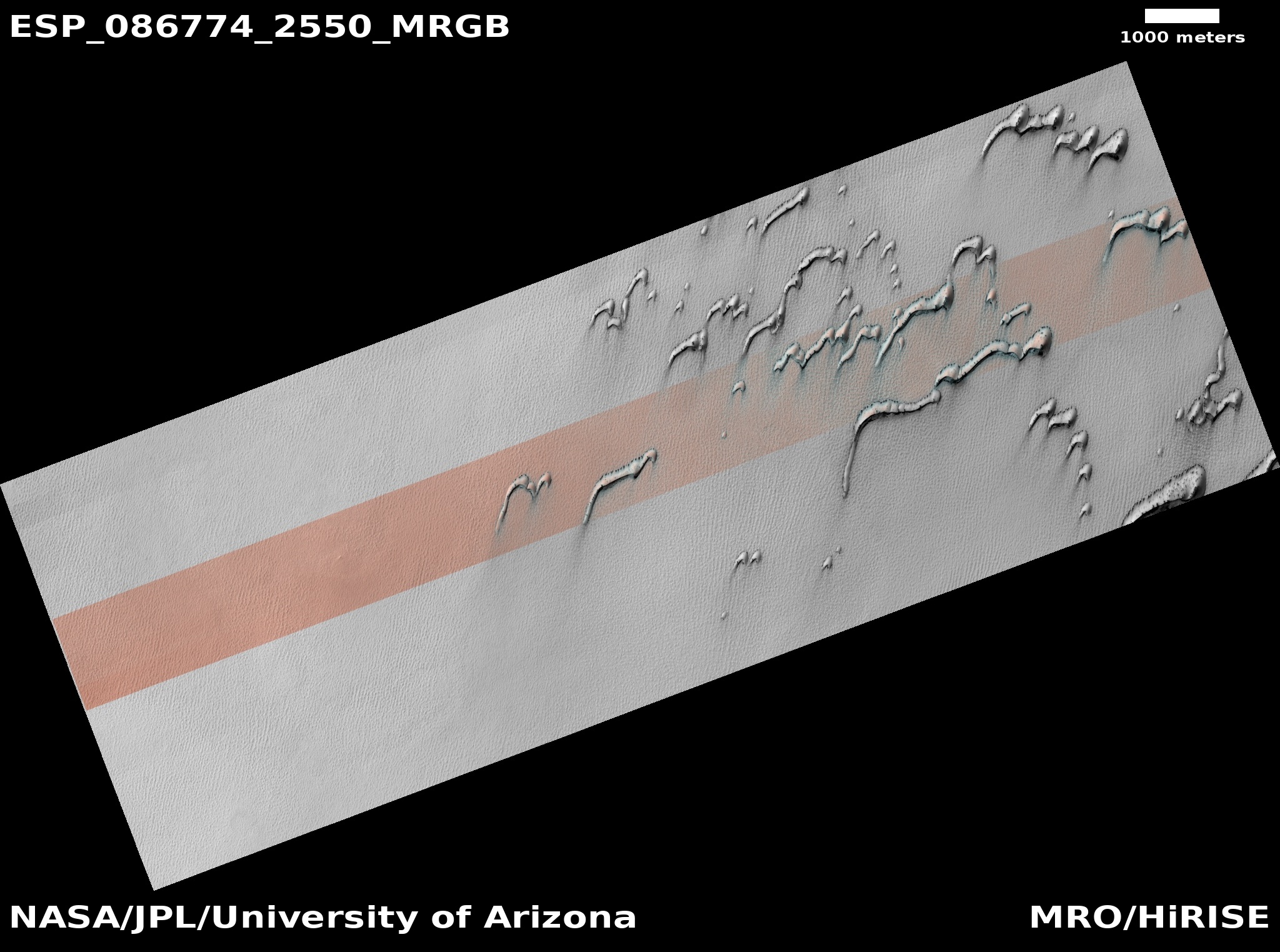
The picture to the right, rotated, cropped, reduced, and sharpened to post here, is a perfect example. It was taken on January 31, 2025 by the high resolution camera on MRO. At the top it shows part of a small glacial-filled crater surrounded by blobby ground clearly impregnated with ice. That crater in turn sits on the rim of a much larger very-eroded ancient 53-mile-wide crater whose floor, also filled with glacial debris, can be seen at the bottom of this picture. The wavy ridge line at the base of the rim appears to be a moraine formed by the ebb and flow of the glacial ice that fills this larger crater.
None of these glacial features is particularly unique on Mars. I have been documenting their presence now at Behind the Black for more than six years. Yet, I find still that most news organizations — including many in the space community — remain utterly unaware of these revelations. Any new NASA or university press release that mentions the near-surface ice that covers about two-thirds of the planet’s surface results in news stories claiming “Water has been found on Mars!”, as if this is a shocking new fact from a place where little water is found.
It is very shameful that so many reporters and news organizations are so far out of touch with the actual state of the research on Mars.
» Read more


