
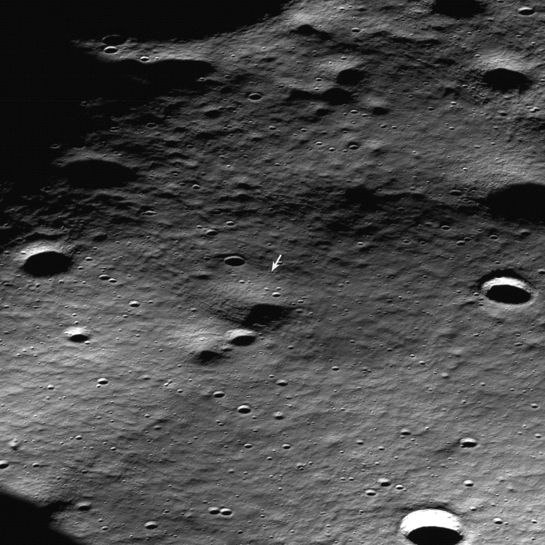
Athena located from lunar orbit
Click for original master image.
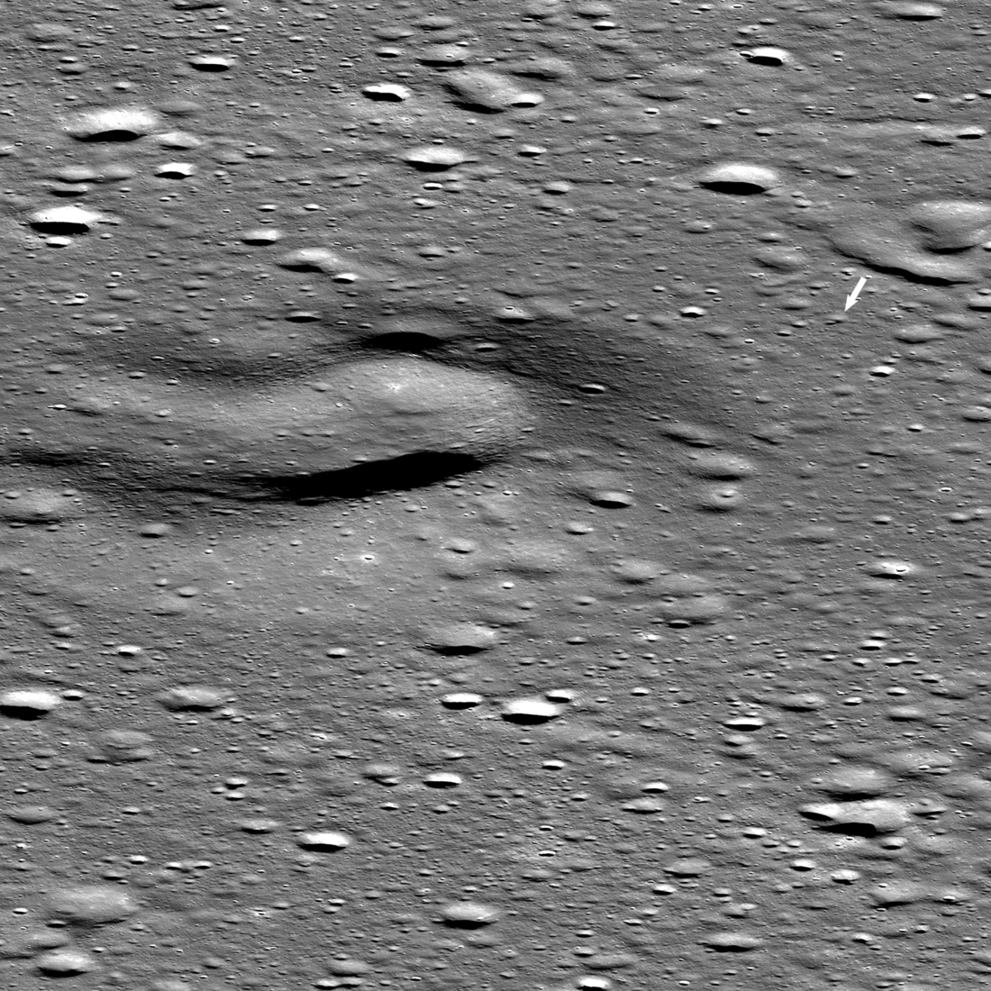
Using Lunar Reconnaissance Orbiter (LRO), scientists have now located and photographed Intuitive Machines lunar lander Athena where it sits on its side on the Moon.
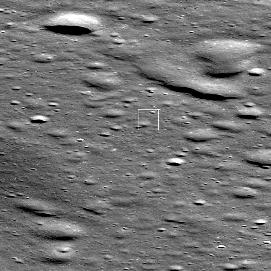
The picture to the right, reduced to post here, shows that location with the small arrow. This is definitely on Mons Mouton, the intended landing zone about 100 miles from the Moon’s south pole. However at the best magnification provided by the LRO science team, the rover is not visible. Reader James Fincannon was puzzled by this and downloaded the highest resolution version of this image and sent it to me. I have added it to the picture as the inset. Athena is the little white dot in the center of a small 65-foot-wide crater. Note that its shadow falls in the opposite direction of all the shadows in the craters, as the lander projects upward from the surface while the craters descend downward.
One can’t help questioning the quality of the lander’s landing software, if it ended up picking the center of this small crater to touch down, especially considering there appear to be large relatively clear flat areas all around.


