SLIM lowers orbit in preparation for January 19, 2024 lunar landing
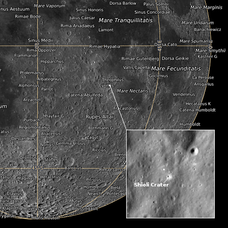
Map showing SLIM landing zone on the Moon.
Click for interactive map.
The Japanese unmanned lunar lander SLIM, in orbit around the Moon since December 25, 2023, has now lowered its orbit in preparation for its lunar landing attempt, now scheduled for tomorrow, January 19, 2024, with operations beginning at 10:00 am (Eastern).
The image to the right indicates the targeted landing area near Shioli Crater. The mission’s prime engineering goal is to demonstrate precise robotic landing technology, able to land a spacecraft softly on another planet within a target zone less than 300 feet across. If successful it is expected to survive for about two weeks, studying the surface below it with a multi-spectral camera but also releasing two test probes, one a hopping rover and the second a rolling spherical rover. Both carry their own science instruments.
I have embedded the live stream for tomorrow’s landing below.
» Read more