
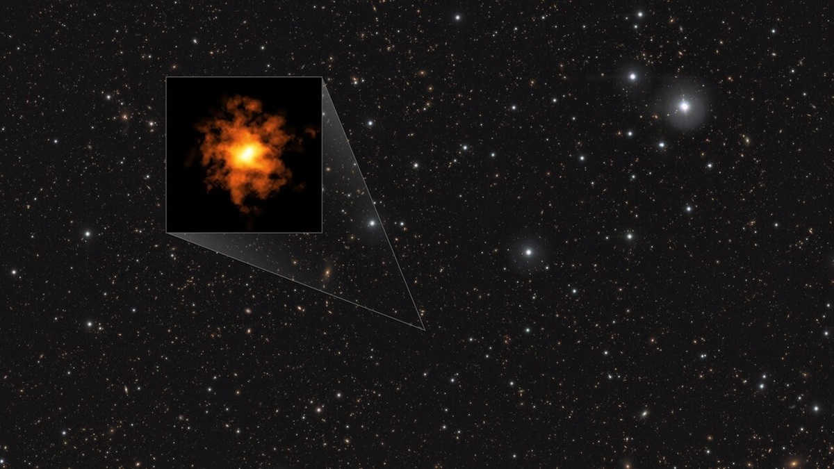
A water sprinkler in space
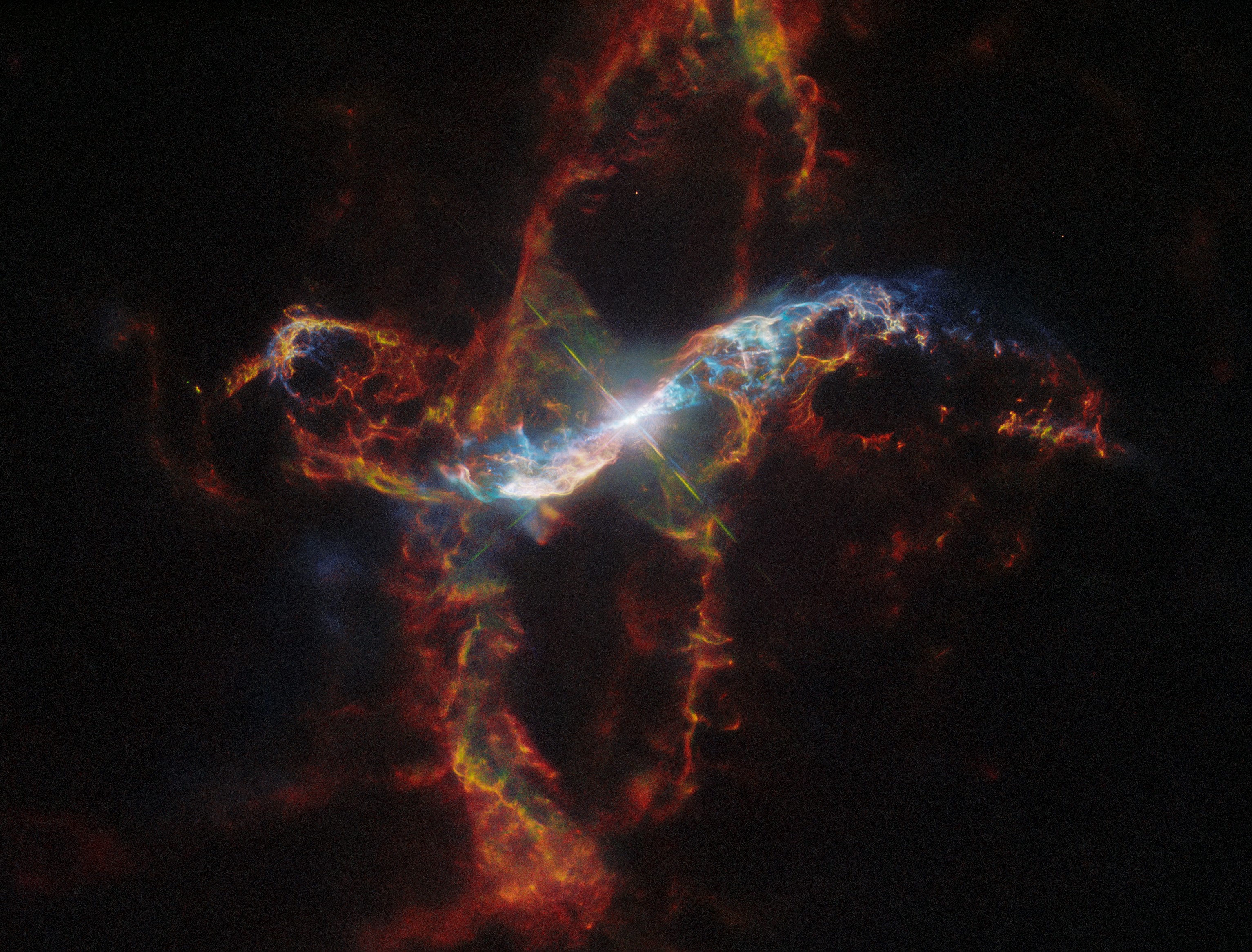
Cool image time! The picture to the right, cropped, reduced, and sharpened to post here, was taken by the Hubble Space Telescope as part of a long term program to monitor changes in the R Aquarii binary star system, located about 700 light years away.
R Aquarii belongs to a class of double stars called symbiotic stars. The primary star is an aging red giant and its companion is a compact burned-out star known as a white dwarf. The red giant primary star is classified as a Mira variable that is over 400 times larger than our Sun. The bloated monster star pulsates, changes temperature, and varies in brightness by a factor of 750 times over a roughly 390-day period. At its peak the star is blinding at nearly 5,000 times our Sun’s brightness.
When the white dwarf star swings closest to the red giant along its 44-year orbital period, it gravitationally siphons off hydrogen gas. This material accumulates on the dwarf star’s surface until it undergoes spontaneous nuclear fusion, making that surface explode like a gigantic hydrogen bomb. After the outburst, the fueling cycle begins again.
This outburst ejects geyser-like filaments shooting out from the core, forming weird loops and trails as the plasma emerges in streamers. The plasma is twisted by the force of the explosion and channeled upwards and outwards by strong magnetic fields. The outflow appears to bend back on itself into a spiral pattern. The plasma is shooting into space over 1 million miles per hour – fast enough to travel from Earth to the Moon in 15 minutes! The filaments are glowing in visible light because they are energized by blistering radiation from the stellar duo.
The press release likens these filaments to the spray thrown out by a water sprinkler, and I must say that’s an apt description.
Since 2014 scientists have taken regular pictures of R Aquarii, and found that the central structures have been changing in a perceptible manner, despite their gigantic size. Below is a movie created from five photos taken from 2014 to 2023.
» Read more


