
Curiosity looks up Gediz Vallis as it starts its journey out
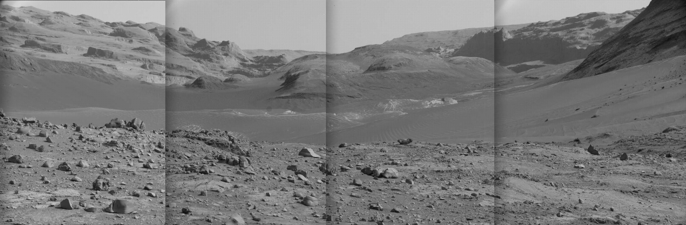 Curiosity panorama looking south on July 16, 2024. Click for high resolution. Go here, here, here, and here
for original images.
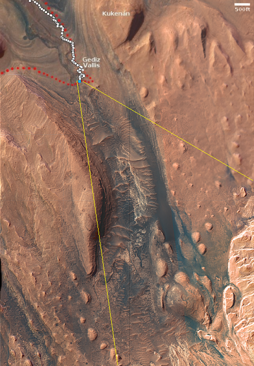
Click for interactive map.
Even as the Curiosity science team is beginning the rover’s journey out of the giant Martian slot canyon Gediz Vallis, they have on July 16, 2024 used its high resolution camera to gather a new mosaic of the surrounding terrain. I have used four of those images (available here, here, here, and here) to create a panorama, as shown above, focusing on the view looking south up into Gediz Vallis. Make sure you click on the image to see the full resolution version.
The overview map to the right provides the context. The blue dot marks Curiousity’s present position. The yellow lines indicate the approximate area covered by the panorama. The white dotted line indicates Curiosity’s actual traveled route, while the red dotted line the planned route.
The peak of Mount Sharp is directly ahead in this panorama, out of sight and about 26 miles away and 16,000 feet higher up. To get a sense of how far away that remains, note that Curiosity in its dozen years of exploration on Mars has so far traveled just under 20 miles and climbed about 2,500 feet.
The plan is to back track downhill and circle around the nose of the western wall of Gediz Vallis and head south in a parallel canyon that is believed to provide easier traveling for Curiosity’s damaged wheels.


