The highest point on Mars

The highest point on Mars
Click for full image.

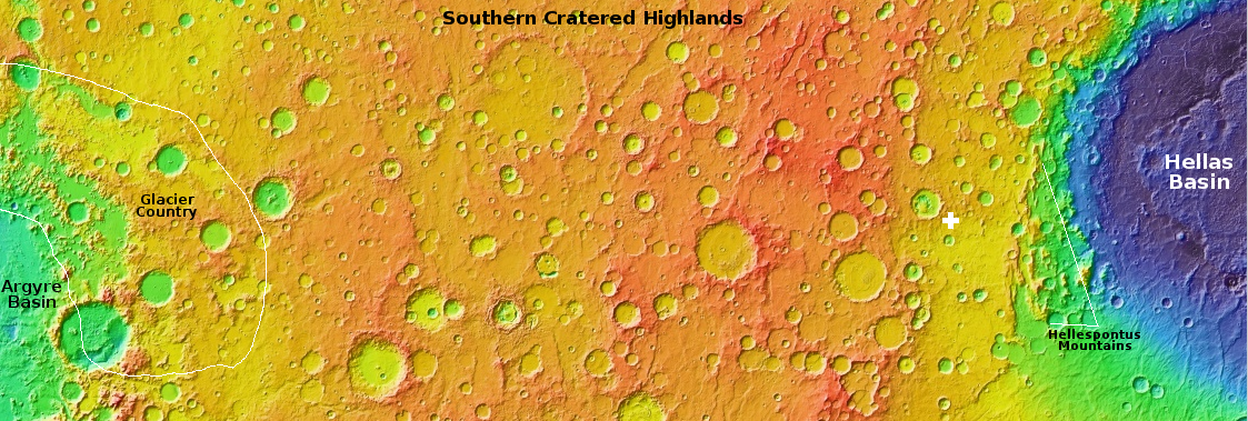
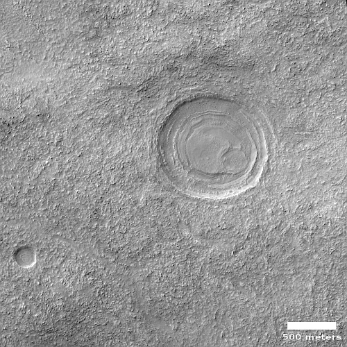
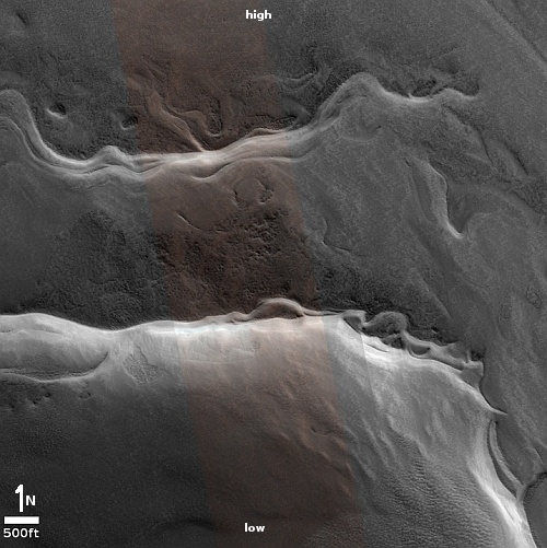
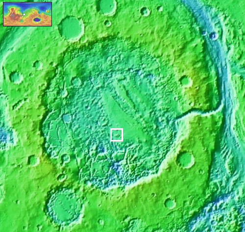
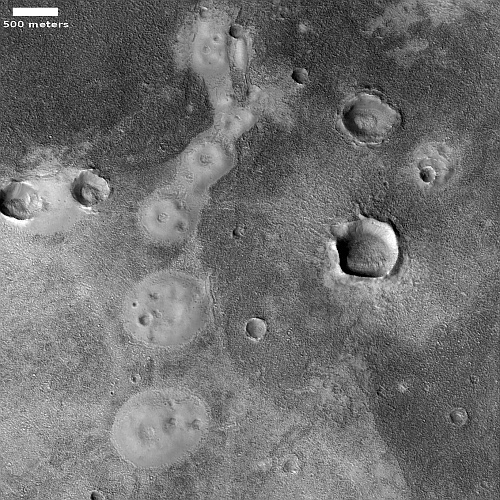
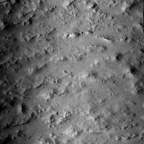
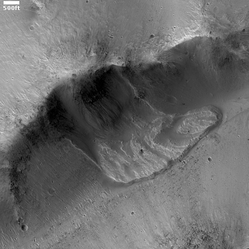
Today’s cool image is cool not because of anything visible within it, but because of its location. The picture to the right, cropped to post here, was taken on May 27, 2022 by the high resolution camera on Mars Reconnaissance Orbiter (MRO). While the terrain shown is a relatively featureless plain of craters and gullies not unlike the surface of the Moon, what we are really looking at is the peak of Mars’ tallest mountain, Olympus Mons.

That’s right, this spot on Mars sits about 70,000 feet above Mars’ mean “sea level”, the elevation scientists have chosen as the average elevation on Mars from its center. At 70,000 feet, this peak is more than twice as high as Mount Everest on Earth.

Yet you wouldn’t really know you are at this height if you stood there. The scale of this mountain is so large that this peak, which actually forms the southern rim of the volcano’s 50 to 60 mile wide caldera, is actually relatively flat. If you stood here, you would not see the vast distant terrain far below. Instead, you’d see an ordinary horizon line in the near distance only slightly lower than where you stand.
» Read more

Today’s blacklisted American: Scientists questioning Big Bang theory protest censorship of their work

Webb's first deep field image
Nothing in Webb’s first deep field image shall be questioned, by anyone!

While the blacklisting described in today’s column has little to do with left vs right politics, it demonstrates clearly that the desire to silence dissent is now culturally pervasive across many fields. In science it has become especially toxic, as this story clearly shows:

Twenty-four astronomers and physicists from ten countries have signed a petition protesting the censorship of papers that are critical of the Big Bang Hypothesis by the open pre-print website arXiv. Run by Cornell University, arXiv is supposed to provide an open public forum for researchers to exchange pre-publication papers, without peer-review. But during June, 2022, arXiv rejected for publication on the website three papers by Dr. Riccardo Scarpa, Instituto de Astrofisica de Canarias, and Eric J. Lerner, LPPFusion, Inc. which are critical of the validity of the Big Bang hypothesis.

…[quoting the petition] “Without judging the scientific validity of the papers, it is clear to us that these papers are both original and substantive and are of interest to all those concerned with the current crisis in cosmology. It plainly appears that arXiv has refused publication to these papers only because of their conclusions, which both provide specific predictions relevant to forthcoming observations and challenge LCDM cosmology [the standard dark matter/dark energy Big Bang hypothesis]. Such censorship is anathema to scientific discourse and to the possibility of scientific advance.

“We strongly urge that arXiv maintain its long-standing practice of being an “open-access archive” of non-peer reviewed “scholarly articles” and not violate that worthy practice by imposing any censorship. Instead, we encourage arXiv to abide by its own principles, and publish these three papers and others like them that clearly provide ‘sufficient original or substantive scholarly research’ results and are of obvious great interest to the arXiv audience.”

Lerner and Scarpa had attempted to get their papers published in a peer review journal and had been stymied, apparently because the topic of their paper was inappropriate for that journal. They then decided to publish on arXiv, which has for almost three decades been open to the publication of all scientific papers written by credentialed scientists, as noted at the website:
» Read more

More Webb images released

Southern Ring Nebula, as taken by Webb
Click for full image.

As planned, NASA this morning released four new science images from the James Webb Space Telescope, in addition to the deep field image released yesterday.

All are spectacular, with each producing new information not previously observed. To see the Stephen’s Quintet image go here. For the exoplanet data, showing the presence of water in its atmosphere, go here. For the Carina nebula image, go here.

The image to the right, reduced to post here, shows the Southern Ring Nebula as taken by two Webb cameras in different infrared wavelengths. From the press release:

Two stars, which are locked in a tight orbit, shape the local landscape. Webb’s infrared images feature new details in this complex system. The stars – and their layers of light – are prominent in the image from Webb’s Near-Infrared Camera (NIRCam) [at the top], while the image from Webb’s Mid-Infrared Instrument (MIRI) on the [bottom] shows for the first time that the second star is surrounded by dust. The brighter star is in an earlier stage of its stellar evolution and will probably eject its own planetary nebula in the future.

In the meantime, the brighter star influences the nebula’s appearance. As the pair continues to orbit one another, they “stir the pot” of gas and dust, causing asymmetrical patterns.

Because this is an infrared image, the colors are not natural, but were assigned based on the slightly different infrared wavelengths produced by the object’s different features. From the image’s webpage:

Several filters were used to sample narrow and broad wavelength ranges. The color results from assigning different hues (colors) to each monochromatic (grayscale) image associated with an individual filter.

Eventually astronomers will use Webb to look at many astronomical objects that Hubble has been observing for the past thirty years, adding a high resolution infrared view that will add to Hubble’s views.

First science image released from Webb

Webb's first deep field image
Click for original image.

The first science image from the James Webb Space Telescope has now been unveiled.

That image is to the right, reduced to post here. From the press release:

Known as Webb’s First Deep Field, this image of galaxy cluster SMACS 0723 is overflowing with detail. Thousands of galaxies – including the faintest objects ever observed in the infrared – have appeared in Webb’s view for the first time. This slice of the vast universe covers a patch of sky approximately the size of a grain of sand held at arm’s length by someone on the ground.

This deep field, taken by Webb’s Near-Infrared Camera (NIRCam), is a composite made from images at different wavelengths, totaling 12.5 hours – achieving depths at infrared wavelengths beyond the Hubble Space Telescope’s deepest fields, which took weeks.

The image shows the galaxy cluster SMACS 0723 as it appeared 4.6 billion years ago. The combined mass of this galaxy cluster acts as a gravitational lens, magnifying much more distant galaxies behind it. Webb’s NIRCam has brought those distant galaxies into sharp focus – they have tiny, faint structures that have never been seen before, including star clusters and diffuse features.

The smeared concentric arrangement of many reddish objects surrounding the picture’s center strongly suggests we are seeing distortion by the gravity of this galaxy cluster.

While nothing in this image appears at first glance to be different than many earlier Hubble images, it looks at objects in the infrared that are much farther away than anything ever seen before, farther than Hubble in the optical could see. To understand the new discoveries hidden in such an image will likely take several years of further research. For example, before astronomers can understand what this image shows they need to determine the red shift of each galaxy, thus roughly determining its distance and the overall 3D structure of the objects visible. Moreover, the consequences of the gravitational lensing must be unpacked.

The White House briefing itself was somewhat embarrassing to watch, as Vice President Kamala Harris, President Joe Biden, and NASA administrator Bill Nelson all struggled to explain what this image shows, and failed miserably. Moreover, the briefing had technical problems, started very late, and it appeared that Bill Nelson especially had no idea what he was looking at. The briefing also ended very abruptly when it shifted to reporters’ questions.

Collapse pits on Mars

Elongated collapse pit on Mars
Click for full image.

Cool image time! The photo to the right, cropped to post here, was taken on May 21, 2022 and was today’s picture of the day from the high resolution camera on Mars Reconnaissance Orbiter (MRO). Dubbed “An Elongated Collapse Pit” by the science team, their caption explains:

This observation can help to tell whether or not there is a subterranean connection to this pit. As an added bonus, the much smaller depression to its south also appears to be another collapse pit.

This image had already been in my queue for a future cool image post, but since the scientists have posted it, it is time that I did as well.

In the inset I have brightened the image drastically to try to illuminate the darkest spots in both pits. The elongated pit appears to slope downward towards a hole in the southeast corner, while the interior of the second pit to the south remains completely dark. Both appear to suggest a void below that both reach.

The wider context image and overview map below shows that there is further evidence of more voids in this region of Mars, dubbed Ceraunius Fossae, because of its many north-south parallel fissures.
» Read more
More lacy Martian rocks

lacy Martian rock
Click for full image.

Cool image time! Because the Curiosity team is presently conducting a drilling campaign at its present position in the lower mountains of Gale Crater, the rover has not moved in the past few weeks. At these times, the science team also has the rover’s other cameras do extensive surveys of the surrounding terrain, including high resolution mosaics by its high resolution camera.

To the right is one photo from the most recent mosaic, cropped to post here. It was taken on July 10, 2022, and shows one many layered rock on the ground near the rover. Though no scale is provided, I suspect the extended flake from this rock is somewhere between six to twelve inches long.

Another illustration of the alien nature of Mars. This flake could not exist on Earth, where the heavier gravity and atmosphere would have acted to break it.

Biden to unveil first Webb science image today

This should be entertaining: NASA today announced that the unveiling of the first science image from the James Webb Space Telescope has been moved up to later today, so that President Joe Biden can do the unveiling from the White House. From the NASA tweet:

We can’t contain the excitement for @NASAWebb’s first full-color images!

On Monday, July 11 at 5pm ET (21:00 UTC), President Biden will unveil one of the space telescope’s first images of deep space as a preview of what’s ahead.

It appears that the picture Biden will use in this photo op will be the only deep field cosmological picture scheduled for release:

SMACS 0723: Massive foreground galaxy clusters magnify and distort the light of objects behind them, permitting a deep field view into both the extremely distant and intrinsically faint galaxy populations.

The remaining four images will still be released on July 12, 2022, as originally planned.

The live stream of this event will be broadcast on NASA TV.

A galaxy with swirling arms

A galaxy with swirling arms
Click for full image.

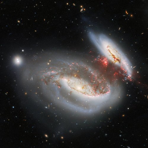
Cool image time! The picture to the right, cropped and reduced to post here, was released yesterday by the science team that operates the Hubble Space Telescope. It captures a galaxy about 520 million light years away that appears to have been reshaped due to a galaxy merger.

That merger somehow distorted the disk of the inner galaxy, the brightest area, while also producing two sweeping spiral streams in the surrounding periphery.

Despite its unusual shape, astronomers did not choose to study this galaxy. From the caption:

This observation is a gem from the Galaxy Zoo project, a citizen science project involving hundreds of thousands of volunteers from around the world who classified galaxies to help scientists solve a problem of astronomical proportions: how to sort through the vast amounts of data generated by telescopes. A public vote selected the most astronomically intriguing objects for follow-up observations with Hubble. CGCG 396-2 is one such object, imaged here by Hubble’s Advanced Camera for Surveys.

The colorful layers of the Martian north pole icecap

Colorful layers in the Martian north pole ice cap
Click for full image.

Wider view
Click for full image.

Today’s cool image above, rotated, reduced, and annotated to post here, comes from today’s picture of the day for the high resolution camera on Mars Reconnaissance Orbiter (MRO), which in turn is a retrospective of a captioned image first taken in 2010. The photo to the right, rotated, cropped, and reduced to post here, shows a larger area to provide some context. For this image north is towards the top. The rectangle indicates the area covered by the picture above.

The ice cap at the north pole is about 600 miles across and a little less than 7,000 feet deep, made up of many layers that are a mixture of water ice and cemented dust and sand. From the picture’s caption:

In many locations erosion has created scarps and troughs that expose this layering. The tan colored layers are the dusty water ice of the polar layered deposits; however a section of bluish layers is visible below them. These bluish layers contain sand-sized rock fragments that likely formed a large polar dunefield before the overlying dusty ice was deposited.

The lack of a polar ice cap in this past epoch attests to the variability of the Martian climate, which undergoes larger changes over time than that of the Earth.

The overview map below provides some further context.
» Read more

NASA announces the targets picked for Webb’s first science images

NASA today announced the astronomical targets scientists have chosen for the first infrared science images taken by the James Webb Space Telescope which will be unveiled on July 12, 2022.

  • Carina Nebula. The Carina Nebula is one of the largest and brightest nebulae in the sky, located approximately 7,600 light-years away in the southern constellation Carina. Nebulae are stellar nurseries where stars form. The Carina Nebula is home to many massive stars, several times larger than the Sun.
  • WASP-96 b (spectrum). WASP-96 b is a giant planet outside our solar system, composed mainly of gas. The planet, located nearly 1,150 light-years from Earth, orbits its star every 3.4 days. It has about half the mass of Jupiter, and its discovery was announced in 2014.
  • Southern Ring Nebula. The Southern Ring, or “Eight-Burst” nebula, is a planetary nebula – an expanding cloud of gas, surrounding a dying star. It is nearly half a light-year in diameter and is located approximately 2,000 light years away from Earth.
  • Stephan’s Quintet: About 290 million light-years away, Stephan’s Quintet is located in the constellation Pegasus. It is notable for being the first compact galaxy group ever discovered in 1877. Four of the five galaxies within the quintet are locked in a cosmic dance of repeated close encounters.
  • SMACS 0723: Massive foreground galaxy clusters magnify and distort the light of objects behind them, permitting a deep field view into both the extremely distant and intrinsically faint galaxy populations.

That only the last image is focused on distant deep space cosmology, the scientific research that Webb’s infrared instruments are optimized for suggests that NASA wishes to highlight the telescope’s other observational possibilities.

The images will be released one by one during a press conference beginning at 10:30 am (Eastern) on July 12th. It is once again important to note that though the images are likely to be spectacular, they will be false color infrared images measuring the heat produced by the objects, not optical images that we could see with our eyes.

OSIRIS-REx’s sample grab at Bennu in 2020 proved the rubble-pile asteroid has far less cohesion than predicted

The post touchdown crater on Bennu

The OSIRIS-REx science team, using data gathered during the spacecraft’s sample grab at Bennu in 2020, has determined that the rubble-pile asteroid has far less cohesion than predicted, with its rubble behaving less like a solid object and more like the playground ball-pits found in amusement parks.

After analyzing data gathered when NASA’s OSIRIS-REx spacecraft collected a sample from asteroid Bennu in October 2020, scientists have learned something astonishing: The spacecraft would have sunk into Bennu had it not fired its thrusters to back away immediately after it grabbed dust and rock from the asteroid’s surface.

It turns out that the particles making up Bennu’s exterior are so loosely packed and lightly bound to each other that if a person were to step onto Bennu they would feel very little resistance, as if stepping into a pit of plastic balls that are popular play areas for kids.

The image above shows what the touch down crater looked like after the sample grab, taken from the video that was part of the press release. The false colors indicate the depth changes produced by the touch down. The final crater was 26 feet across and more than two feet in depth, far larger than expected. Moreover, the energy from the spacecraft’s thrusters as it lifted off had increased the size of that crater further, by about 40%.

These results about the asteroid’s lack of cohesion match the earlier results studying a different impact crater on Bennu.

From the rim to the floor of Valles Marineris

Overview map

From the rim to the floor of Valles Marineris
Click for full image.

For today’s cool Martian image, we begin from afar and zoom in. The overview map above shows the solar system’s largest canyon, Valles Marineris, 1,500 miles long, and 400 miles wide at its widest. The white dot on the north rim of the section of the canyon dubbed Melas marks the location of the photo to the right, rotated, cropped and reduced to post here and taken on January 28, 2011 by the wide angle context camera on Mars Reconnaissance Orbiter (MRO).

I have added elevation numbers to this picture to give it some understandable scale. From the rim to the interior canyon floor — a distance of about ten miles — the canyon wall drops about 19,000 feet. Compare this with Bright Angel Trail in the Grand Canyon, which from the rim to the Colorado River drops about 4,400 feet in about the same distance. The wall of Valles Marineris is about four times steeper.

Even that doesn’t give you the full scale. Having hiked down to that interior canyon floor, you are still about 10,000 feet above Valles Marineris’s main canyon floor, with fifteen more miles of hiking to go to reach it.

The white rectangle marks the area covered by the MRO high resolution image below.
» Read more

Today’s blacklisted American: Thomas Jefferson and other important American historical figures banned by Cleveland school authorities

Thomas Jefferson banned in Cleveland
Thomas Jefferson, banned by Cleveland school officials

The modern dark age: Officials of Cleveland Metropolitan Schools have decided that its schools cannot be named after Thomas Jefferson and Patrick Henry because these great Americans — who trail-blazed the fight for individual freedom — had also owned slaves.

Guidelines implemented by the district last year with the urging of the Cleveland City Council require that schools not be named after people who have a documented history of enslaving other humans.

The district also prohibits naming schools for those who have actively participated in the institution of slavery, systemic racism, the oppression of people of color, women, or other minority groups, or who have been a member of a supremacist organization.

The two schools are now named after a black Democratic Party politician and a former school official. In our new dark age, these relatively minor individuals are now considered more important than two giants who made it possible to found the first country on Earth dedicated to freedom and individual liberty where the people were sovereign and the government was only their servant.
» Read more

CAPSTONE completes mid-course correction

Engineers at Advanced Space today successfully completed CAPSTONE’s first mid-course correction, following a quick investigation that determined why communications with the probe was lost for almost a full day.

The communications blackout was apparently due to software issues and human error.

During [in-flight] commissioning of NASA’s CAPSTONE (short for Cislunar Autonomous Positioning System Technology Operations and Navigation Experiment) spacecraft, the Deep Space Network team noted inconsistent ranging data. While investigating this, the spacecraft operations team attempted to access diagnostic data on the spacecraft’s radio and sent an improperly formatted command that made the radio inoperable. The spacecraft fault detection system should have immediately rebooted the radio but did not because of a fault in the spacecraft flight software.

CAPSTONE’s autonomous flight software system eventually cleared the fault and brought the spacecraft back into communication with the ground, allowing the team to implement recovery procedures and begin commanding the spacecraft again.

All looks good for a November 13, 2022 arrival in lunar orbit.

Scientists: Impacts on rubble-pile asteroid are different than on planets

Landslide on Bennu from impact
Click for full image.

Using data collected by OSIRIS-REx at the asteriod Bennu, scientists have determined that the ejecta from impacts on a rubble-pile asteroid behaves in a very different manner than on planets with higher gravity.

Instead of flying away at about the same speed as the impactor and escaping into space, as expected in the weak gravity, the material is lifted up at a very slow speed, falls back down, and then rolls downhill like a landslide. The graphic to the right from the press release, reduced and enhanced to post here, illustrates what the scientists think happened when one of Bennu’s larger craters was created.

[M]ost of that material, called ejecta, returned to the surface and slid down the face of the asteroid, starting a wide avalanche that slowly rolled toward Bennu’s equator. Perry said the only way this could happen on a small object like Bennu, which is less than 500 meters (1,640 feet) in diameter and has low gravity, is if the dust had low or next to no cohesion.

“Because Bennu is so small, its escape velocity is less than a few tenths of a mile per hour, so any particle ejected faster than that would leave the surface,” he said. “These slow speeds are possible only if Bennu’s surface is weaker than we thought, even weaker than very loose, dry sand. This extremely low surface strength also means material on a slope is easily disturbed, and that’s what led to the landslide.”

In other words, the low cohesion prevents the impact’s energy from being transferred efficiently to the asteroid’s particles. They move, but only slowly, and thus end up sliding away more or less along the asteroid’s surface.

This discovery helps explain how these rubble-pile asteroids accumulate material, despite their low gravity.

Having regained communications with CAPSTONE, engineers prepare for first mid-course burn

Engineers are now preparing CAPSTONE for its first first mid-course engine burn, slightly late due to a loss of communications during the past two days.

The spacecraft is in good health and functioning properly.

The CAPSTONE team is still actively working to fully establish the root cause of the issue. Ground-based testing suggests the issue was triggered during commissioning activities of the communications system. The team will continue to evaluate the data leading up to the communications issue and monitor CAPSTONE’s status.

If all goes well, that engine burn will occur as early as 11:30 am (Eastern) on July 7th.

How did sand dunes get to the top of a Martian mesa?

Sand dunes at the top of a Martian mountain
Click for full image.

Cool image time! The photo to the right, cropped and reduced to post here, was taken on January 1, 2022 by the high resolution camera on Mars Reconnaissance Orbiter (MRO) and shows one of the peaks of a 5,000+ foot high mesa inside Juventai Chasma, one of Mars’ deep mostly-enclosed chasms north of Valles Marineris.

I grabbed this picture because its label, “Bedform Change Detection in Juventae Chasma”, suggested something had changed from past photos, probably related to the sand dunes that hug the upper slopes of this peak. Unfortunately, in comparing this image with the earliest high-res image taken by MRO back in February 2018, I could not spot any change, probably because the resolution of the pictures released is not as high as MRO’s raw images.

However, the caption written for that 2018 image tells us where that change has likely occurred:

This image reveals a unique situation where this small dune field occurs along the summit of the large 1-mile-tall [mesa] near the center of Juventae Chasma. The layered [mesa] slopes are far too steep for dunes to climb, and bedform sand is unlikely to come from purely airborne material. Instead, the mound’s summit displays several dark-toned, mantled deposits that are adjacent to the dunes and appear to be eroding into fans of sandy material.

In other words, somewhere in the full resolution image scientists have spotted a change in the bedform sands that make-up these high mountain dunes that hug the peak. Since the data so far has suggested that the source for the sand of these high elevation dunes likely comes from the mesa itself — not from any distant source — any change found will help confirm or disprove that hypothesis.

The white box indicates the area covered by the close-up higher resolution picture below. Also below is an overview map, showing both the location of this mountain in Juventai Chasma as well as Juventai’s location relative to Valles Marineris.
» Read more
Engineers propose flying gliders on Mars

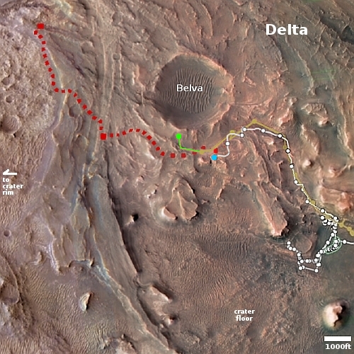
Proposed sailplane flights in Valles Marineris
Proposed sailplane flights in Valles Marineris. Click for full image.

Engineers at the University of Arizona are developing a prototype sailplane that they think could fly for long distances on Mars at higher altitudes than a helicopter and not be reliant on solar batteries.

Using dynamic soaring, the sailplane utilises increases in horizontal wind speed with gaining altitude to continue flying long distances. It’s the same process albatrosses use to fly long distances without flapping their wings and expending crucial energy.

After lifting themselves up into fast, high-altitude air, albatrosses then turn their bodies to descend rapidly into regions of slower, low-altitude air. With the force of gravity providing downward acceleration, the albatross uses this momentum to slingshot itself back to higher altitudes. Continuously repeating this process enables albatross and other seabird species to cover thousands of kilometres of ocean, flap-free.

It’s the inspiration for the sailplane’s own propulsion system, enabling it to cover the canyons and volcanoes dotted across the red planet currently inaccessible to Mars rovers.

The graphic above, figure 1 from the engineers’ research paper, shows one possible sailplane mission, deploying two gliders, one to observe the canyon wall and a second to survey the canyon floor. Both would become a weather station upon landing. While the paper doesn’t state a Mars location for this concept, the graphic strikes a strong resemblance to the section of Valles Marineris where scientists have recently taken “Mars Helicopter” high resolution images using Mars Reconnaissance Orbiter (MRO). This paper and those images might be related, or they could be illustrating the general interest by many scientists for this Mars’ location.

Regardless, the engineers are now planning test flights at 15,000 feet elevation, an elevation that will most closely simulate the atmosphere of Mars, on Earth.

Engineers lose contact with CAPSTONE on its way to Moon

Shortly after the spacecraft was successfully deployed from its Proton upper stage on yesterday, engineers lost contact with the spacecraft as it headed towards the Moon.

“The spacecraft team currently is working to understand the cause and re-establish contact. The team has good trajectory data for the spacecraft based on the first full and second partial ground station pass with the Deep Space Network,” NASA spokesperson Sarah Frazier wrote in an emailed statement today (July 5).

“If needed, the mission has enough fuel to delay the initial post-separation trajectory correction maneuver for several days,” Frazier added. “Additional updates will be provided as soon as possible.”

The spacecraft will not arrive in lunar orbit until November, but along the way it needs to do a number of course corrections. Thus, there is some time pressure to reestablishing communications. That task now falls with the private company Advanced Space, which won a contract to operate the spacecraft for NASA.

UPDATE: More details are provided by the operators of the spacecraft, Advanced Space press, here. Though they canceled a course correction burn today, they apparently have plenty of time to do it, since the probe is already on a course to reach lunar orbit. The burn was simply intended to increase the accuracy of the trajectory.

Scientists: Comet 67P/C-G’s make-up matches the rest of the solar system

A detailed review of the archived data from the Rosetta mission that studied Comet 67P/Churyumov-Gerasimenko closely in 2014-2016 now strongly suggests that the comet’s overall make-up closely matches the rest of the solar system.

“It turned out that, on average, [the comet’s] complex organics budget is identical to the soluble part of meteoritic organic matter”, explains [Nora Hänni of the University of Bern] and adds: “Moreover, apart from the relative amount of hydrogen atoms, the molecular budget of [comet 67P/C-G] also strongly resembles the organic material raining down on Saturn from its innermost ring, as detected by the INMS mass spectrometer onboard NASA’s Cassini spacecraft”.

“We do not only find similarities of the organic reservoirs in the Solar System, but many of [comet 67P/C-G]’s organic molecules are also present in molecular clouds, the birthplaces of new stars”, complements Prof. Dr. Susanne Wampfler, astrophysicist at the Center for Space and Habitability (CSH) at the University of Bern and co-author of the publication. “Our findings are consistent with and support the scenario of a shared presolar origin of the different reservoirs of Solar System organics, confirming that comets indeed carry material from the times long before our Solar System emerged.”

These results are not unexpected, but having those expectations confirmed was one of the main scientific goals of the Rosetta mission. Now, almost a decade later, the results are in.

South Korea ships its first lunar orbiter to U.S. for August launch

The new colonial movement: South Korea today packed and shipped its first lunar orbiter, dubbed Danuri, to the United States for an August 3, 2022 launch on a SpaceX Falcon 9 rocket.

According to the Ministry of Science and ICT, Danuri was sent from the Korea Aerospace Research Institute in Daejeon, 160 kilometers south of Seoul, to Incheon International Airport, west of Seoul, in a specially designed container. The orbiter will be flown to Orlando International Airport and arrive at the Floridian space center Thursday. It will later undergo maintenance, assembly and other pre-launch preparations for about a month before launch.

If all goes right, Danuri will orbit the Moon for a year, both testing its own technology as well as observing the lunar surface.

Sunspot update: For the first time in 2022, sunspot activity eases

With the year half over, the Sun in June did something it had not done since the start of the year: The number of sunspots seen daily on the Sun’s visible hemisphere actually declined from the month before.

I know this because, as I do every month, I have posted below NOAA’s monthly update of its graph tracking the number of sunspots on the Sun’s Earth-facing hemisphere, with some addition details added to provide a larger context.

» Read more
The new damage on Curiosity’s wheels

Comparing a Curiosity wheel from January to June 2022
To see the original images, go here and here.

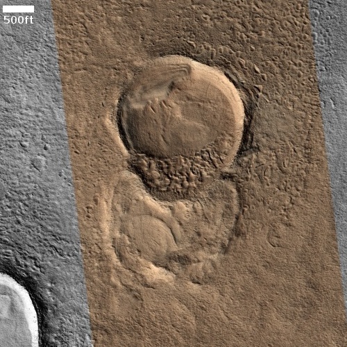
On June 23, 2022 the Curiosity team provided a major update on the rover’s status on Mars, noting that because of new damage discovered on one of wheels, they were increasing the frequency of their wheel checks from once every 1000 meters of travel to once every 500 meters.

The team discovered that the left middle wheel had damaged one of its grousers, the zig-zagging treads along Curiosity’s wheels. This particular wheel already had four broken grousers, so now five of its 19 grousers are broken.

The previously damaged grousers attracted attention online recently because some of the metal “skin” between them appears to have fallen out of the wheel in the past few months, leaving a gap.

The photo comparison to the right might be showing that specific wheel, or not. The top image was taken January 11, 2022, and when compared then with an image taken six months earlier showed little change. Thus, in January 2022 it seemed the wheels were holding up well as Curiosity traveled into the mountains.

The new image at the bottom, taken June 3, 2022, shows new damage (as indicated by the plus sign) which had occurred sometime in the past six months. During that time the rover had attempted to cross the incredibly rough ground of the Greenheugh Pediment, and had been forced to retreat because the ground was too rough.

This most recent wheel survey in June thus confirms that the decision to retreat was a wise one. It appears that while the rover’s wheels can take the general roughness of the terrain in the foothills of Mount Sharp, the Greenheugh Pediment was beyond the wheels’ capabilities.

One of Perseverance’s two wind sensors damaged by wind-blown material

According to the principal investigator for Perseverance’s two wind sensors, one was recently damaged by a wind-blown tiny pebble.

Pebbles carried aloft by strong Red Planet gusts recently damaged one of the wind sensors, but MEDA can still keep track of wind at its landing area in Jezero Crater, albeit with decreased sensitivity, José Antonio Rodriguez Manfredi, principal investigator of MEDA, told Space.com. “Right now, the sensor is diminished in its capabilities, but it still provides speed and direction magnitudes,” Rodriguez Manfredi, a scientist at the Spanish Astrobiology Center in Madrid, wrote in an e-mail. “The whole team is now re-tuning the retrieval procedure to get more accuracy from the undamaged detector readings.”

…Like all instruments on Perseverance, the wind sensor was designed with redundancy and protection in mind, Rodriguez Manfredi noted. “But of course, there is a limit to everything.” And for an instrument like MEDA, the limit is more challenging, since the sensors must be exposed to environmental conditions in order to record wind parameters. But when stronger-than-anticipated winds lifted larger pebbles than expected, the combination resulted in damage to some of the detector elements.

The term “pebble” implies a larger-sized particle than what probably hit the sensor. I suspect the “pebble” was no more than one or two millimeters in diameter, at the most.

Lucy solar panel almost completely open

Engineers have now been able to get the one solar panel that did not deploy completely after launch on the Lucy asteroid probe almost completely open.

From May 6 to June 16, NASA’s Lucy mission team carried out a multi-stage effort intended to further deploy the spacecraft’s unlatched solar array. The team commanded the spacecraft to operate the array’s deployment motor for limited periods of time, allowing them to closely monitor the response of the spacecraft. As a result of this effort, the mission succeeded in further deploying the array and now estimates that the solar array is between 353 degrees and 357 degrees open (out of 360 total degrees for a fully deployed array). Additionally, the array is under substantially more tension, giving it significantly more stabilization. The mission team is increasingly confident the solar array will successfully meet the mission’s needs in its current tensioned and stabilized state.

The spacecraft’s orbit is now moving into a position where communications will be limited until October, so further attempts to completely open the array will have to wait until then.

Strange pitted and isolated ridges on Mars

Context camera image of isolated ridges
Click for full image.

Cool image time! The photo to the right, rotated, cropped, and reduced to post here, was taken on February 17, 2012 by the wide-view context camera on Mars Reconnaissance Orbiter (MRO). It shows a section of the northern lowland plains of Mars, latitude 31 degrees north, where several very inexplicable and isolated ridges can be seen.

One ridge meanders mostly in a north-south direction, while a second instead meanders east-west. The shape of both says that neither has anything to do with any past impact crater. In fact, their random snakelike shape doesn’t really fit any obvious explanation. For example, they do not fit the look of the many fossil rivers found on Mars, where the hardened and dry riverbed channel resists erosion and becomes a ridge when the surrounding terrain erodes away.

What geological process caused them? In the decade since this photo was taken the scientists who use MRO have only been able to snap a handful of high resolution images of these ridges. The image below is the most recent, covering the area in the white rectangle above.
» Read more

New research confirms long term bone loss during long missions in weightlessness

According to new research done on ISS, scientists have confirmed what Soviet-era scientists had learned back in the 20th century, that long term bone loss during long missions in weightlessness can take many months to recover once back on Earth.

The bone density lost by astronauts was equivalent to how much they would shed in several decades if they were back on Earth, said study co-author Dr Steven Boyd, of Canada’s University of Calgary and director of the McCaig Institute for Bone and Joint Health.

The researchers found that the shinbone density of nine of the astronauts had not fully recovered after a year on Earth – and they were still lacking about a decade’s worth of bone mass. The astronauts who went on the longest missions, which ranged from four to seven months on the ISS, were the slowest to recover. “The longer you spend in space, the more bone you lose,” Boyd said.

The study also confirmed that some exercises in space helped to mitigate the bone loss, which ranged from 1% to 2% per month. No exercises prevented it however.

For missions to Mars, the bone loss appears less of an issue than the loss of muscle strength. Even with extensive bone loss after six months to a year in space astronauts do not notice this loss when returning to Earth gravity. They will certainly not notice it on Mars, with a gravity field 39% that of Earth’s.

More concerning is the loss of muscle strength during long missions in weightlessness. After six months to a year in weightlessness astronauts struggle on Earth to walk after first landing. This is why they are helped immediately placed to chairs upon return. On Mars no such help will be available.

Glacial features in a Mars crater at 29 degrees south latitude?

Glacial features in Mars crater
Click for full image.

Cool image time! The photo to the right, cropped and reduced to post here, was taken on January 2, 2022 by the high resolution camera on Mars Reconnaissance Orbiter (MRO). Simply labeled “slope features,” it was likely taken to monitor the gullies and streaks on the interior walls of this 4-mile-wide crater. Scientists have been using MRO to track the coming and going of frost on this crater’s interior walls since 2016.

Equally intriguing however are what appear to be squashed layers within the crater’s interior. These appear to be some form of glacial feature created by repeated climate cycles, similar to the glacial features routinely seen throughout the 30 to 60 degree mid-latitude strips north and south.

What makes the glacial features in this particular crater particularly intriguing is its location, as shown in the overview map below.
» Read more

The utter failure and total evil of government policies during the Wuhan panic

COVID mortality rates among children 10-14 in the UK
COVID mortality rates among children 10-14 in the United Kingdom,
comparing those who got the COVID shots versus those who did not

While stories about the ineffective and harmful consequences of the panic over the Wuhan flu continue to pour in on an almost daily basis, it is often better to step back and see these many stories in aggregate. By looking at the forest from a distance, a clearer picture frequently reveals itself that remains hidden if you only focus on studying the individual trees.

For example, the graph to the right, first published in January 2022, suggests strongly that giving young children the COVID shots only increased their mortality. This is just one story, however. Is it typical, or an outlier? You need to look at the larger picture to know.

Below I list and categorize the many science papers and news stories I have been collecting since my previous detailed two essays in May about the epidemic and its consequences (see: “The evidence keeps pouring in showing the utter failure of all COVID mandates” and “Are the COVID vaccines killing people over time? The data suggests yes.”). The totality of this data does appear shocking, especially because it makes evident the utter failure of almost every policy set by almost every government health official and elected politician since the Wuhan flu arrived in 2020.

First we must take another look at the new research about the mask mandates, policies that decades of research repeatedly showed would do nothing to protect anyone from COVID, and might even be unhealthy.
» Read more

Mirror comparable to Hubble’s ready for JPL balloon astronomy mission

engineers attach panels to the mirror's support structure.
Engineers attach mirror panels to the mirror’s support structure.

An Italian optics company, Media Lario, has now completed construction of the primary mirror — at 2.5 meters width slightly larger than Hubble’s primary mirror — to be used on a JPL balloon astronomy mission dubbed ASTHROS, targeting a December 2023 launch.

The ASTHROS primary mirror features nine panels, which are significantly easier to fabricate than a one-piece mirror. The bulk of the mirror panels consist of lightweight aluminum, formed into a honeycomb structure that reduces its total mass. The panel surfaces are made of nickel and coated with gold, which improves the mirror’s reflectivity at far-infrared wavelengths.

Once launched, the balloon will circle the south pole for up to four weeks, taking data on the gas distribution in several galaxies.

While that data will be worthwhile, the mission’s real goal is to test these technologies for future space-based astronomy missions. If this mission works, it will reduce significantly the cost and time necessary to make big telescope mirrors, while enhancing the robotic capabilities of such telescopes.

1 50 51 52 53 54 271