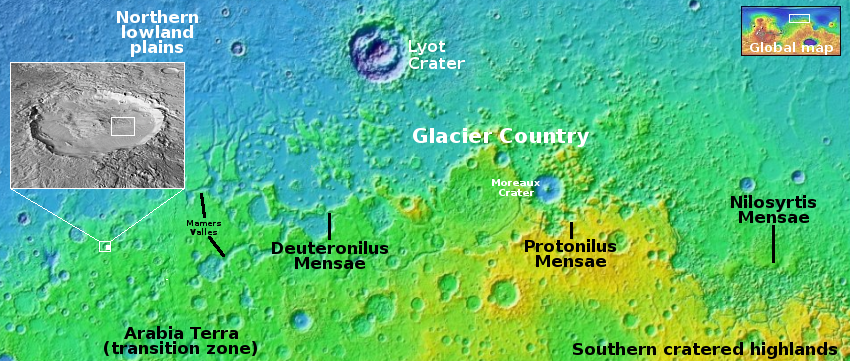
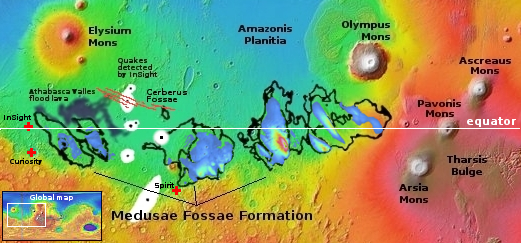
Scientists: Evidence of large deposits of buried ice along Martian equator

Theorized buried ice deposits on Mars
Click for original figure from paper.

Using data obtained from Europe’s Mars Express orbiter, scientists believe they have detected evidence of a very large and extensive deposit of buried ice in the dry Martian equatorial regions, buried within the Medusae Fossae Formation, what is thought to be the largest volcanic ash deposit on Mars.

The blue-to-orange areas inside the Medusae on the map to the right, taken from figure 5 of the paper, shows where they have detected potential buried ice, at depths ranging from one to two thousand feet below the surface. The orange areas indicate the thickest ice deposits, as much as two miles thick. From the paper’s abstract:

The MARSIS radar sounder [on Mars Express] detects echoes in Medusae Fossae Formation deposits that occur between the surface and the base which are interpreted as layers within the deposit like those found in Polar Layered Deposits of the North and South Poles. The subsurface reflectors suggest transitions between mixtures of ice-rich and ice-poor dust analogous to the multi-layered, ice-rich polar deposits.

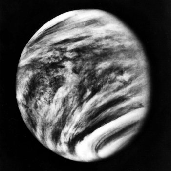
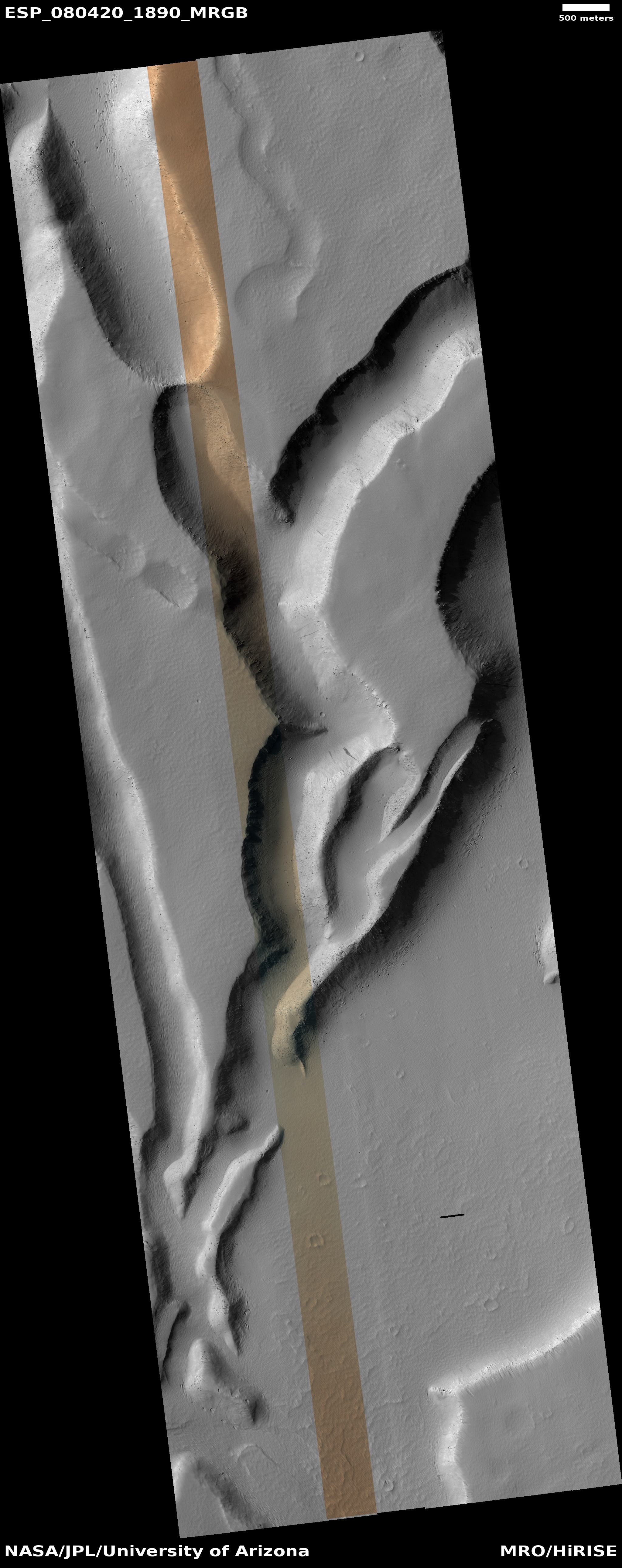
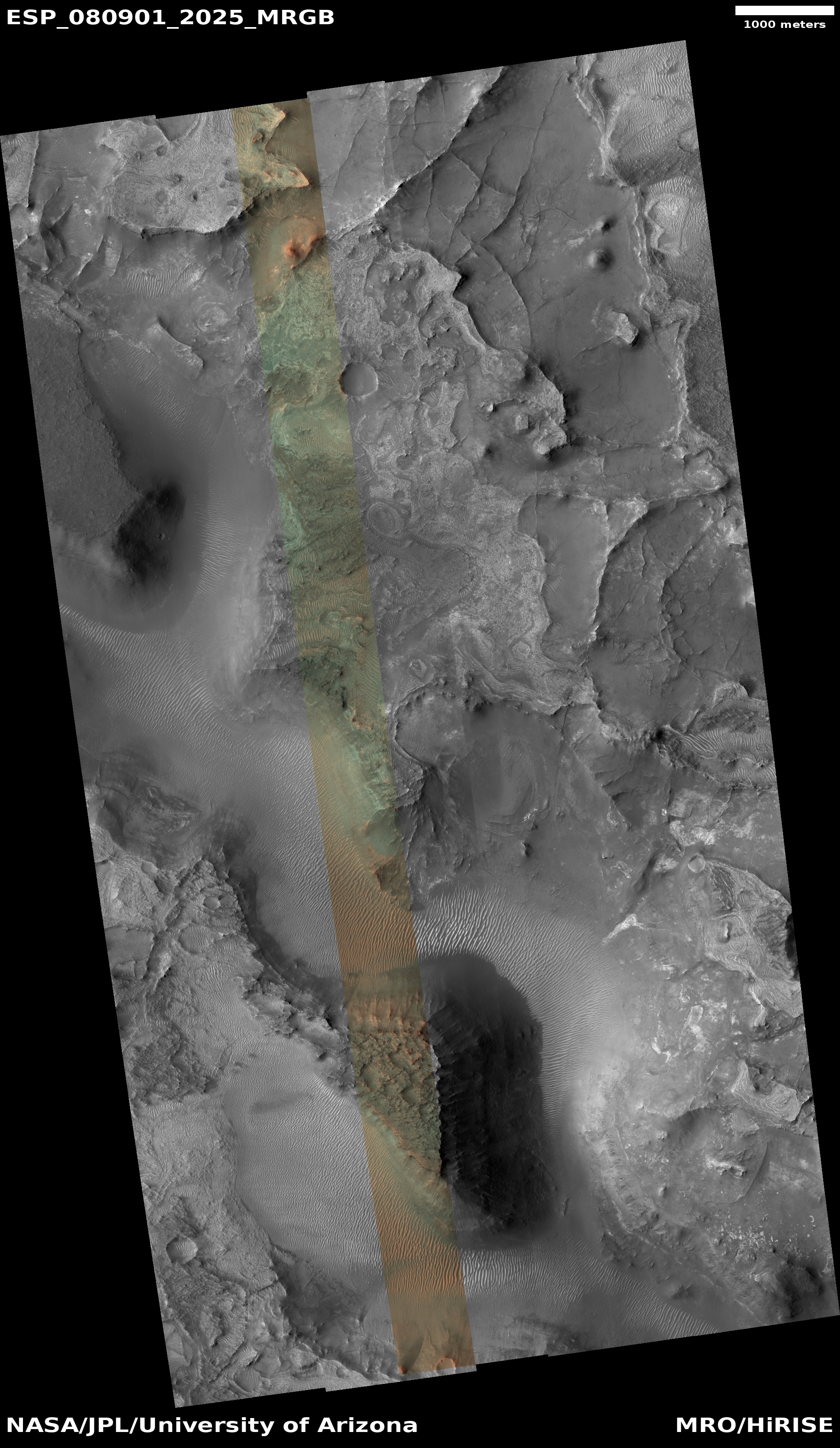
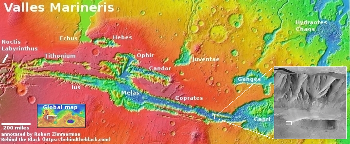
Assuming this detection is real, this would be the largest reservoir of potential water in the dry equatorial regions found yet, comparable to another similar buried detection deep below the giant canyon Valles Marineris but much larger.

Accessing this water however will not be simple, as it is deep underground. You couldn’t just drill a well, as it is ice, not a liquid water table. It would have to mined like minerals on Earth. There are uncertainties about this conclusion as well. It is possible the detection is not water but volcanic ash or dust compacted in a way that mimics an ice detection.

SLIM lowers orbit in preparation for January 19, 2024 lunar landing

SLIM's landing zone
Map showing SLIM landing zone on the Moon.
Click for interactive map.

The Japanese unmanned lunar lander SLIM, in orbit around the Moon since December 25, 2023, has now lowered its orbit in preparation for its lunar landing attempt, now scheduled for tomorrow, January 19, 2024, with operations beginning at 10:00 am (Eastern).

The image to the right indicates the targeted landing area near Shioli Crater. The mission’s prime engineering goal is to demonstrate precise robotic landing technology, able to land a spacecraft softly on another planet within a target zone less than 300 feet across. If successful it is expected to survive for about two weeks, studying the surface below it with a multi-spectral camera but also releasing two test probes, one a hopping rover and the second a rolling spherical rover. Both carry their own science instruments.

I have embedded the live stream for tomorrow’s landing below.
» Read more

Astronomical high-altitude balloon flight now exceeds two weeks

GUSTO's flight path as of January 18, 2024

A high-altitude stratospheric balloon, dubbed GUSTO and designed to study the interstellar medium, has now been circling the south pole over Antarctica for fifteen days.

The map to the right shows its full flight path since its launch on December 31, 2023. From the press release:

GUSTO is mapping a large portion of the Milky Way galaxy and Large Magellanic Cloud to help scientists study the interstellar medium. The observatory is transmitting the data it collects back to watchful teams on the ground as it steadily circumnavigates the South Pole around 120,000+ feet.

GUSTO is flying on a 39 million cubic-foot zero-pressure scientific balloon, which is so large it could easily fit 195 blimps inside of it. The balloon is used to fly missions for long periods of time during the Austral Summer over Antarctica. GUSTO is aiming for a NASA record of 55+ days in flight to achieve its science goals.

You can follow GUSTO’s flight in real time here.

A rock tadpole on Mars

A rock tadpole on Mars

Cool image time! The picture to the right, cropped, reduced, and sharpened to post here, was taken on January 11, 2024 by the left navigation camera of the Mars rover Curiosity.

The picture was highlighted in yesterday’s update from the rover’s science team, describing the team’s upcoming geological goals for the next few days.

We have observed resistant, polygonal fractures/ridges in many recent bedrock blocks. There is much speculation among the team as to the origin of these features. Hypotheses have different implications for past environments, and the polygonal fractures are therefore of high interest. As well as the polygonal fractures, there are more continuous linear veins. The relationship between the polygonal and linear fractures can also help to inform our interpretations

You can see the polygonal fractures in the full image. The thin line of rock sticking up from the tadpole illustrates one of these continuous linear veins. The material that fills the vein is obviously more resistent to erosion, so as the wind (and maybe ancient ice or water activity) scoured the rock into its tadpole shape, the vein material remained.
» Read more

Webb confirms the unusual shape of early galaxies as seen by Hubble

Earth galaxies shapes, as seen by Webb in infrared
Click for original image.

The uncertainty of science: The infrared view of the Webb Space Telescope appears to have confirmed and even underlined the unusual shapes of many early galaxies as previously seen by the Hubble Space Telescope.

Researchers analyzing images from NASA’s James Webb Space Telescope have found that galaxies in the early universe are often flat and elongated, like surfboards and pool noodles – and are rarely round, like volleyballs or frisbees. “Roughly 50 to 80% of the galaxies we studied appear to be flattened in two dimensions,” explained lead author Viraj Pandya, a NASA Hubble Fellow at Columbia University in New York. “Galaxies that look like pool noodles or surfboards seem to be very common in the early universe, which is surprising, since they are uncommon nearby.”

The team focused on a vast field of near-infrared images delivered by Webb, known as the Cosmic Evolution Early Release Science (CEERS) Survey, plucking out galaxies that are estimated to exist when the universe was 600 million to 6 billion years old.

While most distant galaxies look like surfboards and pool noodles, others are shaped like frisbees and volleyballs. The “volleyballs,” or sphere-shaped galaxies, appear the most compact type on the cosmic “ocean” and were also the least frequently identified. The frisbees were found to be as large as the surfboard- and pool noodle-shaped galaxies along the “horizon,” but become more common closer to “shore” in the nearby universe.

The galaxies also appear generally far less massive than galaxies in the near universe, which fits with the Big Bang theory that says they had less time to grow.

The press release notes that the sample size is still very small, and further observations will be required to confirm whether these shapes are common in the early universe.

Gullies and avalanches in Martian crater

Gullies and avalanches in a Martian crater
Click for original image.

Cool image time! The picture to the right, cropped, reduced, and sharpened to post here, was taken on September 17, 2023 by the high resolution camera on Mars Reconnaissance Orbiter (MRO). It shows two significant features, both of which suggest the action of near-surface water ice to change to surface of Mars.

First are the gullies on the cliff wall, which also happens to be the interior slope of a 30-mile-wide crater. Since the first discovery of gullies on Mars, scientists have pondered their origin, with all their hypothesises always pointing to some form of water process. One popular theory [pdf] points to some form of intermittent water flow linked to long term climate cycles caused by the extreme shifts in the red planet’s rotational tilt, from 11 to 60 degrees. Another theory suggests the gullies form from the winter-summer freeze-thaw cycle and the accumulation of frost during winter.

The second feature are the three avalanche debris piles at the base of these gullies. The long extent of each suggests the avalanches flowed more like wet mud than falling rocks. If the ground here was impregnated with ice, than this look makes sense.
» Read more

The divide in a giant Martian lava river

The divide in a giant Martian lava river
Click for original image.

Cool image time! The photo to the right, rotated, cropped, reduced, sharpened, and annotated to post here, was taken on September 24, 2023 by the high resolution camera on Mars Reconnaissance Orbiter (MRO).

As indicated by the arrows, this is a frozen river of lava on Mars, flowing to the southwest and then splitting into two streams, one to the west and the other to the south. Being a Martian lava flow, when it was liquid it flowed much faster than lava on Earth, almost like a thick water. The flow bored into any high features, such as the two mesas in this picture, and streamlined their shapes, tearing material away as the lava moved by quickly. In the process the lava flow exposed many layers in those mesas, indicating many other previous lava flow events.

The crater in the lower mesa, where the stream splits, appears to have been more resistent to the flow, having been compacted into harder and denser material by the impact itself.
» Read more

A cluster of strange terrain in Martian glacier country

Overview map

A cluster of strange terrain on Mars
Click for original image.

Cool image time! The picture to the right, rotated, cropped, reduced, and sharpened to post here, was taken on October 21, 2023 by the high resolution camera on Mars Reconnaissance Orbiter (MRO).

The science team labels this “patterned ground.” I see instead a whole range of inexplicable Martian geological features that, while each has been documented previously, each remains puzzling as to its formation process.

First there is the stucco-like peaks of all sizes on the upper left. This surface really looks like it had been wet plaster covered with Saran Wrap that had its peaks pulled up when that wrap was pulled off quickly.

Then there is brain terrain on the right. Always associated with glacier features on Mars, these convolutions are unique to Mars and as yet not entirely understood.

Next there is the circular arc on the middle left. It appears to be the remains of an impact crater now filled partly, but if so why has its northern rim disappeared so completely?

If you look close at the image above as well as the full image, you will find other mysterious features as well.

The location is the white dot on the overview map above. The rectangle in the inset shows the area covered by this picture, part of the floor of an unnamed eighteen-mile-wide and one-mile deep crater. The glacial material that appears to fill its interior as well as the splash apron that surrounds it all suggest the ground here is impregnated with water ice. Located as it is on the western end of the 2,000-mile-long north mid-latitude strip I dub glacier country — where practically every image shows glacial features — this conclusion is not surprising.

In fact, this photo illustrates well the alieness of Mars. We understand glaciers and ice, but on Mars, with its very cold temperatures, one-third Earth gravity, and thin atmosphere, those glaciers and ice are able to do things that we don’t yet understand. Untangling these geological processes will take decades of work, and likely will not be completed until people can walk the Martian surface and study it up close.

And won’t that be fun?

A new plan to send a probe to interstellar object Oumuamua

Project Lyra about to rendezvous with Oumuamua
Click to watch the animation.

Scientists have proposed a project to send an unmanned probe to Oumuamua, using the Earth, Jupiter, and then the Sun to slingshot onto a path that would catch up with the interstellar object on its journey leaving the solar system in the mid-2050s.

The project, dubbed Lyra, was first proposed in 2023. The scientists have now revised the plan to account for the greater speeds needed to catch up with Oumuamua as it continues to move away from us. It is still within the solar system, but it is moving away very fast.

The graphic to the right, a screen capture of an animation at the link, shows the spacecraft as it finally approaches the interstellar object in 2055. To get there it would launch in the early 2030s, slingshot past the Earth to reach Jupiter, which would then slow it down so that it would fall back to the Sun, passing it by less than 450,000 miles, which would slingshot it out to Oumuamua (with the help of an additional engine burn). To survive the close solar approach it would use the same technology used by the Parker Solar Probe, which has already successfully flown that close to the Sun.

It seems this is an entirely worthwhile project, since Oumuamua continues to baffle scientists as to its nature. While most belief it is a natural but very unusual interstellar asteroid, none can dismiss the possibility that it instead an alien spacecraft. The data precludes nothing. Getting close to it seems worthwhile, no matter what.

For me, that rendezvous will happen when I would be 102 years old. I don’t think I’ll be here to see it.

Double-ringed crater near the Starship landing zone on Mars

Double-ringed crater
Click for original image.

Cool image time! The picture to the right, rotated, cropped, reduced, and sharpened to post here, was taken on September 10, 2023 by the high resolution camera on Mars Reconnaissance Orbiter (MRO). It shows what the scientists label simply as a “double-rim crater.”

If you look close you might not be unreasonable to call this instead a triple-rim crater, as there appear to be two rings on each side of the highest crater rim.

Multple rings in craters are not rare. We see many on the Moon. Most however are associated with very large impacts, and are an expression of the ripples formed at impact, not unlike the ripples seen when you drop a pebble in water. Unlike water ripples, the ripples formed in rock are impact melt that quickly refreezes, thus capturing those ripples as concentric rings.

In this case, these rings likely signal not freezing rock but freezing ice.
» Read more

Fauci: Now an admitted liar as well as incompetent scientist

Fauci: Washington's top liar
Anthony Fauci: the liar-in-chief during
the Wuhan panic

This week Anthony Fauci was brought before a committee in the House of Representatives for closed-door hearings on his actions during the COVID epidemic in 2020-2021. Though supposedly private, the committee has been providing detailed recaps of Fauci’s testimony.

What it has learned is that Fauci was not only a chronic liar during his time as director of the National Institute of Allergy and Infectious Diseases (NIAID), he was also utterly incompetent as both a scientist as well as an administrator.

None of this really is news. As early as December 2020 Fauci admitted publicly that he had purposely misstated facts and scientific data for political reasons. Repeatedly I have reported many other examples of his dishonesty and incompetence (see for example these posts from June ’21, April ’22, September ’22, November ’22, and September ’23).

Nonetheless, Fauci’s testimony now is worth reviewing, because it underlines starkly how he misled and misinformed the public, causing great harm for no gain.

First, he admitted in testimony that the demands by him and the government that everyone maintain a six-foot distance during the epidemic was utter garbage, based on no scientific data at all.

In Tuesday’s session, Fauci admitted that the six-foot social distancing recommendation “was likely not based on any data,” according to the committee. “It just sort of appeared,” it wrote, quoting Fauci.

In August 2020 I found evidence suggesting the only source for this absurd rule came from a high school science project. Fauci has now essentially confirmed this, admitting that there is no legitimate science behind the six-foot rule.
» Read more

Webb infrared data detects unexpected structure inside debris disk of Beta Pictoris

Beta Pictoris debris disk
Click for original image.

A new false color infrared image from the Webb Space Telescope has revealed an unexpected structure extending out from the two debris disks that surround the near-by star Beta Pictoris, with computer modeling suggesting might this structure have been the result of a large collision as recently as only 100 years ago.

That false-colr image is the right, with this newly discovered structure, described by the scientists as resembling “a cat’s tail”, on the right side. The infrared light of the star has been blocked in the center in order to see the details of the disk.

Webb’s mid-infrared data also revealed differences in temperature between Beta Pic’s two disks, which likely is due to differences in composition. “We didn’t expect Webb to reveal that there are two different types of material around Beta Pic, but MIRI clearly showed us that the material of the secondary disk and cat’s tail is hotter than the main disk,” said Christopher Stark, a co-author of the study at NASA’s Goddard Space Flight Center in Greenbelt, Maryland. “The dust that forms that disk and tail must be very dark, so we don’t easily see it at visible wavelengths — but in the mid-infrared, it’s glowing.”

To explain the hotter temperature, the team deduced that the dust may be highly porous “organic refractory material,” similar to the matter found on the surfaces of comets and asteroids in our solar system. For example, a preliminary analysis of material sampled from asteroid Bennu by NASA’s OSIRIS-REx mission found it to be very dark and carbon-rich, much like what MIRI detected at Beta Pic.

In an attempt to explain the cat’s tail, the scientists used computer models, which suggested it might have been caused by an event that produced a lot of dust, such as a collision between two large objects in the debris disk, and that event could have happened as recently as a hundred years ago.

This hypothesis remains unconfirmed, with much more data required before a final explanation can be accepted.

Astronomers discover Earth-sized exoplanet roasted by a Sunlike star

Using data from the TESS space telescope, astronomers have discovered an Earth-sized exoplanet in a 4.2 day orbit around a G-type star like our Sun about 70 light years away.

The tidally locked planet is very close to Earth size (it is approximately 1.1 times the diameter of our own planet) and it’s orbiting a star that’s similar to the size of our Sun (the star is about 0.91 the size and 0.99 the mass of the Sun).

The star in this system is a G-type star, the same type as our Sun. But HD 63433 d orbits much closer to its star than we do, with a minuscule 4.2 day long “year” and extremely high temperatures on its dayside.

To read the research paper, go here. At an estimated age of only 400 million years, this exoplanet and its solar system of at least two other planets is much younger than the 4.5-billion-year-old Earth. Though the press release and paper note the possibility that it is similar in many ways to Io, a volcanic planet covered with lava, we don’t know this. All we know is that it is roasted by its star by orbiting so close to it.

Update on Astrobotic’s Peregrine lunar lander

The expected flight path of Peregrine
Click for original image.

The company Astrobotic has released several more updates on the status of its Peregrine lunar lander, which will no longer attempt a lunar landing because of a major fuel leak.

The map to the right shows its expected path in the coming days. While sent in a very elongated Earth orbit by ULA’s Vulcan rocket, the spacecraft was unable to do the additional engine burns that would have put it on the correct path to reach the Moon. Instead, it will fall back towards Earth, though its fate beyond that is unclear at this time.

Meanwhile, engineers have succeeded in getting data from all payloads designed to communicate back to Earth.

We have successfully received data from all 9 payloads designed to communicate with the lander. All 10 payloads requiring power have received it, while the remaining 10 payloads aboard the spacecraft are passive. These payloads have now been able to prove operational capability in space and payload teams are analyzing the impact of this development now.

Engineers have also been able to get the spacecraft to send back a number of images. These successes help the company prove out some of the spacecraft’s systems, though it is unable to test the mission’s prime goal, landing on the Moon.

Engineers succeed in releasing two fasteners that blocked access to OSIRIS-REx Bennu samples

Using new specially designed tools, engineers have finally succeeded in removing the two fasteners that had prevented them from opening the sample return capsule that holds the bulk of material from the asteroid Bennu that was grabbed by OSIRIS-REx and brought back to Earth.

Curation processors paused disassembly of the TAGSAM head hardware in mid-October after they discovered that two of the 35 fasteners could not be removed with the tools approved for use inside the OSIRIS-REx glovebox.

In response, two new multi-part tools were designed and fabricated to support further disassembly of the TAGSAM head. These tools include newly custom-fabricated bits made from a specific grade of surgical, non-magnetic stainless steel; the hardest metal approved for use in the pristine curation gloveboxes.

The fasterners have been removed, but the sample capsule still needs to be dissassembled before the samples can be accessed and analyzed. It is now expected that by the spring the material will be fully catelogued and available for scientists to study.

In an ironic twist, OSIRIS-REx brought back so much extra material clinging to the outside of that sample return capsule that such research has already begun. In fact, that extra material actually exceeded in weight the minimum amount the mission wanted to capture inside the capsule. What will be found inside the capsule will only add to the mission’s success.

Endless ash fields on Mars

Endless ash fields on Mars
Click for original image.

Cool image time! The picture to the right, cropped, reduced, and sharpened to post here, was taken on September 18, 2023 by the high resolution camera on Mars Reconnaissance Orbiter (MRO).

It shows the very typical surface on a high plateau in Mars’ dry tropical regions. The dunes you see here, in this very small slice, cover a region about 80 miles square, with the prevailing winds appearing to consistently blow from the northeast to the southwest and forming these endless striations.

The dunes are made of volcanic ash, and the size of this particular ash field gives us a sense of the past volcanic activity that once dominated the red planet. Once, the atmosphere was filled with ash, which covered the ground across large regions. In the subsequent eons the thin Martian atmosphere has reshaped and piled that ash into giant mounds hundreds of miles across, with the surface striated as we see here.
» Read more

Another giant star undergoes dimming

The changes seen in RW Cephei
Click for original image.

Astronomers have detected another giant star dimming in a manner similar to the dimming that Betelgeuse experienced around 2019.

Old stars display light variations that are related to changes in their outer layers. The changes are usually small, so scientists were amazed when astronomers Wolfgang Vollmann and Costantino Sigismondi announced in 2022 that RW Cephei had faded dramatically over the previous few years. By December 2022, RW Cephei had faded to about one third of its normal brightness, an unprecedented drop.

You can read the published paper here. The researchers believe the dimming was caused by the release of dust from the star, blocking its light, much as what is believed happened with Betelgeuse.

RW Cephei, like Betelgeuse, is like a giant gas bag that fluctuates in shape like blob of water in weightlessness. This blob however so big that if placed where the Sun is its surface would be about the orbit of Jupiter. As shown in the two pictures to the right taken by this research team, the shape changed during this dimming.

The star however is much farther away, 16,000 light years compared to Betelgeuse’s 550 light years. Because of Betelgeuse’s size and nearness, until recently it was the only star outside of the Sun whose actual disk had been imaged. That astronomers can now get images of a star as far away as RW Cephei illustrates the incredible improvement in astronomical technology in the past three decades.

The Surt volcano on Io

The Surt volcano on Io in close-up
Click for original image.

Cool image time! The picture to the right, rotated, reduced, and sharpened to post here, was taken by Juno during its 57th close-fly of Jupiter on December 30, 2023. It shows of one of the many volcanoes that cover and continually recoat the surface of the Jupiter moon Io.

The picture was initially processed by citizen scientist Gerald Eichstädt. Thomas Thomopoulos then zoomed in and added additional enhancements to this particular area. (I thank Thomas for his additional help in making this post happen.)

The location is an active volcano named Surt, which has been observed to erupt several times since the 1970s, with its February 2001 eruption the most powerful yet observed on Io, though the pictures by the Jupiter orbiter Galileo taken before and after revealed few significant surface changes.

The picture itself shows a region where major changes have definitely occurred. The large arc of mountains across the photo’s center suggests the remaining half of a large caldera, its northern half now either buried or destroyed. The deep obvious hole inside that crescent appears to be the main vent from which the recent eruptions have spewed, as indicated by the light-colored apron surrounding it.

In the southwest section of that large mountain arc is a distinct ridgeline with a small circular curve in its middle that suggests a former volcanic cone, its northern half now gone.

To put it mildly, Io appears a very alien place, shaped entirely and continuously by endlessly volcanic eruptions that spread lava across its entire surface repeatedly.

Layered volcanic vent on Mars

Layered volcanic vent on Mars
Click for original image.

Cool image time! The picture to the right, rotated, cropped, reduced, and sharpened to post here, was taken on August 31, 2023 by the high resolution camera on Mars Reconnaissance Orbiter (MRO), and shows what the science team labels as a “vent near Olympica Fossae.”

The grade within the fissure is downhill to its center. Outside the vent the grade is downhill to the north and south, with the overall grade sloping to the west as well. Note the layers on each side of the depression. Each indicates another volcanic flood event that laid down another layer of lava. At some point this vent either blew up through those layers, or it had remained opened during all those many events, the lava flowing out and acting like water to erode the layers on the north and the south.

As always, the scale of Martian geology is daunting, as shown by the overview map below.
» Read more

Scientists: Suspended iron minerals floating in Venus’s atmosphere explain dark UV streaks

Venus as seen in ultraviolet by Mariner 10, February 5, 1974
Venus as seen in ultraviolet by Mariner 10,
February 5, 1974

The uncertainty of science: Since the mid-1970s scientists have been trying to figure out the cause of the dark streaks seen in the atmosphere of Venus when photographed in ultraviolet. The image to the right was the first such UV image, taken by Mariner 10 during its fly-by on its way to Mercury. These streaks are caused by some unknown material that absorbs the UV light.

Researchers have now proposed that two different iron-bearing minerals, floating in Venus’s atmosphere, are what cause these dark UV streaks. From the absract:

Our results demonstrate that ferric iron can react with sulfuric acid to form two mineral phases: rhomboclase [(H5O2)Fe(SO4)2·3H2O] and acid ferric sulfate [(H3O)Fe(SO4)2]. A combination of these two mineral phases and dissolved Fe3+ in varying concentrations of sulfuric acid are shown to be good candidates for explaining the 200- to 300-nm and 300- to 500-nm features of the reported unknown UV absorber.

Iron has been detected in the atmosphere previously, and is theorized could come from volcanic eruptions on the planet’s million-plus volcanoes.

This new hypothesis explaining the dark UV absorber however remains unconfirmed, and joins a list of other candidates for that absorber, many of which propose either iron or sulfur in different combinations. Because so little data really exists about the atmosphere of Venus, with what is known also uncertain, it is presently impossible to solve this mystery with confidence. The problem is made even more difficult in that scientists understand almost nothing about the chemistry of materials under the conditions seen in Venus’s atmosphere, which is extremely hot (800 degrees Fahrenheit) and very thick and dense (100 times that of Earth).

NASA: UAE to build airlock module for lunar station plus have astronaut fly there

According to a press release from NASA today, the United Arab Emirates (UAE) will build the airlock module for the Lunar Gateway space station plus have one astronaut fly a mission to the station after it is built.

Under a new implementing arrangement expanding their human spaceflight collaboration with NASA through Gateway, MBRSC will provide Gateway’s Crew and Science Airlock module, as well as a UAE astronaut to fly to the lunar space station on a future Artemis mission.

I strongly suspect that the UAE will mostly pay for this module to be built, hiring outside contractors from either the U.S. or Europe to do the work.

Canyons formed from the giant crack that splits Mars

Canyons formed by the giant crack that splits Mars
Click for original image.

Cool image time! The photo to the right, cropped, reduced, and sharpened to post here, was taken on September 22, 2023 by the high resolution camera on Mars Reconnaissance Orbiter (MRO). It shows a complex of north-south trending canyons, with easternmost cliff about 400 feet high (though the full drop to the large canyon on its east is closer to 800 feet).

These canyons however have nothing to do with ice or water flow. They were formed by underground tectonic forces that pushed the ground upward, forced it to split and form cracks. Those cracks in turn produced these canyons. In some cases, such as the depression on top of the central ridge, the formation process probably occurred because fissures formed below ground, causing the surface to sag.

As always, the hiker in me wants to walk up the nose of that ridge and then along its western edge, with the western canyon on my left and that smaller depression on my right.

The larger context of this location is in itself even more spectacular.
» Read more

Researchers propose method for removing toxic perchlorates from Martian water

Of the twelve research grants just awarded by NASA to develop a variety of new technologies for astronomy and future space exploration, one proposes a new method for removing the toxic perchlorates that are thought to exist in all Martian water.

What if we could make the perchlorates just vanish? This is the innovative solution we propose here, taking advantage of the reduction of chlorate and perchlorate to chloride and oxygen being thermodynamically favorable, if kinetically slow. This is the promise of our regenerative perchlorate reduction system, leveraging synthetic biology to take advantage of and improve upon natural perchlorate reducing bacteria.

These terrestrial microbes are not directly suitable for off-world use, but their key genes pcrAB and cld, which catalyze the reduction of perchlorates to chloride and oxygen, have been previously identified and well-studied. This proposed work exploits the prior work studying perchlorate-reducing bacteria by engineering this perchlorate reduction pathway into the spaceflight proven Bacillus subtilis strain 168, under the control of a robust, active promoter. This solution is highly sustainable and scalable, and unlike traditional water purification approaches, outright eliminates perchlorates rather than filtering them to dump somewhere nearby.

Essentially the researchers will try to engineer bacteria known to be able to survive space so that it carries genes from another microbe able of changing the perchlorate into chloride and oxygen.

This study as well as the other eleven are only in phase one of their contracts, with the award of later phases determined by their initial successes or failures.

The mining potential on Mars

The mining potential on Mars
Click for original image.

Cool image time! The picture to the right, cropped, reduced, and sharpened to post here, was taken on October 30, 2023 by the high resolution camera on Mars Reconnaissance Orbiter (MRO). Labeled simply as a “terrain sample,” it was probably taken not as part of any specific research project but to fill a gap in the schedule in order to properly maintain the camera’s temperature.

Nonetheless, the larger region where this photo is located is one of great interest to scientists as well as to future explorers. First note the colors. The wide variations between the bright orange of that peak (only a few tens of feet high) and the light orange and aqua-green of the bedrock to the north and south suggest a terrain with a lot of different materials within it.

The location is in the dry equatorial regions, so the swirls visible on the plateaus north and south of that small peak are not related to near surface ice. Instead, this is warped bedrock, with those swirls also suggesting material of a varied nature, exposed to the surface by erosion processes.
» Read more

Hubble detects changes in atmosphere of exoplanet

Using data from collected in 2016, 2018, and 2019 combined with computer simulations, scientists now believe they have detected changes in the atmosphere of the exoplanet WASP-121b, also nicknamed Tylos.

The Jupiter-sized planet orbits a star about 880 light years away.

WASP-121 b is so close to its parent star that the orbital period is only 1.27 days. This close proximity means that the planet is tidally locked so that the same hemisphere always faces the star, in the same way that our Moon always has the same side pointed at Earth. Daytime temperatures approach 3,450 degrees Fahrenheit (2,150 degrees Kelvin) on the star-facing side of the planet.

The team used four sets of Hubble archival observations of WASP-121 b. The complete data-set included observations of WASP-121 b transiting in front of its star (taken in June 2016); WASP-121 b passing behind its star, also known as a secondary eclipse (taken in November 2016); and the brightness of WASP-121 b as a function of its phase angle to the star (the varying amount of light received at Earth from an exoplanet as it orbits its parent star, similar to our Moon’s phase-cycle). These data were taken in March 2018 and February 2019, respectively.

A computer model was then used to fill in the gaps and provide a simulation of the hot temperatures of that exoplanet’s atmosphere over time. Two videos of that simulation are available at the link.

There of course is a lot of uncertainty in this result, though the fundamental discovery of changes is important. This data proves there is weather on such alien planets, even if that weather is so alien we really don’t understand it in the slightest based on the available data on hand.

Sunspot update: Are we now in the next solar maximum?

Time for my monthly update on the Sun’s sunspot activity has it proceeds through its eleven-year sunspot cycle. NOAA has released its update of its monthly graph showing the number of sunspots on the Sun’s Earth-facing hemisphere, and I have posted it below, annotated with further details to provide a larger context.

In December sunspot activity increased slightly for the second month in a row, but only by a little bit. The number of sunspots for the month was still significantly below the highs seen in the summer, and continue to suggest that the Sun has already entered solar maximum (two years early), and like the previous two solar maximums in 2001 and 2013, will be double peaked.
» Read more

Dunes on the floor of Valles Marineris

Overview map

Dunes on the floor of Valles Marineris
Click for original image.

Cool image time! The picture to the right, cropped, reduced, and sharpened to post here, was taken on September 26, 2023 by the high resolution camera on Mars Reconnaissance Orbiter (MRO). It shows a field of scattered elongated dunes on a flat older surface with craters and what appear to be smaller ripple dunes (in the lower left). The large elongated dunes tend to be oriented in an east-west manner, while the older tiny ripple dunes appear to have a north-south orientation.

Very clearly the larger dunes appear to be traveling across that flat older surface, though whether there is any documented movement is unknown. Generally (though there are exceptions) scientists have found most of the dunes on Mars to be either inactive, or if they are moving because of the wind that movement is very tiny per year. In this case there is one dark spot on the dunes, near the center of the picture, where it appears a collapse might have occurred, suggesting recent change.

On the center right of the picture is the end point of a long ridgeline extending 10 to 12 miles to the east and rising about 7,300 feet, as shown in the overview map above. The small rectangle in the inset shows the area covered by the photograph.

At the base of that ridgeline can be seen a series of terraces descending to the west, suggesting that this hill might be volcanic in nature, with each terrace indicating a separate lava flow. The location is in the dry equatorial regions, so near-surface ice is likely not an explanation.

In the inset the mountain wall to the north is the large mountain chain that bisects this part of Valles Marineris. It overwhelms this small 7,300-foot-high ridge, rising more than 22,000 feet from these dunes with its high point still one or two thousand feet below the rim of Valles Marineris itself.

Once again, the grand scenery of Mars amazes. Imaging hiking a trail along that ridgeline, with the mountains rising far above you to the north and south.

First Juno images of Io from December 30th fly-by

Io as seen by Juno on December 30, 2023
For original global image go here. For original of inset go here.

The first raw Juno images taken of the Jupiter moon Io during its close fly-by on December 30, 2023, the closest in more than twenty years, have been released by the science team and citizen scientists have begun processing them.

The global picture to the right, rotated and reduced to post here, was processed by Kevin Gill. The inset of the volcanic mountains near the terminator was processed by Thomas Thomopoulos. As he notes, to obtain better detail he enhanced the colors and image and then zoomed in.

In the inset, note the northeast flows coming off the two mountains near the center. With the lower mountain, this flow appears to lie on top of a larger flow that extended out almost to the mountain to the right.

Io is a planet of continuous volcanic activity. For example, when the global image above was taken, the plume of a volcano eruption was visible on the right horizon, as shown in this version, its exposure adjusted by Ted Stryk. Catching such eruptions on Io is not unusual, considering its continuous volcanic activity generated by the tidal forces the planet undergoes from its orbit around Jupiter. In fact, the very first plume was imaged in 1979 by Voyager 1 during its short fly-by, and proved a hypothesis of such activity that scientists had only published one week earlier.

The ancientness of rocks on Mars

Ancient rocks on Mars
Click for original image.

Cool image time! The picture to the right, cropped, reduced, and enhanced to post here, was taken on December 27, 2023 by the high resolution camera on the Mars rover Curiosity. It shows what is a somewhat typical rock found on the ground as Curiosity climbs Mount Sharp in Gale Crater.

Two features stand out. First, the many layers illustrate again the cyclical nature of Martian geology. Many sedimentary events occurred over a long time to create this rock, each cycle putting down a new layer, with some intervening time periods possibly removing layers as well. Such layering has now become evident in both ground photos taken by rovers as well as orbital images.

Second, the delicate nature of some layers indicates the incredibly slow erosion process on Mars, enhanced by the red planet’s one-third gravity. The atmosphere is incredibly thin, less than 0.1% of Earth’s. Yet given time the wind had been able to wear away the edges of this rock. The thin atmosphere and light gravity has also allowed some material to remain in a delicate manner that would be impossible on Earth.

Thus, for these thin flakes to have formed has required a great deal of time. The very nature of this rock speaks of an ancient terrain, shaped slowly by inanimate processes with no active life around to disturb things.

Curiosity science team releases movies of Mars from dawn to dusk

Using its front and rear hazard avoidence cameras, the Curiosity science team had the rover take two full sets of images looking in one direction for twelve hours straight in order to create two movies of Mars that show an entire day, from dawn to dusk.

I have embedded both movies below. From the press release:

When NASA’s Curiosity Mars rover isn’t on the move, it works pretty well as a sundial, as seen in two black-and-white videos recorded on Nov. 8, the 4,002nd Martian day, or sol, of the mission. The rover captured its own shadow shifting across the surface of Mars using its black-and-white Hazard-Avoidance Cameras, or Hazcams.

Instructions to record the videos were part of the last set of commands beamed up to Curiosity just before the start of Mars solar conjunction, a period when the Sun is between Earth and Mars. Because plasma from the Sun can interfere with radio communications, missions hold off on sending commands to Mars spacecraft for several weeks during this time.

The first looks forward, into Gediz Vallis, where Curiosity will eventually travel. The second looks back down Mt Sharp and out across the rim of Gale Crater.
» Read more

1 4 5 6 7 8 259