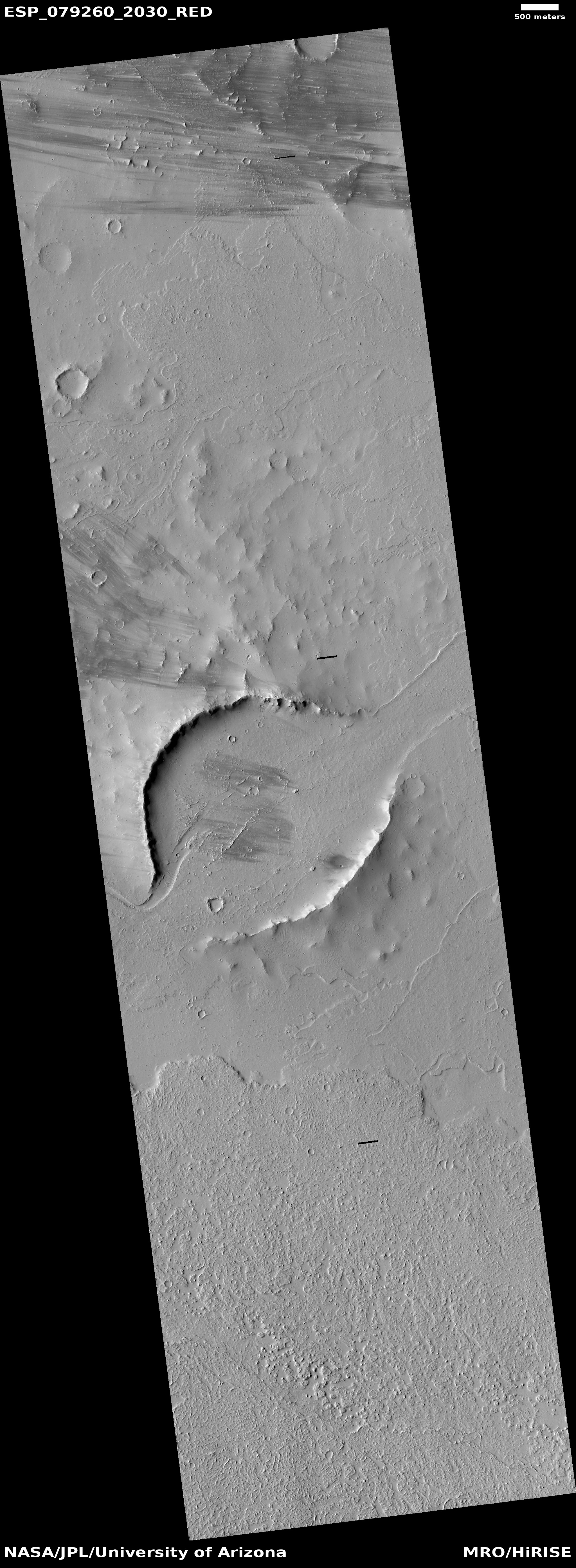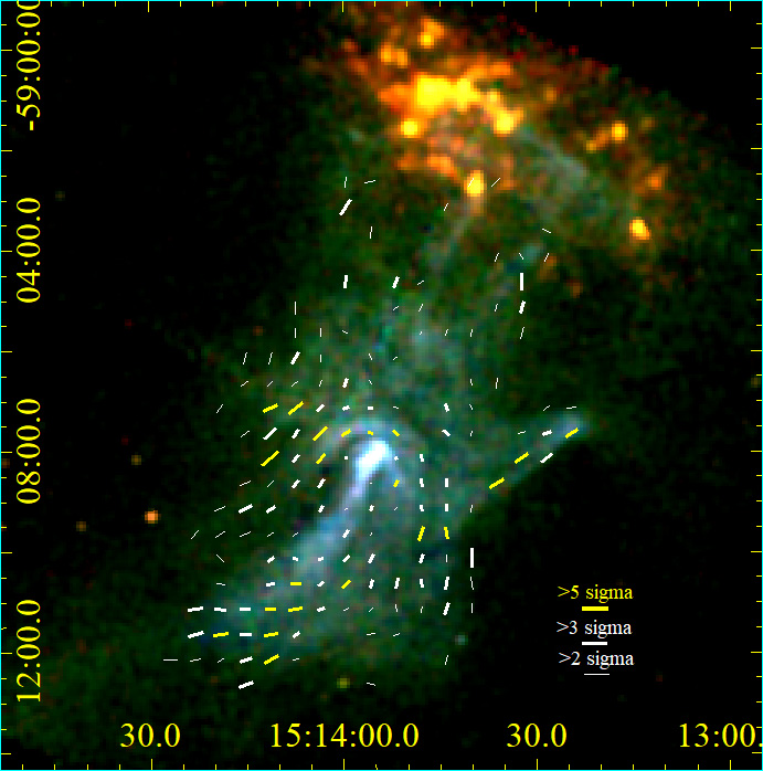
Click for original image.
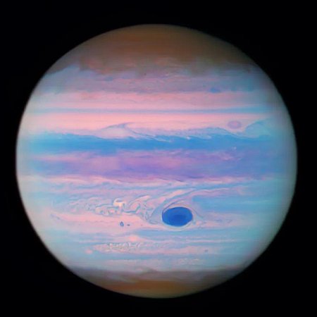
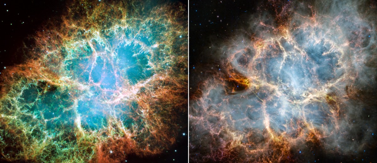
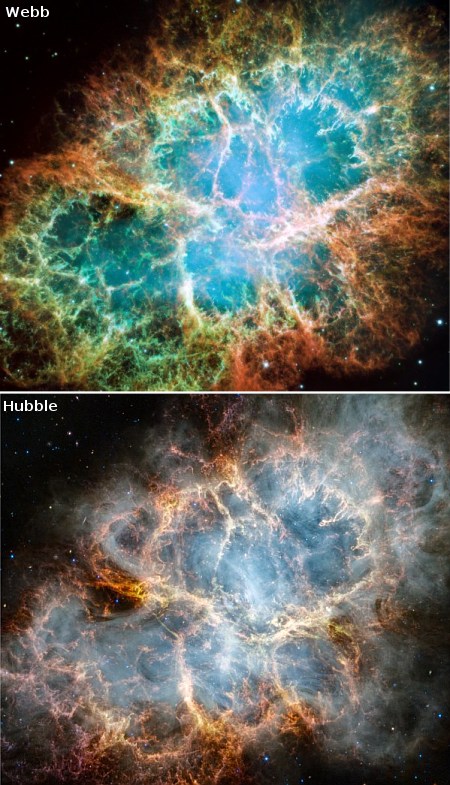
Using the Webb Space Telescope astronomers have taken the first detailed infrared image of the Crab Nebula, the remnant from a supernova that occurred in 1054 AD.
The two pictures on the right compare Webb’s false color infrared view with a natural light Hubble image in optical wavelengths, taken in 2005. From the press release:
The supernova remnant is comprised of several different components, including doubly ionized sulfur (represented in red-orange), ionized iron (blue), dust (yellow-white and green), and synchrotron emission (white). In this image, colors were assigned to different filters from Webb’s NIRCam and MIRI: blue (F162M), light blue (F480M), cyan (F560W), green (F1130W), orange (F1800W), and red (F2100W).
In comparing the images, it appears the scientists chose colors for the Webb image to more or less match those of Hubble’s natural color picture. However, as the press release notes:
Additional aspects of the inner workings of the Crab Nebula become more prominent and are seen in greater detail in the infrared light captured by Webb. In particular, Webb highlights what is known as synchrotron radiation: emission produced from charged particles, like electrons, moving around magnetic field lines at relativistic speeds. The radiation appears here as milky smoke-like material throughout the majority of the Crab Nebula’s interior.
This feature is a product of the nebula’s pulsar, a rapidly rotating neutron star. The pulsar’s strong magnetic field accelerates particles to extremely high speeds and causes them to emit radiation as they wind around magnetic field lines. Though emitted across the electromagnetic spectrum, the synchrotron radiation is seen in unprecedented detail with Webb’s NIRCam instrument.
The release also notes this remarkable but somewhat unfortunate fact:
Scientists will have newer Hubble data to review within the next year or so from the telescope’s reimaging of the supernova remnant. This will mark Hubble’s first look at emission lines from the Crab Nebula in over 20 years, and will enable astronomers to more accurately compare Webb and Hubble’s findings.
In 2005 repeated Hubble images of the Crab revealed that its filaments and radiation were stormy, with constant activity. The scientists actually produced a movie of those changes. It was expected that new images would be taken at regular intervals to track that activity. Apparently it was not, either because no scientist was interested or the committee that assigns time on Hubble decided this wasn’t important enough reseach.