The strange scattered rocks of Gediz Vallis on Mars

Click for full image.
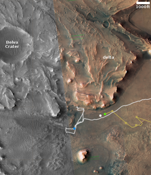
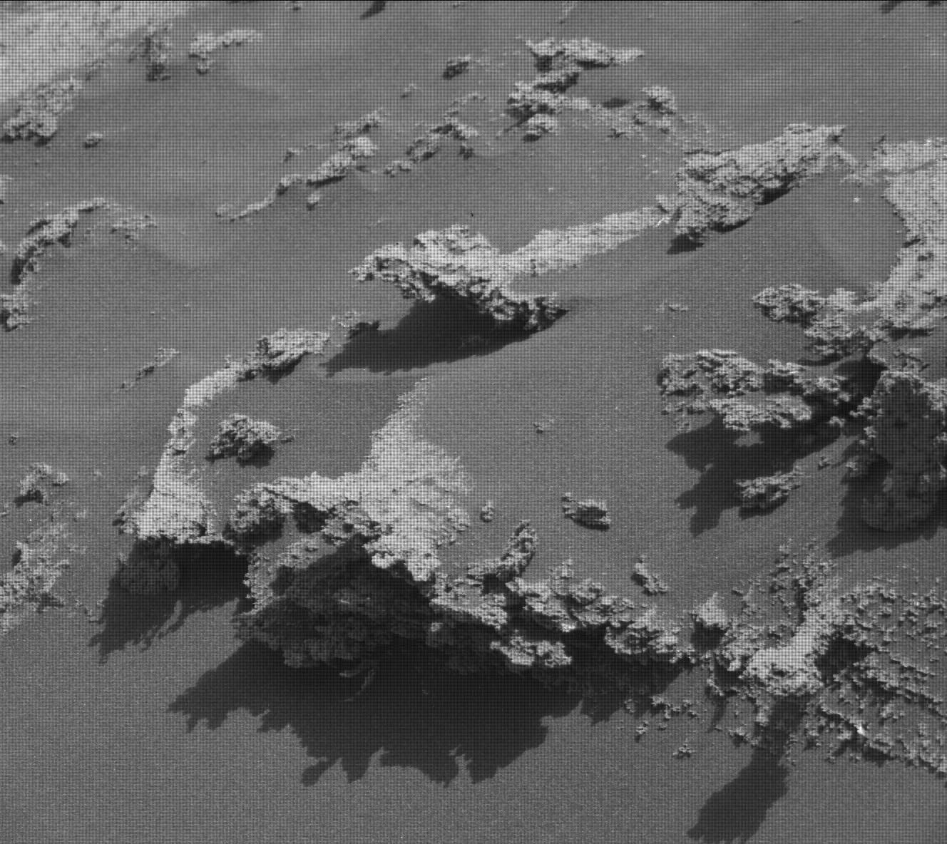
Cool image time! The photo to the right, reduced to post here, was taken on August 20, 2022 by Curiosity’s high resolution camera. It shows some of the scattered and very delicate rocks that it is finding on the floor of Gediz Vallis, the valley the rover had been striving for since landing more than a decade ago and finally entered in mid-August.
Because of Mars weak gravity, about 39% of Earth’s, and very thin atmosphere, about 1% of Earth’s, it is possible for surface rocks to erode into such delicate shapes. The shapes appear to be further encouraged by the many layers that exist in Mars, with each layer having different characteristics. In the case of the hanging flakes to the right, these layers were more resistant to erosion and thus remains intact while material above and below was slowly blown away.
Click for full image.
Cool image time! The photo to the right, reduced to post here, was taken on August 20, 2022 by Curiosity’s high resolution camera. It shows some of the scattered and very delicate rocks that it is finding on the floor of Gediz Vallis, the valley the rover had been striving for since landing more than a decade ago and finally entered in mid-August.
Because of Mars weak gravity, about 39% of Earth’s, and very thin atmosphere, about 1% of Earth’s, it is possible for surface rocks to erode into such delicate shapes. The shapes appear to be further encouraged by the many layers that exist in Mars, with each layer having different characteristics. In the case of the hanging flakes to the right, these layers were more resistant to erosion and thus remains intact while material above and below was slowly blown away.