A hiking paradise on Mars!

Click for original image.
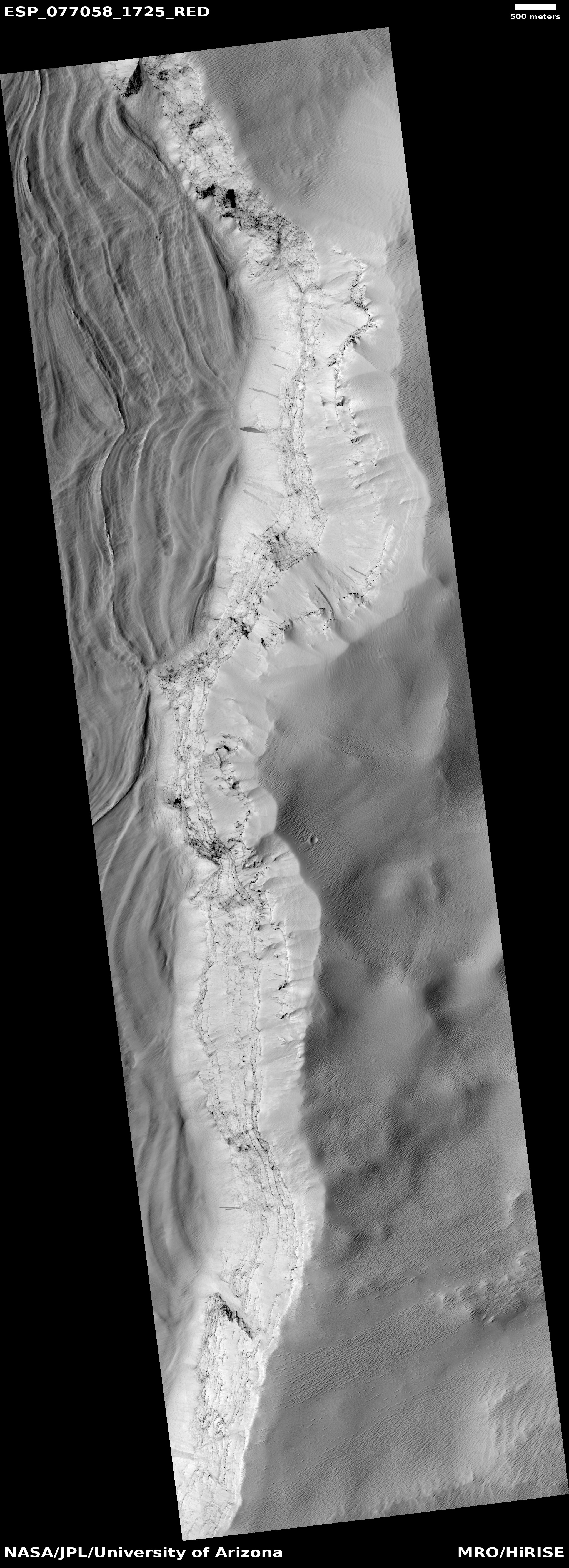
Cool image time! The picture to the right, cropped, reduced, sharpened, and annotated to post here, was taken on May 21, 2023 by the high resolution camera on Mars Reconnaissance Orbiter (MRO). It shows one of Mars’ more impressive mountains with the Sun somewhat low in the western sky, resulting in the long dark shadows on the eastern slopes.
The line is my quick attempt to mark the obvious route that would be taken along that ridge line to get from the bottom to the top. This could be a hiking trail, or a road. In either case, the elevation gain from the bottom of the ridge to the plateau on top would be about 3,900 feet in about a mile and a half, very steep for Earth — at approximately a 26 degree grade — but probably quite doable in the one-third Martian gravity.
The lower end of my proposed route however is hardly the bottom of the mountain. The slope, now alluvial fill made up of dust and debris from above, continues downhill for another 5,400 feet. All told, from top to bottom the elevation gain is about 9,300 feet over 8.5 miles.
» Read more