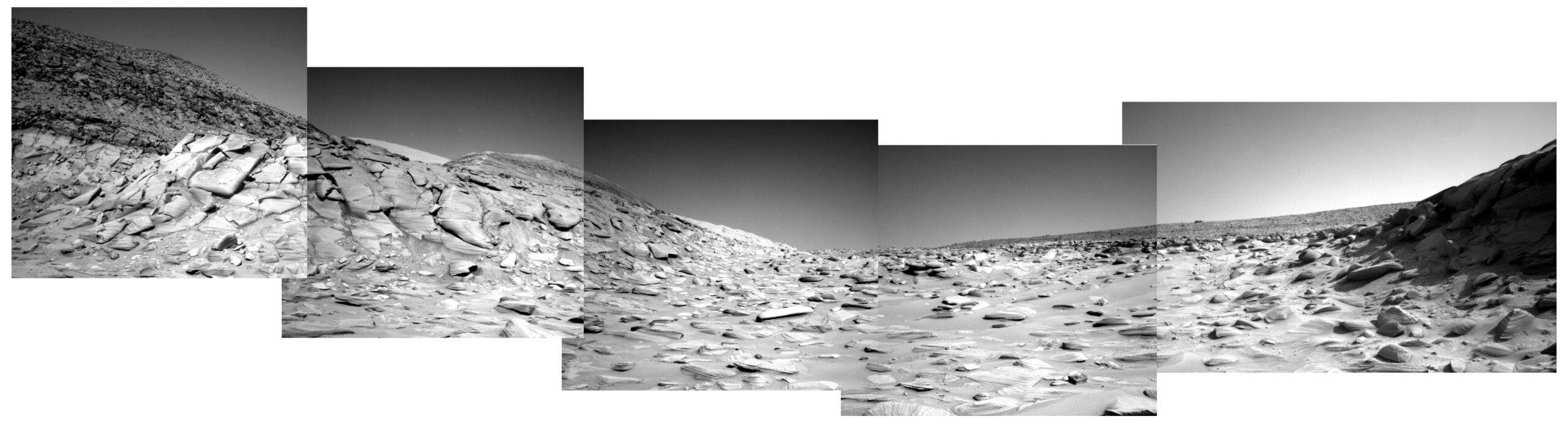
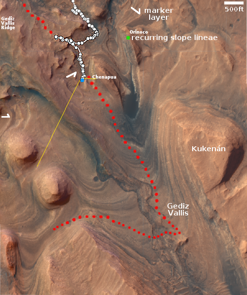
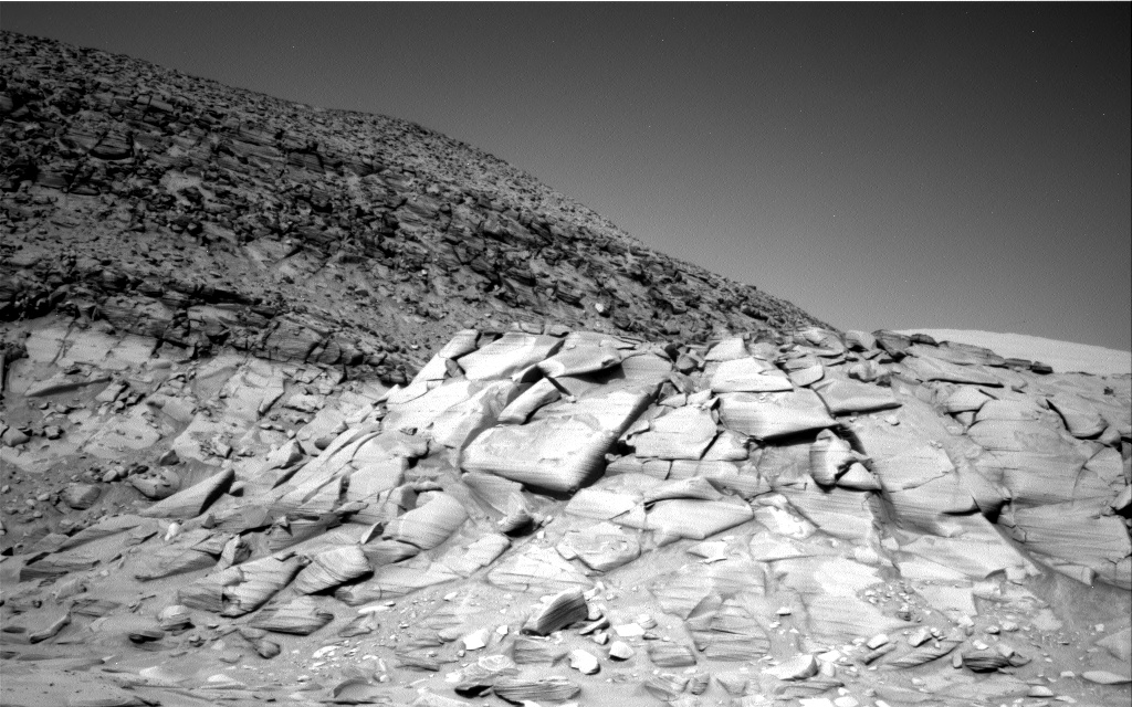
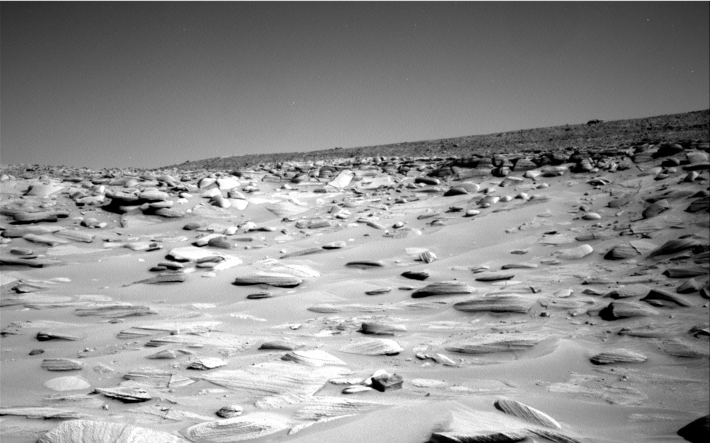
Click for original image.
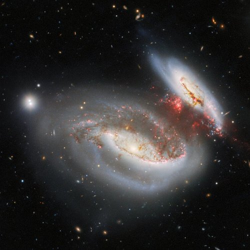
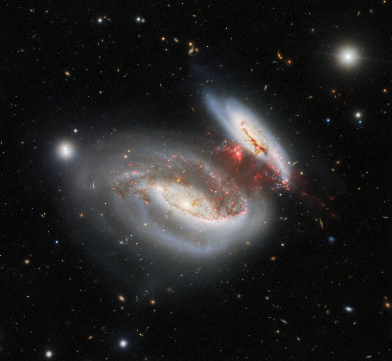
Cool image time! The picture to the right, cropped, reduced, and sharpened to post here, was taken using the Gemini North ground-based 8-meter telescope in Hawaii. It shows two spiral galaxies about 180 million light years away following a head-on collision about 25 million years ago, in which the smaller spiral moved through the larger from the bottom to the top.
Upon exiting, the smaller spiral trailed behind it the reddish stream of material, while its outside arms on the right were bent downward. That trailing material is why astronomers have dubbed these the “Taffy Galaxies.” Imagine pulling two clumps of taffy apart. The stretched material linking the two clumps is the bridge of trailing material between these two galaxies. From the caption:
When the Taffy Galaxies’ collided, their galactic disks and gaseous components smashed right into each other. This resulted in a massive injection of energy into the gas, causing it to become highly turbulent. As the pair emerged from their collision, high-velocity gas was pulled from each galaxy, creating a massive gas bridge between them. The turbulence of the stellar material throughout the bridge is now prohibiting the collection and compression of gas that are required to form new stars.
The evolution of galaxies is incredibly slow, from the perspective of human existence. For example, this first collision 25 million years ago seems like it took a long time, but it will likely be followed by many more over the next billion years, eventually resulting in a single spherical elliptical galaxy. On the time scale of the universe, collisions every 100 million years or so means galaxies like this can mix and collide many times, and do so well within the existence of the theorized lifespan of the universe itself.
To us short-lived humans, however, this process just seems so slow it can’t possibly happen as described. But it does.
Sidebar: It appears this image was released to herald the repair of Gemini North’s primary mirror, which was damaged in two places on its edge during a recoating operation on October 20, 2022. Since then the telescope has been shut down as repair operations were undertaken. That repair is now complete, and it is expected the telescope will resume science observations in a few weeks.


