United Kingdom awards rocket startup Orbex $25 million
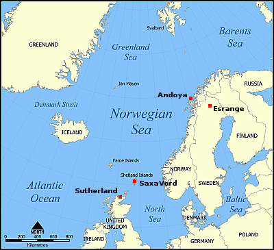
The government of the United Kingdom has made a sudden and unexpected $25 million grant to the British rocket startup Orbex, which recently announced it was abandoning its launchpad at the Sutherland spaceport and switching to the Saxavord spaceport on the Shetland Islands.
While the UK Government has supported Orbex through grants awarded via the European Space Agency’s Boost! programme, the £20 million investment appears to represent the state acquiring a stake in the company and its future. This signals a significant show of support from the government as the company gears up to compete in the European Launcher Challenge.
Channeling former NASA Administrator Jim Bridenstine, Technology Secretary Peter Kyle declared that the government’s backing of Orbex would enable the launch of “British rockets carrying British satellites from British soil.”
It seems to me that this cash award is less an investment in the company and more a kind of guilt payment by the United Kingdom government because the red tape of its bureaucracy, the Civil Aviation Authority, prevented Orbex from launching at Sutherland for almost three years, delays that eventually forced the switch to Saxavord, which after its own long red tape delays finally has its license approvals not yet issued to Sutherland.
Orbex has probably indicated to the government that these delays have caused it significant cash flow problems, similar to what happened to Virgin Orbit where red tape delays eventually drove it to bankruptcy. The company also probably told the government it needed extra cash to prepare the launchpad at Saxavord for its rocket, money it had already spent at Sutherland and no longer had.
Thus, this $25 million government grant. The UK government realized that if a second rocket company went belly-up due to its red tape, it would likely end forever any chance of getting any rocket company from considering launching from the United Kingdom.


