Varda’s third capsule begins orbital operations

Varda’s first capsule on the ground in Utah.
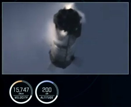
The in-space commercial company Varda on March 15, 2025 confirmed that its third capsule has successfully begun orbital operations after its launch on a Falcon 9 rocket, carrying an Air Force payload that will test measuring the capsule’s re-entry speeds in connection with military hypersonic research.
W-3’s payload is an advanced navigation system called an Inertial Measurement Unit (IMU) developed by the US Air Force and Innovative Scientific Solutions Incorporated (ISSI). This payload will be tested at reentry speeds it was designed to withstand but has never encountered before.
This payload is part of a $48 million Air Force contract awarded to Varda in December. The company also notes in the press release that it is aiming for a monthly launch rate for its capsules, which provide customers an opportunity to do all kinds of in-space testing and manufacturing. Since this launch took place only fifteen days after the landing of its second capsule, it appears Varda is moving swiftly in that direction, thus providing more business for American rocket startups.
The capsule includes a service module built by Rocket Lab, and will stay in orbit several weeks before it returns to Earth, landing at the Koonibba Test Range in South Australia, operated by the Australian commercial spaceport startup Southern Launch.