
Curiosity scientists find evidence of lake water higher on Mount Sharp than expected

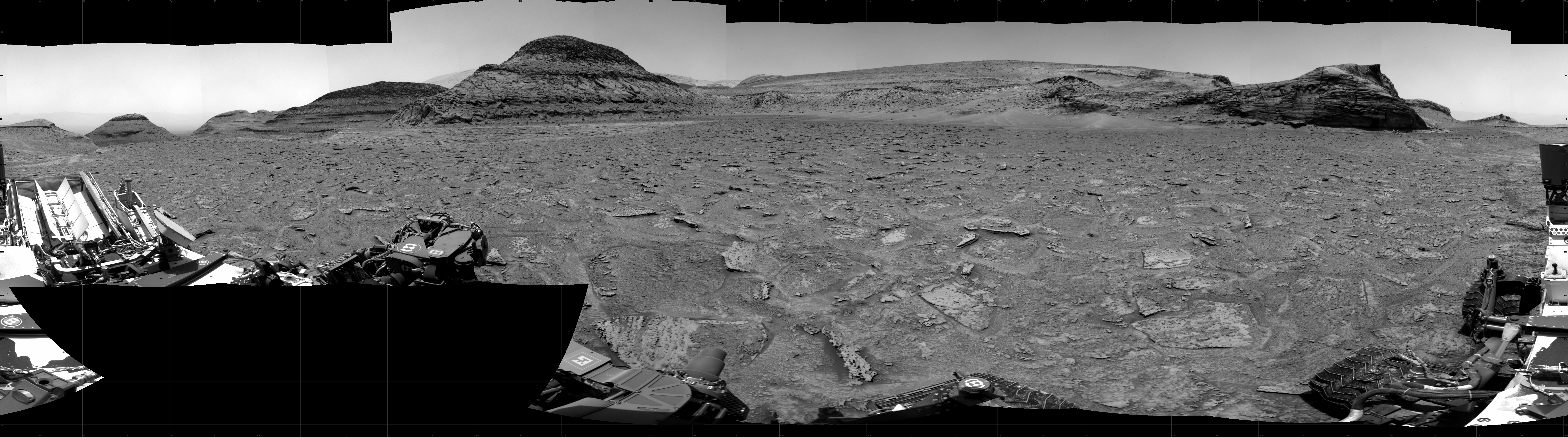
Curiosity’s view of the marker band on January 17, 2023, the red dotted line the planned future route. Click for full image.
The science team for the Mars rover Curiosity today revealed that the marker band layer where the rover present sits shows some of the best evidence of liquid water and waves yet seen on Mount Sharp, and it has been found much higher on the mountain than expected.
Having climbed nearly a half-mile above the mountain’s base, Curiosity has found these rippled rock textures preserved in what’s nicknamed the “Marker Band” – a thin layer of dark rock that stands out from the rest of Mount Sharp. This rock layer is so hard that Curiosity hasn’t been able to drill a sample from it despite several attempts. It’s not the first time Mars has been unwilling to share a sample: Lower down the mountain, on “Vera Rubin Ridge,” Curiosity had to try three times before finding a spot soft enough to drill.
Scientists will be looking for softer rock in the week ahead.
As Curiosity climbs the mountain it transitions onto new younger layers of rock. Based on Curiosity’s earlier data lower down the mountain, scientists had assumed it had gone from layers that had been under a past lake to layers that were at the lake’s shoreline to layers where only running water once flowed. They had thought the marker layer and other higher layers would only show evidence of running water. Instead, in the marker layer they have once again found evidence of an ancient lake.
This quote by Ashwin Vasavada, Curiosity’s project scientist, sums things up nicely: “Mars’ ancient climate had a wonderful complexity to it, much like Earth’s.”
