The search for Mars Polar Lander
In December 1999 the U.S. lander Mars Polar Lander was to set down near the southern polar cap of Mars. After an almost routine eleven month journey to Mars, all efforts to contact the spacecraft after its landing failed. A NASA review eventually concluded that the spacecraft had prematurely shut down its landing engines while the spacecraft was still far above the surface, and had therefore crashed to the ground.
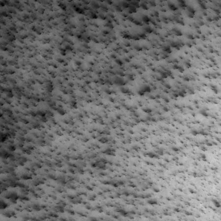
Since then there have been extensive efforts to locate the lander’s remains on the surface, all to no avail. Though Mars Global Surveyor, in orbit at the time, tried to find it, its resolution was not sufficient. In recent years Mars Reconnaissance Orbiter (MRO) has taken several dozen high resolution images of the estimated landing area, two of the most recent were included in the August 2018 image release. The image on the right is a cropped section of one of those images, illustrating the difficulty of the search. (If you click on the image you can explore the full version.) The other image is quite similar.
As the southern polar cap shrinks and grows seasonally, it produces endless numbers of black spots from the release of underground dust as the carbon dioxide dry ice sublimates into gas. Moreover, the growth and retreat of the dry ice cap changes the landscape, periodically covering any remains of the rover as well as quickly removing many of the ground disturbances that the crash might have caused. In the almost two decades since the lander’s crash landing, about ten Martian years have passed, meaning that cap has melted and frozen ten times over this region in that time.

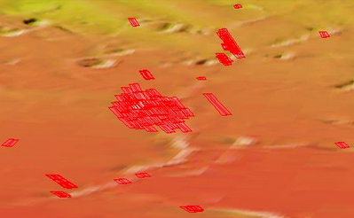
The image on the right shows the footprint of all the images that MRO has so far taken of the Mars Polar Lander landing area. If you are ambitious and want to get your name in the news, all you have to do is spend some time combing through those images and find the lander there. Every one of these images is available for public download at full resolution. Go to HiRise image archive, hover your mouse over latitude 77 degrees south, longitude 166 degrees east, and click several times to zoom in. You then change the selector icon at the top from “+” to “the arrow”. When next you click on any portion of that footprint it will show you a bunch of the images taken, all of which you can now download and inspect.
If you are successful and find the lander, please let me know. It would be nice to make that announcement here on Behind the Black.

