
Strange terrain at the Martian equator

Click for full image.
Cool image time! The photo to the right, cropped to post here, was taken on January 29, 2022 by the high resolution camera of Mars Reconnaissance Orbiter (MRO). It shows a small portion of the floor of 41-mile-wide Tuskegee Crater, sitting at the Martian equator on the rim of the outlet to the giant canyon Valles Marineris.
I have purposely focused on a section of the color strip, because of its strange green color. Most MRO images are reddish (indicating dust) or blue (indicating coarse rocks or ice). Green seems to me to be rare, and in fact is not even mentioned in the MRO science’s team explanation [pdf] of the colors the instrument produces. Since green is neither dust nor ice, this suggests some form of hard bedrock, with a mineralogy that produces that color.
The overview map below gives some context.
» Read more
Click for full image.
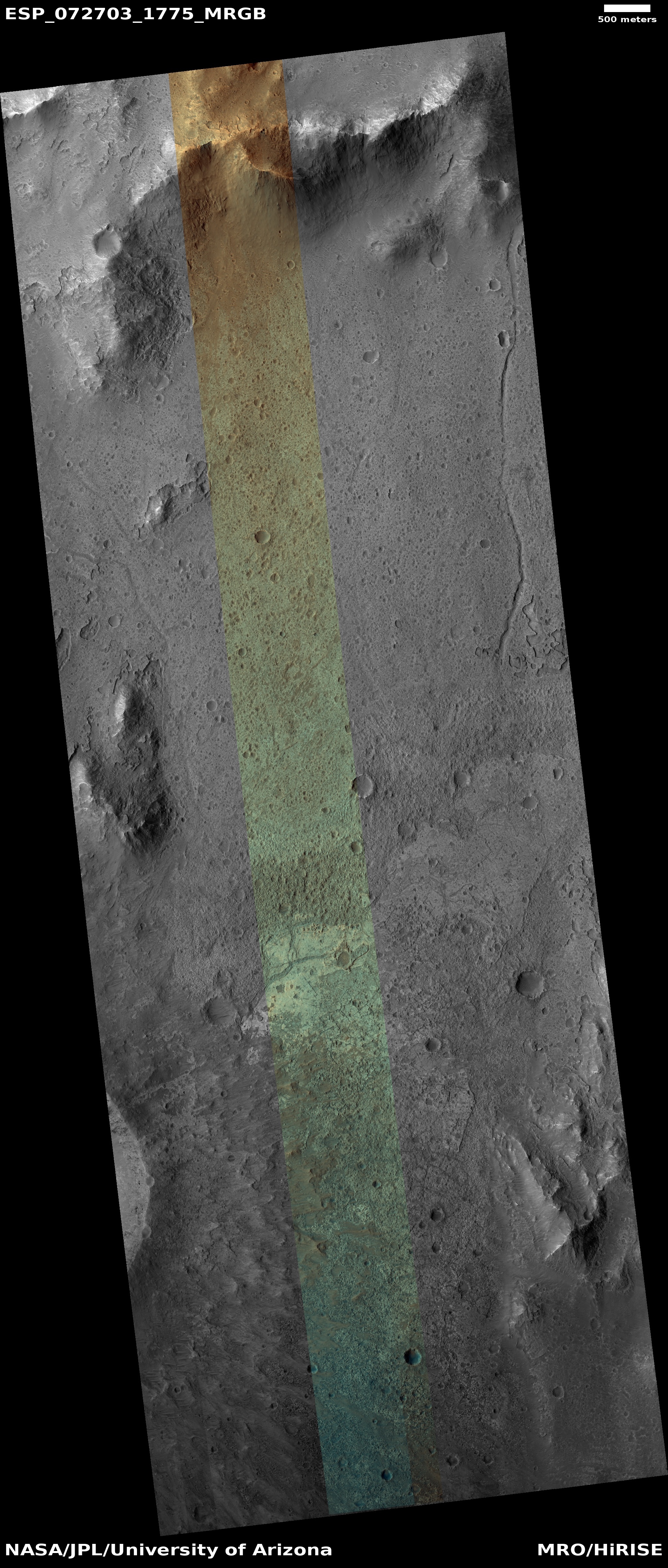
Cool image time! The photo to the right, cropped to post here, was taken on January 29, 2022 by the high resolution camera of Mars Reconnaissance Orbiter (MRO). It shows a small portion of the floor of 41-mile-wide Tuskegee Crater, sitting at the Martian equator on the rim of the outlet to the giant canyon Valles Marineris.
I have purposely focused on a section of the color strip, because of its strange green color. Most MRO images are reddish (indicating dust) or blue (indicating coarse rocks or ice). Green seems to me to be rare, and in fact is not even mentioned in the MRO science’s team explanation [pdf] of the colors the instrument produces. Since green is neither dust nor ice, this suggests some form of hard bedrock, with a mineralogy that produces that color.
The overview map below gives some context.
» Read more