Massive flow on Mars

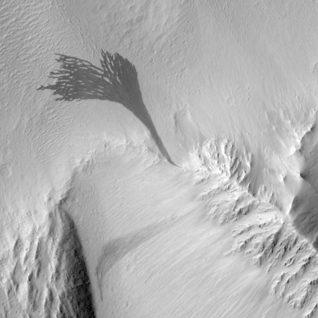
Cool image time! The image on the right, cropped to post here, comes from a Mars Reconnaissance Orbiter image that shows a massive relatively recent and dark slope streak that emanates out from a single point on the surface. (Note that the release at this link rotates the image so that north points down. I have rotated back so that north points up.)
Streaks form on slopes when dust cascades downhill. The dark streak is an area of less dust compared to the brighter and reddish surroundings. What triggers these avalanches is not known, but might be related to sudden warming of the surface.
These streaks are often diverted by the terrain they flow down. This one has split into many smaller streaks where it encountered minor obstacles. These streaks fade away over decades as more dust slowly settles out of the Martian sky.


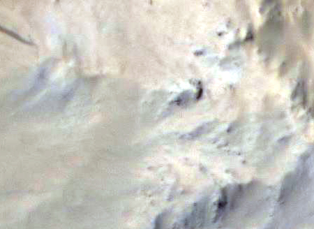
The MRO release focuses on the fingerlike breakup of the flow as it descends into sand-dune filled plain. What is more interesting to me is the terrain where this flow originated. A close-up of that area from the full image, shown on the right, reveals a feature that could be a wash running in line with the flow’s origin, and leading uphill to a dark feature that is a likely a cliff face. (The light in this image is coming from the southeast.)
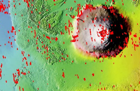
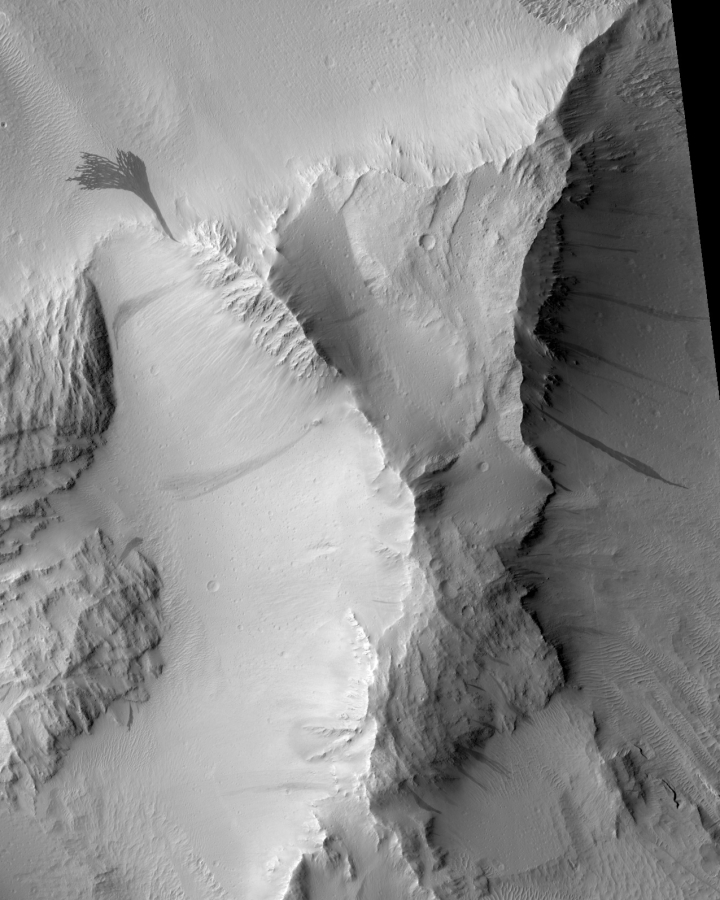
This location, at 15.2N latitude, 214.9E longitude and shown by the small cross in the image on the right and captured from this page, is west of Olympus Mons, the largest volcano on Mars. This suggests to me that the originating feature might be an outlet from a lava tube, from which water suddenly seeped out to produce this massive slope streak. A look at the mesa from which this flow came, cropped from the full image and posted below the fold, shows numerous similar slope streaks of varying ages flowing out of this mesa, with some very faint because they occurred farther in the past. Some are even within the bowl at the top of the mesa.
Whether these come from lava tubes is definitely unclear, and I suspect I will be told by geologists not likely. The seeps however do suggest strongly that this mesa might be a very good location for future colonists to look for underground water ice. Since clouds form on the western slopes of Arsia Mons, the southernmost of the three giant volcanoes to the east of Olympus Mons, and that past glacial activity has been documented there, I wonder if some of these same conditions might also exist here, on the nearby terrain west of Olympus Mons.

On Christmas Eve 1968 three Americans became the first humans to visit another world. What they did to celebrate was unexpected and profound, and will be remembered throughout all human history. Genesis: the Story of Apollo 8, Robert Zimmerman's classic history of humanity's first journey to another world, tells that story, and it is now available as both an ebook and an audiobook, both with a foreword by Valerie Anders and a new introduction by Robert Zimmerman.
The print edition can be purchased at Amazon or from any other book seller. If you want an autographed copy the price is $60 for the hardback and $45 for the paperback, plus $8 shipping for each. Go here for purchasing details. The ebook is available everywhere for $5.99 (before discount) at amazon, or direct from my ebook publisher, ebookit. If you buy it from ebookit you don't support the big tech companies and the author gets a bigger cut much sooner.
The audiobook is also available at all these vendors, and is also free with a 30-day trial membership to Audible.
"Not simply about one mission, [Genesis] is also the history of America's quest for the moon... Zimmerman has done a masterful job of tying disparate events together into a solid account of one of America's greatest human triumphs."--San Antonio Express-News


What is the volume of water that this flow represents? What caused the water to become liquid? What happened to the water, did it freeze in place or did it sublimate into the atmosphere? What is the humidity at this location and how much does it change over the course of a Martian day?
I’ve read that the humidity on Mars is at or near 100% but that it fluctuates a little depending on what time of day it is and that location influences this too.
Places like this may be great for mining water but also not the safest until we understand what causes the freeze/thaw process and how to mitigate or take advantage of events like this.
wodun: The flows here are not completely understood. It is assumed water is a component, but it is also believed that it is mixed with other materials to produce a brinelike material that is seeping across the surface.
@wodun
What I’ve gathered is that there is probably very little water in such formations nowadays. What is seen is clay minerals or other stuff once created by a water flow. But if it came from a subsurface glacier, there might be more of it left at the source. One cause of melting is a (modest) asteroid impact. Maybe wind erosion can cause a landslide that heats and exposes ice. InSight to be launched this May 5th will give data about Mars’ inner temperature, it’ll be the first dig into the subsurface. The ExoMars rover to be launched at the conjunction after that will also drill. Finally Mars exploration has come to that.
Properties of Mars’ atmosphere varies alot. Mars distance to the Sun varies by 10% from Summer to Winter. Combined with the axial tilt, seasons in the southern highlands of Mars are more extreme than in the northern lowlands. Mars has real weather, climate and seasons and it depends alot on at what latitude and altitude one is. The thin atmosphere doesn’t make it all so very important to astronauts, though.
Not water flows at all. http://earthsky.org/todays-image/mars-dust-cascade-photo
I find it very interesting how many small craters there are, ALL over the place.
For terrain that is modified, ‘relatively’ often, there sure are a bunch on them.