
Landslides on Charon
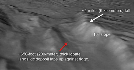
Images from New Horizons have detected evidence of past avalanches on Pluto’s largest moon, Charon. The image on the right is a reduced version of a perspective view created using data from various instruments.
This perspective view of Charon’s informally named “Serenity Chasm” consists of topography generated from stereo reconstruction of images taken by New Horizons’ Long Range Reconnaissance Imager (LORRI) and Multispectral Visible Imaging Camera (MVIC), supplemented by a “shape-from-shading” algorithm. The topography is then overlain with the PIA21128 image mosaic and the perspective view is rendered. The MVIC image was taken from a distance of 45,458 miles (73,159 kilometers) while the LORRI picture was taken from 19,511 miles (31,401 kilometers) away, both on July 14, 2015.
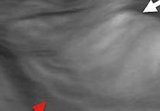
To the left is a close-up taken from the annotated image. You can see the slump materials at the base of the mountain left behind after the material slide down the mountain. It is not clear whether it is Charon’s lower gravity and alien composition and environment (very very very cold) that makes this look more muddy than one would expect, or whether it is because of the limited resolution of the original image and the modeling to create the oblique version.

On Christmas Eve 1968 three Americans became the first humans to visit another world. What they did to celebrate was unexpected and profound, and will be remembered throughout all human history. Genesis: the Story of Apollo 8, Robert Zimmerman's classic history of humanity's first journey to another world, tells that story, and it is now available as both an ebook and an audiobook, both with a foreword by Valerie Anders and a new introduction by Robert Zimmerman.
The print edition can be purchased at Amazon or from any other book seller. If you want an autographed copy the price is $60 for the hardback and $45 for the paperback, plus $8 shipping for each. Go here for purchasing details. The ebook is available everywhere for $5.99 (before discount) at amazon, or direct from my ebook publisher, ebookit. If you buy it from ebookit you don't support the big tech companies and the author gets a bigger cut much sooner.
The audiobook is also available at all these vendors, and is also free with a 30-day trial membership to Audible.
"Not simply about one mission, [Genesis] is also the history of America's quest for the moon... Zimmerman has done a masterful job of tying disparate events together into a solid account of one of America's greatest human triumphs."--San Antonio Express-News
The smoothness is probably because they used a 2D image and then stretched it to fit the 3D elevation data.
In the Army we often used a 2D map and laid it over Digital Terrain Elevation Data (DTED). Looked the same way this image does…