
Strange craters in the Martian northern lowlands
Click for full image.
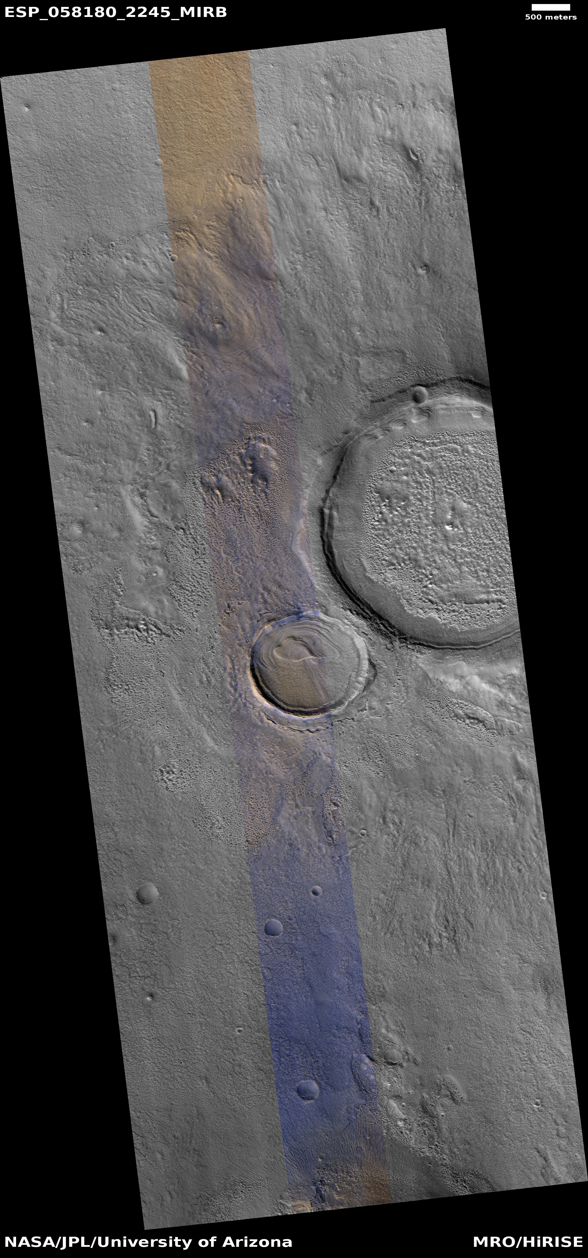
Cool image time! The image on the right, cropped and rotated to post here, was taken by the high resolution camera on Mars Reconnaissance Orbiter (MRO) and released in the monthly image dump provided by the science team. The release had no caption. It merely described this as a “Layered mound in crater.”
That is certainly what is is. However, layering suggests a regionwide process. The crater to the immediate northeast (the rim of which can be seen in the upper corner of this image), does not have the same kind of layering. (Be sure to click on the image to see that other crater.) Its crater floor is instead a blob of chaotic knobs, with the only layering scattered in spots along its north interior rim.
That the layering of both craters favors the north suggests a relationship, but what that is is beyond me. Prevailing winds? Maybe, but I don’t have the knowledge to explain how that process would work.
It is not even certain that these two craters were formed by impact. They are located in the northern lowlands where an intermittent ocean is believed to have once existed, and thus might be remnants of that ocean’s floor. That they both have a muddy appearance reinforces this hypothesis, but once again, I would not bet much money on this theory. The features here could also be expressing the effect of an impact on a muddy seafloor.
In either case the craters imply that the ocean that might have once been here existed a long enough time ago for these craters to form (either by impact or some other process) and then evolve. This has been a relatively dry place for a very long time.

On Christmas Eve 1968 three Americans became the first humans to visit another world. What they did to celebrate was unexpected and profound, and will be remembered throughout all human history. Genesis: the Story of Apollo 8, Robert Zimmerman's classic history of humanity's first journey to another world, tells that story, and it is now available as both an ebook and an audiobook, both with a foreword by Valerie Anders and a new introduction by Robert Zimmerman.
The print edition can be purchased at Amazon or from any other book seller. If you want an autographed copy the price is $60 for the hardback and $45 for the paperback, plus $8 shipping for each. Go here for purchasing details. The ebook is available everywhere for $5.99 (before discount) at amazon, or direct from my ebook publisher, ebookit. If you buy it from ebookit you don't support the big tech companies and the author gets a bigger cut much sooner.
The audiobook is also available at all these vendors, and is also free with a 30-day trial membership to Audible.
"Not simply about one mission, [Genesis] is also the history of America's quest for the moon... Zimmerman has done a masterful job of tying disparate events together into a solid account of one of America's greatest human triumphs."--San Antonio Express-News
Guessing, the muddy appearance of the splash ring around the large crater favors an impact. ( perhaps a shallow sea at the time?)
This would’ve caused heated hollow steam air pockets under the surface that would shift in layers as it cooled. Water filled caverns would collapse as they dried up forming the heart shape in the smaller crater?
One curious thing, six distinct cone volcanos, perfectly round cinder mounds, two of which have volcanic calderas. They could almost be mistaken for impact craters…
I Heart this crater.