
The crack that splits the giant volcanoes on Mars

Click for full image.
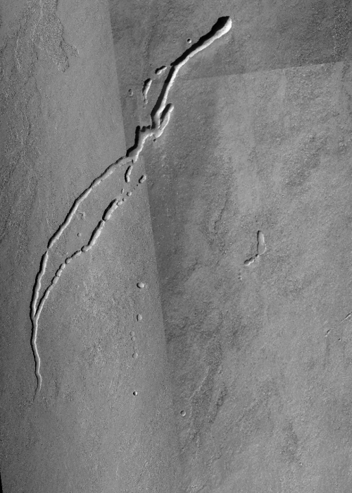
Cool image time! In the April download of new images from the high resolution camera on Mars Reconnaissance Orbiter (MRO) was the photo to the right, taken on February 23, 2021 and cropped and reduced to post here, of what was labeled as “Source Region of Possible Rille on South Flank of Arsia Mons.”
Arsia Mons is the southernmost of the string of three giant volcanoes that sit between Mars’ biggest volcano to the west, Olympus Mons, and Mars’ biggest canyon to the east, Valles Marineris. This depression is on the mountain’s lower southern flank, and likely shows an ancient resurgence point where lava once flowed out from beneath the ground to form a rill meandering to the southwest. Today there is no visible resurgence. The floor of the depression appears to be filled with sand and dust, with the surrounding slopes spotted with scattered boulders.
What makes this particular image more interesting is how, when we take a very wide view, it reveals one of the most dramatic geological features on Mars, the 3,500 mile-long crack that caused these three volcanoes, and is actually not obvious unless you know what to look for.
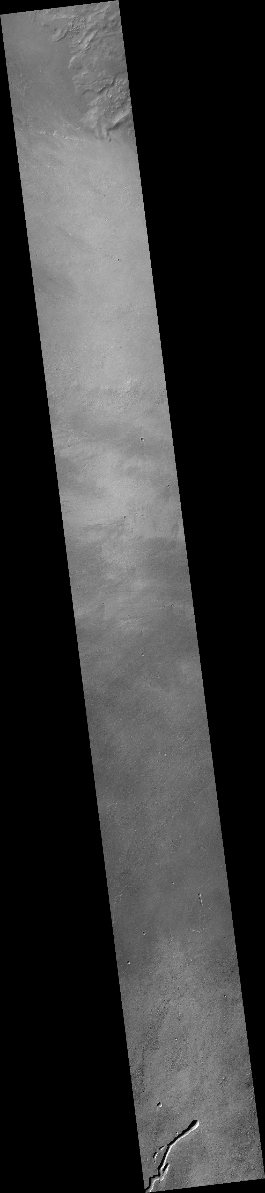
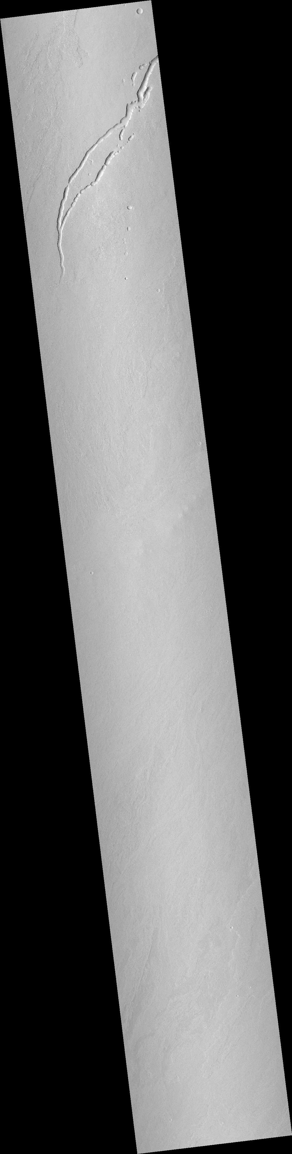
So we need to zoom out. Let us first begin with a mosaic of three wider MRO context camera images, showing the entire rille and the immediately surrounding terrain.
Click here, here, and here to see original images.
The slope goes downhill to the south. Note how the rille appears at several points to break into a series of pits. This suggests that there is actually an underground lava tube below the rille, which is revealed by the sinking of the surface ground above it.
Note also how the rille appears to fade away. This suggests that either the flow that created it had ended, or had begun to spread out, propagating more evenly so that no specific channel or tube was created.
The lack of other similar features in the surrounding terrain is important. While there are a handful of other depressions, they do not show the same kind of obvious trend or pattern. The line of depressions to the east of the rille might indicate an underground tube, but if so it is not as obvious. The uniqueness of the rille suggests that it formed because there was some distinct underground geological feature, such as a fault, at that spot. When two sections of ground either spread apart or shift sideways to each other, creating a crack, the contact point is called a fault, and often becomes the place where flows of lava or water congregate, creating rilles, channels, fissures, etc.
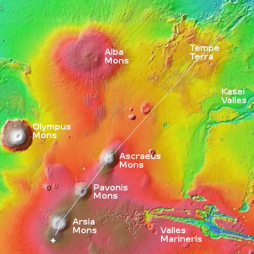
The southeast to southwest trend of the rille is also suggestive. It might be indicating that the underground fault that might have helped form this rille could also be part of a much, much, much larger fault feature, the 3,500-mile-long crack that cuts across all three giant volcanoes and beyond and was actually the reason they all formed in a line. The overview map to the right shows this, with this rill marked by the white dot. The line running from the region of cracks dubbed Tempe Terra to this rill marks the line of the fault. In fact, if you zoom into the caldera of Arsia Mons you can see obvious evidence of this fault in its northeast and southwest rims.
The volcanic processes that more than a billion years ago shaped this part of Mars was caused by deep and larger underground forces that also cracked the planet. The evidence of those epic planetary events is still visible, on scales ranging from mere feet to thousands of miles.

On Christmas Eve 1968 three Americans became the first humans to visit another world. What they did to celebrate was unexpected and profound, and will be remembered throughout all human history. Genesis: the Story of Apollo 8, Robert Zimmerman's classic history of humanity's first journey to another world, tells that story, and it is now available as both an ebook and an audiobook, both with a foreword by Valerie Anders and a new introduction by Robert Zimmerman.
The print edition can be purchased at Amazon or from any other book seller. If you want an autographed copy the price is $60 for the hardback and $45 for the paperback, plus $8 shipping for each. Go here for purchasing details. The ebook is available everywhere for $5.99 (before discount) at amazon, or direct from my ebook publisher, ebookit. If you buy it from ebookit you don't support the big tech companies and the author gets a bigger cut much sooner.
The audiobook is also available at all these vendors, and is also free with a 30-day trial membership to Audible.
"Not simply about one mission, [Genesis] is also the history of America's quest for the moon... Zimmerman has done a masterful job of tying disparate events together into a solid account of one of America's greatest human triumphs."--San Antonio Express-News
Perhaps a Hellas impactor loaded the terrain with energy…displaced here?
Jeff Wright: Yes, I’ve seen this posited also. What we need to find out however is firm dating, which we won’t get until we are on the planet, as humans, in relatively large numbers.
Miranda’s chevron and race-track looking like strip-mines is what has me flummoxed
As presented, the features, to me, appear to be humps.
However, upside down, they are indeed depressions.
At least I do not see canals!