May 22, 2025 Quick space links
Courtesy of BtB’s stringer Jay. This post is also an open thread. I welcome my readers to post any comments or additional links relating to any space issues, even if unrelated to the links below.
- Blue Origin touts underwater tests of its manned lunar lander design
Essentially divers tested the ladder and hatch design for getting astronauts and cargo in and out of the lander.
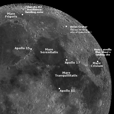
- Ispace reports Resilience is continuing to operate as planned in lunar orbit
The landing is still planned for June 5, 2025.
- The UAE hires Firefly’s Blue Ghost to land its Rashid-2 rover on the far side of the Moon
UAE’s first Rashid rover had been carried by Ispace’s first lunar lander, Hakuto-R1, which crashed. It appears the UAE chose Firefly this time after its successful landing of Blue Ghost earlier this year.
- Chinese astronauts on Tiangong-3 complete their first spacewalk
They installed “a debris protection device at its designated location.” It appears they are testing this shield’s effectiveness against micrometeorites and space junk at various locations on the station.
- On this day in 1969 Apollo 10 descended to within nine miles of the lunar surface, testing both the Apollo capsule and Lunar Module in lunar orbit
This was a complete dress rehearsal prior to the Apollo 11 landing two months later. It accomplished everything but the landing itself.

