Rimstone dams in Mars’ youngest lava deposit

Rimstone dams in Mars' youngest lava deposit
Click for original image.

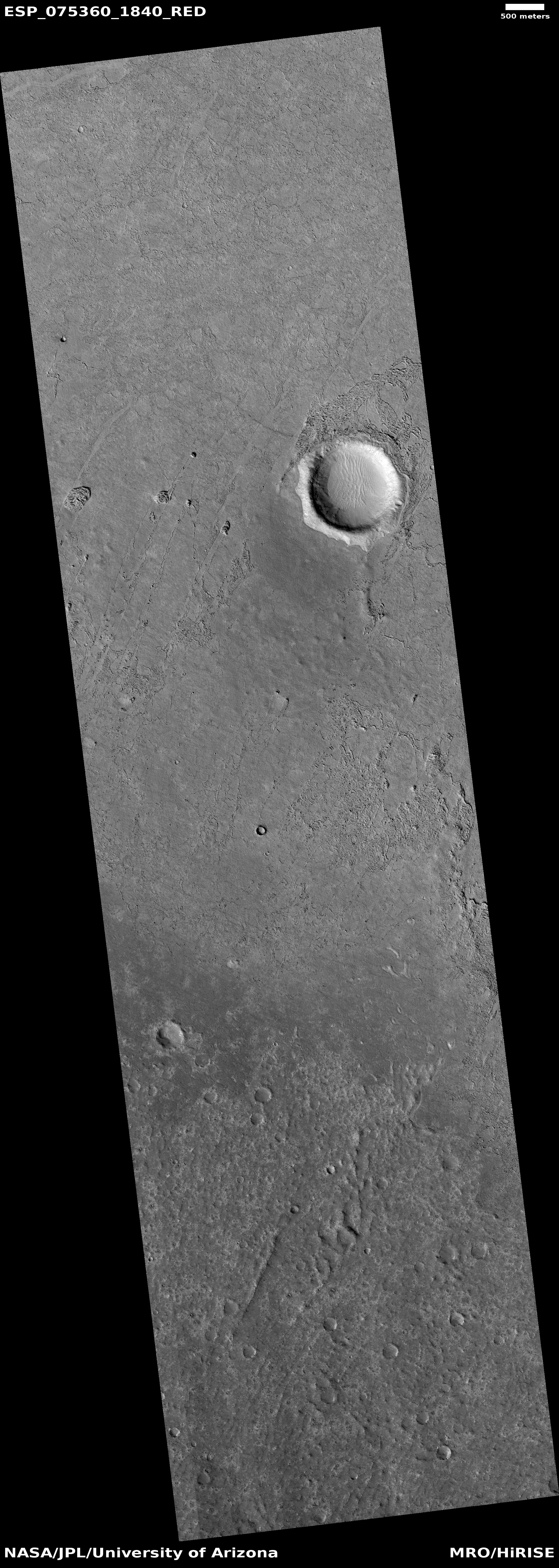
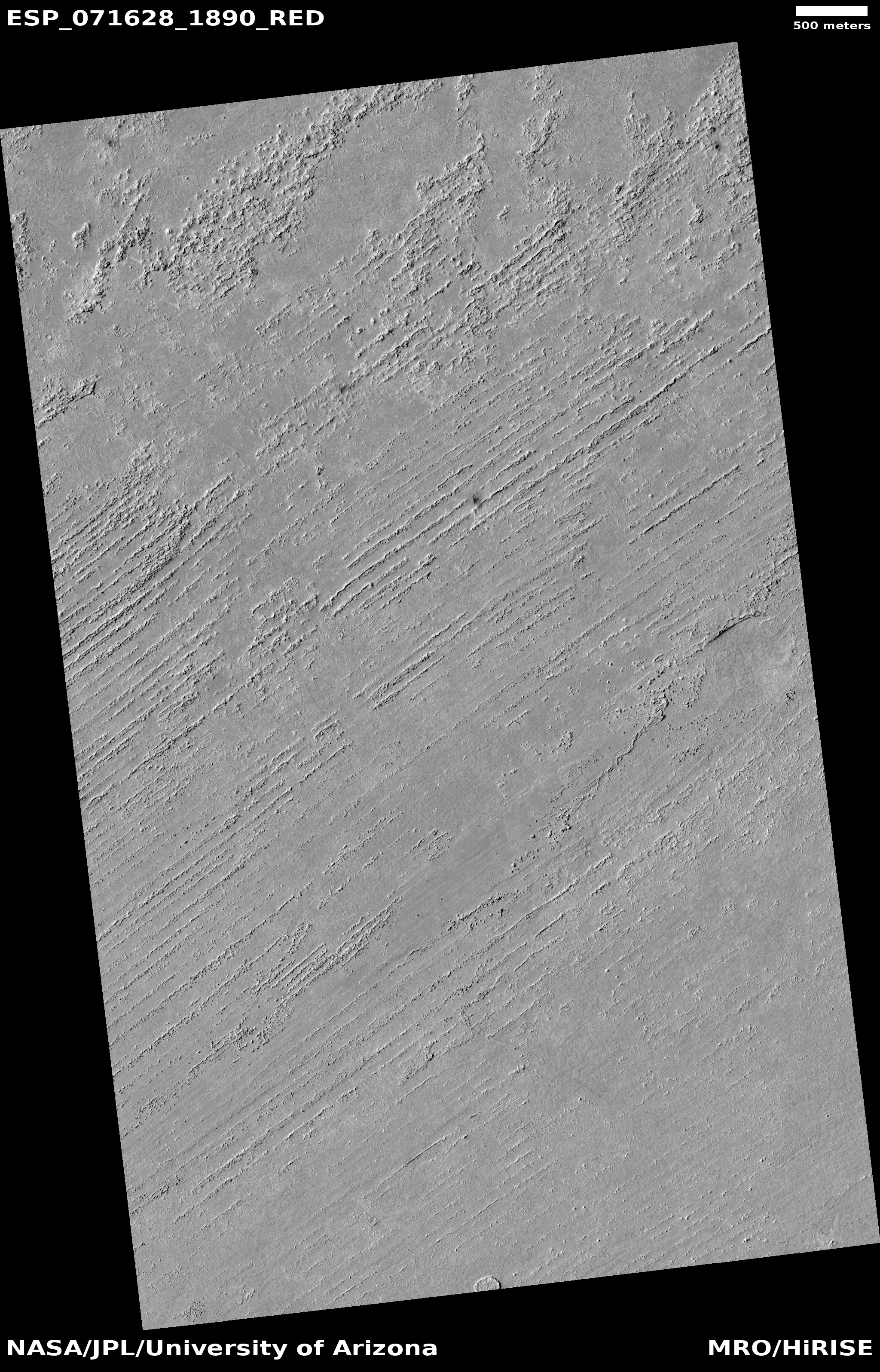
Cool image time! The picture to the right, rotated, cropped, reduced, and sharpened to post here, was taken on April 23, 2023 by the high resolution camera on Mars Reconnaissance Orbiter (MRO).

The scientists dub the features here merely as “land forms,” probably because it is difficult to explain the origins of many of these strange features. For example, why is the half-mile-wide crater filled that knobby terrain, far different than the surrounding plains? Similarly, what caused the small meandering ridges (less than five feet high) that appear to closely resemble the cave formation called rimstone dams?

And why is this terrain so generally flat and smooth?

As usual, the overview map helps explains some of this, but not all.
» Read more

Frozen lava flows around Martian hills

Martian lava flowing around hills
Click for full image.

Cool image time! The photo to the right, rotated, cropped, reduced, and enhanced to post here, was taken on August 24, 2022 by the high resolution camera on Mars Reconnaissance Orbiter (MRO). It shows the westernmost edge of the Athabasca flood lava plain, thought to be the youngest lava flow on Mars, having covered the area of Great Britain in a matter of weeks 600 million years ago.

This image was a captioned feature yesterday by the MRO science team. As they note:

Although you can’t sail a boat on a sea of lava, hills and craters that stick up higher than the lava flow act like barriers. When a boat is driven through the water, there is a bow wave at the front of the boat, and a wake that trails off behind that indicates which way the boat is moving. In a lava flow, when a hill sticks up, the lava piles up on the upstream side (just like a bow wave) and can leave a wake on the downstream side, so we can tell which way the lava was moving against the stationary hill.

As you can see, every hill has a pile of lava on its northeast slopes, and a wake to its southeast. As the main vent of the Athabasca eruption is to the northeast, about 500 miles away (as shown on the overview map below), the flow direction suggested by the wakes fit the general geography.
» Read more

A “What the heck!?” crater on Mars

A
Click for full image.

Today’s cool image falls into what I call my “What the heck?” category. The photo to the right, cropped and reduced to post here, was taken on May 31, 2022 by the high resolution camera on Mars Reconnaissance Orbiter. It was also picked by the science team as that camera’s picture of the day on July 12, 2022. From the caption:

This seems to belong to a class of craters in the Cerberus Plains that was flooded by lava, which was subsequently uplifted and fractured by an unknown process. This class of filled, uplifted and fractured craters is informally called “the waffle.” A combination of volcanic and periglacial processes seems possible.

In other words, the scientists only have a vague idea what created the broken up floor of this crater. For example, why did only the material in the interior of the crater get uplifted and fractured? Did this uplift occur before, during, or after the lava event?

The overview map below tells us a little about where that lava came from, and when.
» Read more

Mars’ youngest lava flow

Mars' youngest lava flow
Click for full image.

Today’s cool image is in some ways another version of my last cool image yesterday. Both are in Mars’s volcano country. Both show what appears to be a lava flow.

Yesterday’s image showed the leftover evidence of a confined flow of lava running in a meandering pattern like a river, and was somewhat distant from the biggest nearby volcanoes. Today’s cool image, to the right and rotated, cropped, and reduced to post here, is instead located smack dab on the inside of what is thought to be Mars’ youngest major lava event, the Athabasca flood lava plain, and in fact is near its outlet, when about 600 million years ago it belched out enough lava in just a matter of a few weeks to cover an area about the size of Great Britain.

The overview map below illustrates this.

» Read more