A peanut-shaped crater in the northern plains of Mars

Click for full image.
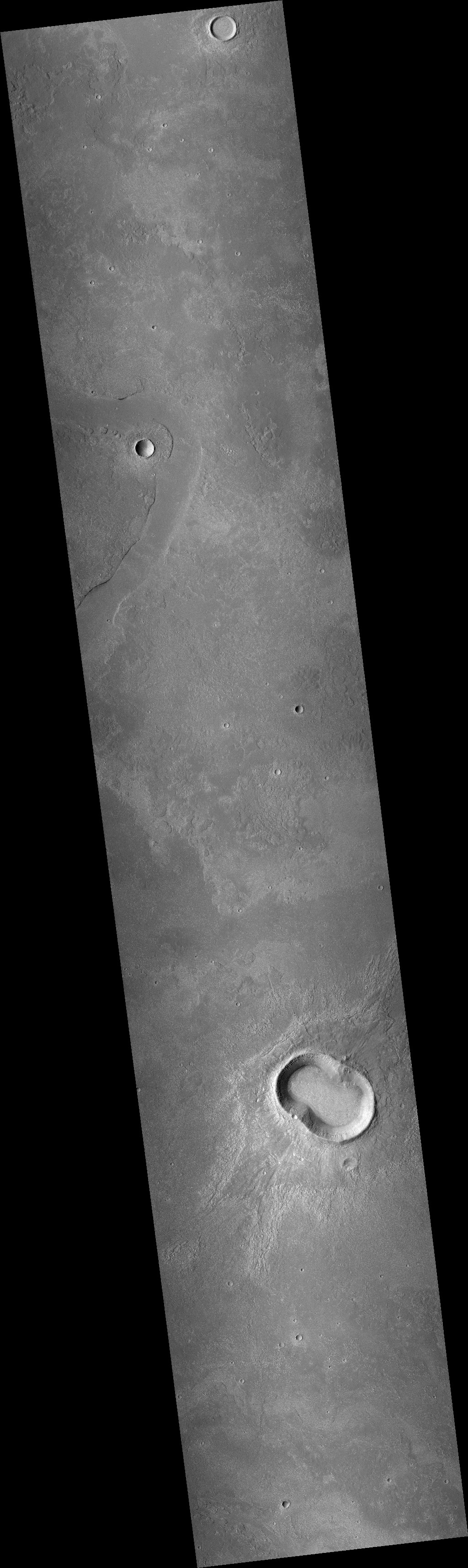
Cool image time! The photo to the right, rotated, cropped and reduced to post here, was taken in May 2008 by the wide angle context camera on Mars Reconnaissance Orbiter (MRO). It shows what the scientists have since labeled a “peanut-shaped crater.”
What caused this unusual shape? The obvious and most likely explanation is that this was a double impact that occurred simultaneously. Imagine the ground being hit either by an asteroid with two lobes or by two similar-sized asteroids falling side-by-side.
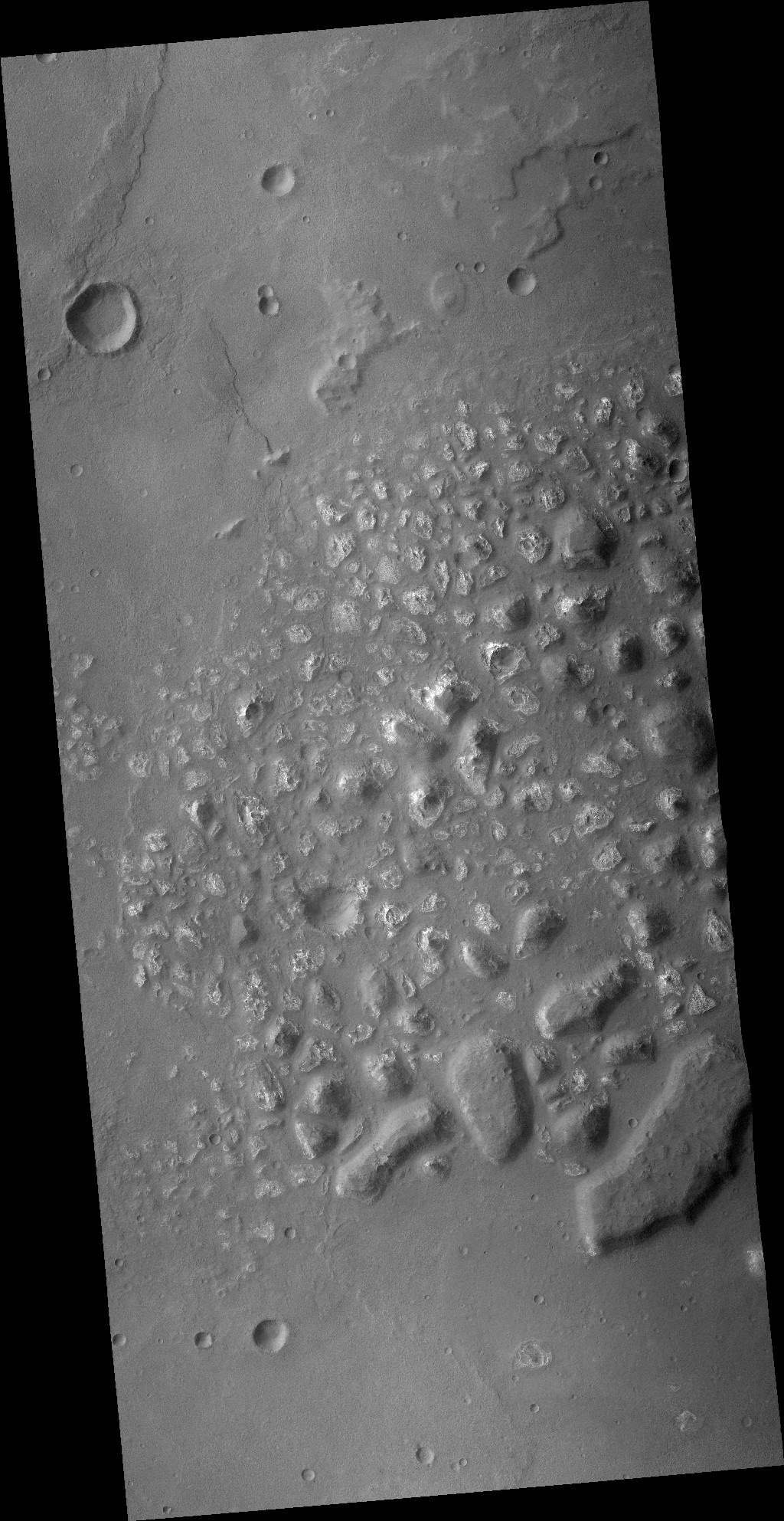
Fast forward thirteen years to 2021. In the fifteen years since 2006 when MRO begin science operations in orbit around Mars no high resolution images were taken of this crater. Finally, on July 30, 2021, scientists finally decided to take a high resolution image of this crater’s western half. You can see that image below, rotated, cropped, and reduced to post here.
» Read more
Click for full image.
Cool image time! The photo to the right, rotated, cropped and reduced to post here, was taken in May 2008 by the wide angle context camera on Mars Reconnaissance Orbiter (MRO). It shows what the scientists have since labeled a “peanut-shaped crater.”
What caused this unusual shape? The obvious and most likely explanation is that this was a double impact that occurred simultaneously. Imagine the ground being hit either by an asteroid with two lobes or by two similar-sized asteroids falling side-by-side.
Fast forward thirteen years to 2021. In the fifteen years since 2006 when MRO begin science operations in orbit around Mars no high resolution images were taken of this crater. Finally, on July 30, 2021, scientists finally decided to take a high resolution image of this crater’s western half. You can see that image below, rotated, cropped, and reduced to post here.
» Read more