
Enigmatic layering and chasms on Mars

Click for full image.
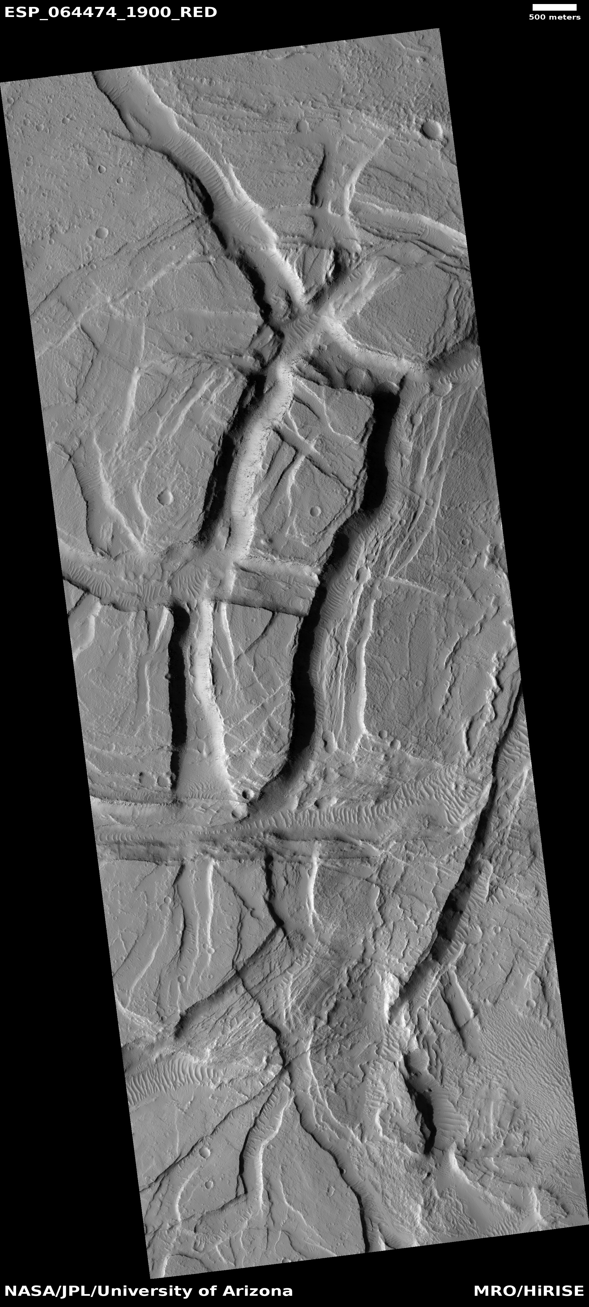
Cool image time! The photo to the right, rotated, cropped, and reduced to post here, was taken on April 28, 2020 by the high resolution camera on Mars Reconnaissance Orbiter. (MRO). The science team entitled it “Enigmatic Uplifts in Echus Montes,” indicating a sense of bafflement on their part about this geology.
The features here are certainly somewhat puzzling. At first glance the terrain is reminiscent of Martian chaos terrain, mesas cut by canyons in an almost random pattern. As I explained at the link,
Chaos terrain is typically a collection of mesas separated by straight-lined canyons. It is found in many places on Mars, most often in the transition zone between the southern highlands and the northern lowlands where an intermittent ocean might once have existed. It is believed to form by erosion, possibly caused by either flowing water or ice, moving along fault lines. As the erosion widened the faults, they turned into canyons separating closely packed mesas. With time, the canyons widened and the mesas turned into a collection of hills.
What makes this particular image puzzling however is that there seem to be multiple layers of mesas and canyons. Look at the top of the rectangular mesa in the upper middle of the image. It appears to have its own miniature chaos terrain on its plateau. Somehow that first layer of chaos was abandoned when the more prominent larger canyons started to form around it.
The location of this feature is indicated by the black cross on the overview map to the right. It is in the middle of the large and wide northward trending part of the giant valley dubbed Kasei Valles. And as usual, knowing the location helps explain what we are seeing.
» Read more