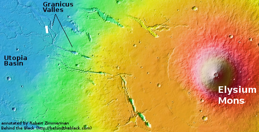
The sagging flank of one of Mars’ giant volcanoes

The sagging flank of Elysium Mons
Click for original image.

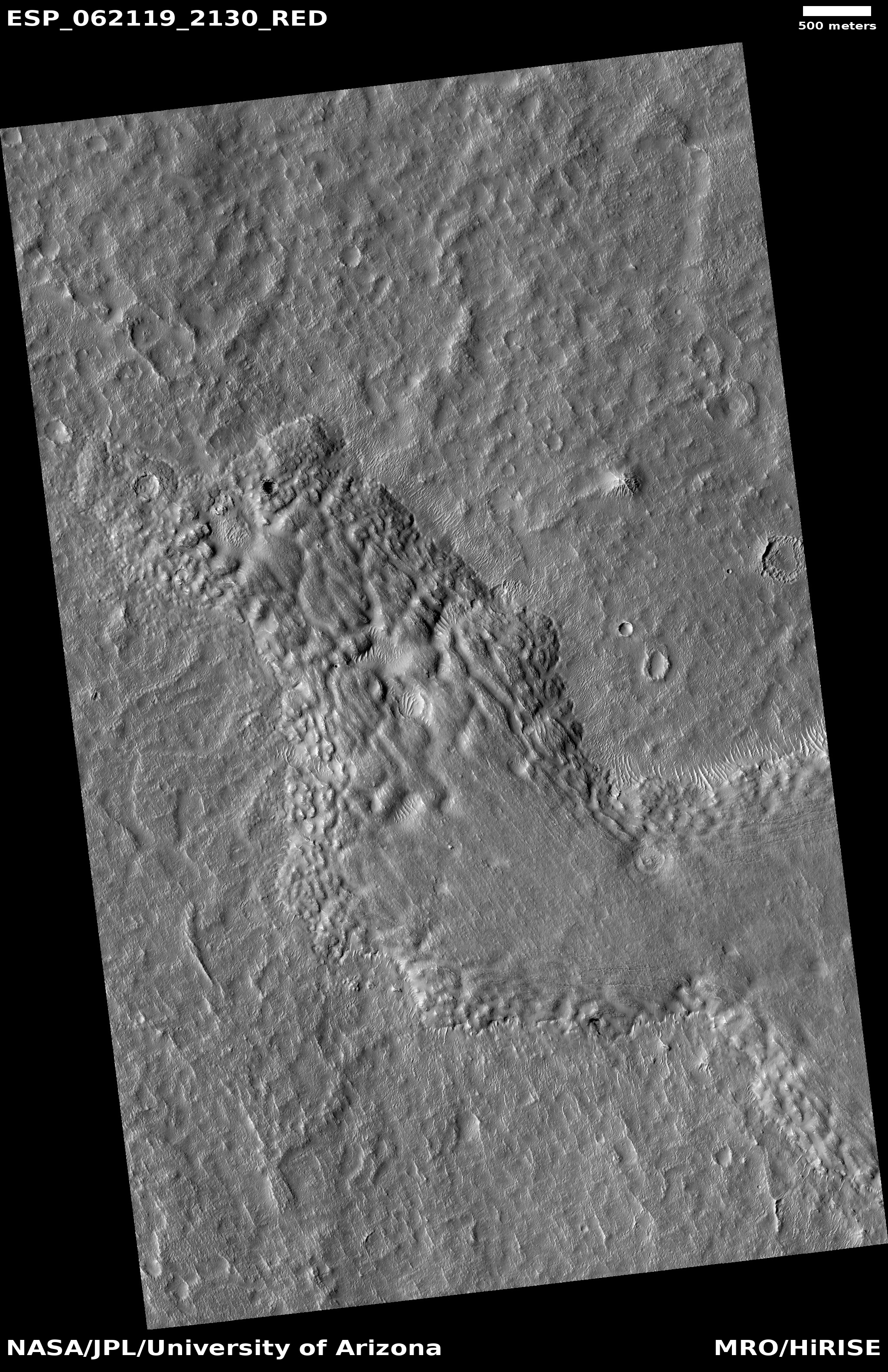
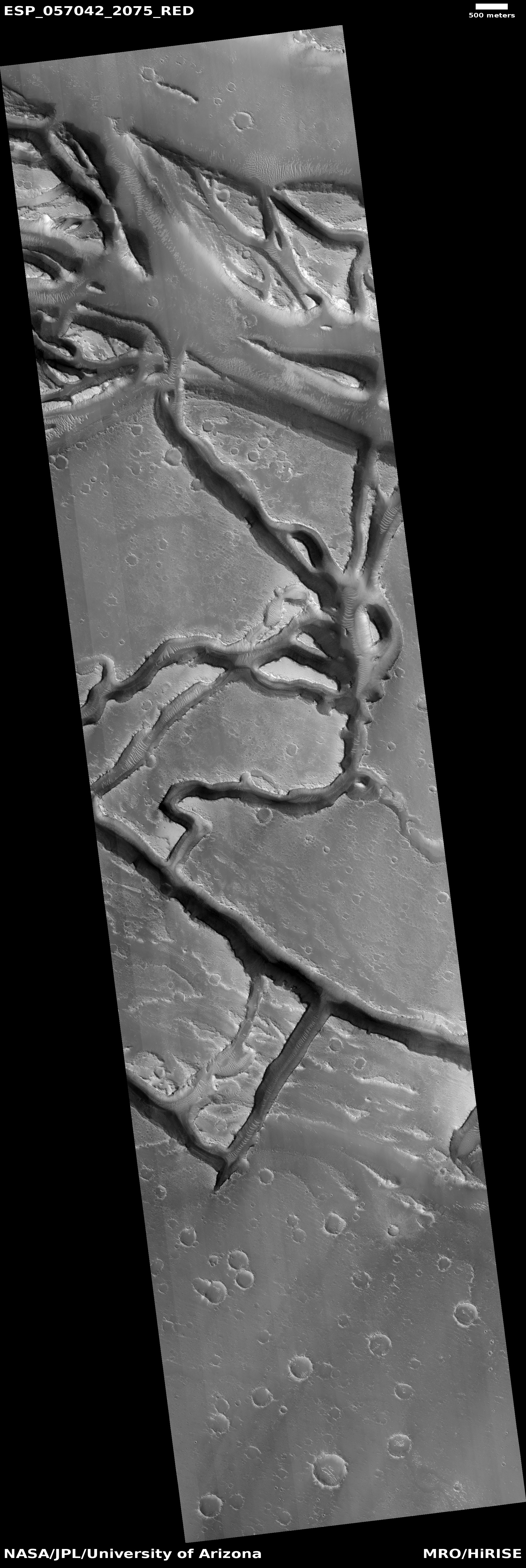
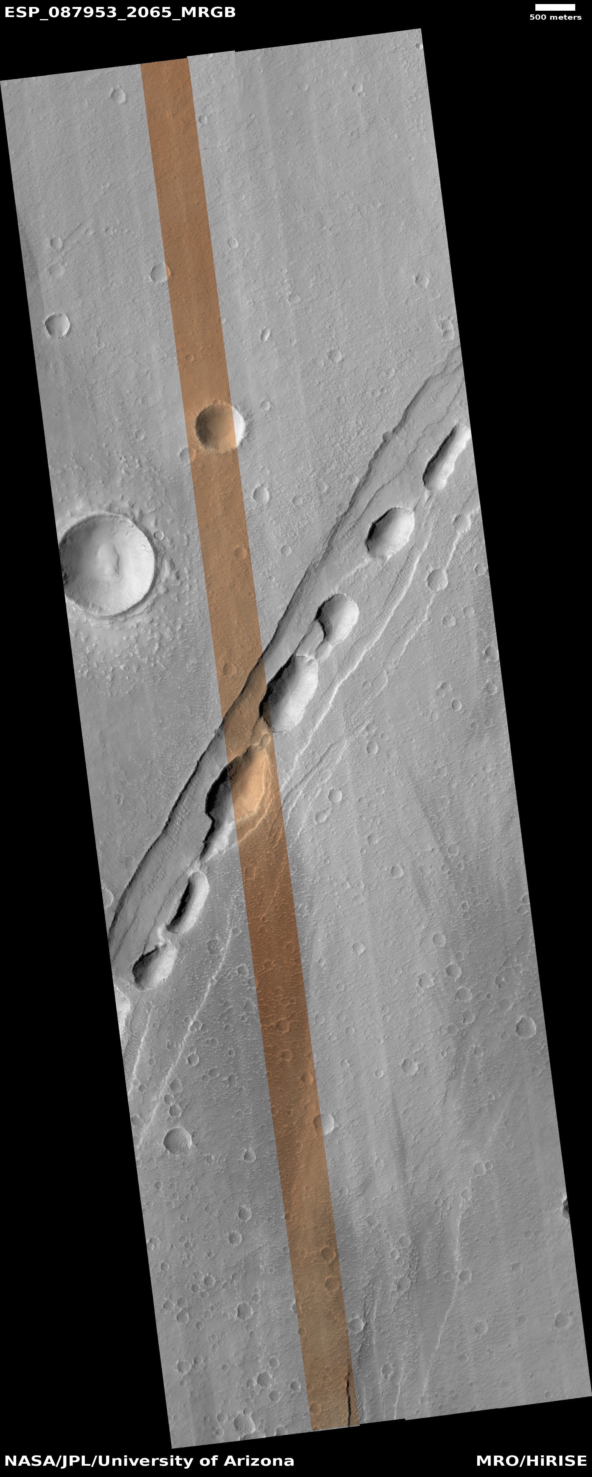
Cool image time! The picture to the right, rotated, cropped, reduced, and sharpened to post here, was taken on May 1, 2025 by the high resolution camera on Mars Reconnaissance Orbiter (MRO). It shows what the science team labels a “chain of pit craters in [a] graben”.

A graben is a surface fissure created when the surface either spreads or two sections shift sideways in opposite directions. The chain of pits suggest that there is a larger void below into which the surface is sinking. It is also likely that a lot of the sinking material is volcanic ash, thrown free in an eruption hundreds of millions of years ago, which over the eons has been blown up to this location to settle in the crack to fill it. It is now trapped there, and sinking.

What caused the ground here to shift and create the fissure? In this case, the cause is quite large and massive, in a way that boggles the mind.
» Read more

Frozen lava that flowed from Elysium Mons

Lava flows off of Elysium Mons
Click for full image.

Cool image time! The photo on the right, rotated, cropped, and reduced to post here, was taken by the high resolution camera on Mars Reconnaissance Orbiter (MRO) on October 27, 2019. It shows a dramatic lava flow coming off the flanks of the giant volcano Elysium Mons, a flow that has probably been frozen in place for somewhere between 600 million to 3.4 billion years.

If you look close you can see several craters on top of the lava flow. To my eye these impacts look like they occurred when the lava was still soft, which suggests they were debris thrown up by the volcano. This however would be surprising, as the eruption of Elysium Mons is not thought to have been explosive, but slow and steady. Either way, these crater impacts are one of the ways scientists have been able to estimate the age of this volcano and its long frozen flows.

MRO has taken a scattering of high resolution images in this area, all of which are aimed at similar frozen flows coming off the volcano. All are about 250 miles from the caldera, which gives you a sense of the size and extent of Elysium Mons. While it is the fourth largest volcano on Mars at 7.5 miles high, its grade is so gentle that if you were standing on the surface the peak would be hard to see from any point.

Volcanic rivers on Mars

Granicus Valles

Cool image time! The photo on the right, cropped and reduced to post here, was part of the November image release from the high resolution camera on Mars Reconnaissance Orbiter (MRO). If you click on the image you can see the full resolution picture.

The uncaptioned release webpage is dubbed “Faults in Granicus Valles.” The image itself only shows a small part of Granicus Valles, named after a river in Turkey, that flows down from the estern slopes of the giant volcano Elysium Mons. While far smaller than the four big Martian volcanoes in the Tharsis region to the east and near Marines Valles (which I highlight often), Elysium Mons still outshines anything on Earth at a height of almost 30,000 feet and a width of 150 miles. It sits at about the same northern latitude of Olympus Mons, but all by itself, rising up at the very northern edge of the transition zone between the southern highlands and the northern plains, with the vast Utopia Basin, the second deepest basin on Mars, to the west.

Overview of Elysium Mons and Granicus Valles

Granicus Valles itself is almost five hundred miles long. At its beginning it flows in a single straight fault, but once it enters the northern plains of Utopia Basin it begins to meander and break up into multiple tributaries. The MRO image above shows only a tiny portion in the northern plains, as illustrated by the white box in the overview map to the left.
» Read more