
A Martian bear!

Click for original image. Full image here.
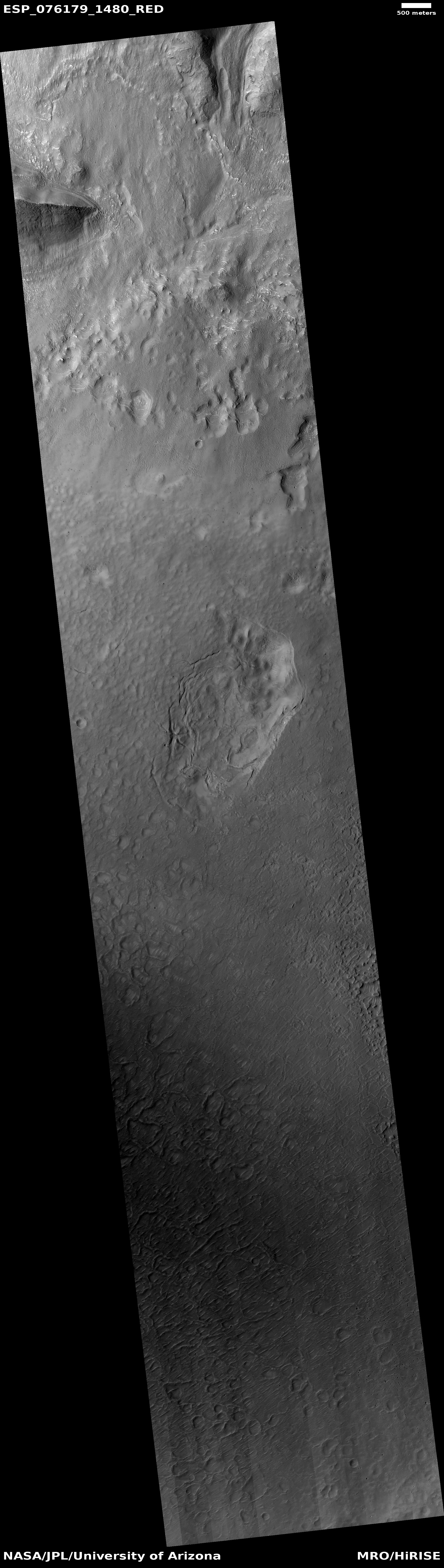
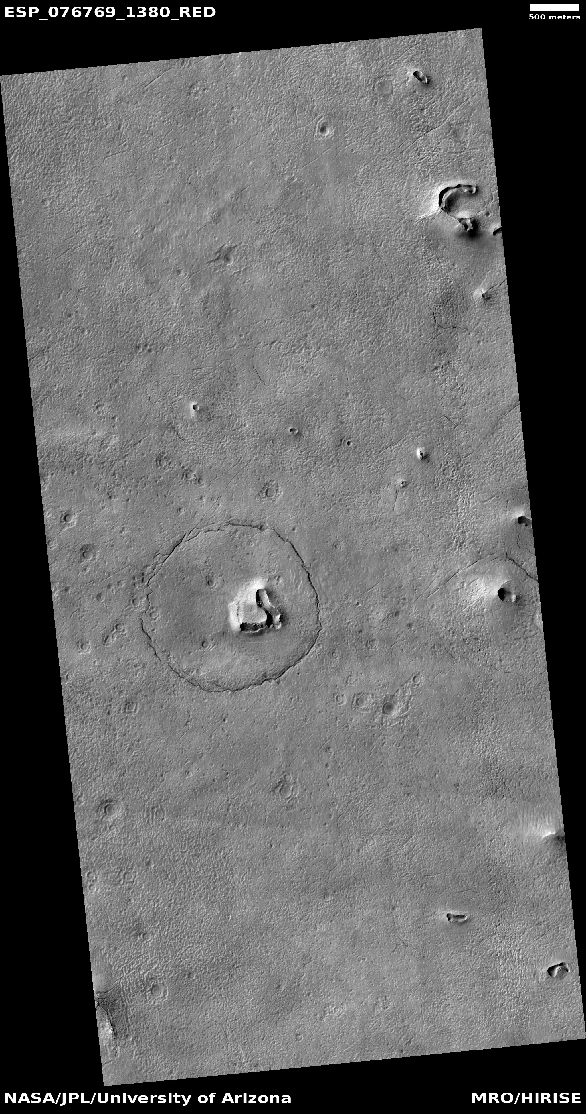
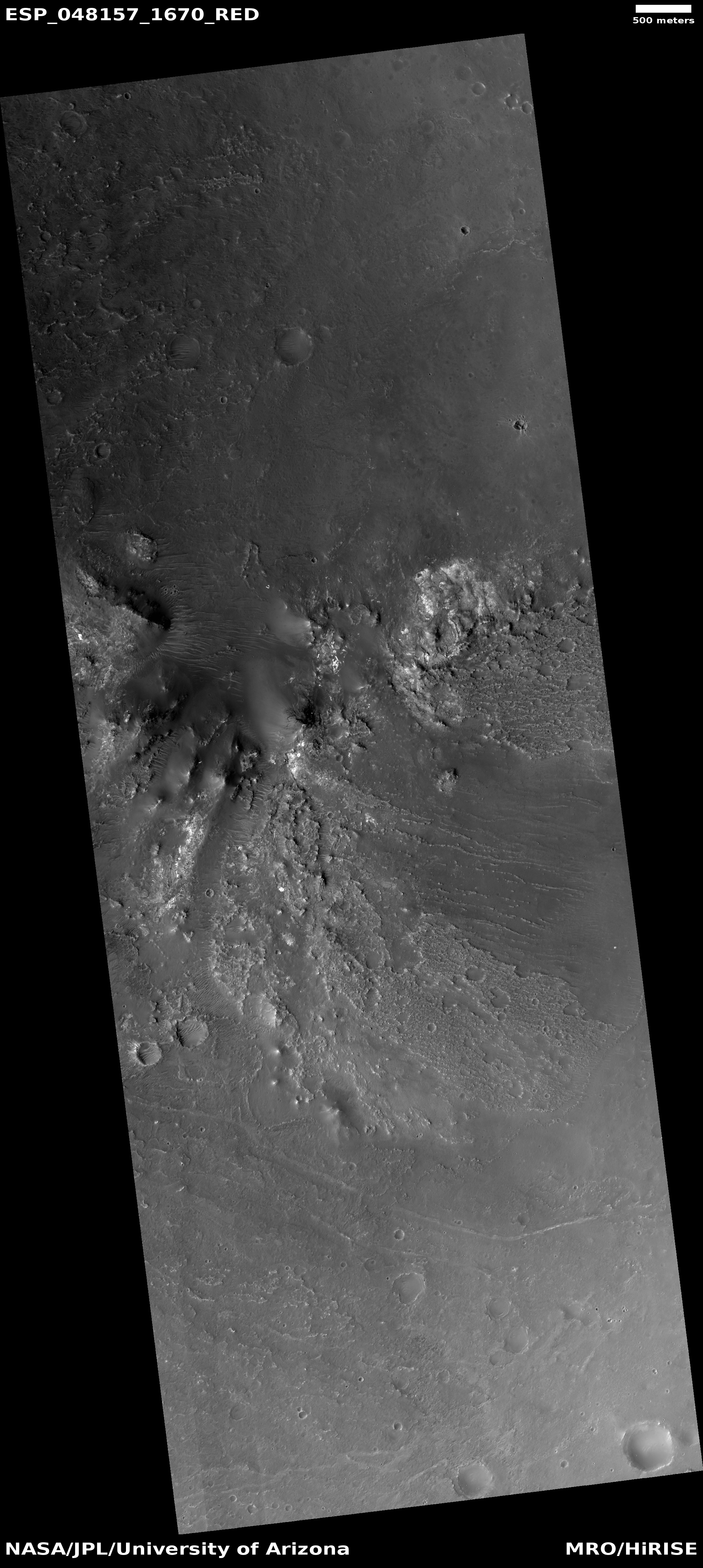
Silly image time! Today the science team for the high resolution camera on Mars Reconnaissance Orbiter posted the photo to the right, which I have cropped, reduced, and annotated to post here. It was taken on December 12, 2022, and was rotated so that north is to the right in order to make its resemblance to a bear’s face obvious. As noted in the caption by Alfred McEwen of the Lunar & Planetary Laboratory in Arizona:
There’s a hill with a V-shaped collapse structure (the nose), two craters (the eyes), and a circular fracture pattern (the head). The circular fracture pattern might be due to the settling of a deposit over a buried impact crater. Maybe the nose is a volcanic or mud vent and the deposit could be lava or mud flows?
Maybe just grin and bear it.
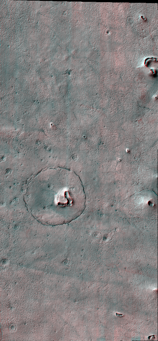
If you have red-green glasses you can see a 3D anaglyph of this image here. The feature itself is located in the southern cratered highlands of Mars at 41 degrees south latitude, so the presence of near surface ice that would cause a mud volcano is definitely possible.
