
Barren Mars
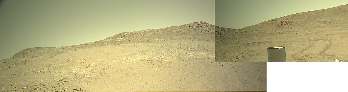
Click for full resolution panorama. For original images, go here, here, and here.
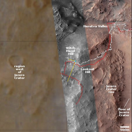
Click for interactive map.
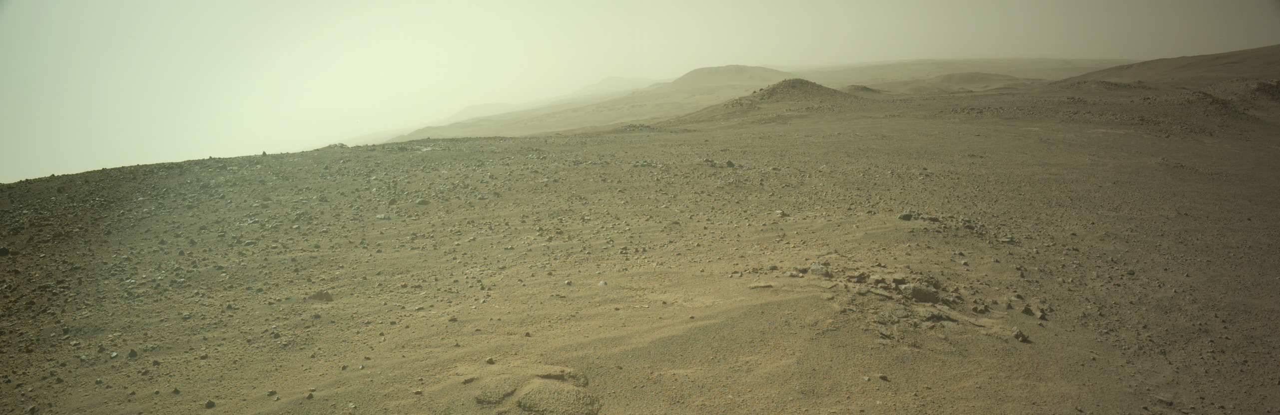
Cool image time! The panorama above was created by me using three pictures taken today (here, here, and here) by the right navigation camera on the Mars rover Perseverance. The top of the rover can be seen to the right, as well as its tracks.
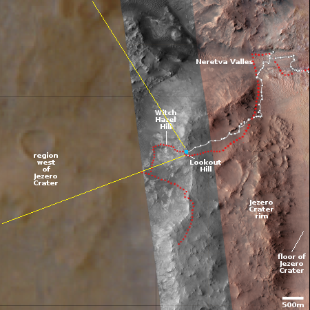
The overview map to the right provides the context. The blue dot marks Perseverance’s present position. The white dotted line its past travel route, with the red dotted line indicating the planned route. The yellow lines indicate the approximate area covered by the panorama.
Though the planned route had the rover head west and then south, the rover team instead had the rover retreat eastward about 450 feet the past few days, where it sits now. At the previous western location the team had attempted to find a location to drill a sample core, but apparently the ground was not satisfactory. By retreating to this previous location it could be they think they will have better luck.
What strikes me about this hilly terrain just outside Jezero Crater is its barrenness. You would have great difficulty anywhere on Earth finding terrain so empty of life. On Mars however there is nothing but dirt and rocks, for as far as the eye can see.
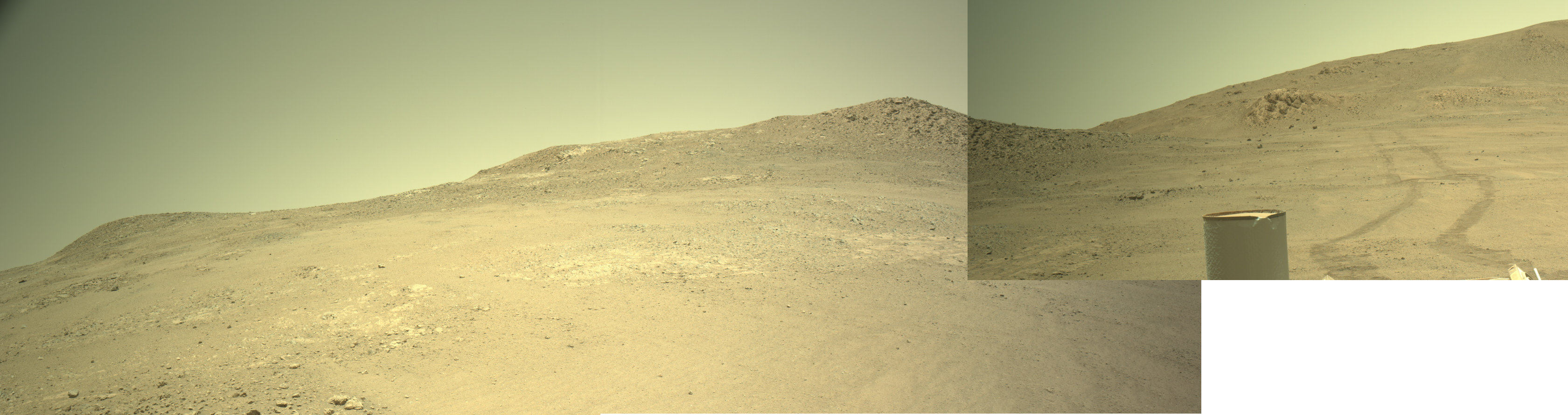
Click for full resolution panorama. For original images, go here, here, and here.
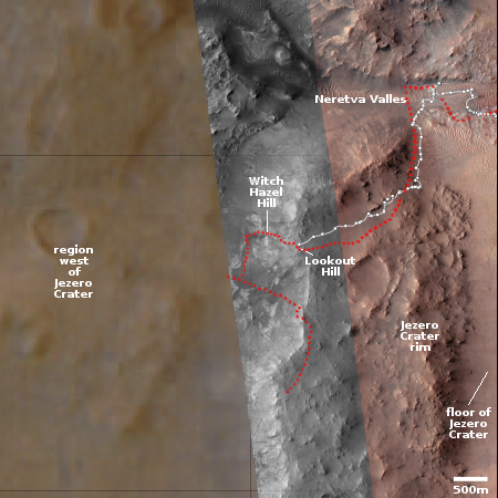
Click for interactive map.
Cool image time! The panorama above was created by me using three pictures taken today (here, here, and here) by the right navigation camera on the Mars rover Perseverance. The top of the rover can be seen to the right, as well as its tracks.
The overview map to the right provides the context. The blue dot marks Perseverance’s present position. The white dotted line its past travel route, with the red dotted line indicating the planned route. The yellow lines indicate the approximate area covered by the panorama.
Though the planned route had the rover head west and then south, the rover team instead had the rover retreat eastward about 450 feet the past few days, where it sits now. At the previous western location the team had attempted to find a location to drill a sample core, but apparently the ground was not satisfactory. By retreating to this previous location it could be they think they will have better luck.
What strikes me about this hilly terrain just outside Jezero Crater is its barrenness. You would have great difficulty anywhere on Earth finding terrain so empty of life. On Mars however there is nothing but dirt and rocks, for as far as the eye can see.